Hazel Down
Downs, Moorland in Hampshire Test Valley
England
Hazel Down

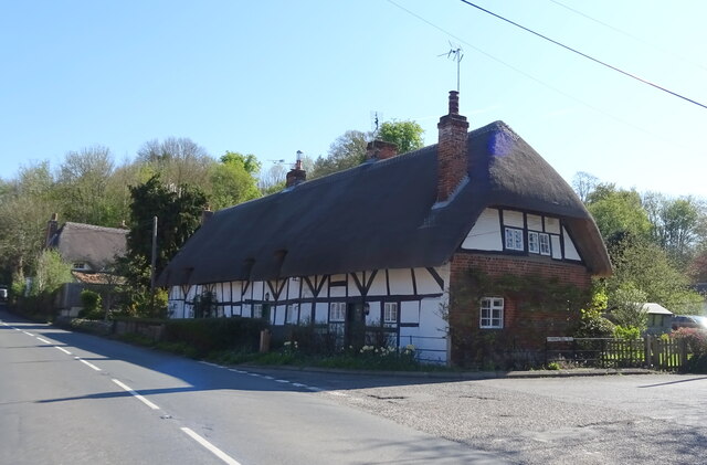
Hazel Down is a picturesque area located in the county of Hampshire, England. Situated in the heart of the South Downs National Park, it encompasses a diverse landscape of downs and moorland. The area is known for its stunning natural beauty, with rolling hills, open meadows, and breathtaking views of the surrounding countryside.
Hazel Down is home to a rich variety of flora and fauna, making it a haven for nature enthusiasts and wildlife lovers. The downs are adorned with patches of hazel woodland, from which the area derives its name. These woodlands provide a habitat for numerous species of birds, mammals, and insects, creating a thriving ecosystem.
The moorland of Hazel Down is characterized by its heather-covered hills and open expanses. This unique landscape is not only visually captivating but also supports a range of rare and protected species. Visitors may spot the vibrant purple hues of heather in the summer months, while in the autumn, the moorland comes alive with an array of rich golden colors.
The area offers ample opportunities for outdoor activities such as hiking, cycling, and horse riding. Several well-marked trails crisscross the downs, allowing visitors to explore the area at their own pace. Additionally, the peaceful surroundings make Hazel Down an ideal spot for picnics and relaxation, providing a welcome escape from the hustle and bustle of everyday life.
Overall, Hazel Down, Hampshire is a natural gem that showcases the beauty and diversity of the South Downs. Its combination of downs and moorland, coupled with its abundant wildlife, makes it a must-visit destination for nature enthusiasts and those seeking a tranquil retreat in the heart of the English countryside.
If you have any feedback on the listing, please let us know in the comments section below.
Hazel Down Images
Images are sourced within 2km of 51.149156/-1.4834816 or Grid Reference SU3639. Thanks to Geograph Open Source API. All images are credited.


Hazel Down is located at Grid Ref: SU3639 (Lat: 51.149156, Lng: -1.4834816)
Administrative County: Hampshire
District: Test Valley
Police Authority: Hampshire
What 3 Words
///divisible.metro.forehand. Near Anna Valley, Hampshire
Nearby Locations
Related Wikis

Longstock Park
Longstock Park is in the civil parish of Longstock in the Test Valley district of Hampshire, England, and forms part of the Leckford Estate (1520 ha.)...

Test Valley
Test Valley is a local government district with borough status in Hampshire, England, named after the valley of the River Test. The council is based in...

Fullerton, Hampshire
Fullerton is a small village in Wherwell civil parish in the Test Valley district of Hampshire, England. At the 2011 Census the Post Office say the population...
Cottonworth
Cottonworth is a small village in the Test Valley district of Hampshire, England. The village lies on the A3057 road between Andover and Romsey. According...

Leckford
Leckford is a village and civil parish in Hampshire, England. It lies on the eastern bank of the River Test just to the south of its confluence with the...

Fullerton Junction railway station
Fullerton Junction railway station served the village of Fullerton, Hampshire, England. It was on the Sprat and Winkle Line and the Fullerton to Hurstbourne...
Abbess Grange
Abbess Grange is a neo-Elizabethan house at Leckford, Hampshire, England designed by Sir Banister Fletcher, a British architect, in 1901 for George Miles...
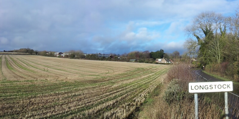
Longstock
Longstock is a village and civil parish in Hampshire, England. It lies on the western bank of the River Test, to the north of Stockbridge and to the west...
Nearby Amenities
Located within 500m of 51.149156,-1.4834816Have you been to Hazel Down?
Leave your review of Hazel Down below (or comments, questions and feedback).