Hart Hill Down

Downs, Moorland in Hampshire Test Valley

England

Hart Hill Down

Edge of field near Hogs Hole
Edge of field near Hogs Hole Credit: David Martin

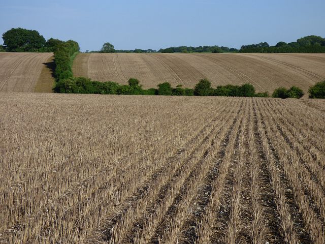
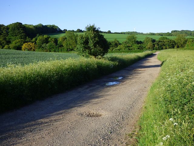
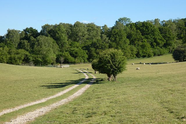
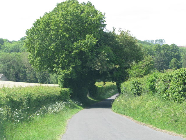
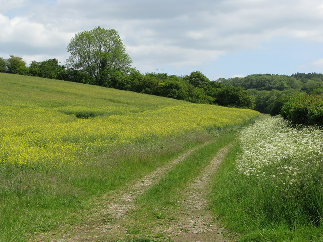
Hart Hill Down is a picturesque area located in Hampshire, England. Situated in the heart of the South Downs National Park, it offers breathtaking views of rolling hills, verdant meadows, and dense woodlands. Spanning over a vast area, Hart Hill Down is known for its diverse landscape, consisting of downs, moorland, and heathland.

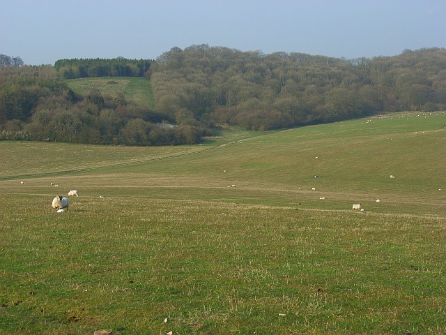
The downs of Hart Hill Down are characterized by their gently sloping hills, covered in lush grasses and wildflowers. These open spaces provide a perfect habitat for various species of wildlife, including rabbits, deer, and a wide variety of bird species. The downland areas are also home to an array of rare and protected plant species, contributing to the area's ecological significance.

Moving towards the moorland, visitors will be captivated by the rugged beauty of the landscape. Heather, gorse, and bracken dominate the moorland, creating a vibrant mosaic of colors throughout the seasons. The moorland is interspersed with rocky outcrops, adding to the area's wild and untamed charm.

Hart Hill Down also features extensive areas of heathland, characterized by low-growing shrubs and patches of open ground. The heathland is particularly important for its unique flora and fauna, including rare reptiles such as adders and smooth snakes.

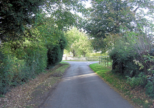
The area is a haven for outdoor enthusiasts, offering numerous walking and hiking trails that showcase the diversity of the landscape. Visitors can explore the downs, moorland, and heathland, taking in the breathtaking views and immersing themselves in the tranquility of nature.

If you have any feedback on the listing, please let us know in the comments section below.

Hart Hill Down Images

Images are sourced within 2km of 51.326561/-1.482095 or Grid Reference SU3658. Thanks to Geograph Open Source API. All images are credited.

Edge of field near Hogs Hole
Farmland, Vernhams Dean There was a surprisingly large amount of stubble in the vicinity given the time of year.
Farmland, Vernhams Dean
There was a surprisingly large amount of stubble in the vicinity given the time of year.
Farmland, Linkenholt There was a surprisingly large amount of stubble in the vicinity given the time of year.
Farmland, Linkenholt
There was a surprisingly large amount of stubble in the vicinity given the time of year.
Track and farmland, Linkenholt A public bridleway in the dry valley below the villages of Faccombe and Linkenholt.
Track and farmland, Linkenholt
A public bridleway in the dry valley below the villages of Faccombe and Linkenholt.
St Peter's Church, Linkenholt
Pumping Station beyond Linkenholt Seen in <a href="https://www.geograph.org.uk/gridref/SU3658">SU3658</a> and <a title="https://www.geograph.org.uk/gridref/SU%20364%20589/links" href="https://www.geograph.org.uk/gridref/SU%20364%20589/links">Link</a>
Pumping Station beyond Linkenholt
Seen in SU3658 and Link
Isolated Cottage beyond Linkenholt Visible on the 1873 OS map. The building extends back quite far. Seemed to be inhabited, although not absolutely sure. Perhaps a gamekeepers cottage.
Isolated Cottage beyond Linkenholt
Visible on the 1873 OS map. The building extends back quite far. Seemed to be inhabited, although not absolutely sure. Perhaps a gamekeepers cottage.
Farmland, Vernhams Dean A crop of wheat to the south of Heath Plantation.
Farmland, Vernhams Dean
A crop of wheat to the south of Heath Plantation.
Track and farmland, Linkenholt Fields of wheat to the south of Limber Copse and the county boundary.
Track and farmland, Linkenholt
Fields of wheat to the south of Limber Copse and the county boundary.
Pasture, Buttermere A bridleway approaching the junction of paths below Rockmoor Down.
Pasture, Buttermere
A bridleway approaching the junction of paths below Rockmoor Down.
Road into Combe Bottom
Field near Combe
Field near Combe
Littledown Methodist Chapel Erected in 1845.  Now in the process of conversion.
Littledown Methodist Chapel
Erected in 1845. Now in the process of conversion.
Lane junction at Netherton To the right is Faccombe. Whilst the wall ahead belongs to Netherton Farm.
Lane junction at Netherton
To the right is Faccombe. Whilst the wall ahead belongs to Netherton Farm.
Lane north of Netherton This is an extraordinary landscape as the lane snakes through the folds in the chalk downland, accompanied by old paths, assarted woodland and ancient field systems.
Lane north of Netherton
This is an extraordinary landscape as the lane snakes through the folds in the chalk downland, accompanied by old paths, assarted woodland and ancient field systems.
Lane junction at Down Copse To the left the lane leads to Linkenholt.
Lane junction at Down Copse
To the left the lane leads to Linkenholt.
An ambush by 5 partridge as we move north from Down Copse towards Combe Bottom the birds string themselves across the road. Behind them they have pheasant reinforcements. Wonder: what is their game?
An ambush by 5 partridge
as we move north from Down Copse towards Combe Bottom the birds string themselves across the road. Behind them they have pheasant reinforcements. Wonder: what is their game?
Hogs Hole from Combe Bottom Careful viewers will note the phone-mast to the left and windmill to the right, both break the horizon and are shown on the O/S map. The crop is probably winter wheat.
Hogs Hole from Combe Bottom
Careful viewers will note the phone-mast to the left and windmill to the right, both break the horizon and are shown on the O/S map. The crop is probably winter wheat.
Show me another place!

Hart Hill Down is located at Grid Ref: SU3658 (Lat: 51.326561, Lng: -1.482095)

Administrative County: Hampshire

District: Test Valley

Police Authority: Hampshire

What 3 Words

///throw.showrooms.destiny. Near Shalbourne, Wiltshire

Related Wikis

Linkenholt

Linkenholt is a village near Andover in Hampshire, England with about 40 inhabitants. It is in the civil Parish of Faccombe. The Domesday Book of 1086...

Combe Wood and Linkenholt Hanging

Combe Wood and Linkenholt Hanging is a 106.5-hectare (263-acre) biological Site of Special Scientific Interest south of Hungerford in Berkshire. It is...

Little Down

Little Down (or Littledown) is a village in Hampshire, England, on the North Downs near the county boundaries with Berkshire and Wiltshire. It lies just...

Vernham Street

Vernham Street is a small village in the civil parish of Vernhams Dean situated in the North Wessex Downs Area of Outstanding Natural Beauty in the Test...

Hog's Hole

Hog's Hole is a 23.7-hectare (59-acre) biological Site of Special Scientific Interest in the civil parish of Combe in the English county of Berkshire....

Netherton, Hampshire

Netherton is a hamlet in northwest Hampshire, England. According to the Post Office the population of the 2011 Census was included in the civil parish...

Combe, Berkshire

Combe is a village and civil parish in the English county of Berkshire. The parish is situated on the top of the North Hampshire Downs near Walbury Hill...

Combe Hill, Berkshire

Combe Hill is a summit in Berkshire, England, with a maximum elevation of 293 m (961 ft). It lies around 1 mile (1.6 km) to the south-east of Walbury Hill...

Nearby Amenities

Located within 500m of 51.326561,-1.482095
Source: Bing
Lat/Long: 51.3273545/-1.4785859
Cleve Hill Down
Place: locality
Source: OS_OpenData_StreetView
Lat/Long: 51.3239279/-1.4769867
Hart Hill Down
Ele: 213
Natural: peak
Lat/Long: 51.3245982/-1.48601
Hart Hill Down
Place: locality
Lat/Long: 51.3267119/-1.4825375
The data included in this document is from www.openstreetmap.org. The data is made available under ODbL.

Have you been to Hart Hill Down?

Leave your review of Hart Hill Down below (or comments, questions and feedback).