Hatton

Settlement in Lincolnshire East Lindsey

England

Hatton

Ridge and Furrow at Hatton, Lincs: aerial 2022 (1) East, West and Northwest and of the village centre.

See: <span class="nowrap"><a title="https://www.heritagegateway.org.uk/Gateway/Results_Single.aspx?uid=MLI42953&resourceID=1006," rel="nofollow ugc noopener" href="https://www.heritagegateway.org.uk/Gateway/Results_Single.aspx?uid=MLI42953&resourceID=1006,">Link</a><img style="margin-left:2px;" alt="External link" title="External link - shift click to open in new window" src="https://s1.geograph.org.uk/img/external.png" width="10" height="10"/></span> <span class="nowrap"><a title="https://www.heritagegateway.org.uk/Gateway/Results_Single.aspx?uid=MLI42952&resourceID=1006" rel="nofollow ugc noopener" href="https://www.heritagegateway.org.uk/Gateway/Results_Single.aspx?uid=MLI42952&resourceID=1006">Link</a><img style="margin-left:2px;" alt="External link" title="External link - shift click to open in new window" src="https://s1.geograph.org.uk/img/external.png" width="10" height="10"/></span> and <span class="nowrap"><a title="https://www.heritagegateway.org.uk/Gateway/Results_Single.aspx?uid=MLI42954&resourceID=1006" rel="nofollow ugc noopener" href="https://www.heritagegateway.org.uk/Gateway/Results_Single.aspx?uid=MLI42954&resourceID=1006">Link</a><img style="margin-left:2px;" alt="External link" title="External link - shift click to open in new window" src="https://s1.geograph.org.uk/img/external.png" width="10" height="10"/></span>
Ridge and Furrow at Hatton, Lincs: aerial 2022 (1) Credit: Chris

Hatton is a small village located in the East Lindsey district of Lincolnshire, England. Situated approximately 7 miles south-east of the historic market town of Wragby, Hatton is nestled amidst the picturesque Lincolnshire Wolds, an Area of Outstanding Natural Beauty.

With a population of around 300 residents, Hatton maintains a close-knit and community-oriented atmosphere. The village is primarily made up of charming cottages and traditional buildings, many of which date back several centuries. Hatton's architectural heritage is evident in notable landmarks such as St. Mary's Church, a Grade II listed building that dates back to the 13th century.

The surrounding countryside offers a wealth of outdoor activities and scenic walks, making Hatton an ideal destination for nature lovers and hikers. The nearby Hatton Nature Reserve provides a haven for wildlife enthusiasts, with its diverse range of flora and fauna. Additionally, the village boasts stunning panoramic views of the Lincolnshire Wolds, which attract visitors seeking tranquility and natural beauty.

Despite its small size, Hatton benefits from a close proximity to amenities and services. The nearby town of Wragby offers a range of shops, cafes, and a primary school, ensuring that residents have easy access to everyday necessities. For those seeking a wider variety of amenities, the city of Lincoln is approximately 15 miles to the west, providing a range of cultural, educational, and retail opportunities.

In summary, Hatton is a charming and serene village nestled in the Lincolnshire Wolds, offering a peaceful rural lifestyle while still being within reach of essential amenities and the cultural offerings of nearby towns and cities.

If you have any feedback on the listing, please let us know in the comments section below.
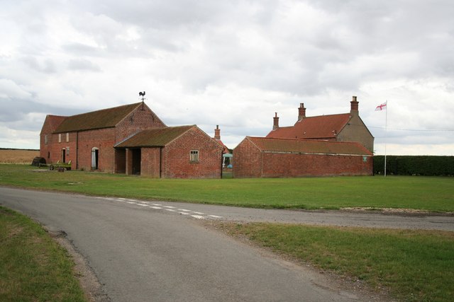
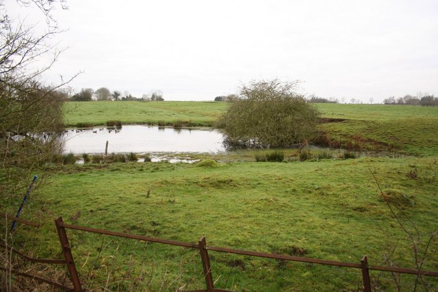
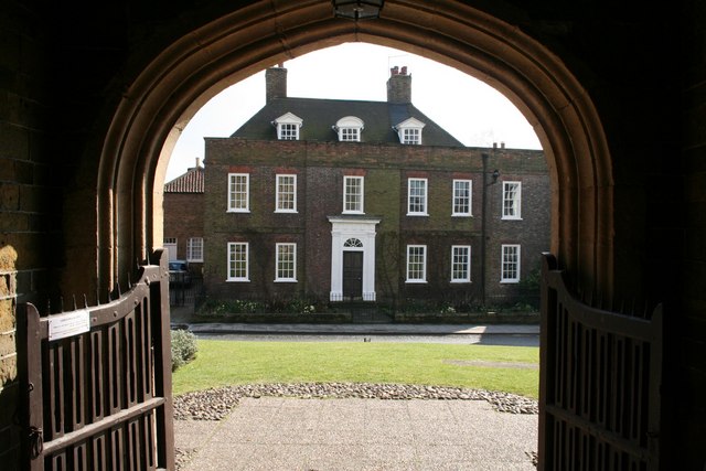
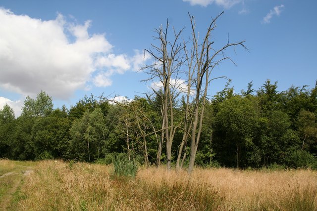
Hatton Images

Images are sourced within 2km of 53.274765/-0.23486519 or Grid Reference TF1776. Thanks to Geograph Open Source API. All images are credited.

Ridge and Furrow at Hatton, Lincs: aerial 2022 (1) East, West and Northwest and of the village centre.

See: <span class="nowrap"><a title="https://www.heritagegateway.org.uk/Gateway/Results_Single.aspx?uid=MLI42953&resourceID=1006," rel="nofollow ugc noopener" href="https://www.heritagegateway.org.uk/Gateway/Results_Single.aspx?uid=MLI42953&resourceID=1006,">Link</a><img style="margin-left:2px;" alt="External link" title="External link - shift click to open in new window" src="https://s1.geograph.org.uk/img/external.png" width="10" height="10"/></span> <span class="nowrap"><a title="https://www.heritagegateway.org.uk/Gateway/Results_Single.aspx?uid=MLI42952&resourceID=1006" rel="nofollow ugc noopener" href="https://www.heritagegateway.org.uk/Gateway/Results_Single.aspx?uid=MLI42952&resourceID=1006">Link</a><img style="margin-left:2px;" alt="External link" title="External link - shift click to open in new window" src="https://s1.geograph.org.uk/img/external.png" width="10" height="10"/></span> and <span class="nowrap"><a title="https://www.heritagegateway.org.uk/Gateway/Results_Single.aspx?uid=MLI42954&resourceID=1006" rel="nofollow ugc noopener" href="https://www.heritagegateway.org.uk/Gateway/Results_Single.aspx?uid=MLI42954&resourceID=1006">Link</a><img style="margin-left:2px;" alt="External link" title="External link - shift click to open in new window" src="https://s1.geograph.org.uk/img/external.png" width="10" height="10"/></span>
Ridge and Furrow at Hatton, Lincs: aerial 2022 (1)
East, West and Northwest and of the village centre. See: LinkExternal link LinkExternal link and LinkExternal link
Extinct hamlet of Strubby, Langton by Wragby, Lincs: aerial 2022 The lost village of Strubby is now represented by Strubby Hall. There is mention in 1316 of Langeton and Strubby.

See <span class="nowrap"><a title="https://www.heritagegateway.org.uk/Gateway/Results_Single.aspx?uid=MLI40348&resourceID=1006" rel="nofollow ugc noopener" href="https://www.heritagegateway.org.uk/Gateway/Results_Single.aspx?uid=MLI40348&resourceID=1006">Link</a><img style="margin-left:2px;" alt="External link" title="External link - shift click to open in new window" src="https://s1.geograph.org.uk/img/external.png" width="10" height="10"/></span>

Not to be confused with Strubby near Withern, Lincs.
Extinct hamlet of Strubby, Langton by Wragby, Lincs: aerial 2022
The lost village of Strubby is now represented by Strubby Hall. There is mention in 1316 of Langeton and Strubby. See LinkExternal link Not to be confused with Strubby near Withern, Lincs.
Ridge and Furrow at Hatton, Lincs: aerial 2022 (2) East, West and Northwest and of the village centre.

See: <span class="nowrap"><a title="https://www.heritagegateway.org.uk/Gateway/Results_Single.aspx?uid=MLI42953&resourceID=1006," rel="nofollow ugc noopener" href="https://www.heritagegateway.org.uk/Gateway/Results_Single.aspx?uid=MLI42953&resourceID=1006,">Link</a><img style="margin-left:2px;" alt="External link" title="External link - shift click to open in new window" src="https://s1.geograph.org.uk/img/external.png" width="10" height="10"/></span> <span class="nowrap"><a title="https://www.heritagegateway.org.uk/Gateway/Results_Single.aspx?uid=MLI42952&resourceID=1006" rel="nofollow ugc noopener" href="https://www.heritagegateway.org.uk/Gateway/Results_Single.aspx?uid=MLI42952&resourceID=1006">Link</a><img style="margin-left:2px;" alt="External link" title="External link - shift click to open in new window" src="https://s1.geograph.org.uk/img/external.png" width="10" height="10"/></span> and <span class="nowrap"><a title="https://www.heritagegateway.org.uk/Gateway/Results_Single.aspx?uid=MLI42954&resourceID=1006" rel="nofollow ugc noopener" href="https://www.heritagegateway.org.uk/Gateway/Results_Single.aspx?uid=MLI42954&resourceID=1006">Link</a><img style="margin-left:2px;" alt="External link" title="External link - shift click to open in new window" src="https://s1.geograph.org.uk/img/external.png" width="10" height="10"/></span>

The earthworks are picked out by the early January morning frost.
Ridge and Furrow at Hatton, Lincs: aerial 2022 (2)
East, West and Northwest and of the village centre. See: LinkExternal link LinkExternal link and LinkExternal link The earthworks are picked out by the early January morning frost.
Grass field near Strubby
Bridleway to Langton Hill Farm
Autumn sown field near Minting
Prepared field near Hatton Rather wet after several rainy days.
Prepared field near Hatton
Rather wet after several rainy days.
Strubby Seen across a field of maize from Walk Lane
Strubby
Seen across a field of maize from Walk Lane
Corner Farm Marked Sturton Harden on some old maps
Corner Farm
Marked Sturton Harden on some old maps
Park House & Park Farm Cottages Near Hatton
Park House & Park Farm Cottages
Near Hatton
St.Stephen's church, Hatton, Lincs. By James Fowler in 1870-4
St.Stephen's church, Hatton, Lincs.
By James Fowler in 1870-4
Hatton Village Hall Former schoolroom, now Hatton Village Hall
Hatton Village Hall
Former schoolroom, now Hatton Village Hall
Victorian postbox At Hatton Village Hall <a title="https://www.geograph.org.uk/photo/208095" href="https://www.geograph.org.uk/photo/208095">Link</a>
Victorian postbox
At Hatton Village Hall Link
Beware of the bull A handsome bull with his harem of cows and their calves near Hatton
Beware of the bull
A handsome bull with his harem of cows and their calves near Hatton
The road to Pants ? Some malicious rearrangement of the letters on this fingerpost suggest a nearby village of 'Pants'. It should read Panton, E Barkwith and Sturton.
The road to Pants ?
Some malicious rearrangement of the letters on this fingerpost suggest a nearby village of 'Pants'. It should read Panton, E Barkwith and Sturton.
Grange Beck Bridge On the road north of Hatton
Grange Beck Bridge
On the road north of Hatton
Cop Hills Wood Managed woodland, part of Sotby Wood
Cop Hills Wood
Managed woodland, part of Sotby Wood
Cottages at Whitegates Farm On Roman Road near Sotby Wood
Cottages at Whitegates Farm
On Roman Road near Sotby Wood
Show me another place!

Hatton is located at Grid Ref: TF1776 (Lat: 53.274765, Lng: -0.23486519)

Division: Parts of Lindsey

Administrative County: Lincolnshire

District: East Lindsey

Police Authority: Lincolnshire

What 3 Words

///rejoined.bombard.spooned. Near Wragby, Lincolnshire

Related Wikis

Nearby Amenities

Located within 500m of 53.274765,-0.23486519
Hatton
Is In: Lincolnshire, England, UK
Place: hamlet
Source: Bing
Lat/Long: 53.2753416/-0.235003
Bus Stop
Village Hall
Naptan AtcoCode: 270000010474
Naptan Bearing: S
Naptan CommonName: Village Hall
Naptan Indicator: opp
Naptan Landmark: Village Hall
Naptan NaptanCode: linjmtjg
Naptan Street: Mill Lane
Naptan Verified: no
Source: naptan_import
Lat/Long: 53.2744614/-0.2348074
Bus Stop
Village Hall
Naptan AtcoCode: 2700LHTG5099
Naptan Bearing: N
Naptan CommonName: Village Hall
Naptan Indicator: adj
Naptan Landmark: Village Hall
Naptan NaptanCode: lindptdj
Naptan Street: Mill Lane
Naptan Verified: no
Source: naptan_import
Lat/Long: 53.2744647/-0.2350322
Power: pole
Lat/Long: 53.2719422/-0.2294134
Power: pole
Lat/Long: 53.2763515/-0.2334313
Power: pole
Lat/Long: 53.2723144/-0.2308684
Power: pole
Lat/Long: 53.2752953/-0.2335023
Power: pole
Source: Bing
Lat/Long: 53.2753523/-0.2343539
Power: pole
Lat/Long: 53.277426/-0.2333709
Power: pole
Lat/Long: 53.27265/-0.2321419
Power: pole
Lat/Long: 53.2741702/-0.2335801
Power: pole
Lat/Long: 53.2730105/-0.2335399
Power: pole
Lat/Long: 53.2730258/-0.2336499
Power: pole
Lat/Long: 53.2721612/-0.2345752
Power: pole
Lat/Long: 53.2712549/-0.2355314
Power: pole
Lat/Long: 53.2704277/-0.2363898
Power: pole
Lat/Long: 53.2707162/-0.236497
Power: pole
Lat/Long: 53.2714947/-0.2374161
Power: pole
Lat/Long: 53.271532/-0.2378653
Power: pole
Lat/Long: 53.2716216/-0.2397161
The data included in this document is from www.openstreetmap.org. The data is made available under ODbL.

Have you been to Hatton?

Leave your review of Hatton below (or comments, questions and feedback).