Beauchief Park

Downs, Moorland in Derbyshire

England

Beauchief Park

Construction of new loop at Dore West Creating a third track on which freight services will be able to pause between the Midland Main line and Hope Valley line rather than blocking either before being allowed to proceed between them. Due to become operational from April 2024.
Construction of new loop at Dore West Credit: Chris Morgan

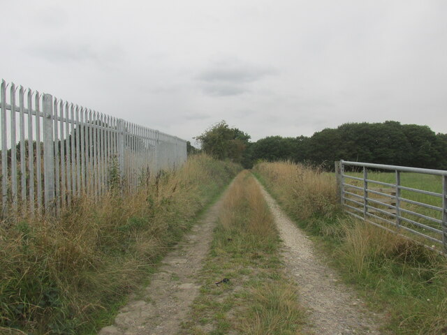
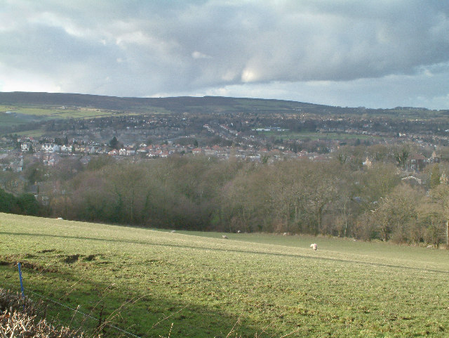
Beauchief Park is a picturesque area located in Derbyshire, England. Situated in the eastern outskirts of Sheffield, it spans over 100 hectares and is known for its diverse landscapes, including downs and moorland.

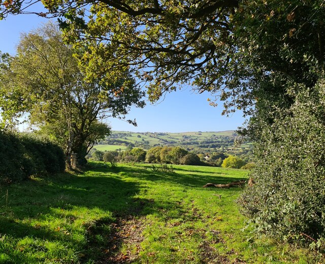
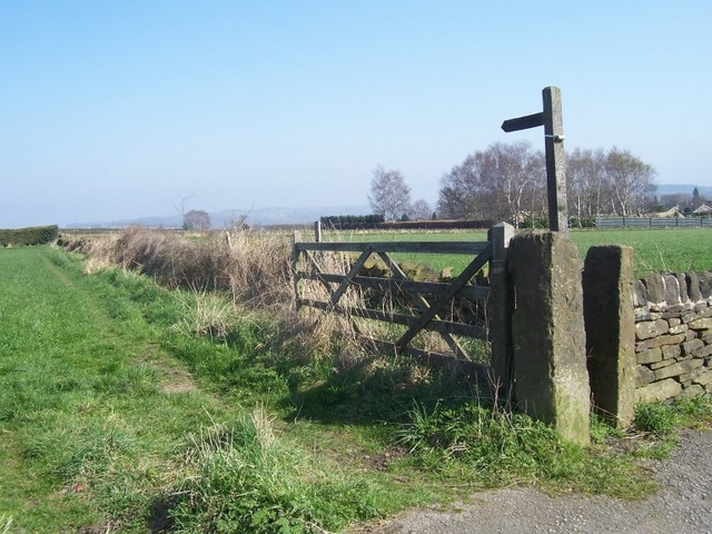
The park offers a haven for nature enthusiasts and walkers, with its rolling hills and stunning views. The downs in Beauchief Park are characterized by their gently sloping grasslands, providing ample space for recreational activities such as picnicking or flying kites. These downs are interspersed with patches of woodland, creating a beautiful contrast between open spaces and shaded areas.

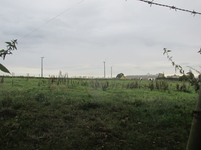
The moorland in Beauchief Park is another highlight of the area. It consists of vast expanses of heather and bracken, offering a unique and wild atmosphere. Moorland birds, such as red grouse and curlews, can often be spotted here, making it a popular destination for birdwatchers.

In addition to its natural beauty, Beauchief Park also boasts a rich history. The ruins of Beauchief Abbey, a medieval monastic house founded in the 12th century, can be found within the park. These ruins provide a glimpse into the region's past and offer a serene spot for reflection.

Overall, Beauchief Park in Derbyshire is a stunning location that combines the beauty of downs and moorland. Whether you're looking for a peaceful walk, a picnic spot, or an opportunity to explore a historic site, this park has something to offer for everyone.

If you have any feedback on the listing, please let us know in the comments section below.

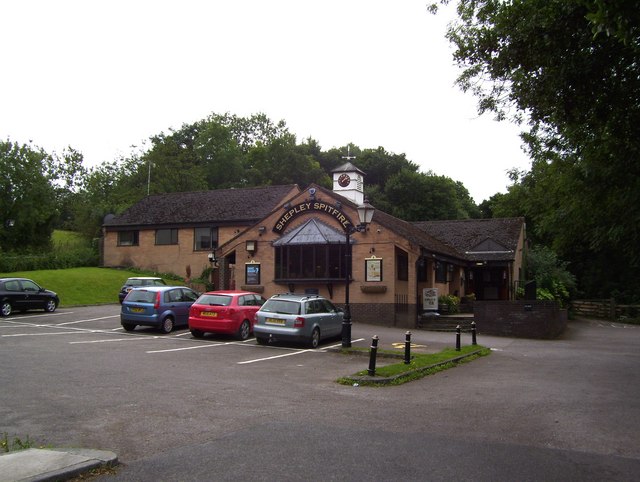
Beauchief Park Images

Images are sourced within 2km of 53.324914/-1.5077766 or Grid Reference SK3281. Thanks to Geograph Open Source API. All images are credited.

Construction of new loop at Dore West Creating a third track on which freight services will be able to pause between the Midland Main line and Hope Valley line rather than blocking either before being allowed to proceed between them. Due to become operational from April 2024.
Construction of new loop at Dore West
Creating a third track on which freight services will be able to pause between the Midland Main line and Hope Valley line rather than blocking either before being allowed to proceed between them. Due to become operational from April 2024.
Track near Bowshaw farm. The Dronfield 2000 rotary walk.
Track near Bowshaw farm.
The Dronfield 2000 rotary walk.
Upper Birchitt farm and wind turbines. Along the Dronfield 2000 rotary walk.
Upper Birchitt farm and wind turbines.
Along the Dronfield 2000 rotary walk.
Looking towards Owler Bar From top of Totley Lane, Bradway
Looking towards Owler Bar
From top of Totley Lane, Bradway
Mickley Lane. This shows the New Totley end of the road which runs through to Mickley.
Mickley Lane.
This shows the New Totley end of the road which runs through to Mickley.
View from Mickley Lane. A view looking out to Totley Rise and beyond from the road running between New Totley and Mickley.
View from Mickley Lane.
A view looking out to Totley Rise and beyond from the road running between New Totley and Mickley.
Footpath from Northern Common
Footpath off Barnes Lane
Mickley - Rod Moor Road Approaching junction with Mickley Lane.
Mickley - Rod Moor Road
Approaching junction with Mickley Lane.
Mickley Lane approaching New Totley
Footpath through golf course The path goes north towards Bradway, from Barnes Lane
Footpath through golf course
The path goes north towards Bradway, from Barnes Lane
Barnes Lane and footpath, in winter
Trees and holly bushes on bridleway Approaching Rod Moor Road, between Mickley and Bradway
Trees and holly bushes on bridleway
Approaching Rod Moor Road, between Mickley and Bradway
Northern Common becomes Rod Moor Road At the junction, Rod Moor on the right, and Mickley Lane on the left
Northern Common becomes Rod Moor Road
At the junction, Rod Moor on the right, and Mickley Lane on the left
On the straight and narrow Footpath from Northern Common
On the straight and narrow
Footpath from Northern Common
Laverdene Avenue
Laverdene Avenue
The Shepley Spitfire
Mickley Lane
Mickley Lane
Show me another place!

Beauchief Park is located at Grid Ref: SK3281 (Lat: 53.324914, Lng: -1.5077766)

Unitary Authority: Sheffield

Police Authority: South Yorkshire

What 3 Words

///oath.pitch.glee. Near Dronfield, Derbyshire

Related Wikis

Dore & Totley railway station

Dore & Totley railway station serves the south-western Sheffield suburbs of Dore and Totley in South Yorkshire, England 4+3⁄4 miles (7.6 km) south of Sheffield...
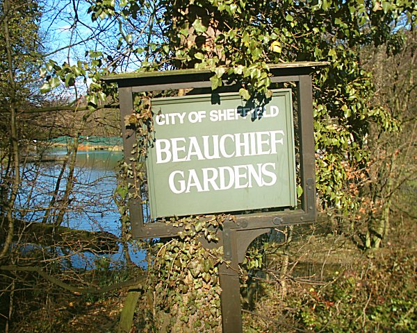
Beauchief Gardens

Beauchief Gardens is a small area of formal parkland in south-west Sheffield. The gardens lie between Abbeydale Road South to the north-west, the River...

Abbeydale Park

Abbeydale Park is a sports venue in Dore, South Yorkshire, England. It is unusual in having hosted home games for two different county cricket teams....

Abbeydale Industrial Hamlet

Abbeydale Industrial Hamlet is an industrial museum in the south of the City of Sheffield, England. The museum forms part of a former steel-working site...

Beauchief Abbey

Beauchief Abbey is a medieval monastic house now serving as a parish church in the southern suburbs of Sheffield, England. == History == The abbey was...

Beauchief railway station

Beauchief railway station (pronounced Beechif) was in Sheffield, South Yorkshire, England. It was built by the Midland Railway in 1870 and was designed...
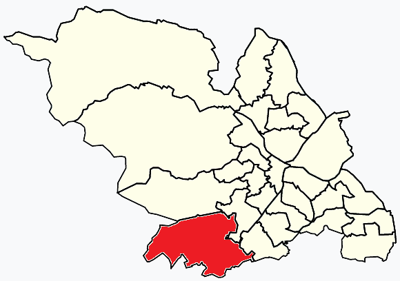
Dore and Totley

Dore and Totley ward—which includes the districts of Bradway , Dore, Totley, and Whirlow—is one of the 28 electoral wards in City of Sheffield, England...

Bradway Tunnel

Bradway Tunnel, 1 mile 266 yards (1.853 km) long, was built in 1870 about 1-mile (1.6 km) north of Dronfield, Derbyshire, in South Yorkshire, England.It...

Nearby Amenities

Located within 500m of 53.324914,-1.5077766
Turning Circle
Lat/Long: 53.3213953/-1.5123976
Turning Circle
Lat/Long: 53.3218721/-1.5123609
Railway: switch
Lat/Long: 53.3229723/-1.5119804
Twentywell Sick
Place: locality
Lat/Long: 53.3223564/-1.5085381
Barrier: stile
Lat/Long: 53.3259227/-1.5145182
Railway: switch
Lat/Long: 53.3234244/-1.5126862
Railway: switch
Lat/Long: 53.3227299/-1.5114967
Dore South Junction
Railway: junction
Source: OS OpenData StreetView
Lat/Long: 53.3234344/-1.5126626
Bench
Backrest: no
Lat/Long: 53.3282647/-1.5053821
Bench
Backrest: no
Lat/Long: 53.3281865/-1.5050832
Man Made: survey_point
Lat/Long: 53.3210947/-1.5048007
Bench
Backrest: no
Lat/Long: 53.3247424/-1.5005002
Bench
Backrest: no
Lat/Long: 53.3284041/-1.5120889
Barrier: kissing_gate
Lat/Long: 53.3280153/-1.5051551
Bench
Backrest: no
Material: wood
Lat/Long: 53.3268339/-1.5097578
Grit Bin
Operator: Sheffield City Council
Operator Type: government
Operator Wikidata: Q7492609
Seasonal: no
Lat/Long: 53.3208883/-1.510224
Grit Bin
Operator: Sheffield City Council
Operator Type: government
Operator Wikidata: Q7492609
Seasonal: no
Lat/Long: 53.32088/-1.5103892
Grit Bin
Operator: Sheffield City Council
Operator Type: government
Operator Wikidata: Q7492609
Seasonal: no
Lat/Long: 53.3219443/-1.509101
Bench
Backrest: no
Lat/Long: 53.3269646/-1.5130198
Defibrillator
Access: yes
Check Date: 2023-03-09
Defibrillator Location: On outside wall.
Emergency: defibrillator
Indoor: no
Opening Hours: 24/7
Lat/Long: 53.3215708/-1.510229
Bench
Backrest: no
Lat/Long: 53.3271969/-1.5117363
The data included in this document is from www.openstreetmap.org. The data is made available under ODbL.

Have you been to Beauchief Park?

Leave your review of Beauchief Park below (or comments, questions and feedback).