Boldon Fell

Downs, Moorland in Durham

England

Boldon Fell

The Strang Riding Centre Officially opened on July 26 1977 by Princess Anne, the Strang Riding Centre offers horse riding for children and adults with physical, learning and sensory disabilities.
The Strang Riding Centre Credit: Steve McShane

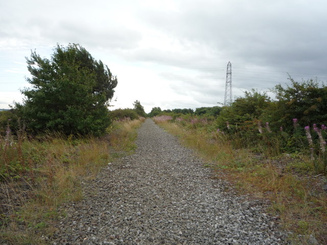
Boldon Fell is a small village located in County Durham, England. Situated on the outskirts of the town of Sunderland, it is part of the wider area known as Boldon. The village is surrounded by picturesque downs and moorland, offering stunning views of the countryside.

With a population of around 2,000 residents, Boldon Fell is a close-knit community with a strong sense of community spirit. The village is mainly residential, with a mix of houses and cottages that reflect its historic charm. Many of the properties in Boldon Fell date back several centuries, adding to the village's character.

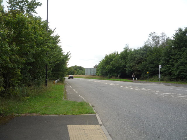
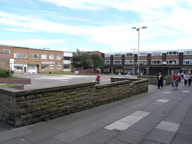
Despite its rural setting, Boldon Fell benefits from its proximity to urban amenities. The nearby town of Sunderland provides residents with access to a wide range of shops, restaurants, and leisure facilities. The village also benefits from good transportation links, with easy access to major road networks such as the A19 and A1.

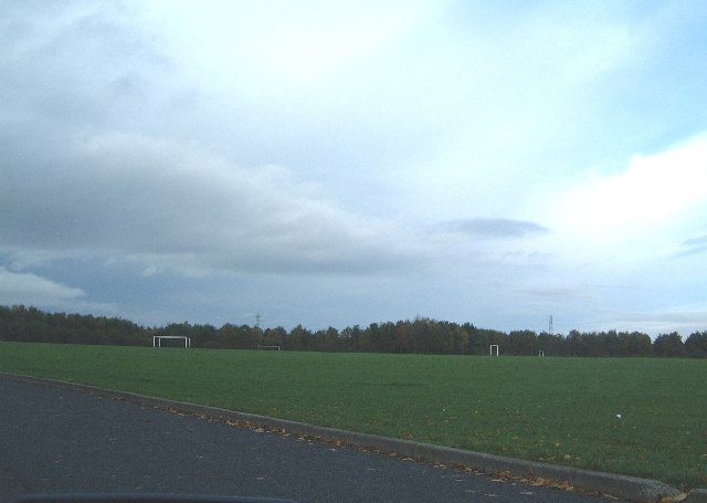
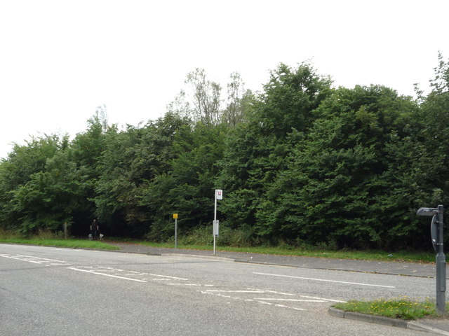
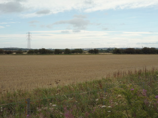
Nature lovers are drawn to Boldon Fell for its beautiful countryside. The downs and moorland surrounding the village offer opportunities for walking, hiking, and exploring the local flora and fauna. The area is also home to various bird species, making it a popular spot for birdwatching.

Overall, Boldon Fell is a charming village nestled in the stunning Durham countryside. Its mix of historic properties, sense of community, and natural beauty make it an attractive place to live for those seeking a peaceful rural lifestyle with easy access to urban amenities.

If you have any feedback on the listing, please let us know in the comments section below.

Boldon Fell Images

Images are sourced within 2km of 54.942461/-1.5062421 or Grid Reference NZ3160. Thanks to Geograph Open Source API. All images are credited.

The Strang Riding Centre Officially opened on July 26 1977 by Princess Anne, the Strang Riding Centre offers horse riding for children and adults with physical, learning and sensory disabilities.
The Strang Riding Centre
Officially opened on July 26 1977 by Princess Anne, the Strang Riding Centre offers horse riding for children and adults with physical, learning and sensory disabilities.
Northern Playing Fields There's not much in this square - there is a main A195 road to Washington, the Washington Moat House golf course and here, the Northern Playing Fields.
Northern Playing Fields
There's not much in this square - there is a main A195 road to Washington, the Washington Moat House golf course and here, the Northern Playing Fields.
Entrance to 'Triple A' dog kennels Large dog kennels and grooming / training centre. About the only thing round here, farmland otherwise.
Entrance to 'Triple A' dog kennels
Large dog kennels and grooming / training centre. About the only thing round here, farmland otherwise.
Lines near Usworth Hall They appear to be disused by the nature and variety of the flora growing upon the tracks
Lines near Usworth Hall
They appear to be disused by the nature and variety of the flora growing upon the tracks
National Trail to East House
Farm track leading to the River Don
T Junction near West Pastures
A195 nears Usworth Roundabout
Tractor movement lines through rape field Cultivation of fields necessitates the movement of machinery through fields with an inevitable loss of crop area.
Tractor movement lines through rape field
Cultivation of fields necessitates the movement of machinery through fields with an inevitable loss of crop area.
Field of oilseed rape beginning to flower The field lies to the east of a minor road named as West Pastures. The buildings of Hylton Grove Farm can just be discerned.
Field of oilseed rape beginning to flower
The field lies to the east of a minor road named as West Pastures. The buildings of Hylton Grove Farm can just be discerned.
Road near Hylton Grove Farm Looking north west.
Road near Hylton Grove Farm
Looking north west.
Cereal crop near Hylton Grove Farm
Lane towards Follingsby Looking west.
Lane towards Follingsby
Looking west.
Bus stop and woodland beside Northumberland Way (A195)
Northumberland Way (A195) towards Washington Looking south east.
Northumberland Way (A195) towards Washington
Looking south east.
Cereal crop, Follingsby  View south east from the disused railway.
Cereal crop, Follingsby
View south east from the disused railway.
Course of disused railway, Follingsby  Tracks were still in place 2006 - <a href="https://www.geograph.org.uk/photo/223501">NZ3159 : Lines near Usworth Hall</a>
Course of disused railway, Follingsby
Tracks were still in place 2006 - NZ3159 : Lines near Usworth Hall
Pit stop for the Tyne Bridge and Red Arrows Collecting for Cystic Fibrosis, Great North Run 2022.
Pit stop for the Tyne Bridge and Red Arrows
Collecting for Cystic Fibrosis, Great North Run 2022.
Show me another place!

Boldon Fell is located at Grid Ref: NZ3160 (Lat: 54.942461, Lng: -1.5062421)

Unitary Authority: South Tyneside

Police Authority: Northumbria

What 3 Words

///enthused.bearings.when. Near The Boldons, Tyne & Wear

Nearby Locations

Boldon Fell

Related Wikis

A194 road

The A194 road is a road in Tyne and Wear, England. It runs northeast from its start at junction 65 of the A1(M) near Washington, and the first 3 miles...

Springwell railway station

Springwell railway station served Springwell Village, Tyne and Wear, England, from 1844 to 1871 on the Durham Coast Line. == History == The station opened...

Monkton Coke Works

Monkton Coke Works was a coking plant near Hebburn, Tyne and Wear, England. == History == The works were constructed in 1936, as the government's response...

Bill Quay

Bill Quay is a residential area in Gateshead, located around 4 miles (6.4 km) from Newcastle upon Tyne, 12 miles (19 km) from Sunderland, and 17 miles...

Wardley, Gateshead

Wardley is a residential area in Gateshead, located around 4 miles (6.4 km) from Newcastle upon Tyne, 10 miles (16 km) from Sunderland, and 15 miles (24...

Washington F.C.

Washington Football Club is a football club based in Washington, Tyne and Wear, England. The club was formed by the local miners at the local "F-Pit" Colliery...

Fellgate Metro station

Fellgate is a Tyne and Wear Metro station, serving the suburbs of Fellgate and Hedworth, South Tyneside in Tyne and Wear, England. It joined the network...

Leam Lane Estate

Leam Lane Estate is a housing estate in Gateshead, built in the 1950s and early 60's. Originally made up solely of council-built accommodation and housing...

Nearby Amenities

Located within 500m of 54.942461,-1.5062421
Motorway Junction
Whitemare Pool Roundabout
Lat/Long: 54.9445022/-1.5091263
Bus Stop
NEWCASTLE ROAD-HIGH HOUSE FARM-E/B
Bench: no
Bus: yes
Covered: no
Local Ref: E
Naptan AtcoCode: 410000016073
Naptan Bearing: E
Naptan CommonName: NEWCASTLE ROAD-HIGH HOUSE FARM-E/B
Naptan Indicator: E
Naptan Landmark: OPPOSITE HIGH HOUSE FARM
Naptan NaptanCode: twrdjmjp
Naptan Street: NEWCASTLE ROAD
Naptan Verified: no
Public Transport: platform
Shelter: no
Source: naptan_import
Wheelchair: yes
Lat/Long: 54.9444317/-1.505142
Bus Stop
NEWCASTLE ROAD-HIGH HOUSE FARM-W/B
Bench: no
Bus: yes
Covered: no
Local Ref: W
Naptan AtcoCode: 410000016082
Naptan Bearing: W
Naptan CommonName: NEWCASTLE ROAD-HIGH HOUSE FARM-W/B
Naptan Indicator: W
Naptan Landmark: OUTSIDE HIGH HOUSE FARM
Naptan NaptanCode: twrdjmpw
Naptan Street: NEWCASTLE ROAD
Naptan Verified: no
Public Transport: platform
Shelter: no
Source: naptan_import
Wheelchair: yes
Lat/Long: 54.9441902/-1.505129
Power: pole
Lat/Long: 54.9447883/-1.5077795
Power: pole
Lat/Long: 54.9432416/-1.5065028
Power: pole
Lat/Long: 54.941761/-1.5053575
Power: pole
Lat/Long: 54.9409152/-1.5048586
Power: pole
Lat/Long: 54.9393729/-1.5028952
Power: pole
Lat/Long: 54.944109/-1.5069051
Power: pole
Lat/Long: 54.9440587/-1.5071854
Power: pole
Lat/Long: 54.9425082/-1.5060871
Power: pole
Lat/Long: 54.9394284/-1.5025653
Power: pole
Lat/Long: 54.9457919/-1.5082851
Power: pole
Lat/Long: 54.9448537/-1.5075153
Power: pole
Lat/Long: 54.9432755/-1.5062319
Power: pole
Lat/Long: 54.9417364/-1.5056606
Power: pole
Lat/Long: 54.9402101/-1.5044281
Power: pole
Lat/Long: 54.9456187/-1.5084394
Power: pole
Lat/Long: 54.9464235/-1.5090952
Power: pole
Lat/Long: 54.9425196/-1.5057987
Power: pole
Lat/Long: 54.9405841/-1.5050044
Power: pole
Lat/Long: 54.9465159/-1.5088645
Power: pole
Lat/Long: 54.940869/-1.5051671
Power: pole
Lat/Long: 54.9401032/-1.5047299
Cafe
Lat/Long: 54.94314/-1.5044638
The data included in this document is from www.openstreetmap.org. The data is made available under ODbL.

Have you been to Boldon Fell?

Leave your review of Boldon Fell below (or comments, questions and feedback).