Brearton High Moor
Downs, Moorland in Yorkshire Harrogate
England
Brearton High Moor
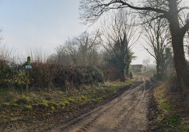
Brearton High Moor is a picturesque area located in the county of Yorkshire, England. Situated in the heart of the Yorkshire Downs, this stunning moorland landscape offers breathtaking views and a tranquil escape from the hustle and bustle of city life.
Spanning over hectares of open land, Brearton High Moor is characterized by its vast expanses of rolling hills, heather-covered moors, and scattered rocky outcrops. The moorland is a mix of rugged terrain and patches of open grassland, providing a unique habitat for a variety of wildlife and plant species.
The area is renowned for its rich history and cultural heritage. Evidence of prehistoric settlements, such as stone circles and burial mounds, can be found scattered throughout the moorland, offering a glimpse into the area's ancient past. Visitors can also explore the remnants of old mining operations, which were once a significant part of the local economy.
Brearton High Moor is a popular destination for outdoor enthusiasts and nature lovers. The moorland offers a network of walking trails and paths, allowing visitors to explore the area on foot and experience its natural beauty up close. Birdwatchers will be delighted by the diverse avian population, with species such as curlews, lapwings, and golden plovers frequently spotted in the area.
The moorland is also a haven for photographers, with its ever-changing light and dramatic landscapes providing endless opportunities for capturing stunning images. Whether it's a peaceful stroll, a challenging hike, or simply a desire to connect with nature, Brearton High Moor offers something for everyone seeking solace in the rugged beauty of Yorkshire's countryside.
If you have any feedback on the listing, please let us know in the comments section below.
Brearton High Moor Images
Images are sourced within 2km of 54.029614/-1.5243039 or Grid Reference SE3159. Thanks to Geograph Open Source API. All images are credited.
Brearton High Moor is located at Grid Ref: SE3159 (Lat: 54.029614, Lng: -1.5243039)
Division: West Riding
Administrative County: North Yorkshire
District: Harrogate
Police Authority: North Yorkshire
What 3 Words
///connector.wager.qualify. Near Knaresborough, North Yorkshire
Nearby Locations
Related Wikis
Nidd
Nidd is a small village and civil parish in the Harrogate district of North Yorkshire, England. The population of the village taken at the 2011 census...
Scotton, Harrogate
Scotton is a small village and civil parish in the Harrogate district of North Yorkshire, England with a population of 524 in the 2001 census, increasing...
Nidd Bridge railway station
Nidd Bridge railway station served the village of Nidd, North Yorkshire, England from 1848 to 1964 on the Leeds-Northallerton Railway. == History == The...
Oak Beck
Oak Beck is a watercourse that flows eastwards across the northern part of Harrogate in North Yorkshire, England. The beck flows through a broad V-shaped...
Nidderdale Greenway
The Nidderdale Greenway is a 4-mile (6.4 km) path that runs between Harrogate and Ripley in North Yorkshire, England. It uses a former railway line that...
Nidd Hall
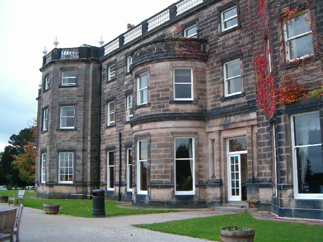
Nidd Hall was a 19th-century country house, now a hotel, in the village of Nidd, North Yorkshire, England. It is a Grade II listed building. It is constructed...
Brearton
Brearton is a village and civil parish in the Harrogate borough of North Yorkshire, England, situated about 3 miles (4.8 km) north of Knaresborough. The...
Harrogate Gasworks Railway
Harrogate Gasworks Railway was an industrial railway in the town of Harrogate, North Yorkshire, England. It was built to the gauge of 2 ft and ran between...
Nearby Amenities
Located within 500m of 54.029614,-1.5243039Have you been to Brearton High Moor?
Leave your review of Brearton High Moor below (or comments, questions and feedback).


