Houndkirk Moor

Downs, Moorland in Derbyshire

England

Houndkirk Moor

Path on Totley Moor
Path on Totley Moor Credit: David Lally

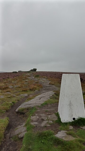
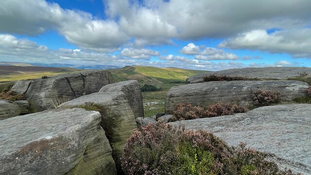
Houndkirk Moor is a picturesque and expansive area of moorland located in Derbyshire, England. Situated in the eastern outskirts of Sheffield, it covers an area of approximately 200 acres and is a popular destination for locals and tourists alike.

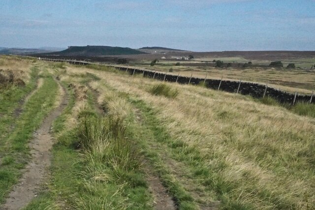
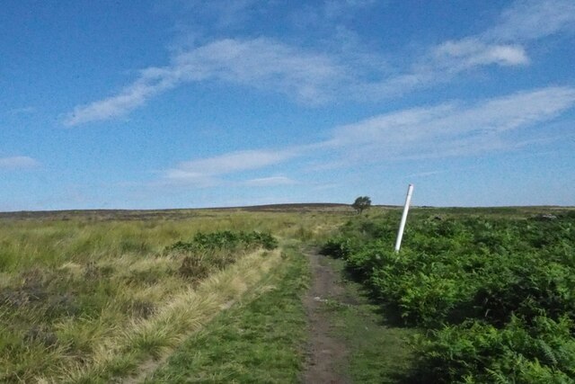
As a part of the Peak District National Park, Houndkirk Moor offers visitors breathtaking views of the surrounding countryside. The moorland is characterized by its rolling hills, rocky outcrops, and heather-covered terrain. It is home to a diverse range of flora and fauna, including various species of birds, insects, and small mammals.

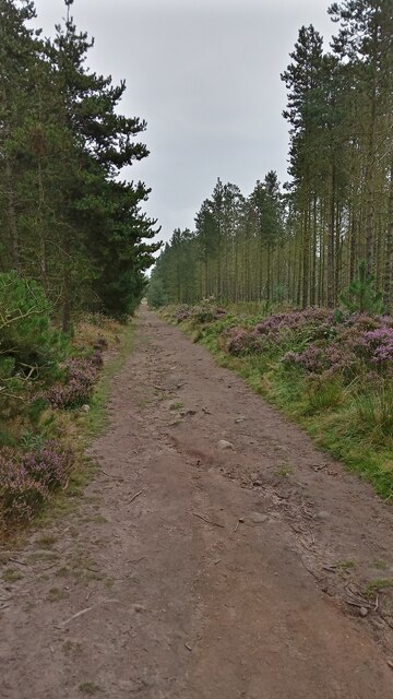
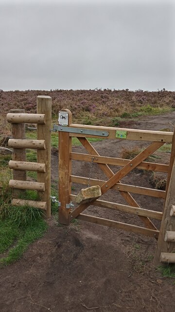
The moorland is intersected by several footpaths and trails, making it a haven for hikers, walkers, and mountain bikers. These paths provide opportunities for exploration and allow visitors to immerse themselves in the natural beauty of the area. Additionally, Houndkirk Moor is a popular spot for dog walkers, with its open spaces providing ample room for pets to roam freely.

Historically, Houndkirk Moor has also played a role in the region's mining industry. Evidence of old lead mines can still be seen scattered throughout the area, adding a sense of history and intrigue to the landscape.

Overall, Houndkirk Moor offers a tranquil and scenic escape from the hustle and bustle of city life. Its natural beauty, coupled with its accessibility and recreational opportunities, make it a favored destination for nature enthusiasts and those seeking a peaceful retreat in the heart of Derbyshire.

If you have any feedback on the listing, please let us know in the comments section below.

Houndkirk Moor Images

Images are sourced within 2km of 53.328611/-1.5813966 or Grid Reference SK2781. Thanks to Geograph Open Source API. All images are credited.

Path on Totley Moor
Path on Totley Moor
Gas main marker on Totley Moor
Panoramic view by Moss Road, Totley
By Moss  Road, Totley
By Moss Road, Totley
Path on Totley Moor The moor is in summer mode, being very dry under foot.
Path on Totley Moor
The moor is in summer mode, being very dry under foot.
Path on Totley Moor A broad rutted track. To the left are views over Sheffield. The city centre is hidden by contours but you can see beyond to Ikea and Meadowhall. Straight ahead there is also a large fire in Nottinghamshire.
Path on Totley Moor
A broad rutted track. To the left are views over Sheffield. The city centre is hidden by contours but you can see beyond to Ikea and Meadowhall. Straight ahead there is also a large fire in Nottinghamshire.
Path on Totley Moor Looking towards Flask Edge where there is a trig point. The land here is about the same height as Flask Edge. The Totley Tunnel crosses where the lower ground is seen.
Path on Totley Moor
Looking towards Flask Edge where there is a trig point. The land here is about the same height as Flask Edge. The Totley Tunnel crosses where the lower ground is seen.
Path on Totley Moor This point is roughly over the Totley railway tunnel. The marker post is highlighting a gas pipeline. Flask Edge is on the horizon.
Path on Totley Moor
This point is roughly over the Totley railway tunnel. The marker post is highlighting a gas pipeline. Flask Edge is on the horizon.
Public Bridleway sign Pointing toward Totley Moor, through it doesn't say that.
Public Bridleway sign
Pointing toward Totley Moor, through it doesn't say that.
Lady Canning's Plantation There are far more paths on the ground than on the map in this wood, including two recently purpose-built mountain bike trails - Europe's first to have been crowdfunded according to one site.
There doesn't seem to be anything definitive about its name, though there are a couple of discussions online about the mysterious Lady Canning. I have my own theory!
The Lady Canning that gets mentioned the most was the wife of Britain's shortest ever serving Prime Minister, George Canning, who died in office after less than four months in the job. There isn't a great deal written about her (in the usual places anyway), and she died in 1837. When she died the title then transferred to the wife of her only surviving son, Charles Canning, who also held government posts, but is best remembered for his roles in India : he was effectively the British guy in  charge there for a number of years, holding the posts of Governor-General and Viceroy.
The second Lady Canning (born Charlotte Stuart) spent the majority of her twenties and thirties as one of a select few in the inner circle of Queen Victoria. Her official job title was 'Lady of the Bedchamber', but her main duties revolved around accompanying the Queen at functions and making sure things were to her liking at them when required. She only left the post when her husband got dispatched to India.
Once there, she painted prolifically, and a few hundred of her pictures are held by the V&A in London. It is also mentioned that she was a keen botanist too, collecting bits of previously unseen plants (by her at least) on her travels. She died of malaria in India in 1861.
Considering that the later Lady Canning, on top of being important enough to supposedly have had an Indian dessert named in her honour (the 'ledikeni'), was a good friend of the Queen, was a recognized artist and plant collector, and that some of the oldest trees in the plantation have had their rings counted, showing a likely planting date in the 1850s or 60s, I rest my case! I think the name was probably given by a local landowning noble, to commemorate her, shortly after  her death.
Lady Canning's Plantation
There are far more paths on the ground than on the map in this wood, including two recently purpose-built mountain bike trails - Europe's first to have been crowdfunded according to one site. There doesn't seem to be anything definitive about its name, though there are a couple of discussions online about the mysterious Lady Canning. I have my own theory! The Lady Canning that gets mentioned the most was the wife of Britain's shortest ever serving Prime Minister, George Canning, who died in office after less than four months in the job. There isn't a great deal written about her (in the usual places anyway), and she died in 1837. When she died the title then transferred to the wife of her only surviving son, Charles Canning, who also held government posts, but is best remembered for his roles in India : he was effectively the British guy in charge there for a number of years, holding the posts of Governor-General and Viceroy. The second Lady Canning (born Charlotte Stuart) spent the majority of her twenties and thirties as one of a select few in the inner circle of Queen Victoria. Her official job title was 'Lady of the Bedchamber', but her main duties revolved around accompanying the Queen at functions and making sure things were to her liking at them when required. She only left the post when her husband got dispatched to India. Once there, she painted prolifically, and a few hundred of her pictures are held by the V&A in London. It is also mentioned that she was a keen botanist too, collecting bits of previously unseen plants (by her at least) on her travels. She died of malaria in India in 1861. Considering that the later Lady Canning, on top of being important enough to supposedly have had an Indian dessert named in her honour (the 'ledikeni'), was a good friend of the Queen, was a recognized artist and plant collector, and that some of the oldest trees in the plantation have had their rings counted, showing a likely planting date in the 1850s or 60s, I rest my case! I think the name was probably given by a local landowning noble, to commemorate her, shortly after her death.
Stone Hanging from a Gate I think the idea is that the weight of the stone ensures that the gate always shuts - it is completely ineffective, though, as the gate stays in whatever position it is left!
Such well-meaning work will have been carried out by the Peak District National Park Authority, who maintain the footpaths within the boundaries of the park. This area is on its far Eastern edge, fairly close to Sheffield.
The Peak District National Park was the first in Britain to be designated, in 1951, perhaps because there were trespass marches held on its land in the 1930s - one of which led to scuffles with gamekeepers, arrests, and imprisonments - which further pushed forward the case for public access to wild land. It covers part of four counties - Cheshire, Derbyshire, South Yorkshire and Staffordshire. Others followed fairly quickly, and there are now 15 national parks across Britain in total.
Stone Hanging from a Gate
I think the idea is that the weight of the stone ensures that the gate always shuts - it is completely ineffective, though, as the gate stays in whatever position it is left! Such well-meaning work will have been carried out by the Peak District National Park Authority, who maintain the footpaths within the boundaries of the park. This area is on its far Eastern edge, fairly close to Sheffield. The Peak District National Park was the first in Britain to be designated, in 1951, perhaps because there were trespass marches held on its land in the 1930s - one of which led to scuffles with gamekeepers, arrests, and imprisonments - which further pushed forward the case for public access to wild land. It covers part of four counties - Cheshire, Derbyshire, South Yorkshire and Staffordshire. Others followed fairly quickly, and there are now 15 national parks across Britain in total.
Ox Stones Trig Point The TrigpointingUK website is the best place to find out the serious stuff regarding Britain's 6,000+ trig points, plus there are often detailed write-ups from the various trig-baggers, which every now and again contain a few interesting titbits of information. One thing that always confuses me on there though is the seemingly arbitrary marking system that the baggers use to rate the trig. This one has marks that regularly vary between 5/10 and 10/10.
The interesting information about this one is that somebody called Alex applied four coats of white paint to it this April. Whoever Alex  is joined the trig-bagging community in April this year and secretly carried tins of white paint up to 10 trig points in England, then disappeared three weeks later. It isn't mentioned whether all of the trigs had previously been white, though older pictures confirm that this one was. Apart from being chased by a park ranger somewhere it seems to have been a successful short-lived hobby, and Alex always seems very proud of his or her work, often reporting how they can afterwards be clearly seen at great distances!
The trig pillar gets its name from the two big stones in the distance and stands at 419 metres. It was first computed - which I'm pretty sure means its height was officially determined so it could then be used for subsequent measurements itself - like so many of them, in 1948.
Ox Stones Trig Point
The TrigpointingUK website is the best place to find out the serious stuff regarding Britain's 6,000+ trig points, plus there are often detailed write-ups from the various trig-baggers, which every now and again contain a few interesting titbits of information. One thing that always confuses me on there though is the seemingly arbitrary marking system that the baggers use to rate the trig. This one has marks that regularly vary between 5/10 and 10/10. The interesting information about this one is that somebody called Alex applied four coats of white paint to it this April. Whoever Alex is joined the trig-bagging community in April this year and secretly carried tins of white paint up to 10 trig points in England, then disappeared three weeks later. It isn't mentioned whether all of the trigs had previously been white, though older pictures confirm that this one was. Apart from being chased by a park ranger somewhere it seems to have been a successful short-lived hobby, and Alex always seems very proud of his or her work, often reporting how they can afterwards be clearly seen at great distances! The trig pillar gets its name from the two big stones in the distance and stands at 419 metres. It was first computed - which I'm pretty sure means its height was officially determined so it could then be used for subsequent measurements itself - like so many of them, in 1948.
Approaching Hathersage Moor On a moorland path from the A6187 Hathersage Road
Approaching Hathersage Moor
On a moorland path from the A6187 Hathersage Road
On Burbage Edge Looking over Hathersage Moor to Higger Tor
On Burbage Edge
Looking over Hathersage Moor to Higger Tor
On Burbage Edge Looking over Hathersage Moor to Higger Tor
On Burbage Edge
Looking over Hathersage Moor to Higger Tor
Abandoned millstones Lying in a former quarry on Burbage Edge
Abandoned millstones
Lying in a former quarry on Burbage Edge
Woodland on the Longshaw Estate
Lichen-covered sign in the woods at Longshaw Lodge
Show me another place!

Houndkirk Moor is located at Grid Ref: SK2781 (Lat: 53.328611, Lng: -1.5813966)

Unitary Authority: Sheffield

Police Authority: South Yorkshire

What 3 Words

///waving.cafe.gums. Near Hathersage, Derbyshire

Nearby Locations

Houndkirk Moor

Related Wikis

Fox House, South Yorkshire

Fox House is a 17th-century Grade-II listed Inn, located near the Longshaw Estate in the Peak District, near the border between South Yorkshire and Derbyshire...

Blacka Moor Nature Reserve

Blacka Moor Nature Reserve is a nature reserve located on Hathersage Road between Sheffield and Hathersage in the Peak District National Park in the United...

Totley Moor

Totley Moor is an open moorland hill to the west of the Sheffield suburb of Totley, in the Derbyshire Peak District. The summit is 395 metres (1,296 ft...

Burbage Rocks

Burbage Rocks is a gritstone escarpment in South Yorkshire, overlooking the village of Hathersage in the Peak District. The highest point along the escarpment...

Hathersage Road (Sheffield)

Hathersage Road is a road in Sheffield South Yorkshire, England and Derbyshire. It leads south-west from the suburb of Whirlow over the border between...

Totley Tunnel

Totley Tunnel is a 6,230-yard (3.5 mi; 5.7 km) tunnel under Totley Moor, on the Hope Valley line between Totley on the outskirts of Sheffield and Grindleford...

Carl Wark

Carl Wark (sometimes Carl's Wark) is a rocky promontory on Hathersage Moor in the Peak District National Park, just inside the boundary of Sheffield, England...

Longshaw Estate

Longshaw Estate is an area of moorland, woodland and farmland within the Peak District National Park in Derbyshire, England. The name of Longshaw is thought...

Nearby Amenities

Located within 500m of 53.328611,-1.5813966
Barrier: kissing_gate
Foot: yes
Source: Local_Knowledge
Lat/Long: 53.331059/-1.5861495
Barrier: kissing_gate
Foot: yes
Source: Local_Knowledge
Lat/Long: 53.329062/-1.5886198
Historic: WW2_Starfish_Decoy
Lat/Long: 53.3302706/-1.5861807
Marker: post
Lat/Long: 53.3290475/-1.5885799
Boomerang Boulder
Climbing: crag
Climbing Boulder: yes
Climbing Rock: gritstone
Natural: stone
Sport: climbing
Lat/Long: 53.3282863/-1.5866036
Marker: post
Lat/Long: 53.3304883/-1.5767577
Marker: post
Lat/Long: 53.327563/-1.5878102
The data included in this document is from www.openstreetmap.org. The data is made available under ODbL.

Have you been to Houndkirk Moor?

Leave your review of Houndkirk Moor below (or comments, questions and feedback).