Roughbirchworth Common

Downs, Moorland in Yorkshire

England

Roughbirchworth Common

Farmland and pylon off Hunshelf Hall Lane
Farmland and pylon off Hunshelf Hall Lane Credit: JThomas

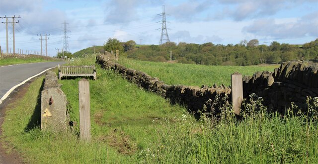
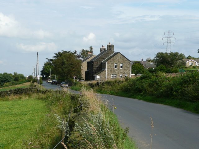
Roughbirchworth Common is a scenic and expansive area located in Yorkshire, England. Situated amidst the stunning Yorkshire Downs and Moorland, it spans across approximately 500 acres of natural beauty. This common is a designated Site of Special Scientific Interest (SSSI), which further highlights its ecological significance.

The terrain of Roughbirchworth Common is characterized by its diverse landscapes, including rolling hills, heather-covered moorland, and picturesque valleys. It is home to a wide array of flora and fauna, with rare and protected species thriving within its boundaries. The common is particularly renowned for its vibrant display of heather, which blankets the moorland in a rich purple hue during the summer months.

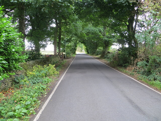
Walking trails crisscross the common, allowing visitors to explore its vast expanse and take in the breathtaking views. From the higher points, one can enjoy panoramic vistas of the surrounding countryside, with glimpses of the nearby reservoirs adding to the charm of the scenery.

Given its ecological significance and natural beauty, Roughbirchworth Common is a popular destination for nature enthusiasts, hikers, and photographers. It offers a peaceful retreat away from the hustle and bustle of city life, providing a tranquil setting for relaxation and wildlife observation.

Visitors to Roughbirchworth Common can expect to encounter a variety of wildlife, including birds of prey, such as kestrels and buzzards, as well as small mammals like hares and voles. The common also boasts a rich insect population, with butterflies and bees adding splashes of color to the landscape.

Overall, Roughbirchworth Common is a hidden gem in Yorkshire, offering a unique blend of natural beauty, biodiversity, and tranquility that attracts visitors from near and far.

If you have any feedback on the listing, please let us know in the comments section below.

Roughbirchworth Common Images

Images are sourced within 2km of 53.511015/-1.5993108 or Grid Reference SE2601. Thanks to Geograph Open Source API. All images are credited.

Farmland and pylon off Hunshelf Hall Lane
Field entrance off Hunshelf Hall Lane
Hunshelf Hall Lane Heading north west at the junction with Dean Head Lane.
Hunshelf Hall Lane
Heading north west at the junction with Dean Head Lane.
An old sheep dip? Beside Hunshelf Hall Lane
An old sheep dip?
Beside Hunshelf Hall Lane
Tip it on Mucky Lane! Where better named, but surely there are better places to dispose of unwanted furniture?
Tip it on Mucky Lane!
Where better named, but surely there are better places to dispose of unwanted furniture?
All lines lead to Mucky Lane A major sub-station on the grid bringing in power that will supply Stocksbridge and the steelworks behind this viewpoint on the Barnsley Boundary Walk.
All lines lead to Mucky Lane
A major sub-station on the grid bringing in power that will supply Stocksbridge and the steelworks behind this viewpoint on the Barnsley Boundary Walk.
Pecks Pond The natural ancient watering hole was used by both drovers taking cattle and pack horses carrying salt along the Cheshire to East Yorkshire Salters' Way. In 1741, this road became the turnpike road to Manchester. The walls were built through the pond to allow two different lots of livestock to water.
Pecks Pond
The natural ancient watering hole was used by both drovers taking cattle and pack horses carrying salt along the Cheshire to East Yorkshire Salters' Way. In 1741, this road became the turnpike road to Manchester. The walls were built through the pond to allow two different lots of livestock to water.
Old farm buildings at Far Coates Along the Trans Pennine trail.
Old farm buildings at Far Coates
Along the Trans Pennine trail.
Walkers enter the Hunthwaite Tunnel
Thurgoland Tunnel Portals Former railway tunnels with the up tunnel a relatively new single bore now used as a cycle path. The tunnel is renowned for its acoustics
Thurgoland Tunnel Portals
Former railway tunnels with the up tunnel a relatively new single bore now used as a cycle path. The tunnel is renowned for its acoustics
Thurgoland Tunnel The Former railway single bore tunnel looking to the north portal
Thurgoland Tunnel
The Former railway single bore tunnel looking to the north portal
Old milepost The last of the metal posts still in situ between Thurgoland and Oxspsring on the old route from Sheffield to Penistone.   3½ years since it was painted, it has suffered from chippings thrown up by passing traffic and the black lettering has been washed off by the rain and splashes.  Another visit with paint brushes needed.
Old milepost
The last of the metal posts still in situ between Thurgoland and Oxspsring on the old route from Sheffield to Penistone. 3½ years since it was painted, it has suffered from chippings thrown up by passing traffic and the black lettering has been washed off by the rain and splashes. Another visit with paint brushes needed.
Old milepost Painted again and in the setting sun.  Milepost on the original Sheffield to Penistone route through Oxspring.   Grade II listed 1315034.
Old milepost
Painted again and in the setting sun. Milepost on the original Sheffield to Penistone route through Oxspring. Grade II listed 1315034.
Dyson Cote Lane approaching Snowden Hill Looking eastward.
Dyson Cote Lane approaching Snowden Hill
Looking eastward.
Grudgby Lane near Snowden Hill Looking northward.
Grudgby Lane near Snowden Hill
Looking northward.
Wall and tree enclosed Long Lane, Roughbirchworth Looking westward.
Wall and tree enclosed Long Lane, Roughbirchworth
Looking westward.
Willow Bridge, Oxspring
Railway infrastructure remnants Railway infrastructure remnants close to the Trans Pennine Trail (TPT) at Oxspring.
Railway infrastructure remnants
Railway infrastructure remnants close to the Trans Pennine Trail (TPT) at Oxspring.
Show me another place!

Roughbirchworth Common is located at Grid Ref: SE2601 (Lat: 53.511015, Lng: -1.5993108)

Division: West Riding

Unitary Authority: Barnsley

Police Authority: South Yorkshire

What 3 Words

///suspended.tapers.slowness. Near Penistone, South Yorkshire

Related Wikis

Oxspring railway station

Oxspring railway station was a short lived station built by the Sheffield, Ashton-under-Lyne and Manchester Railway to serve the village of Oxspring, South...

Oxspring

Oxspring is a village and civil parish in the Metropolitan Borough of Barnsley in South Yorkshire, England. At the 2001 census it had a population of...

Penistone and Stocksbridge (UK Parliament constituency)

Penistone and Stocksbridge is a constituency in South Yorkshire represented in the House of Commons of the UK Parliament since 2019 by Miriam Cates, a...

Hunshelf

Hunshelf is a civil parish in the Metropolitan Borough of Barnsley. At the 2001 census it had a population of 324, reducing to 246 at the 2011 Census...

Nearby Amenities

Located within 500m of 53.511015,-1.5993108
Oxspring
Designation: Parish Council
Place: village
Wikidata: Q2022029
Wikipedia: en:Oxspring
Lat/Long: 53.5146456/-1.5987625
Turning Circle
Mayfield
Turning Circle: square
Lat/Long: 53.5140434/-1.5948275
Turning Circle
Fields End
Lat/Long: 53.5115473/-1.5955747
Bus Stop
Sheffield Road
Alt Name: Sheffield Road
Bench: yes
Bus: yes
Covered: yes
Departures Board: realtime
Naptan AltCommonName: Sheffield Road
Naptan AtcoCode: 370055413
Naptan Bearing: N
Naptan CommonName: Sheffield Road
Naptan Indicator: 55413
Naptan Landmark: OUTSIDE SCHOOL
Naptan PlusbusZoneRef: ROTHCEN
Naptan Street: Sheffield Road
Naptan Verified: no
Public Transport: platform
Shelter: yes
Source: naptan_import
Lat/Long: 53.515098/-1.596464
Bus Stop
Roughbirchworth Lane/Park Lane
Bus: yes
Naptan AtcoCode: 370055767
Naptan Bearing: NE
Naptan BusStopType: CUS
Naptan CommonName: Roughbirchworth Lane/Park Lane
Naptan Indicator: 55767
Naptan Landmark: 55767
Naptan PlusbusZoneRef: ROTHCEN
Naptan Street: Roughbirchworth Lane
Naptan Verified: no
Public Transport: platform
Source: naptan_import
Lat/Long: 53.5100306/-1.6051075
Bus Stop
Roughbirchworth Lane/Park Lane
Bus: yes
Naptan AtcoCode: 370055768
Naptan Bearing: W
Naptan BusStopType: CUS
Naptan CommonName: Roughbirchworth Lane/Park Lane
Naptan Indicator: 55768
Naptan Landmark: 55768
Naptan PlusbusZoneRef: ROTHCEN
Naptan Street: Roughbirchworth Lane
Naptan Verified: no
Public Transport: platform
Source: naptan_import
Lat/Long: 53.5145461/-1.5953489
Grit Bin
Source: survey
Lat/Long: 53.5132987/-1.5974033
Post Office
Oxspring Post Office
Addr City: Sheffield
Addr Postcode: S36 8YW
Addr Street: Sheffield Road
Addr Suburb: Oxspring
Brand: Post Office
Brand Wikidata: Q1783168
Opening Hours: Mo,Tu,Th,Fr 09:00-13:00,14:00-17:30; We 09:00-13:00; Sa 09:00-12:30
Ref Pol Id: 10858
Source: survey
Source Addr Postcode: FSA Food Hygiene Ratings Database
Website: https://www.postoffice.co.uk/branch-finder/2723409/oxspring
Lat/Long: 53.5148392/-1.5957861
Grit Bin
Lat/Long: 53.5131498/-1.5966121
Post Box
Collection Times: Mo-Fr 16:45; Sa 11:15
Operator: Royal Mail
Operator Wikidata: Q638098
Post Box Type: wall
Ref: S36 455
Royal Cypher: GR
Royal Cypher Wikidata: Q33102273
Source: survey
Lat/Long: 53.5149019/-1.595712
Bench
Lat/Long: 53.5117337/-1.5925103
Post Box
Ref: S36 404
Lat/Long: 53.5098251/-1.6053606
Grit Bin
Lat/Long: 53.5137175/-1.5940621
Bench
Lat/Long: 53.5146903/-1.5953674
Grit Bin
Lat/Long: 53.5120405/-1.5951569
Roughbirchworth
Place: hamlet
Lat/Long: 53.5097406/-1.6054599
Power: pole
Lat/Long: 53.5132231/-1.6029623
Power: pole
Lat/Long: 53.512236/-1.6007751
Power: pole
Lat/Long: 53.5093379/-1.5952681
Barrier: stile
Lat/Long: 53.511225/-1.6058587
Barrier: stile
Lat/Long: 53.5108739/-1.6030743
Barrier: stile
Lat/Long: 53.5103779/-1.6023454
Barrier: stile
Lat/Long: 53.5102563/-1.5998675
Barrier: stile
Lat/Long: 53.510001/-1.5977007
Barrier: stile
Lat/Long: 53.5103958/-1.5966886
Grit Bin
Source: survey
Lat/Long: 53.5143692/-1.5968937
Power: pole
Lat/Long: 53.51129/-1.5989774
Power: pole
Lat/Long: 53.5103476/-1.5970317
Bus: yes
Public Transport: stop_position
Lat/Long: 53.5145782/-1.5953368
Bus: yes
Public Transport: stop_position
Lat/Long: 53.5100037/-1.6050647
Give Way
Direction: forward
Lit: no
Lat/Long: 53.5099136/-1.6052889
The data included in this document is from www.openstreetmap.org. The data is made available under ODbL.

Have you been to Roughbirchworth Common?

Leave your review of Roughbirchworth Common below (or comments, questions and feedback).