Lamb Down

Downs, Moorland in Wiltshire

England

Lamb Down

Tree planting in Ashdown Copse In March 2020 the MoD announced the felling of thousands of trees in Ashdown Copse due to infection by Ash dieback disease <span class="nowrap"><a title="https://www.forestryjournal.co.uk/features/18344394.clearing-ash-military-precision/" rel="nofollow ugc noopener" href="https://www.forestryjournal.co.uk/features/18344394.clearing-ash-military-precision/">Link</a><img style="margin-left:2px;" alt="External link" title="External link - shift click to open in new window" src="https://s1.geograph.org.uk/img/external.png" width="10" height="10"/></span> . I don't know if this replanting is related to that. Whips of various species were being planted by men who, it seemed, did not speak English.
Tree planting in Ashdown Copse Credit: Peter Facey

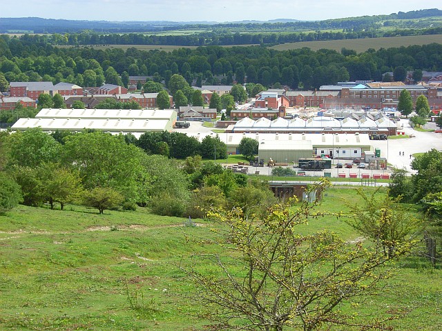
Lamb Down, located in Wiltshire, England, is a picturesque area encompassing downs and moorland, offering a diverse and stunning landscape. The region is known for its natural beauty, attracting visitors from near and far.

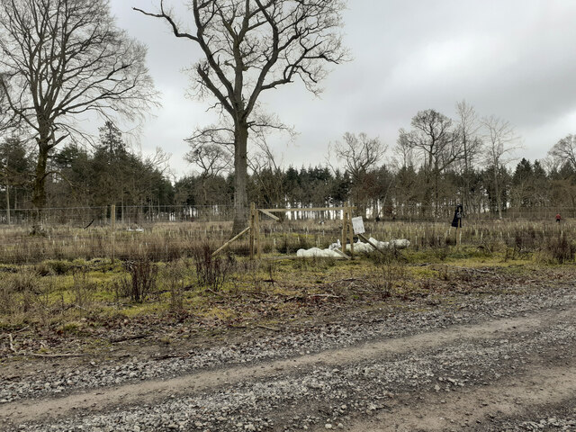
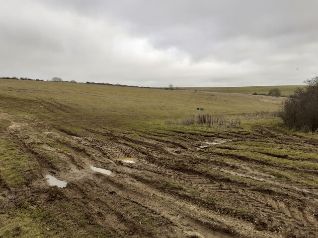
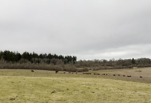
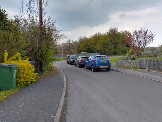
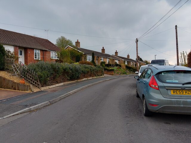
The downs of Lamb Down are characterized by gently rolling hills covered in lush green grass and scattered with wildflowers, creating a vibrant and idyllic scenery. These downs provide ample opportunities for outdoor activities such as walking, hiking, and picnicking, as well as offering panoramic views of the surrounding countryside.

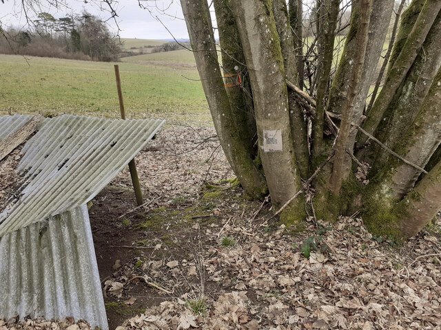
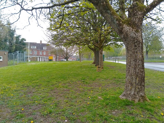
In contrast, the moorland in Lamb Down showcases a more rugged and untamed landscape. Here, visitors can experience the raw beauty of open expanses, heather-covered hills, and scattered patches of woodland. Moorland is home to a variety of wildlife, including birds, rabbits, and sometimes even deer, making it a haven for nature enthusiasts and birdwatchers.

Lamb Down is not only a haven for nature lovers but also holds historical significance. The area is scattered with ancient archaeological sites, including burial mounds and stone circles, hinting at its rich past and providing fascinating insights into the region's history.

The tranquility and natural beauty of Lamb Down, Wiltshire, make it an ideal destination for those seeking a peaceful retreat or an escape from the hustle and bustle of everyday life. Whether exploring the downs or immersing oneself in the rugged moorland, visitors are sure to find solace in the breathtaking surroundings of this enchanting area.

If you have any feedback on the listing, please let us know in the comments section below.

Lamb Down Images

Images are sourced within 2km of 51.235864/-1.6331675 or Grid Reference SU2548. Thanks to Geograph Open Source API. All images are credited.

Tree planting in Ashdown Copse In March 2020 the MoD announced the felling of thousands of trees in Ashdown Copse due to infection by Ash dieback disease <span class="nowrap"><a title="https://www.forestryjournal.co.uk/features/18344394.clearing-ash-military-precision/" rel="nofollow ugc noopener" href="https://www.forestryjournal.co.uk/features/18344394.clearing-ash-military-precision/">Link</a><img style="margin-left:2px;" alt="External link" title="External link - shift click to open in new window" src="https://s1.geograph.org.uk/img/external.png" width="10" height="10"/></span> . I don't know if this replanting is related to that. Whips of various species were being planted by men who, it seemed, did not speak English.
Tree planting in Ashdown Copse
In March 2020 the MoD announced the felling of thousands of trees in Ashdown Copse due to infection by Ash dieback disease LinkExternal link . I don't know if this replanting is related to that. Whips of various species were being planted by men who, it seemed, did not speak English.
Track junction in Ashdown Copse At this point I had mistraken my route and strayed off the public footpath I had previously been following <a title="https://www.geograph.org.uk/photo/7396602" href="https://www.geograph.org.uk/photo/7396602">Link</a> .
Track junction in Ashdown Copse
At this point I had mistraken my route and strayed off the public footpath I had previously been following Link .
Weird shelter in Ashdown Copse The note on the tree reads "RV 4 Friendly prisoners are being held at grid SD 299 126". SD 299 126 is a holiday park at Ainsdale-on-Sea south of Southport about 180 miles from here. Whether this note is part of military training or perhaps some paintball event I don't know.
Weird shelter in Ashdown Copse
The note on the tree reads "RV 4 Friendly prisoners are being held at grid SD 299 126". SD 299 126 is a holiday park at Ainsdale-on-Sea south of Southport about 180 miles from here. Whether this note is part of military training or perhaps some paintball event I don't know.
Gate in forestry fence The public footpath here runs through the fine mesh improvised gate seen at right in the photo. It runs for 138 yards in a NNW direction before emerging through another such gate onto another track. There is no visible footpath inside this fence so I followed it by GPS. Essentially this new plantation fencing has cut across the footpath. Rather than following the footpath it would be much easier to simply follow the tracks round the other two sides of this triangle, although there is no right of way to do so.
Gate in forestry fence
The public footpath here runs through the fine mesh improvised gate seen at right in the photo. It runs for 138 yards in a NNW direction before emerging through another such gate onto another track. There is no visible footpath inside this fence so I followed it by GPS. Essentially this new plantation fencing has cut across the footpath. Rather than following the footpath it would be much easier to simply follow the tracks round the other two sides of this triangle, although there is no right of way to do so.
Track junction at SE corner of Warren Hill plantation The Wiltshire County Council right of way sign here has been rotated 90 degrees to give false information. I rotated it back. The real public footpath runs diagonally from the bottom left corner of this photo to the middle right.
Track junction at SE corner of Warren Hill plantation
The Wiltshire County Council right of way sign here has been rotated 90 degrees to give false information. I rotated it back. The real public footpath runs diagonally from the bottom left corner of this photo to the middle right.
Public Footpath in valley south of Warren Hill
Wildlife Area in valley south of Warren Hill The woodland ahead is marked as a wildlife area and there is a request to keep dogs on leads.
Wildlife Area in valley south of Warren Hill
The woodland ahead is marked as a wildlife area and there is a request to keep dogs on leads.
Track junction at Kimpton Gorse The Wiltshire County Council public footpath sign had been rotated here through ninety degrees to give  misleading picture of the right of way. I rotated it back. The real public footpath does not follow any of the grassy tracks seen here. Rather, it runs diagonally across the hillside from here towards the second tiny clump of trees just seen on the horizon near the left of this photo.
Track junction at Kimpton Gorse
The Wiltshire County Council public footpath sign had been rotated here through ninety degrees to give misleading picture of the right of way. I rotated it back. The real public footpath does not follow any of the grassy tracks seen here. Rather, it runs diagonally across the hillside from here towards the second tiny clump of trees just seen on the horizon near the left of this photo.
Looking along public footpath towards Kimpton Gorse The hillside here seemed to have been dug up or had a crop on it recently. There was no trace of the public footpath, so I followed by GPS.
Looking along public footpath towards Kimpton Gorse
The hillside here seemed to have been dug up or had a crop on it recently. There was no trace of the public footpath, so I followed by GPS.
Public footpath from Klimpton Gorse towards Ashdown Copse The footpath passes in a straight line to the right of the disused pit seen in the distance. The line of scrub seen in the foreground is not marked on the 1:25K OS map. The footpath here is undiscernible but can be followed by GPS.
Public footpath from Klimpton Gorse towards Ashdown Copse
The footpath passes in a straight line to the right of the disused pit seen in the distance. The line of scrub seen in the foreground is not marked on the 1:25K OS map. The footpath here is undiscernible but can be followed by GPS.
Fearsome horned cattle blocking public footpath The indiscernible public footpath is climbing towards Ashdown Copse. I was following it by GPS. The cattle were enclosed by an electric fence. I deviated southwards from the footpath to avoid the cattle.
Fearsome horned cattle blocking public footpath
The indiscernible public footpath is climbing towards Ashdown Copse. I was following it by GPS. The cattle were enclosed by an electric fence. I deviated southwards from the footpath to avoid the cattle.
Beech Hill Road, Tidworth Beech Hill Road is a road between Tidworth Road and Hawthorn Road in Tidworth. It also connects to Cherry Tree Avenue.
Beech Hill Road, Tidworth
Beech Hill Road is a road between Tidworth Road and Hawthorn Road in Tidworth. It also connects to Cherry Tree Avenue.
Beech Hill Road, Tidworth Beech Hill Road is a road between Tidworth Road and Hawthorn Road in Tidworth. It also connects to Cherry Tree Avenue.
Beech Hill Road, Tidworth
Beech Hill Road is a road between Tidworth Road and Hawthorn Road in Tidworth. It also connects to Cherry Tree Avenue.
Halton Road, Perham Down Halton Road is a road in Perham Down off Somme Road, leading to Wouldham Close and Upnor Close.
Halton Road, Perham Down
Halton Road is a road in Perham Down off Somme Road, leading to Wouldham Close and Upnor Close.
Verge beside Perham Down Road A large verge beside Perham Down Road. The white building is a nursery. To the left is Swinton Barracks.
Verge beside Perham Down Road
A large verge beside Perham Down Road. The white building is a nursery. To the left is Swinton Barracks.
Perham Down Community Centre and Swinton Barracks Welfare Office A building with two uses in Perham Down.
Perham Down Community Centre and Swinton Barracks Welfare Office
A building with two uses in Perham Down.
Verge beside Perham Down Road A large verge beside Perham Down Road. Both sides of the road are parts of Swinton Barracks.
Verge beside Perham Down Road
A large verge beside Perham Down Road. Both sides of the road are parts of Swinton Barracks.
Ox Drove near Kimpton Down Farm Ox Drove is a restricted byway heading north near to Kimpton Down Farm, off Down Road.
Ox Drove near Kimpton Down Farm
Ox Drove is a restricted byway heading north near to Kimpton Down Farm, off Down Road.
Show me another place!

Lamb Down is located at Grid Ref: SU2548 (Lat: 51.235864, Lng: -1.6331675)

Unitary Authority: Wiltshire

Police Authority: Wiltshire

What 3 Words

///cork.decay.marathon. Near Tidworth, Wiltshire

Nearby Locations

Lamb Down Lambdown Furze

Related Wikis

Perham Down

Perham Down is a village in Wiltshire, England, in Tidworth parish on the eastern edge of Salisbury Plain. It lies on a minor road about 1+1⁄2 miles (2...

Swinton Barracks

Swinton Barracks is a military installation accommodating two engineer regiments at Perham Down in Wiltshire, England. The site is on the east edge of...

Tidworth

Tidworth is a garrison town and civil parish in south-east Wiltshire, England, on the eastern edge of Salisbury Plain. Lying on both sides of the A338...

The Wellington Academy

The Wellington Academy, founded in 2009, is an 11–19 non-selective state-funded school near Ludgershall, Wiltshire, England. The school has academy status...

Ludgershall railway station, Wiltshire

Ludgershall railway station was a railway station which served the town of Ludgershall in Wiltshire, England from 1882 to 1961. == History == The station...

St Mary's Church, South Tidworth

St Mary's Church in South Tidworth, Wiltshire, England, was built in 1878. It is recorded in the National Heritage List for England as a designated Grade...

Perriam Down

Perriam Down or Perriam Downs, near Ludgershall, Wiltshire, England was a venue for five first-class cricket matches and at least three other matches between...

Ludgershall, Wiltshire

Ludgershall ( LUG-ər-shawl, with a hard g) is a town and civil parish 16 miles (26 km) north east of Salisbury, Wiltshire, England. It is on the A342 road...

Nearby Amenities

Located within 500m of 51.235864,-1.6331675
Post Box
Brand: Royal Mail
Brand Wikidata: Q638098
Brand Wikipedia: en:Royal Mail
Collection Plate: CP1
Collection Times: Mo-Fr 16:00; Sa 11:45
Last Checked: 2021-12-08
Operator: Royal Mail
Operator Wikidata: Q638098
Post Box Type: pillar
Ref: SP11 6
Royal Cypher: EVIIR
Royal Cypher Wikidata: Q33102324
Source: survey
Lat/Long: 51.2387972/-1.6329925
Give Way
Direction: backward
Lat/Long: 51.239242/-1.6347738
Give Way
Direction: backward
Lat/Long: 51.2392035/-1.6350141
Give Way
Direction: backward
Lat/Long: 51.2391826/-1.6352582
Give Way
Direction: backward
Lat/Long: 51.239196/-1.635706
Stop
Direction: forward
Lat/Long: 51.2389/-1.6343907
Stop
Direction: forward
Lat/Long: 51.2392472/-1.6356238
Give Way
Direction: backward
Lat/Long: 51.2391141/-1.6343793
Give Way
Direction: backward
Lat/Long: 51.2391469/-1.6363225
Give Way
Direction: backward
Lat/Long: 51.2390591/-1.6368174
Give Way
Direction: backward
Lat/Long: 51.2391515/-1.6367215
Give Way
Direction: backward
Lat/Long: 51.2391297/-1.636574
Give Way
Direction: forward
Lat/Long: 51.2389659/-1.6381343
Noexit: yes
Lat/Long: 51.2390008/-1.637665
Give Way
Direction: forward
Lat/Long: 51.238858/-1.6375617
The data included in this document is from www.openstreetmap.org. The data is made available under ODbL.

Have you been to Lamb Down?

Leave your review of Lamb Down below (or comments, questions and feedback).