Brailsford Green

Downs, Moorland in Derbyshire Derbyshire Dales

England

Brailsford Green

Brailsford Methodist Church, Derbyshire
Brailsford Methodist Church, Derbyshire Credit: Alf Beard

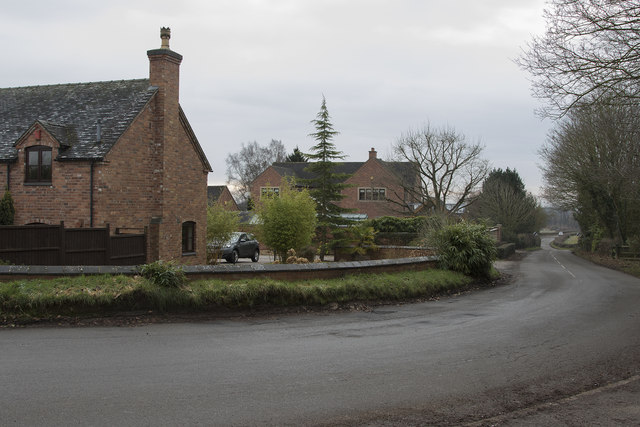
Brailsford Green is a picturesque village located in the county of Derbyshire, England. Situated amidst the rolling hills and lush countryside, it offers a serene and idyllic setting for residents and visitors alike. The village is part of the wider Brailsford parish, which also includes the nearby hamlets of Ednaston and Shirley.

With a population of around 400, Brailsford Green is a close-knit community that prides itself on its strong sense of community spirit. The village is home to a range of amenities, including a village hall, a primary school, a post office, and a traditional village pub. These facilities help foster a vibrant social scene, with regular events and activities organized throughout the year.

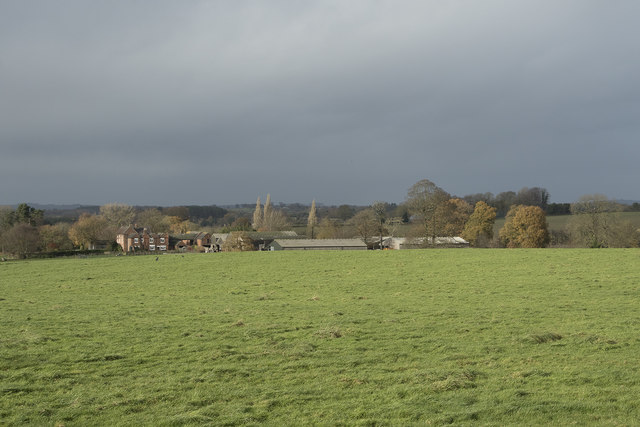
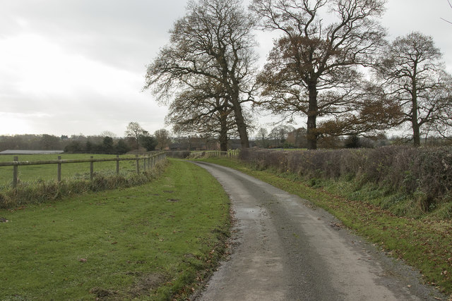
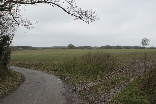
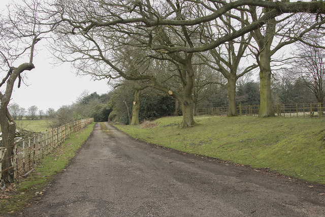
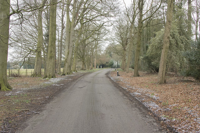
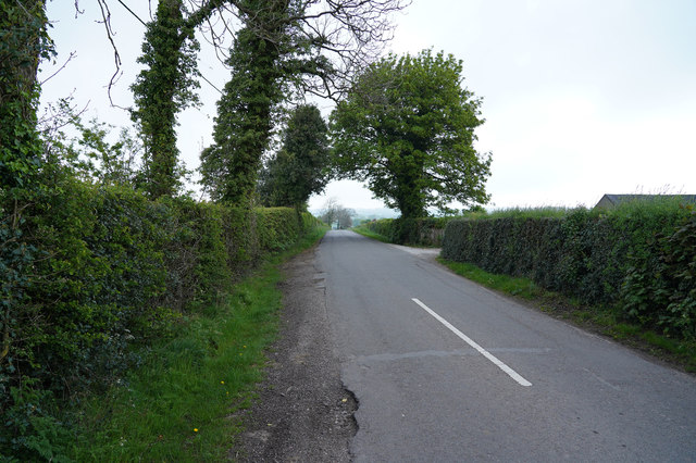
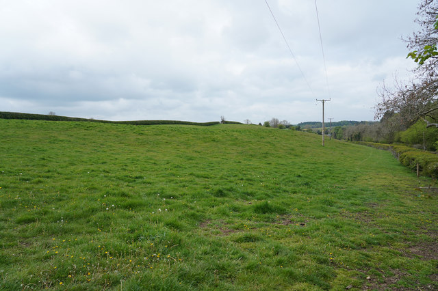
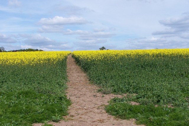
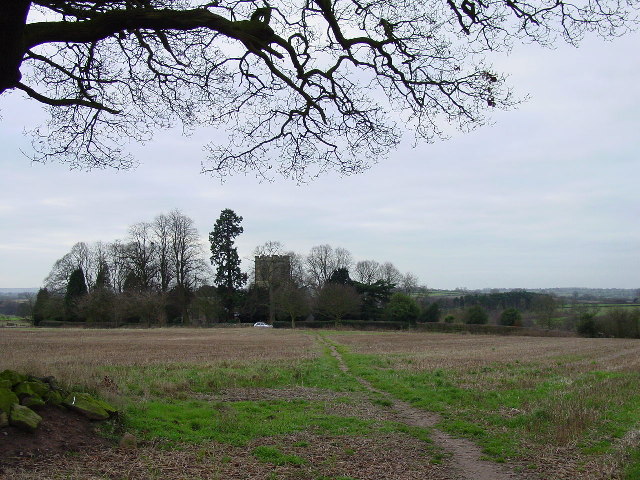
Surrounded by stunning natural beauty, Brailsford Green is a popular destination for outdoor enthusiasts. The village is bordered by expansive moorland, offering ample opportunities for walking, hiking, and birdwatching. The nearby Brailsford Golf Course also attracts golf enthusiasts from far and wide.

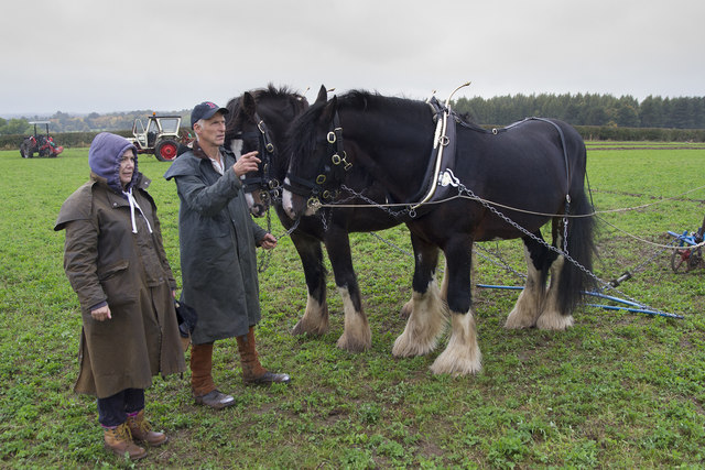
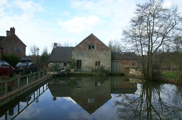
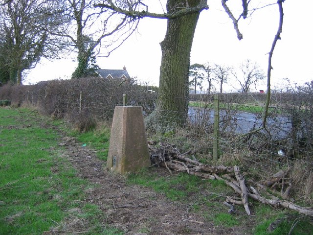
In addition to its natural wonders, Brailsford Green boasts a rich history. The village is home to several historic buildings, including a 12th-century church and a number of traditional stone cottages. The annual Brailsford and Ednaston Country Show, held in the summer, celebrates the area's agricultural heritage and is a highlight of the local calendar.

Overall, Brailsford Green is a charming and welcoming village that combines natural beauty with a strong sense of community. Whether enjoying the peaceful countryside or engaging in local events, visitors to Brailsford Green are sure to be captivated by its timeless appeal.

If you have any feedback on the listing, please let us know in the comments section below.

Brailsford Green Images

Images are sourced within 2km of 52.970581/-1.6279544 or Grid Reference SK2541. Thanks to Geograph Open Source API. All images are credited.

Brailsford Methodist Church, Derbyshire
Brailsford Ploughing Match This ploughing match and country fair has been going for many years. though called the Brailsford match it actually takes place at different farms around the area and is often a long way from the village of Brailsford.  This year however it was very close to Brailsford.
Brailsford Ploughing Match
This ploughing match and country fair has been going for many years. though called the Brailsford match it actually takes place at different farms around the area and is often a long way from the village of Brailsford. This year however it was very close to Brailsford.
Looking along the edge of a copse The long and narrow copse runs along the edge of this field.
Looking along the edge of a copse
The long and narrow copse runs along the edge of this field.
A storm is threatened The morning about an hour before was bright and sunny but very windy. The wind brought in these very dark and threatening clouds over the fields at Pools Head.
A storm is threatened
The morning about an hour before was bright and sunny but very windy. The wind brought in these very dark and threatening clouds over the fields at Pools Head.
Farm track The farm track leads to Churchfields Farm near Brailsford.
Farm track
The farm track leads to Churchfields Farm near Brailsford.
Near Brailsford Green Brailsford Green just outside the small village of Brailsford.
Near Brailsford Green
Brailsford Green just outside the small village of Brailsford.
The Plain Brailsford A small group of houses on a road simply called the Plain. It is in Brailsford and will soon be in the village even more as there is a proposal to build a lot more houses.
The Plain Brailsford
A small group of houses on a road simply called the Plain. It is in Brailsford and will soon be in the village even more as there is a proposal to build a lot more houses.
Grazing sheep A truly rural scene with sheep grazing on what I think, for them, is rather long and lush grass.
Grazing sheep
A truly rural scene with sheep grazing on what I think, for them, is rather long and lush grass.
The edge of Ednaston Fairly modern detached houses on the edge of Ednaston. The entrance to Ednaston Hall is behind and to the right of the camera position.
The edge of Ednaston
Fairly modern detached houses on the edge of Ednaston. The entrance to Ednaston Hall is behind and to the right of the camera position.
Ednaston Hall drive Quite a lot of work has been carried out to the trees lining the drive as many large branches had been cut off.
Ednaston Hall drive
Quite a lot of work has been carried out to the trees lining the drive as many large branches had been cut off.
Looking towards St. Mary's Nursing home This is the tree lined drive to St. Mary's Nursing Home. It is a quiet and peaceful place.
Looking towards St. Mary's Nursing home
This is the tree lined drive to St. Mary's Nursing Home. It is a quiet and peaceful place.
Brailsford Mill Converted water mill at Brailsford, viewed across the mill pond.
Brailsford Mill
Converted water mill at Brailsford, viewed across the mill pond.
A lane by Fiddlers Folly Just outside the village of Brailsford is this minor road through the countryside which goes to nowhere inparticular.
A lane by Fiddlers Folly
Just outside the village of Brailsford is this minor road through the countryside which goes to nowhere inparticular.
An interesting wall The brick wall in the middle distance is not straight but has two distinct curves. Whether this to act as a sun trap I do not know but it does face roughly SE.
An interesting wall
The brick wall in the middle distance is not straight but has two distinct curves. Whether this to act as a sun trap I do not know but it does face roughly SE.
A public footpath Not a much used footpath judging from the lack of an obvious route under the low voltage electricity cables.
A public footpath
Not a much used footpath judging from the lack of an obvious route under the low voltage electricity cables.
Trig pillar, Brailsford. Just outside the village under an ash tree. The hedges around here are home to quite a few ashes.
Trig pillar, Brailsford.
Just outside the village under an ash tree. The hedges around here are home to quite a few ashes.
Footpath through early rape crop The footpath from Brailsford Church to the village continues over the horizon. Part of the Centenary Way which runs from Long Eaton to Ashbourne.
Footpath through early rape crop
The footpath from Brailsford Church to the village continues over the horizon. Part of the Centenary Way which runs from Long Eaton to Ashbourne.
Footpath to the church This footpath forming part of the Centenary Way runs from Brailsford to the isolated All Saints Church in the same parish.
Footpath to the church
This footpath forming part of the Centenary Way runs from Brailsford to the isolated All Saints Church in the same parish.
Show me another place!

Brailsford Green is located at Grid Ref: SK2541 (Lat: 52.970581, Lng: -1.6279544)

Administrative County: Derbyshire

District: Derbyshire Dales

Police Authority: Derbyshire

What 3 Words

///courage.eggshell.vowed. Near Ashbourne, Derbyshire

Related Wikis

Brailsford

Brailsford (52°58′16″N 1°37′26″W) is a small red-brick village and civil parish in Derbyshire on the A52 midway between Derby and Ashbourne. The parish...

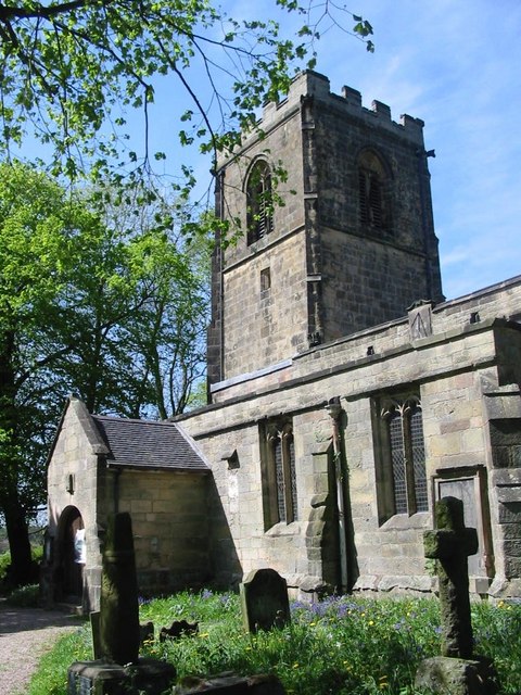
All Saints' Church, Brailsford

All Saints’ Church, Brailsford is a Grade I listed parish church in the Church of England in Brailsford, Derbyshire. == History == The church dates from...

Ednaston Manor

Ednaston Manor is a country house in Ednaston, near Brailsford, Derbyshire, England. It was built in 1912–19 in a Queen Anne style by Edwin Lutyens, for...

Mercaston

Mercaston is a hamlet in Derbyshire, England. It is located in the Peak District 7 miles west of Duffield. It is in the civil parish of Hulland Ward. In...

Hollington, Derbyshire

Hollington is a village and civil parish near the town of Uttoxeter and 5.5 miles (8.9 km) from the city of Derby, in the English county of Derbyshire...

Mercaston Hall

Mercaston Hall is a 16th-century timber framed farmhouse within the hamlet of Mercaston, near the market town of Ashbourne, Derbyshire, England. It is...

Shirley, Derbyshire

Shirley is a small village and civil parish in Derbyshire, 4 miles (6 km) south-east of Ashbourne. The population of the civil parish as taken at the 2011...

St Michael's Church, Shirley

St Michael's Church, Shirley is a Grade II* listed parish church in the Church of England: 318  in Shirley, Derbyshire. == History == The church dates...

Nearby Amenities

Located within 500m of 52.970581,-1.6279544
Post Box
Brand: Royal Mail
Brand Wikidata: Q638098
Collection Times: Mo-Fr 17:15; Sa 12:15
Mapillary: 132191262493730
Operator: Royal Mail
Operator Wikidata: Q638098
Post Box Type: pillar
Ref: DE6 896
Survey Date: 2021-07-17
Lat/Long: 52.9694666/-1.6212296
Post Box
Operator: Royal Mail
Ref: DE6 684
Lat/Long: 52.9697531/-1.6239933
Turning Circle
Lat/Long: 52.9714038/-1.6243112
Barrier: stile
Steps: 1
Stile: stepover
Lat/Long: 52.9684979/-1.62148
Barrier: stile
Steps: 1
Stile: stepover
Lat/Long: 52.967415/-1.6241578
Barrier: stile
Steps: 2
Stile: stepover
Lat/Long: 52.9686324/-1.6221905
Barrier: stile
Steps: 2
Stile: stepover
Lat/Long: 52.9704318/-1.6255012
Barrier: stile
Steps: 2
Stile: stepover
Lat/Long: 52.970588/-1.6237972
Brailsford
Place: village
Wikidata: Q2379129
Wikipedia: en:Brailsford
Lat/Long: 52.9701742/-1.6232147
Direction: 175
Generator Method: photovoltaic
Generator Output Electricity: yes
Generator Solar Modules: 14
Generator Source: solar
Generator Type: solar_photovoltaic_panel
Location: roof
Power: generator
Lat/Long: 52.9731087/-1.6232641
Direction: 190
Generator Method: photovoltaic
Generator Output Electricity: yes
Generator Solar Modules: 10
Generator Source: solar
Generator Type: solar_photovoltaic_panel
Location: roof
Power: generator
Lat/Long: 52.9723077/-1.6217445
Direction: 190
Generator Method: photovoltaic
Generator Output Electricity: yes
Generator Solar Modules: 10
Generator Source: solar
Generator Type: solar_photovoltaic_panel
Location: roof
Power: generator
Lat/Long: 52.9722913/-1.6216254
Direction: SSW
Generator Method: photovoltaic
Generator Output Electricity: yes
Generator Solar Modules: 16
Generator Source: solar
Generator Type: solar_photovoltaic_panel
Location: roof
Power: generator
Lat/Long: 52.9716281/-1.6218824
Direction: ESE
Generator Method: photovoltaic
Generator Output Electricity: yes
Generator Solar Modules: 16
Generator Source: solar
Generator Type: solar_photovoltaic_panel
Location: roof
Power: generator
Lat/Long: 52.9713046/-1.6209545
Direction: 175
Generator Method: photovoltaic
Generator Output Electricity: yes
Generator Solar Modules: 14
Generator Source: solar
Generator Type: solar_photovoltaic_panel
Location: roof
Power: generator
Lat/Long: 52.9684981/-1.6259071
Direction: ESE
Generator Method: photovoltaic
Generator Output Electricity: yes
Generator Solar Modules: 9
Generator Source: solar
Generator Type: solar_photovoltaic_panel
Location: roof
Power: generator
Lat/Long: 52.9697854/-1.6219935
Bus Stop
Chapel House
Bench: no
Bin: no
Naptan AtcoCode: 1000DBMR5641
Naptan NaptanCode: dbsagmwj
Public Transport: platform
Shelter: no
Lat/Long: 52.9736315/-1.6328249
Bus Stop
Chapel House
Bench: no
Bin: no
Naptan AtcoCode: 1000DBMR5640
Naptan NaptanCode: dbsagmwg
Public Transport: platform
Shelter: no
Lat/Long: 52.9734777/-1.6325161
Bus Stop
The White Cottage
Naptan AtcoCode: 1000DBMR5638
Naptan NaptanCode: dbsagmwa
Public Transport: platform
Lat/Long: 52.9721116/-1.6277522
Bus Stop
The White Cottage
Naptan AtcoCode: 1000DBMR5639
Naptan NaptanCode: dbsagmwd
Public Transport: platform
Lat/Long: 52.9723216/-1.6285703
Bus Stop
Luke Lane
Naptan AtcoCode: 1000DBMR5637
Naptan NaptanCode: dbsagmtw
Public Transport: platform
Lat/Long: 52.9706728/-1.6233037
Bus Stop
Luke Lane
Naptan AtcoCode: 1000DBMR5636
Naptan NaptanCode: dbsagmtp
Public Transport: platform
Lat/Long: 52.9705937/-1.6232313
Bus Stop
School
Naptan AtcoCode: 1000DBMR5635
Naptan NaptanCode: dbsgjwtg
Public Transport: platform
Lat/Long: 52.9695231/-1.621109
Bus Stop
School
Naptan AtcoCode: 1000DBMR5634
Naptan NaptanCode: dbsgjwtd
Public Transport: platform
Lat/Long: 52.9693644/-1.6210829
Direction: SSW
Generator Method: photovoltaic
Generator Output Electricity: yes
Generator Solar Modules: 16
Generator Source: solar
Generator Type: solar_photovoltaic_panel
Location: roof
Power: generator
Lat/Long: 52.9712172/-1.6220807
Castlewood Joinery
Addr City: Ashbourne
Addr Housenumber: 1
Addr Postcode: DE6 3DB
Addr Street: Throstle Nest Way
Addr Village: Brailsford
Craft: joiner
Website: http://www.castlewood-joinery.co.uk/
Lat/Long: 52.9713348/-1.6209208
The data included in this document is from www.openstreetmap.org. The data is made available under ODbL.

Have you been to Brailsford Green?

Leave your review of Brailsford Green below (or comments, questions and feedback).