Lammy Down

Downs, Moorland in Wiltshire

England

Lammy Down

M4 westbound Travelling westbound on the M4 motorway.
M4 westbound Credit: Oscar Taylor

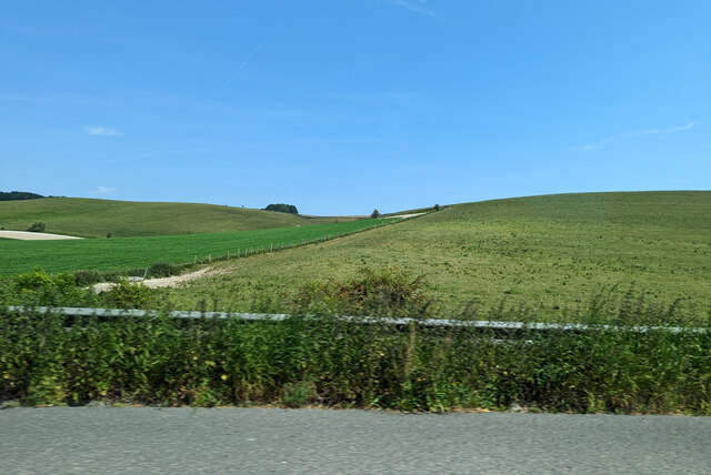
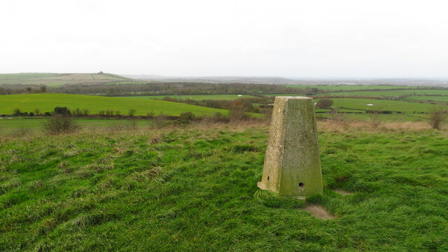
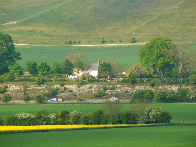
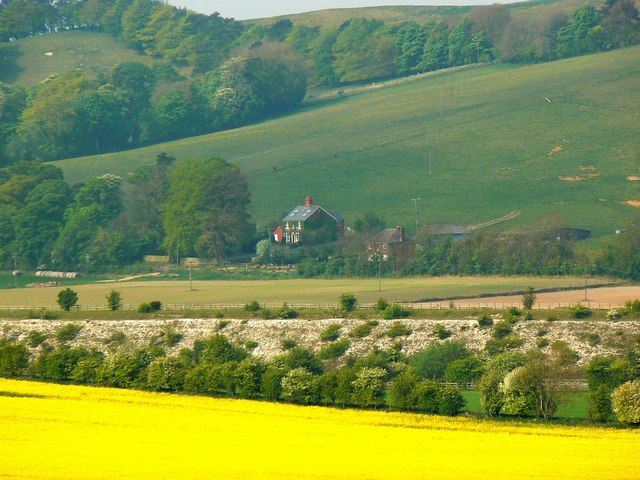
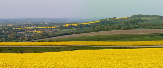
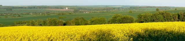
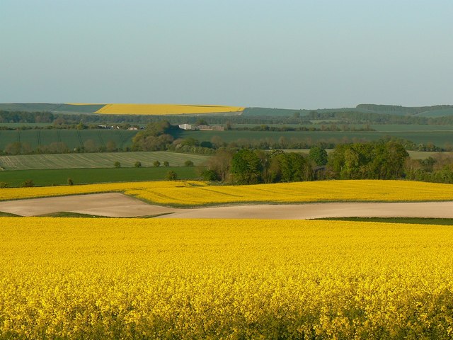
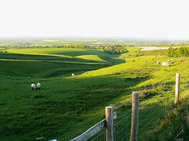
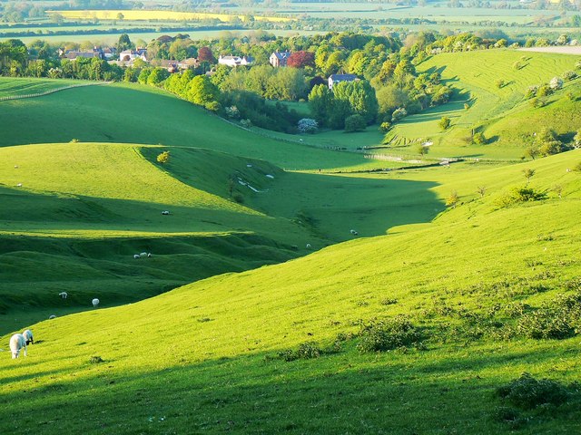
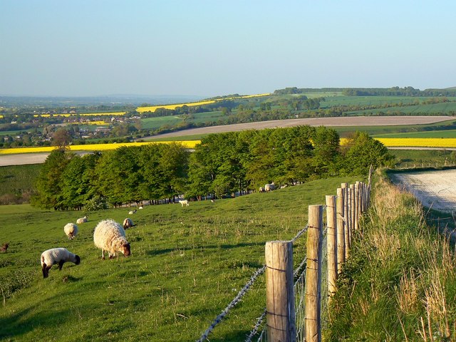
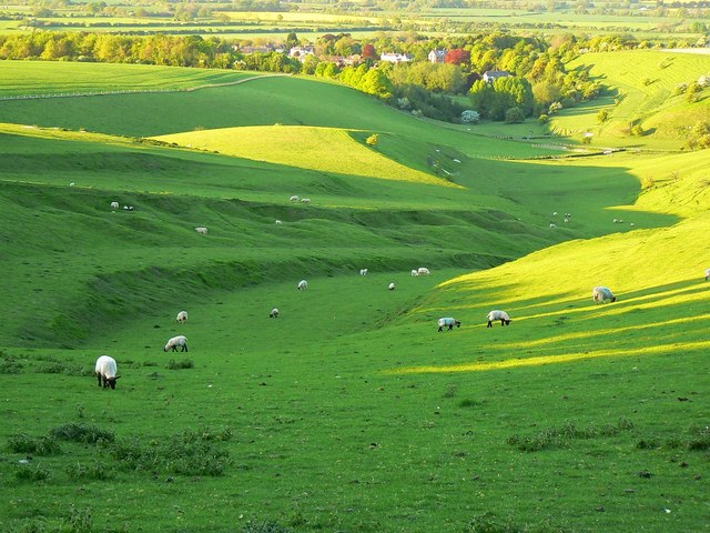
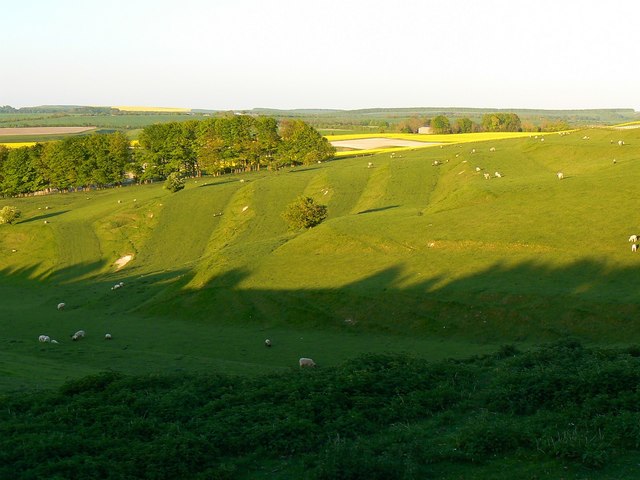
Lammy Down is a small area located in Wiltshire, England, known for its picturesque downs and moorland landscapes. The area is characterized by rolling hills, open grasslands, and scattered patches of woodland, creating a diverse and beautiful natural environment.

Lammy Down is popular among hikers, nature enthusiasts, and bird watchers due to its abundance of wildlife and stunning views. The area is home to a variety of bird species, including skylarks, meadow pipits, and stonechats, making it a prime spot for bird watching.

In addition to its natural beauty, Lammy Down also has a rich history, with evidence of prehistoric settlements and ancient burial mounds scattered throughout the area. Visitors can explore these archaeological sites and learn about the area's past while taking in the breathtaking scenery.

Overall, Lammy Down offers a peaceful and tranquil escape from the hustle and bustle of city life, allowing visitors to immerse themselves in nature and experience the beauty of the Wiltshire countryside.

If you have any feedback on the listing, please let us know in the comments section below.

Lammy Down Images

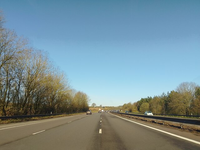
Images are sourced within 2km of 51.533199/-1.6441198 or Grid Reference SU2481. Thanks to Geograph Open Source API. All images are credited.

M4 westbound Travelling westbound on the M4 motorway.
M4 westbound
Travelling westbound on the M4 motorway.
Hinton Downs Looking north from the M4.
Hinton Downs
Looking north from the M4.
Cattle by the M4
Cattle by the M4
Hinton Downs by the M4
On Charlbury Hill - view towards Liddington Hill
M4 westbound Travelling westbound on the M4 motorway.
M4 westbound
Travelling westbound on the M4 motorway.
The Pond, Bishopston
From a typical village scene... ....to The City. One wonders: nightclubs, a football stadium, huge traffic systems, demonstrations?
From a typical village scene...
....to The City. One wonders: nightclubs, a football stadium, huge traffic systems, demonstrations?
Plain Farm, Foxhill, Swindon The maps show this as Wanborough Plain Farm whilst Royal Mail and the Valuation Office both have it listed as plain Plain Farm. It is situated on the eastern edge of Wanborough Plain with the higher ground of Hinton Downs rising behind it. The M4 motorway can be seen beneath the farm buildings.
Plain Farm, Foxhill, Swindon
The maps show this as Wanborough Plain Farm whilst Royal Mail and the Valuation Office both have it listed as plain Plain Farm. It is situated on the eastern edge of Wanborough Plain with the higher ground of Hinton Downs rising behind it. The M4 motorway can be seen beneath the farm buildings.
Hillside Farm, Foxhill, Swindon The farm lies just off the old Roman road, the Ermin Way, that runs between Foxhill and Baydon. Fox Hill is the high ground behind the farm. Almost hidden between the yellow oilseed rape crop and the farm is the M4 motorway.
Hillside Farm, Foxhill, Swindon
The farm lies just off the old Roman road, the Ermin Way, that runs between Foxhill and Baydon. Fox Hill is the high ground behind the farm. Almost hidden between the yellow oilseed rape crop and the farm is the M4 motorway.
View from east of Charlbury Hill, near Bishopstone, Swindon (1 of 2) The viewpoint is just above a coombe and ancient field system. The southern edge of the picturesque village of Bishopstone is visible at the left.
View from east of Charlbury Hill, near Bishopstone, Swindon (1 of 2)
The viewpoint is just above a coombe and ancient field system. The southern edge of the picturesque village of Bishopstone is visible at the left.
View from east of Charlbury Hill, near Bishopstone, Swindon (2 of 2) The viewpoint is just above a coombe and ancient field system. Visible in the distance about 4 kilometres east is the National Trust property Ashdown House <a title="https://www.geograph.org.uk/search.php?i=21092833&displayclass=thumbs" href="https://www.geograph.org.uk/search.php?i=21092833&displayclass=thumbs">Link</a>
View from east of Charlbury Hill, near Bishopstone, Swindon (2 of 2)
The viewpoint is just above a coombe and ancient field system. Visible in the distance about 4 kilometres east is the National Trust property Ashdown House Link
Farmland between Bishopstone, Swindon and Lammy Down This is chalk downland typical of this part of Swindon. The buildings in the distance are part of Ridgeway Farm, about a kilometre away.
Farmland between Bishopstone, Swindon and Lammy Down
This is chalk downland typical of this part of Swindon. The buildings in the distance are part of Ridgeway Farm, about a kilometre away.
Coombe south of Bishopstone, Swindon The coombe as it is now is the result of both natural and human influences. There are a series of strip lynchets here forming an ancient field system, probably Anglo-Saxon. The topography is similar to that found a couple of kilometres west at Hinton Parva <a title="https://www.geograph.org.uk/photo/338730" href="https://www.geograph.org.uk/photo/338730">Link</a> In the distance is Bishopstone.
Coombe south of Bishopstone, Swindon
The coombe as it is now is the result of both natural and human influences. There are a series of strip lynchets here forming an ancient field system, probably Anglo-Saxon. The topography is similar to that found a couple of kilometres west at Hinton Parva Link In the distance is Bishopstone.
A closer look at a coombe south of Bishopstone, Swindon The viewpoint is the same as for this one <a href="https://www.geograph.org.uk/photo/2382393">SU2482 : Coombe south of Bishopstone, Swindon</a> On the other side of the coombe at the upper right the terracing effects that hundreds of sheep over hundreds of years have wrought can be discerned.
A closer look at a coombe south of Bishopstone, Swindon
The viewpoint is the same as for this one SU2482 : Coombe south of Bishopstone, Swindon On the other side of the coombe at the upper right the terracing effects that hundreds of sheep over hundreds of years have wrought can be discerned.
Pasture and arable land, south of Bishopstone, Swindon The fence is to keep the sheep out of the arable crop that is growing out of view to the right. Also out of shot is a stile across the fence. The maps do not show this as being access land but in practice it is.
Pasture and arable land, south of Bishopstone, Swindon
The fence is to keep the sheep out of the arable crop that is growing out of view to the right. Also out of shot is a stile across the fence. The maps do not show this as being access land but in practice it is.
At the head of the coombe south of Bishopstone, Swindon At the upper left beyond the fence is arable land. The coombe however is never cultivated. The complex topography means that modern arable techniques wouldn't work so it remains pastoral. In days past there was cultivation on the strip lynchets just out of sight to the right but visible here <a href="https://www.geograph.org.uk/photo/2382594">SU2482 : Strip Lynchets in the evening sun, Bishopstone, Swindon</a>
At the head of the coombe south of Bishopstone, Swindon
At the upper left beyond the fence is arable land. The coombe however is never cultivated. The complex topography means that modern arable techniques wouldn't work so it remains pastoral. In days past there was cultivation on the strip lynchets just out of sight to the right but visible here SU2482 : Strip Lynchets in the evening sun, Bishopstone, Swindon
Strip Lynchets in the evening sun, Bishopstone, Swindon These are part of a mediaeval field system that may date back to Saxon times. They were constructed to make it easier to cultivate the land on the side of the coombe. They are too regular to be a natural phenomenon. Today the land in the coombe is pastoral with a nice environment for sheep. The building at the upper right is part of Ridgeway Farm.
Strip Lynchets in the evening sun, Bishopstone, Swindon
These are part of a mediaeval field system that may date back to Saxon times. They were constructed to make it easier to cultivate the land on the side of the coombe. They are too regular to be a natural phenomenon. Today the land in the coombe is pastoral with a nice environment for sheep. The building at the upper right is part of Ridgeway Farm.
Show me another place!

Lammy Down is located at Grid Ref: SU2481 (Lat: 51.533199, Lng: -1.6441198)

Unitary Authority: Swindon

Police Authority: Wiltshire

What 3 Words

///convey.taxi.lobbed. Near Bishopstone, Wiltshire

Nearby Locations

Lammy Down

Related Wikis

Bishopstone, Swindon

Bishopstone is a village and civil parish in the Borough of Swindon, England, about 6 miles (10 km) east of Swindon, and on the county border with Oxfordshire...

Foxhill motocross circuit

Foxhill motocross circuit is a well-known motocross circuit situated near to the small village of Foxhill, around six miles south east of Swindon, Wiltshire...

The Coombes, Hinton Parva

The Coombes (grid reference SU228826) is a 15.9 hectare biological Site of Special Scientific Interest at Hinton Parva in the Borough of Swindon, England...

Hinton Parva, Wiltshire

Hinton Parva, also known as Little Hinton, is a village in the Borough of Swindon in Wiltshire, England. It lies about 2 miles (3.2 km) from the eastern...

Nearby Amenities

Located within 500m of 51.533199,-1.6441198
Lammy Down
Ele: 246
Natural: peak
Lat/Long: 51.5331391/-1.6449404
The data included in this document is from www.openstreetmap.org. The data is made available under ODbL.

Have you been to Lammy Down?

Leave your review of Lammy Down below (or comments, questions and feedback).