Auton Crofts

Downs, Moorland in Derbyshire Derbyshire Dales

England

Auton Crofts

Footpath and gate above Stoney Middleton The wooden structures around the gate show some evolutionary randomness.
Footpath and gate above Stoney Middleton Credit: Bill Boaden

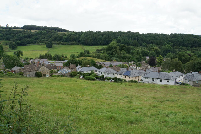
Auton Crofts is a picturesque village located in the county of Derbyshire, England. Situated amidst the serene surroundings of the Downs and Moorland, this charming village offers a delightful escape from the hustle and bustle of city life.

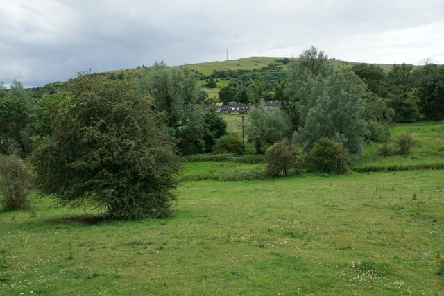
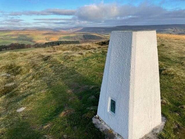
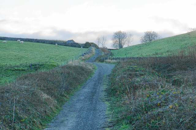
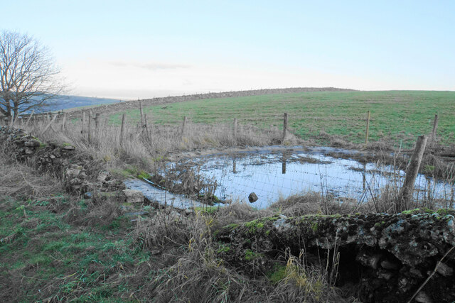
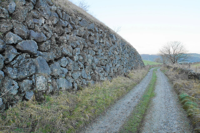
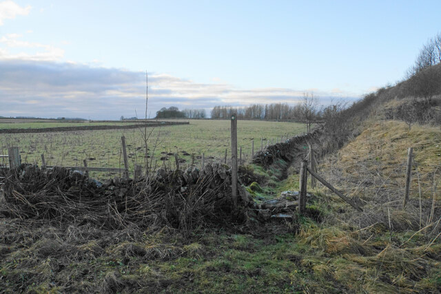
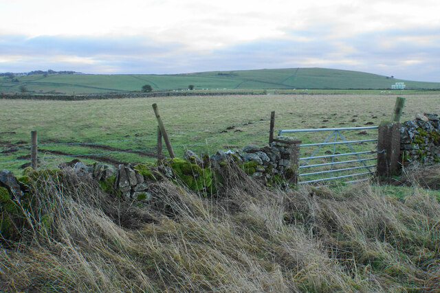
The village is characterized by its idyllic countryside landscapes, with rolling hills and verdant meadows that stretch as far as the eye can see. The Downs provide a stunning backdrop, with their towering cliffs and breathtaking vistas, making Auton Crofts a haven for nature enthusiasts and photographers.

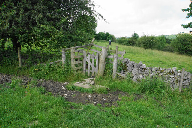
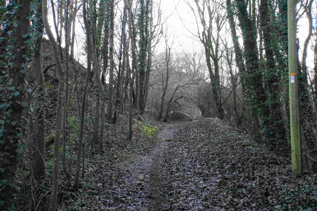
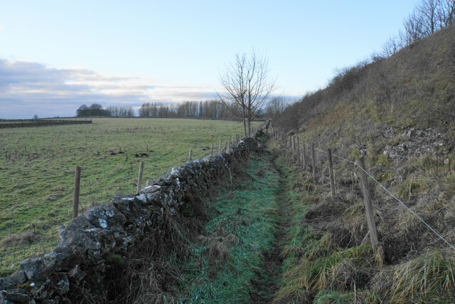
The Moorland, on the other hand, offers a different kind of beauty. Covered in heather and gorse, it provides a rich habitat for a variety of wildlife, including birds, deer, and rabbits. Walking trails meander through the Moorland, offering visitors the chance to explore its hidden treasures and enjoy the tranquility of the surroundings.

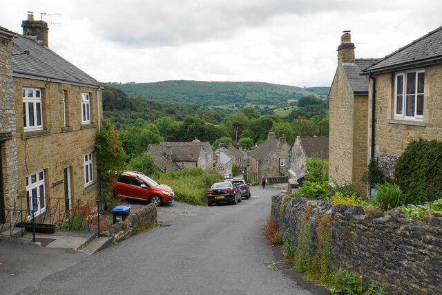
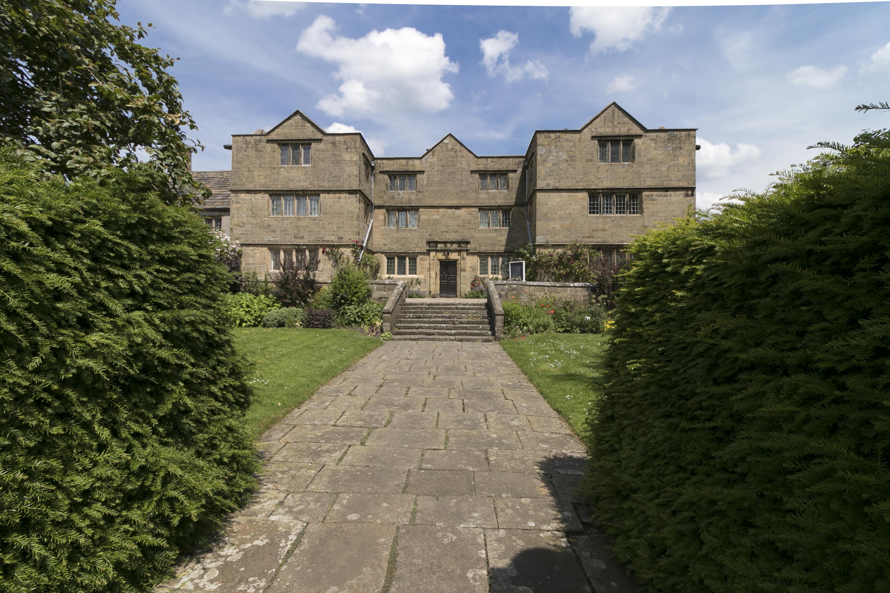
Auton Crofts itself is a small, close-knit community, with a population of around 500 residents. The village is home to a charming church, which dates back to the 12th century and is a testament to the area's rich history. A few local shops and cafes cater to the needs of both residents and visitors, providing a friendly and welcoming atmosphere.

For those seeking outdoor activities, Auton Crofts offers plenty of opportunities. Hiking, cycling, and horseback riding are popular pastimes, with numerous trails and bridleways crisscrossing the surrounding countryside. Additionally, the village is within easy reach of larger towns and cities, such as Derby and Sheffield, providing access to a wider range of amenities and attractions.

In summary, Auton Crofts is a charming village nestled in the Downs and Moorland of Derbyshire. With its stunning natural beauty, welcoming community, and abundance of outdoor activities, it is an ideal destination for those seeking a peaceful and picturesque escape.

If you have any feedback on the listing, please let us know in the comments section below.
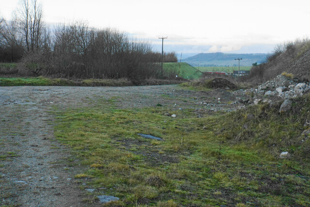
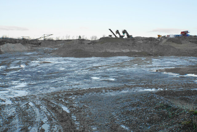
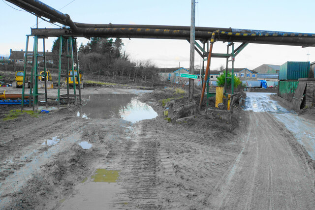
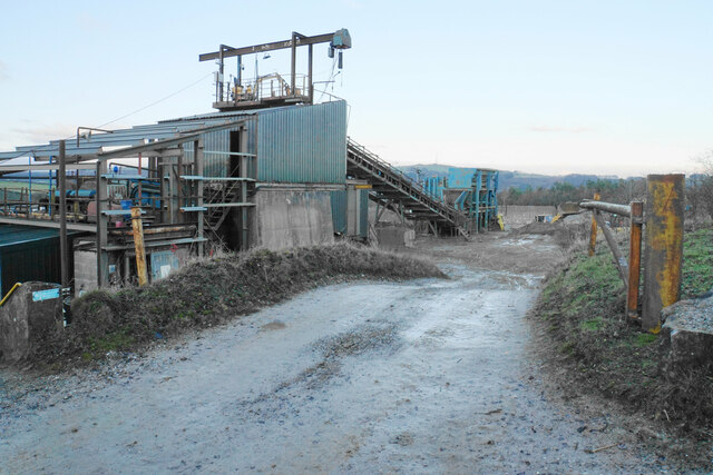
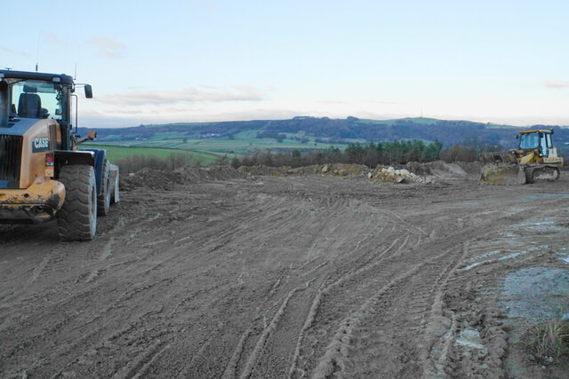
Auton Crofts Images

Images are sourced within 2km of 53.280644/-1.675707 or Grid Reference SK2176. Thanks to Geograph Open Source API. All images are credited.

Footpath and gate above Stoney Middleton The wooden structures around the gate show some evolutionary randomness.
Footpath and gate above Stoney Middleton
The wooden structures around the gate show some evolutionary randomness.
Hillside below Eaton Fold A chance to look down on the rooftops of Stoney Middleton.
Hillside below Eaton Fold
A chance to look down on the rooftops of Stoney Middleton.
Middleton Lane A steeply descending road through Stoney Middleton. The Derwent valley is in the distance.
Middleton Lane
A steeply descending road through Stoney Middleton. The Derwent valley is in the distance.
Green fields at the bottom of Middleton Dale Calver Peak is opposite.
Green fields at the bottom of Middleton Dale
Calver Peak is opposite.
Sir William Hill trig
Black Harry Lane A steep climb out of Middleton Dale.
Black Harry Lane
A steep climb out of Middleton Dale.
Darlton Quarry One of several disused quarries in Middleton Dale. The quarry is shaded from the low winter sun but White Edge above Froggatt Edge is glowing in the distance.
Darlton Quarry
One of several disused quarries in Middleton Dale. The quarry is shaded from the low winter sun but White Edge above Froggatt Edge is glowing in the distance.
Black Harry Lane Approaching Lane Head following a stiff climb out of Middleton Dale.
Black Harry Lane
Approaching Lane Head following a stiff climb out of Middleton Dale.
Pond by Black Harry Lane An artificial pond with a concrete base to preserve its environmental benefit.
Pond by Black Harry Lane
An artificial pond with a concrete base to preserve its environmental benefit.
Retaining wall by Black Harry Lane The wall must relate to quarrying activity but I am not sure of its exact purpose. It appears to be supporting a barrier screening an area on the top of the ridge above the quarry.
Retaining wall by Black Harry Lane
The wall must relate to quarrying activity but I am not sure of its exact purpose. It appears to be supporting a barrier screening an area on the top of the ridge above the quarry.
Path off Black Harry Lane On the plateau on Middleton Moor. The embankment to the right relates to quarrying activity.
Path off Black Harry Lane
On the plateau on Middleton Moor. The embankment to the right relates to quarrying activity.
Path off Black Harry Lane The path is crossing the plateau of Middleton Moor, but an artificial embankment has been created on the right relating to quarrying activity.
Path off Black Harry Lane
The path is crossing the plateau of Middleton Moor, but an artificial embankment has been created on the right relating to quarrying activity.
Grazing land on Middleton Moor A high plateau of farmland. Longstone Edge is seen in the background, with the quarrying activity on it remarkably well disguised.
Grazing land on Middleton Moor
A high plateau of farmland. Longstone Edge is seen in the background, with the quarrying activity on it remarkably well disguised.
Quarry track on Middleton Moor Broad tracks with debris leave this side of the moor less attractive than the farming side.
Quarry track on Middleton Moor
Broad tracks with debris leave this side of the moor less attractive than the farming side.
Quarrying at Moisty Knoll Part of fluorspar production at Cavendish Mill.
Quarrying at Moisty Knoll
Part of fluorspar production at Cavendish Mill.
Footpath arriving at Cavendish Mill The sign suggests the official route is through the puddle to the left. The road to the right is guarded by hoses used for squirting at quarry vehicles, but this route was the safer option on this day.
Footpath arriving at Cavendish Mill
The sign suggests the official route is through the puddle to the left. The road to the right is guarded by hoses used for squirting at quarry vehicles, but this route was the safer option on this day.
Plant off Moisty Lane Part of the fluorspar production process at Cavendish Mill.
Plant off Moisty Lane
Part of the fluorspar production process at Cavendish Mill.
Resting diggers at Cavendish Mill Quite a high spot with views across to Eyam Edge.
Resting diggers at Cavendish Mill
Quite a high spot with views across to Eyam Edge.
Show me another place!

Auton Crofts is located at Grid Ref: SK2176 (Lat: 53.280644, Lng: -1.675707)

Administrative County: Derbyshire

District: Derbyshire Dales

Police Authority: Derbyshire

What 3 Words

///tastes.moves.axed. Near Baslow, Derbyshire

Nearby Locations

Auton Crofts Eyam Dale

Related Wikis

Nearby Amenities

Located within 500m of 53.280644,-1.675707
Eyam
Is In Country: UK
Is In County: Derbyshire
Name Ru: Им
Place: village
Source: npe
Wikidata: Q1385667
Wikipedia: en:Eyam
Lat/Long: 53.2837249/-1.6725141
Tourism: information
Lat/Long: 53.2846757/-1.6772201
Post Box
Collection Times: Mo-Fr 09:00; Sa 07:00
Operator: Royal Mail
Post Box Type: pillar
Ref: S32 523D
Royal Cypher: EIIR
Royal Cypher Wikidata: Q33102113
Source: survey
Lat/Long: 53.283995/-1.6708412
Defibrillator
Access: yes
Booth: K6
Check Date: 2023-03-08
Covered: booth
Defibrillator Location: In old telephone box.
Disused Amenity: telephone
Emergency: defibrillator
Indoor: no
Man Made: telephone_box
Opening Hours: 24/7
Lat/Long: 53.2840304/-1.6708027
Barrier: stile
Material: stone
Source: survey;gps
Stile: squeezer
Lat/Long: 53.2826003/-1.6696647
Church Street Stores
Addr City: Hope Valley
Addr Postcode: S32 5QH
Addr Suburb: Eyam
Fhrs Id: 1626324
Shop: convenience
Source: survey
Source Postcode: FHRS Open Data
Lat/Long: 53.2841033/-1.6718034
Addr City: Hope Valley
Addr Housenumber: 1
Addr Postcode: S32 5RH
Addr Street: Glebe Park
Addr Suburb: Eyam
Source: survey
Source Postcode: Land Registry Prices Paid Open Data
Lat/Long: 53.2840294/-1.6726382
Addr Housename: Corner Cottage
Source: survey
Lat/Long: 53.2841482/-1.6715138
Addr City: Hope Valley
Addr Housenumber: 6
Addr Postcode: S32 5RH
Addr Street: Glebe Park
Addr Suburb: Eyam
Source: survey
Source Postcode: Land Registry Prices Paid Open Data
Lat/Long: 53.2843872/-1.67282
Addr Housename: The Old Store House
Source: survey
Lat/Long: 53.2840616/-1.6719161
Addr Housename: The Cottage
Source: survey
Lat/Long: 53.2840104/-1.6719697
Addr Housename: Thule House
Source: survey
Lat/Long: 53.2843151/-1.6715916
Addr City: Hope Valley
Addr Housenumber: 12
Addr Postcode: S32 5RH
Addr Street: Glebe Park
Addr Suburb: Eyam
Source: extrapolation
Source Postcode: Land Registry Prices Paid Open Data
Lat/Long: 53.2848016/-1.6732481
Addr City: Hope Valley
Addr Housename: Oak Dene
Addr Postcode: S32 5RB
Addr Street: The Square
Addr Suburb: Eyam
Source: survey
Source Addr: Land Registry Prices Paid Open Data
Lat/Long: 53.2839807/-1.6714671
Addr City: Hope Valley
Addr Housenumber: 26
Addr Postcode: S32 5RH
Addr Street: Glebe Park
Addr Suburb: Eyam
Source: extrapolation
Source Postcode: Land Registry Prices Paid Open Data
Lat/Long: 53.2847296/-1.6727708
Addr City: Hope Valley
Addr Housenumber: 27
Addr Postcode: S32 5RH
Addr Street: Glebe Park
Addr Suburb: Eyam
Source: extrapolation
Source Postcode: Land Registry Prices Paid Open Data
Lat/Long: 53.2847049/-1.6728564
Addr City: Hope Valley
Addr Housenumber: 24
Addr Postcode: S32 5RH
Addr Street: Glebe Park
Addr Suburb: Eyam
Source: extrapolation
Source Postcode: Land Registry Prices Paid Open Data
Lat/Long: 53.2848128/-1.6729318
Addr City: Hope Valley
Addr Housenumber: 14
Addr Postcode: S32 5RH
Addr Street: Glebe Park
Addr Suburb: Eyam
Source: extrapolation
Source Postcode: Land Registry Prices Paid Open Data
Lat/Long: 53.2848209/-1.6731462
Addr City: Hope Valley
Addr Housename: Sunnybank
Addr Postcode: S32 5RB
Addr Street: The Square
Addr Suburb: Eyam
Source: survey
Source Addr: Land Registry Prices Paid Open Data
Lat/Long: 53.2840496/-1.6715235
Addr Housename: Mompesson Cottage
Source: survey
Lat/Long: 53.2844746/-1.6722772
Bus Stop
Eyam (The Square)
Bench: yes
Bin: yes
Bus: yes
Lit: yes
Naptan AtcoCode: 1000DEPP3073
Public Transport: platform
Shelter: yes
Source: survey
Tactile Paving: no
Lat/Long: 53.2842244/-1.6712257
Bus Stop
Eyam (The Square)
Bench: yes
Bin: yes
Bus: yes
Lit: yes
Public Transport: platform
Shelter: no
Source: survey
Tactile Paving: no
Lat/Long: 53.2840961/-1.6713706
Bench
Backrest: yes
Source: Bing
Lat/Long: 53.2840736/-1.6713598
Bench
Backrest: yes
Note: circular bench round lamp post
Source: Bing
Lat/Long: 53.2841137/-1.6712445
Bench
Backrest: yes
Source: Bing
Lat/Long: 53.2842404/-1.6712901
Information: interpretation
Source: survey
Tourism: information
Lat/Long: 53.2840881/-1.6712365
The Glebe Mine Site
Information: interpretation
Source: survey
Tourism: information
Lat/Long: 53.2840881/-1.6723228
Information: interpretation
Source: survey
Tourism: information
Lat/Long: 53.2841346/-1.6712794
Material: wood
Operator: National Grid Electricity Distribution
Power: pole
Lat/Long: 53.2815909/-1.6687203
Fixme: location approximate
Information: guidepost
Source: Geograph
Tourism: information
Lat/Long: 53.282729/-1.6699279
Material: wood
Operator: National Grid Electricity Distribution
Power: pole
Lat/Long: 53.2822164/-1.6694579
Material: wood
Operator: National Grid Electricity Distribution
Power: pole
Lat/Long: 53.2821875/-1.6704342
Material: wood
Operator: National Grid Electricity Distribution
Power: pole
Lat/Long: 53.2819662/-1.6709787
Location Transition: yes
Material: wood
Operator: National Grid Electricity Distribution
Power: pole
Lat/Long: 53.2816712/-1.6699676
Barrier: bollard
Source: Bing
Lat/Long: 53.2847143/-1.6772578
Barrier: bollard
Source: Bing
Lat/Long: 53.2846051/-1.6769762
Barrier: bollard
Source: Bing
Lat/Long: 53.2846517/-1.6770539
Barrier: bollard
Source: Bing
Lat/Long: 53.2846981/-1.6771344
Bench
Backrest: yes
Source: survey
Lat/Long: 53.2845603/-1.6771264
Bench
Backrest: yes
Source: survey
Lat/Long: 53.2845716/-1.6771988
Eyam Stocks
Historic: stocks
Source: survey;http://www.geograph.org.uk/photo/3716411
Tourism: attraction
Lat/Long: 53.2846148/-1.6770539
Barrier: bollard
Source: Bing
Lat/Long: 53.2846821/-1.6770969
Barrier: bollard
Source: Bing
Lat/Long: 53.2847255/-1.6771585
Barrier: bollard
Source: Bing
Lat/Long: 53.2847222/-1.6772041
Bench
Backrest: yes
Source: survey
Lat/Long: 53.2845506/-1.6770647
Barrier: bollard
Source: Bing
Lat/Long: 53.2846277/-1.677011
Cafe
Eyam Hall Buttery
Addr City: Hope Valley
Addr Parentstreet: Church Street
Addr Postcode: S32 5QW
Addr Street: Eyam Hall Craft Centre
Addr Suburb: Eyam
Source: survey
Lat/Long: 53.2849308/-1.6771274
Eyam National Trust Shop
Addr City: Hope Valley
Addr Parentstreet: Church Street
Addr Postcode: S32 5QW
Addr Street: Eyam Hall Craft Centre
Addr Suburb: Eyam
Shop: gift
Source: survey
Lat/Long: 53.2849868/-1.6771944
Barrier: door
Source: bing
Lat/Long: 53.2847719/-1.6766106
Cafe
Raphael's Tea Rooms
Addr City: Hope Valley
Addr Parentstreet: Church Street
Addr Postcode: S32 5QW
Addr Street: Eyam Hall Craft Centre
Addr Suburb: Eyam
Alt Name: Stables Restaurant
Building Levels: 1
Layer: 1
Level: 1
Source: survey
Lat/Long: 53.2848875/-1.6770549
Barrier: stile
Material: wood
Source: survey;gps
Stile: stepover
Lat/Long: 53.2763773/-1.6734535
Carlswark Cavern Gin Entrance
Natural: cave_entrance
Lat/Long: 53.2789163/-1.6705888
Eyam Dale Shaft
Natural: cave_entrance
Lat/Long: 53.2802453/-1.6737481
Nickergrove Mine
Man Made: adit
Lat/Long: 53.2804955/-1.6784098
Social Facility
Mechanics Institute Village Club
Addr City: Hope Valley
Addr Postcode: S32 5QH
Addr Street: Church Street
Addr Suburb: Eyam
Alt Name: Eyam Village Club
Contact Facebook: https://www.facebook.com/eyamvillageclub/?locale=en_GB
Fhrs Id: 1626312
Website: https://www.eyamvillage.org.uk/eyammechanicsclub
Lat/Long: 53.2837683/-1.6747894
Bar
Eyam Mechanics Institute
Addr City: Hope Valley
Addr Postcode: S32 5QH
Addr Street: Church Street
Addr Suburb: Eyam
Fhrs Id: 1626312
Lat/Long: 53.2837362/-1.6748135
Cucklet Delph
Historic: archaeological_site
Sport: climbing
Tourism: attraction
Lat/Long: 53.2823026/-1.6787184
Power: pole
Lat/Long: 53.2820769/-1.6817934
Power: pole
Lat/Long: 53.2815715/-1.6805953
Power: pole
Lat/Long: 53.2809735/-1.6790853
Power: pole
Lat/Long: 53.280387/-1.6767128
Location Transition: yes
Power: pole
Lat/Long: 53.2797414/-1.675347
Parking
Lat/Long: 53.2792382/-1.678462
Historic: lime_kiln
Lat/Long: 53.2782465/-1.6711023
Natural: cave_entrance
Lat/Long: 53.278677/-1.6699996
Direction: 113
Tourism: viewpoint
Lat/Long: 53.2770597/-1.679298
Parking
Capacity: 15
Lat/Long: 53.2790497/-1.6775559
Bus Stop
Stoney Middleton The Dale
Bench: no
Bus: yes
Naptan AtcoCode: 1000DSMT3222
Naptan NaptanCode: dbsdapdt
Public Transport: platform
Shelter: no
Lat/Long: 53.2786279/-1.6740997
Bus Stop
Stoney Middleton The Dale
Bench: no
Bus: yes
Naptan AtcoCode: 100000008398
Naptan NaptanCode: dbsdwmgp
Public Transport: platform
Shelter: no
Lat/Long: 53.2785581/-1.6740794
Stoney Middleton The Dale
Bus: yes
Public Transport: stop_position
Lat/Long: 53.2785931/-1.6741102
Stoney Middleton The Dale
Bus: yes
Public Transport: stop_position
Lat/Long: 53.2785901/-1.6740744
Eyam (The Square)
Bus: yes
Public Transport: stop_position
Lat/Long: 53.284175/-1.6712313
Eyam (The Square)
Bus: yes
Public Transport: stop_position
Lat/Long: 53.2841/-1.6713564
Bus Stop
Eyam (Church)
Bench: no
Bin: no
Bus: yes
Lit: yes
Naptan AtcoCode: 1000DECS3225
Naptan NaptanCode: dbsgatga
Public Transport: platform
Shelter: no
Tactile Paving: no
Lat/Long: 53.2839061/-1.6748955
Bus Stop
Eyam (Church)
Bench: no
Bin: yes
Bus: yes
Lit: yes
Public Transport: platform
Shelter: no
Tactile Paving: no
Lat/Long: 53.2839366/-1.6747482
Eyam (Church)
Bus: yes
Public Transport: stop_position
Lat/Long: 53.2839471/-1.6748834
Eyam (Church)
Bus: yes
Public Transport: stop_position
Lat/Long: 53.2839176/-1.674758
Bench
Backrest: yes
Lat/Long: 53.2827906/-1.6698458
Material: wood
Operator: National Grid Electricity Distribution
Power: pole
Lat/Long: 53.2816438/-1.6719335
Streaks Pot - Top Entrance
Natural: cave_entrance
Lat/Long: 53.2801197/-1.6830472
Natural: cave_entrance
Lat/Long: 53.2821634/-1.6778797
The data included in this document is from www.openstreetmap.org. The data is made available under ODbL.

Have you been to Auton Crofts?

Leave your review of Auton Crofts below (or comments, questions and feedback).