Range Moor

Downs, Moorland in Yorkshire

England

Range Moor

WW2 Target Winch Housing WW2 Target Winch Housing on Barnside Moor. Midhope Reservoir is in the distance.
WW2 Target Winch Housing Credit: Dave Pickersgill

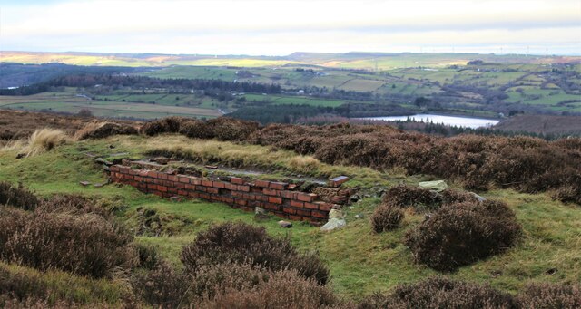
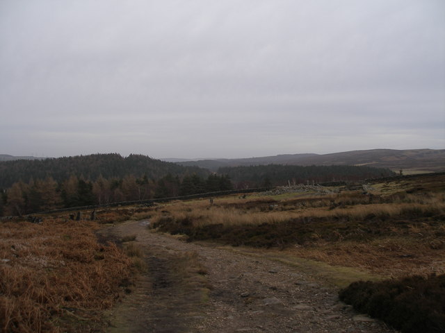
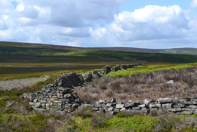
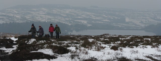
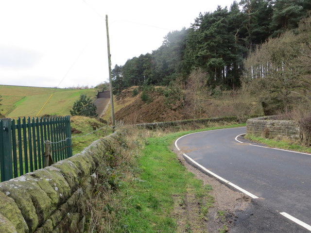
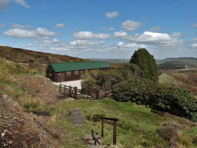
Range Moor is a picturesque area located in Yorkshire, England. Nestled within the stunning Yorkshire Downs, it is a haven for nature enthusiasts and outdoor adventurers alike. The moorland landscape is dominated by rolling hills, vast heather-covered expanses, and scattered patches of woodland, creating a breathtaking panorama.

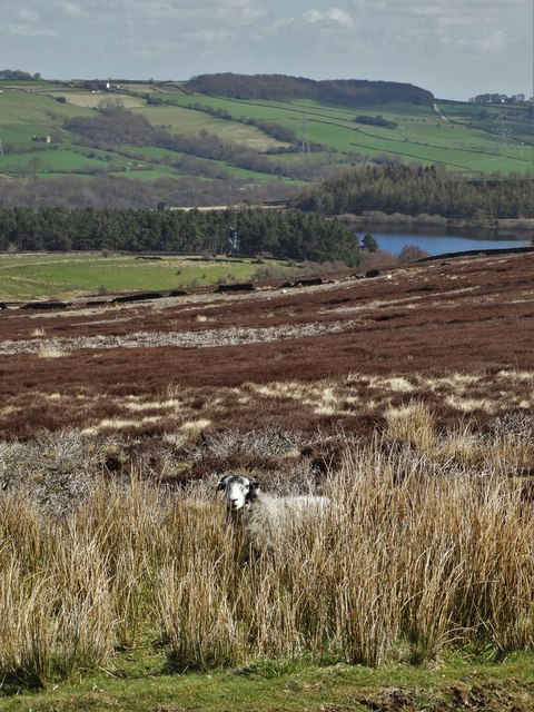
Covering an area of approximately 10 square miles, Range Moor offers a diverse range of habitats that support a rich variety of wildlife. The moorland is home to several bird species, including grouse, curlews, and lapwings, making it a popular destination for birdwatchers. Additionally, the area is teeming with small mammals such as rabbits and voles, as well as larger species like deer and foxes.

Visitors to Range Moor can explore a network of footpaths and trails that wind through the moorland, providing ample opportunities for hiking, cycling, and horseback riding. The stunning vistas and tranquil atmosphere make it an ideal location for outdoor activities and a chance to immerse oneself in the beauty of nature.

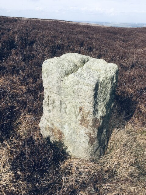
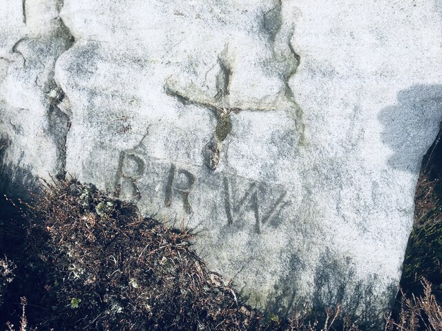
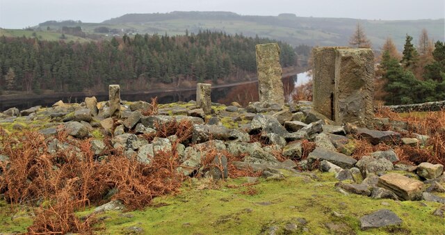
For those interested in history, Range Moor also boasts several archaeological sites dating back to the Bronze Age. This includes burial mounds, stone circles, and remnants of ancient settlements, offering a glimpse into the area's past.

With its unspoiled natural beauty, abundant wildlife, and historical significance, Range Moor is a must-visit destination for anyone seeking a true Yorkshire experience. Whether it's a leisurely stroll, a challenging hike, or simply enjoying the serenity of the moorland, Range Moor has something to offer for everyone.

If you have any feedback on the listing, please let us know in the comments section below.
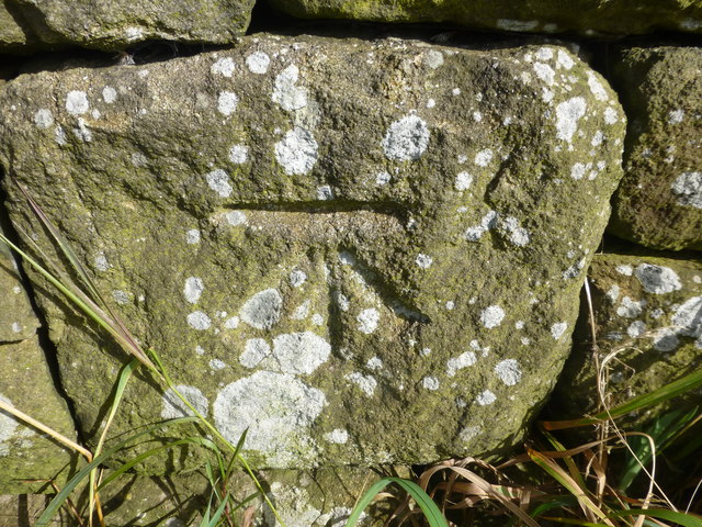
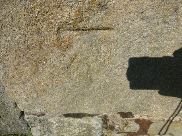
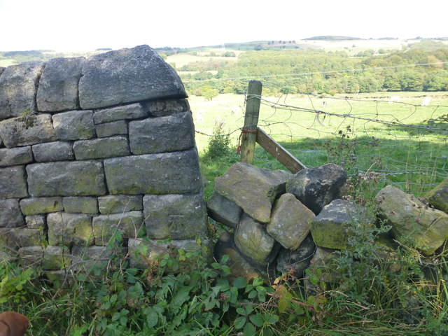
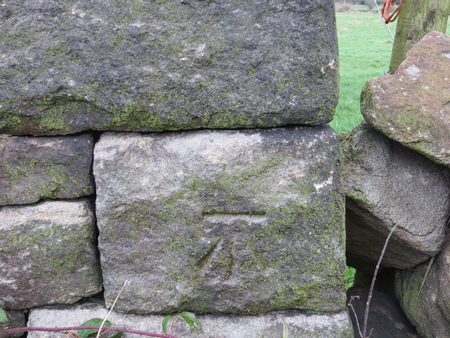
Range Moor Images

Images are sourced within 2km of 53.485729/-1.6793906 or Grid Reference SK2198. Thanks to Geograph Open Source API. All images are credited.

WW2 Target Winch Housing WW2 Target Winch Housing on Barnside Moor. Midhope Reservoir is in the distance.
WW2 Target Winch Housing
WW2 Target Winch Housing on Barnside Moor. Midhope Reservoir is in the distance.
Old Boundary Marker on Candlerush Edge, Bleaklow Estate Boundary Marker on Candlerush Edge, Bleaklow, 2100 metres northeast of Margery Hill. Bradfield parish. R R W refers to R R Wilson, the owner of the Broomhead Estate at the end of the 19C. See also <a title="https://www.geograph.org.uk/photo/398943" href="https://www.geograph.org.uk/photo/398943">Link</a>.

Milestone Society National ID: YW_BRA44em
Old Boundary Marker on Candlerush Edge, Bleaklow
Estate Boundary Marker on Candlerush Edge, Bleaklow, 2100 metres northeast of Margery Hill. Bradfield parish. R R W refers to R R Wilson, the owner of the Broomhead Estate at the end of the 19C. See also Link. Milestone Society National ID: YW_BRA44em
Old Boundary Marker on Candlerush Edge, Bleaklow Estate Boundary Marker on Candlerush Edge, Bleaklow, 2100 metres east-northeast of Margery Hill. Bradfield parish. R R W refers to R R Wilson, the owner of the Broomhead Estate at the end of the 19C.

Milestone Society National ID: YW_BRA45em
Old Boundary Marker on Candlerush Edge, Bleaklow
Estate Boundary Marker on Candlerush Edge, Bleaklow, 2100 metres east-northeast of Margery Hill. Bradfield parish. R R W refers to R R Wilson, the owner of the Broomhead Estate at the end of the 19C. Milestone Society National ID: YW_BRA45em
The Langsett Memory Tree The Langsett Memory Tree (an old fir tree) gains many ornaments over the Christmas period.
The Langsett Memory Tree
The Langsett Memory Tree (an old fir tree) gains many ornaments over the Christmas period.
The ruins of North America The ruins of North America above Langsett Reservoir. In the nineteenth century, outlying farms were often named after far-away places.
The ruins of North America
The ruins of North America above Langsett Reservoir. In the nineteenth century, outlying farms were often named after far-away places.
On the way to North America
Old boundary walls west of Calf Knoll
Walking near Langsett A small group of walkers slowly walk away from Langsett Reservoir towards Mickleden Edge.
Walking near Langsett
A small group of walkers slowly walk away from Langsett Reservoir towards Mickleden Edge.
Midhope Moors from the air Langsett Reservoir is prominent, with Midhope Reservoir to the right.
Midhope Moors from the air
Langsett Reservoir is prominent, with Midhope Reservoir to the right.
Cut Mark Shaw Lane Upper Midhope
Cut Mark Lodge Farm Upper Midhope
Cut Mark Midhope Hall Lane Sheffield
Ordnance Survey Cut Mark This can be found on a roadside wall in Midhope Hall Lane.
For more detail see : <span class="nowrap"><a title="http://www.bench-marks.org.uk/bm70557" rel="nofollow ugc noopener" href="http://www.bench-marks.org.uk/bm70557">Link</a><img style="margin-left:2px;" alt="External link" title="External link - shift click to open in new window" src="https://s1.geograph.org.uk/img/external.png" width="10" height="10"/></span>
Ordnance Survey Cut Mark
This can be found on a roadside wall in Midhope Hall Lane. For more detail see : LinkExternal link
Hagg Bridge and Water Run-off from Midhope Reservoir Looking westward.
Hagg Bridge and Water Run-off from Midhope Reservoir
Looking westward.
Christmas tree at Langsett A fir tree annually decorated for Christmas. Thickwoods, near Langsett.
Christmas tree at Langsett
A fir tree annually decorated for Christmas. Thickwoods, near Langsett.
The Langsett memory tree See how the trees have grown over the last few years. <a href="https://www.geograph.org.uk/photo/3253237">SK2099 : The Memory tree 2012</a> <a href="https://www.geograph.org.uk/photo/1102797">SK2099 : Memory Christmas tree Thickwoods</a>
The Langsett memory tree
See how the trees have grown over the last few years. SK2099 : The Memory tree 2012 SK2099 : Memory Christmas tree Thickwoods
Shooters' cabin by Sugden Clough, Midhope Moors A place for grouse hunters to gather, socialise, shelter from the rain and no doubt exchange tales of their shooting exploits
Shooters' cabin by Sugden Clough, Midhope Moors
A place for grouse hunters to gather, socialise, shelter from the rain and no doubt exchange tales of their shooting exploits
Sheep on Range Moor With view to Midhope Reservoir
Sheep on Range Moor
With view to Midhope Reservoir
Show me another place!

Range Moor is located at Grid Ref: SK2198 (Lat: 53.485729, Lng: -1.6793906)

Division: West Riding

Unitary Authority: Sheffield

Police Authority: South Yorkshire

What 3 Words

///hiker.flap.trying. Near Stocksbridge, South Yorkshire

Nearby Locations

Range Moor Shaw Clough

Related Wikis

Upper Midhope

Upper Midhope (archaic Over Midhope) is a village in the civil parish of Bradfield within the Stocksbridge and Upper Don electoral ward in the borough...

Langsett Reservoir

Langsett Reservoir is in Yorkshire, England, near the villages of Langsett and Upper Midhope, on the edge of the Peak District National Park. The reservoir...

Langsett

Langsett is a village and civil parish near Penistone in South Yorkshire. It lies near the southern edge of the Metropolitan Borough of Barnsley and on...

Midhopestones

Midhopestones (archaic Nether Midhope, also Middup, or Middop) is a village in the civil parish of Bradfield within the Stocksbridge and Upper Don electoral...

Nearby Amenities

Located within 500m of 53.485729,-1.6793906
Source: NPE
Lat/Long: 53.4859537/-1.6742184
Source: OS_OpenData_StreetView
Lat/Long: 53.4865002/-1.6855861
Hunting Stand
Hunting Stand: grouse_butt
Lat/Long: 53.4868318/-1.6850118
Hunting Stand
Hunting Stand: grouse_butt
Lat/Long: 53.4862445/-1.6852616
Hunting Stand
Hunting Stand: grouse_butt
Lat/Long: 53.4886342/-1.6838645
Hunting Stand
Hunting Stand: grouse_butt
Lat/Long: 53.4857544/-1.6854607
Hunting Stand
Hunting Stand: grouse_butt
Lat/Long: 53.488192/-1.6842033
Hunting Stand
Hunting Stand: grouse_butt
Lat/Long: 53.4852668/-1.685661
Hunting Stand
Hunting Stand: grouse_butt
Lat/Long: 53.4877911/-1.6845018
Hunting Stand
Hunting Stand: grouse_butt
Lat/Long: 53.4848426/-1.685827
Hunting Stand
Hunting Stand: grouse_butt
Lat/Long: 53.4873179/-1.6848246
The data included in this document is from www.openstreetmap.org. The data is made available under ODbL.

Have you been to Range Moor?

Leave your review of Range Moor below (or comments, questions and feedback).