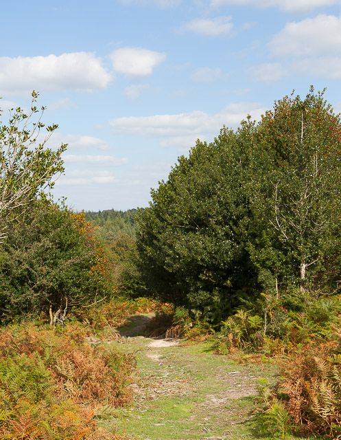
Broomy Plain

Downs, Moorland in Hampshire New Forest

England

Broomy Plain

Ocknell Plain Ocknell Plain by Slufters Inclosure
Ocknell Plain Credit: Shaun Ferguson

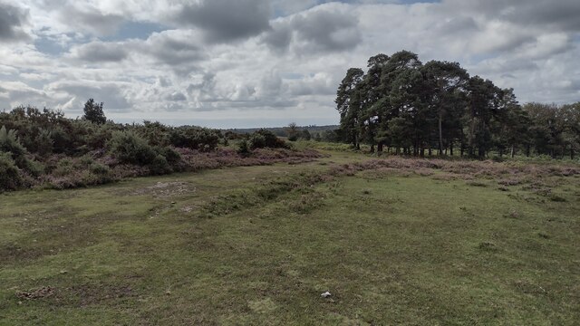
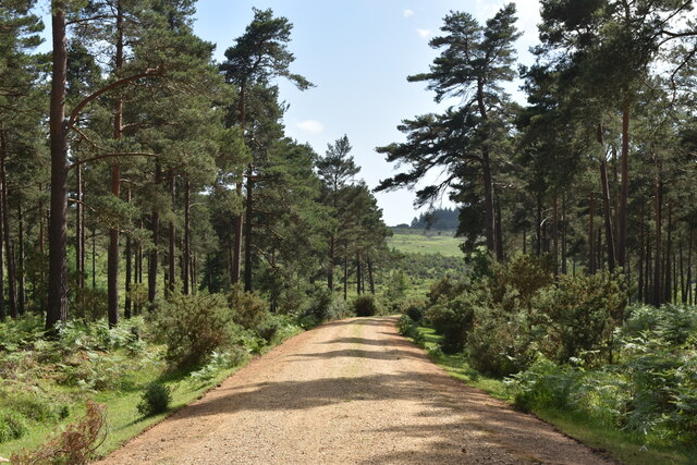
Broomy Plain, located in Hampshire, England, is a captivating natural landscape that encompasses both downs and moorland. Set against the picturesque backdrop of the Hampshire countryside, the area is renowned for its breathtaking beauty and diverse ecosystems.

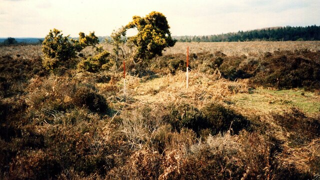
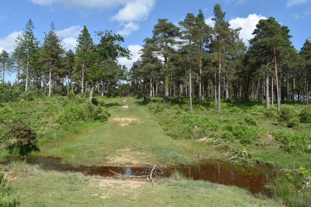
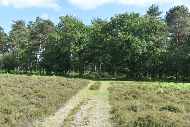
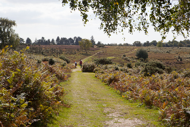
Covering a vast expanse of land, Broomy Plain is characterized by rolling hills, open grasslands, and pockets of heather-covered moorland. The downs, with their gently sloping hills, are primarily composed of chalk, creating a unique and distinctive landscape. These chalk downs provide habitat for a variety of flora and fauna, including rare wildflowers, butterflies, and skylarks, making it an important conservation area.

The moorland, on the other hand, presents a distinctly different landscape. Here, visitors will find expanses of heather, interspersed with gorse and bracken, creating a rich tapestry of vibrant colors. This moorland habitat is home to a range of species, such as grouse, curlews, and adders.

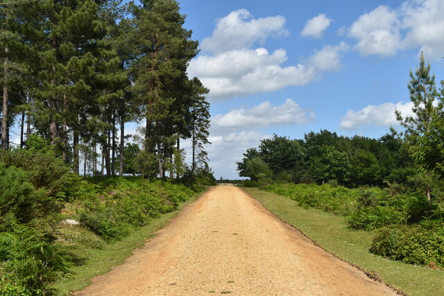
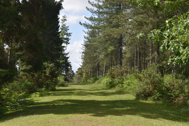
Broomy Plain is a popular destination for outdoor enthusiasts, offering ample opportunities for walking, hiking, and birdwatching. The undulating terrain and extensive network of trails provide stunning views and a chance to immerse oneself in the tranquil surroundings. Whether strolling through the downs or exploring the moorland, visitors can experience a sense of tranquility and harmony with nature.

In summary, Broomy Plain, Hampshire, is a captivating area that seamlessly combines downs and moorland. With its diverse landscapes, rich biodiversity, and opportunities for outdoor activities, it is a true gem in the Hampshire countryside.

If you have any feedback on the listing, please let us know in the comments section below.

Broomy Plain Images

Images are sourced within 2km of 50.895299/-1.6976995 or Grid Reference SU2110. Thanks to Geograph Open Source API. All images are credited.

Ocknell Plain Ocknell Plain by Slufters Inclosure
Ocknell Plain
Ocknell Plain by Slufters Inclosure
Bowl Barrow on Ocknell Plain (Scales 1m) <span class="nowrap"><a title="https://historicengland.org.uk/listing/the-list/list-entry/1010085?section=official-listing" rel="nofollow ugc noopener" href="https://historicengland.org.uk/listing/the-list/list-entry/1010085?section=official-listing">Link</a><img style="margin-left:2px;" alt="External link" title="External link - shift click to open in new window" src="https://s1.geograph.org.uk/img/external.png" width="10" height="10"/></span>
Bowl Barrow on Ocknell Plain
(Scales 1m) LinkExternal link
Track towards the eastern car park, Milkham Inclosure
Grassy ride in Milkham Inclosure
Cycle track descending through Milkham Inclosure
Ford on path in Milkham Inclosure
Path into Milkham Inclosure
Fields and woodland south of High Corner Inn
High Corner Inn
High Corner Inn
Path over Broomy Walk Seen from gravel track to High Corner Inn.
Path over Broomy Walk
Seen from gravel track to High Corner Inn.
Path from Broomy Walk to Amberslade Bottom With holly berries. Just as the path enters High Corner Wood.
Path from Broomy Walk to Amberslade Bottom
With holly berries. Just as the path enters High Corner Wood.
Stream restoration in Amberslade Bottom At this point the bed level of the stream has been raised by insertion of heather bales and hoggin. The bales are bound with polypropylene twine which is here exposed and may possibly constitute a hazard to wildlife.
Stream restoration in Amberslade Bottom
At this point the bed level of the stream has been raised by insertion of heather bales and hoggin. The bales are bound with polypropylene twine which is here exposed and may possibly constitute a hazard to wildlife.
Amberslade Bottom, upstream of the 2015 restoration works A plan of work by the Forestry Commission, financed under the Higher Level Stewardship Scheme, to undo the damage caused by drainage works in the 19th century. Those works involved straightening and deepening naturally meandering streams, resulting in increased flow rates, erosion and separation of the stream from its flood plain. The plan involves raising the stream bed, restoring old meanders, and filling in drainage ditches.

A similar but larger scheme was carried out at Warwickslade Cutting ( <a title="https://www.geograph.org.uk/snippet/53" href="https://www.geograph.org.uk/snippet/53">Link</a> ) in 2009 and was successful. Subsequent schemes carried out or planned for the part of the New Forest north of the A31 have proved more controversial. In particular, the plan to restore Latchmore Brook has been strongly opposed by a local action group.

This Amberslade & Broomy Inclosure scheme builds upon restoration work done earlier upstream in Amberslade Bottom. The present scheme was carried out between May and June 2015 and the photographs here therefore show the result shortly after completion of the works, but with insufficient time allowed for naturalisation.
Amberslade Bottom, upstream of the 2015 restoration works
A plan of work by the Forestry Commission, financed under the Higher Level Stewardship Scheme, to undo the damage caused by drainage works in the 19th century. Those works involved straightening and deepening naturally meandering streams, resulting in increased flow rates, erosion and separation of the stream from its flood plain. The plan involves raising the stream bed, restoring old meanders, and filling in drainage ditches. A similar but larger scheme was carried out at Warwickslade Cutting ( Link ) in 2009 and was successful. Subsequent schemes carried out or planned for the part of the New Forest north of the A31 have proved more controversial. In particular, the plan to restore Latchmore Brook has been strongly opposed by a local action group. This Amberslade & Broomy Inclosure scheme builds upon restoration work done earlier upstream in Amberslade Bottom. The present scheme was carried out between May and June 2015 and the photographs here therefore show the result shortly after completion of the works, but with insufficient time allowed for naturalisation.
Replacement of bridge by ford, Amberslade Bottom A wooden footbridge has been replaced by a gravel vehicle ford here.
Replacement of bridge by ford, Amberslade Bottom
A wooden footbridge has been replaced by a gravel vehicle ford here.
Newly raised stream bed, Amberslade Bottom The bed of the stream has been raised with hoggin. However, the stream, it seems, continues to flow as before, so that the stream bed becomes dry downstream (towards the camera) of the tree.
Newly raised stream bed, Amberslade Bottom
The bed of the stream has been raised with hoggin. However, the stream, it seems, continues to flow as before, so that the stream bed becomes dry downstream (towards the camera) of the tree.
Newly raised stream bed, in Broomy Inclosure The bed here is dry, at time of photographing, with the stream, presumably, flowing below the hoggin (towards the camera).
Newly raised stream bed, in Broomy Inclosure
The bed here is dry, at time of photographing, with the stream, presumably, flowing below the hoggin (towards the camera).
Restored meander, in Broomy Inclosure At time of photographing the stream bed was dry here, with the stream, presumably, flowing below ground. Debris on the earth track along the right edge of the picture suggests that when the flow is higher it flows along the track rather than along the meander.
Restored meander, in Broomy Inclosure
At time of photographing the stream bed was dry here, with the stream, presumably, flowing below ground. Debris on the earth track along the right edge of the picture suggests that when the flow is higher it flows along the track rather than along the meander.
Filled-in drain, in Broomy Inclosure I think, with new stream meander at left.
Filled-in drain, in Broomy Inclosure
I think, with new stream meander at left.
Show me another place!

Broomy Plain is located at Grid Ref: SU2110 (Lat: 50.895299, Lng: -1.6976995)

Administrative County: Hampshire

District: New Forest

Police Authority: Hampshire

What 3 Words

///amused.assurance.upwardly. Near Fordingbridge, Hampshire

Nearby Locations

Broomy Bottom Broomy Plain

Related Wikis

Ocknell Plain

Ocknell Plain can be found in the New Forest near Southampton, England. The area was used in World War II for the Stoney Cross airfield and it is now very...

Linwood, Hampshire

Linwood is a hamlet in the New Forest National Park of Hampshire, England. Its nearest town is Ringwood, which lies approximately 4.2 miles (5.9 km) south...

RAF Stoney Cross

Royal Air Force Stoney Cross or more simply RAF Stoney Cross is a former Royal Air Force station in the New Forest, Hampshire, England. The airfield is...

Ogdens

Ogdens is a small hamlet south of Hyde Common near Frogham in the New Forest area of Hampshire, England. Ogdens is a hamlet in the civil parish of Hyde...

Gorley Lynch

Gorley Lynch is a hamlet in the civil parish of Gorley in the New Forest National Park of Hampshire, England. It is in the civil parish of Hyde. Its nearest...
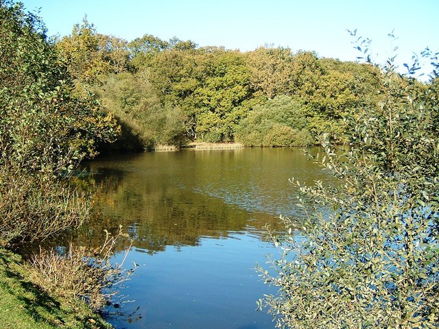
Eyeworth Pond

Eyeworth Pond is a pond located near Fritham in the New Forest, in Hampshire, England. The pond was created in 1871 by damming Latchmore Brook, with the...

Furze Hill

Furze Hill (or Furzehill) is a hamlet situated in the New Forest National Park of Hampshire, England. It is in the civil parish of Ellingham, Harbridge...

Fritham

Fritham is a small village in Hampshire, England. It lies in the north of the New Forest, near the Wiltshire border. It is in the civil parish of Bramshaw...

Related Videos

Bolderwood Deer Sanctuary & WE GOT ENGAGED!!! | Nature Diaries

Hi Conservation Crew! In this episode of Nature Diaries, our mini-break adventures continue as we explore the beautiful deer ...

Getting lost in the new forest. #forest #camera #photography #new

after what has been a wet summer so far, the sun finally came out so I thought it would be a great time to venture into the new ...

New Forest Hike - Bolderwood

Visit to the New Forest in Hampshire UK. Bolderwood is the entry point for this hike and has lots of car parking. We picked this ...

Bolderwood Deer Sanctuary | New Forest National Park | England | UK【SCENIC WALK】

This place is famous as deer watching. We saw a herd of deers three times while walking around there for one and a half hours.

Nearby Amenities

Located within 500m of 50.895299,-1.6976995
Lcn Ref: 52
Lat/Long: 50.8942494/-1.6954553
Broomy Bottom
Place: locality
Lat/Long: 50.8979585/-1.6942121
Broomy Plain
Place: locality
Lat/Long: 50.8941545/-1.7035559
Lcn Ref: 53
Lat/Long: 50.8973901/-1.7029722
Ford: yes
Lat/Long: 50.8957914/-1.7007527
Passing Place
Lat/Long: 50.8930482/-1.7018754
Passing Place
Lat/Long: 50.8935068/-1.6987607
Passing Place
Lat/Long: 50.8937951/-1.6966972
Passing Place
Lat/Long: 50.8938503/-1.6938969
Passing Place
Lat/Long: 50.8930633/-1.6922243
The data included in this document is from www.openstreetmap.org. The data is made available under ODbL.

Have you been to Broomy Plain?

Leave your review of Broomy Plain below (or comments, questions and feedback).