Fox Stones Moss

Downs, Moorland in Yorkshire

England

Fox Stones Moss

Old Boundary Marker on Candlerush Edge, Bleaklow Estate Boundary Marker on Candlerush Edge, Bleaklow, 1860 metres north-northeast of Margery Hill. Bradfield parish. R R W refers to R R Wilson, the owner of the Broomhead Estate at the end of the 19C.

Milestone Society National ID: YW_BRA43em
Old Boundary Marker on Candlerush Edge, Bleaklow Credit: D Garside

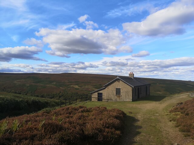
Fox Stones Moss is a picturesque natural area located in the county of Yorkshire, England. Nestled among the rolling hills and stunning landscapes of the Yorkshire Downs and Moorland, it is a popular destination for nature enthusiasts and hikers seeking tranquility and breathtaking views.

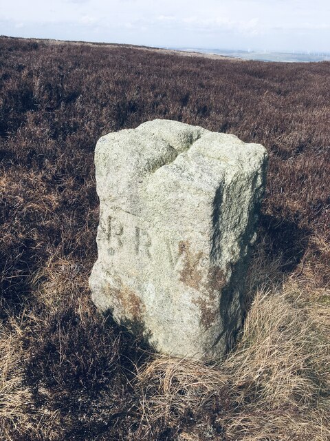
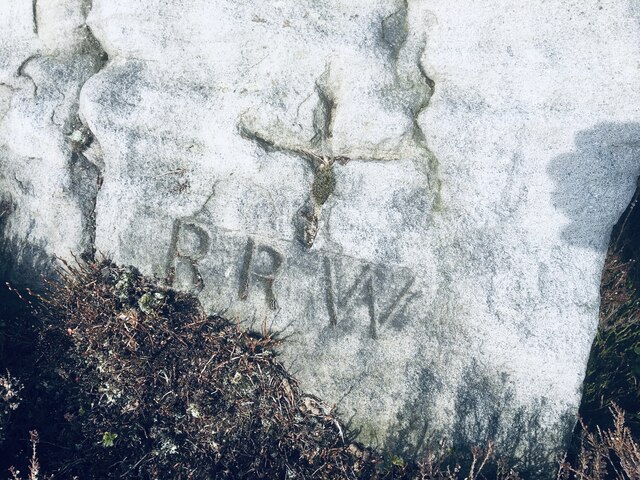
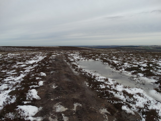
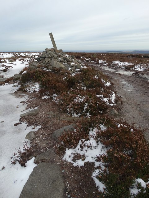
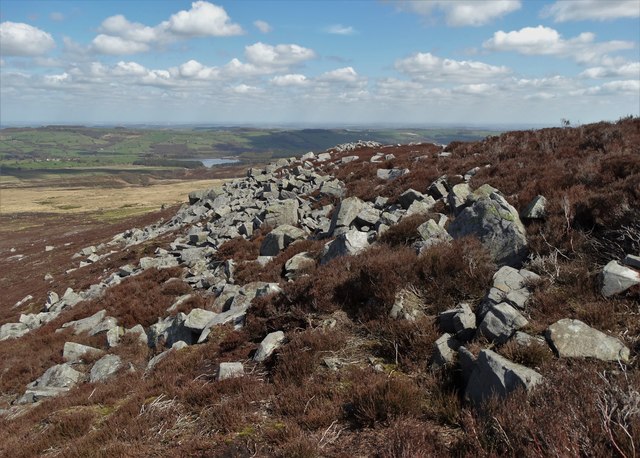
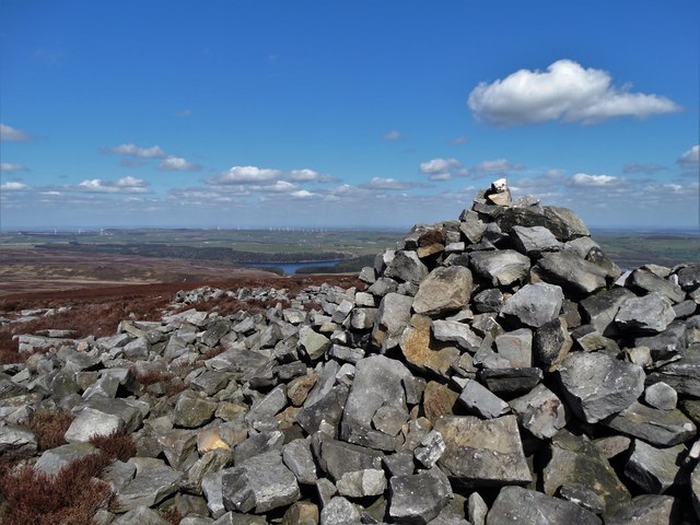
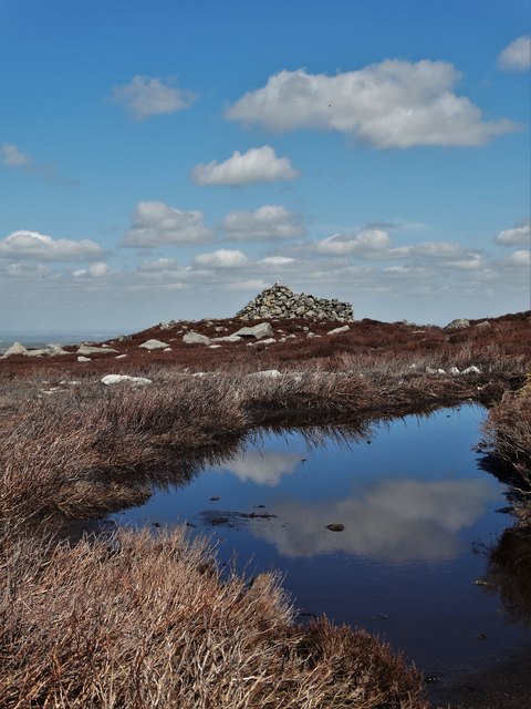
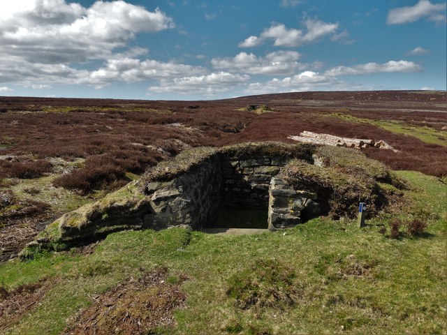
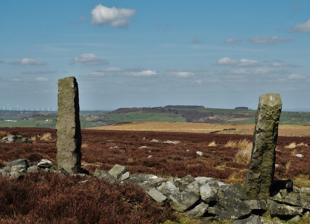
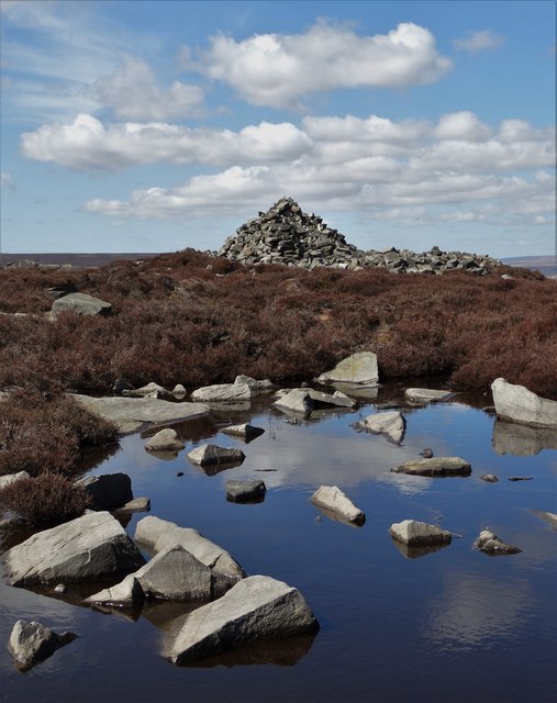
Covered in a lush carpet of moss, the area is dominated by a cluster of distinctive rock formations known as the Fox Stones. These impressive rocks, shaped by centuries of weathering and erosion, stand tall against the sky, adding a touch of mystery and intrigue to the landscape.

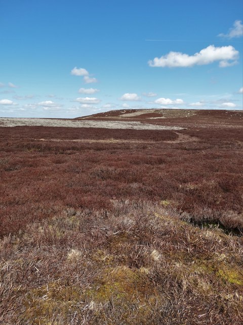
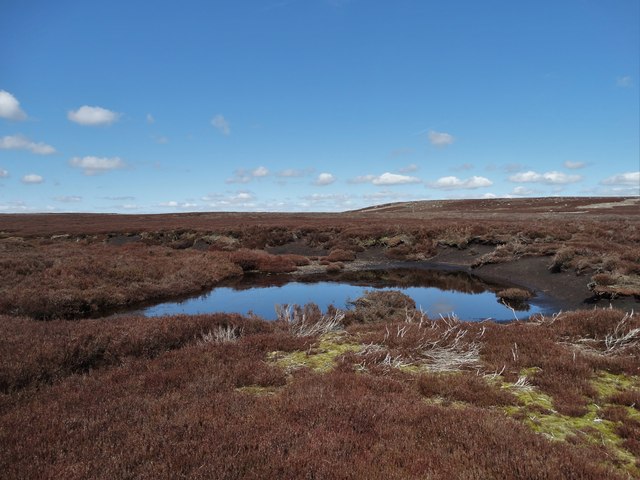
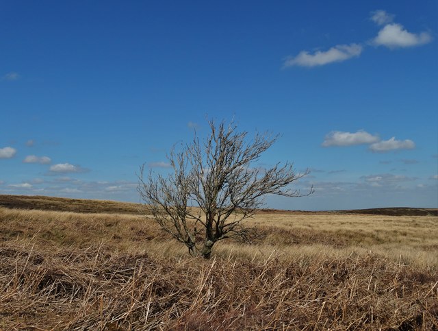
The moss surrounding the rocks creates a magical atmosphere, with its vibrant green hues and soft texture underfoot. This unique feature is a result of the area's damp climate and the abundance of rainfall it receives throughout the year.

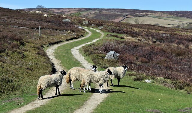
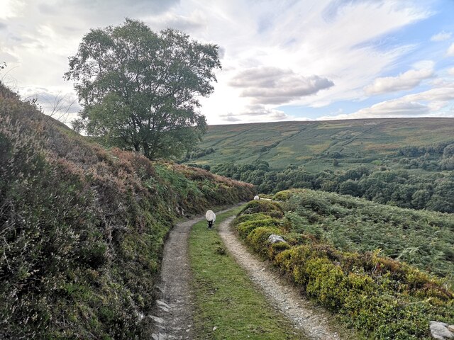
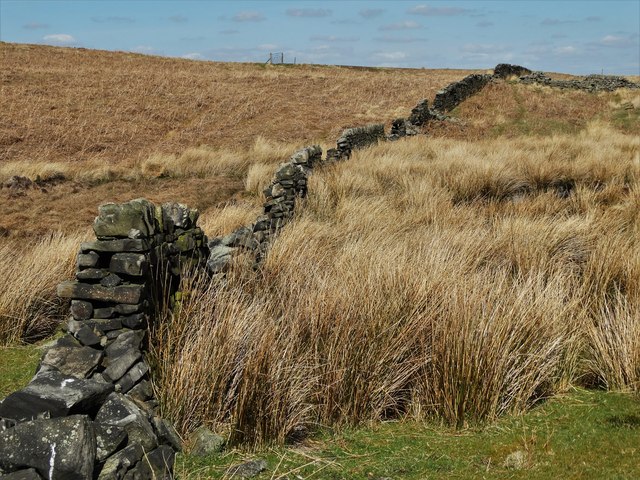
Visitors to Fox Stones Moss can enjoy leisurely walks along the well-maintained trails that wind through the area. The moss-covered ground is a delight to explore, and the rocks offer ample opportunities for rock climbing and bouldering for those seeking more adventure.

The beauty of Fox Stones Moss is further enhanced by the diverse flora and fauna that call it home. Rare plant species thrive in the damp conditions, while birds and small mammals can be spotted among the rocks and trees. The area also provides a tranquil habitat for a variety of insects and butterflies.

In summary, Fox Stones Moss is a captivating natural area in Yorkshire, offering a peaceful retreat for nature lovers and outdoor enthusiasts. Its unique moss-covered landscape, impressive rock formations, and abundant wildlife make it a truly remarkable destination.

If you have any feedback on the listing, please let us know in the comments section below.

Fox Stones Moss Images

Images are sourced within 2km of 53.462972/-1.6801795 or Grid Reference SK2196. Thanks to Geograph Open Source API. All images are credited.

Old Boundary Marker on Candlerush Edge, Bleaklow Estate Boundary Marker on Candlerush Edge, Bleaklow, 1860 metres north-northeast of Margery Hill. Bradfield parish. R R W refers to R R Wilson, the owner of the Broomhead Estate at the end of the 19C.

Milestone Society National ID: YW_BRA43em
Old Boundary Marker on Candlerush Edge, Bleaklow
Estate Boundary Marker on Candlerush Edge, Bleaklow, 1860 metres north-northeast of Margery Hill. Bradfield parish. R R W refers to R R Wilson, the owner of the Broomhead Estate at the end of the 19C. Milestone Society National ID: YW_BRA43em
Old Boundary Marker on Candlerush Edge, Bleaklow Estate Boundary Marker on Candlerush Edge, Bleaklow, 2100 metres northeast of Margery Hill. Bradfield parish. R R W refers to R R Wilson, the owner of the Broomhead Estate at the end of the 19C. See also <a title="https://www.geograph.org.uk/photo/398943" href="https://www.geograph.org.uk/photo/398943">Link</a>.

Milestone Society National ID: YW_BRA44em
Old Boundary Marker on Candlerush Edge, Bleaklow
Estate Boundary Marker on Candlerush Edge, Bleaklow, 2100 metres northeast of Margery Hill. Bradfield parish. R R W refers to R R Wilson, the owner of the Broomhead Estate at the end of the 19C. See also Link. Milestone Society National ID: YW_BRA44em
Old Boundary Marker on Candlerush Edge, Bleaklow Estate Boundary Marker on Candlerush Edge, Bleaklow, 2100 metres east-northeast of Margery Hill. Bradfield parish. R R W refers to R R Wilson, the owner of the Broomhead Estate at the end of the 19C.

Milestone Society National ID: YW_BRA45em
Old Boundary Marker on Candlerush Edge, Bleaklow
Estate Boundary Marker on Candlerush Edge, Bleaklow, 2100 metres east-northeast of Margery Hill. Bradfield parish. R R W refers to R R Wilson, the owner of the Broomhead Estate at the end of the 19C. Milestone Society National ID: YW_BRA45em
Sheep on the path!
Sheep on the path!
Track to Shooting Lodge On Broomhead Moor. Ewden Beck is in the valley.
Track to Shooting Lodge
On Broomhead Moor. Ewden Beck is in the valley.
Shooting Lodge on Broomhead Moor
Dukes Road on Flint Hill Here the track bends eastwards towards Mortimer Road.
Dukes Road on Flint Hill
Here the track bends eastwards towards Mortimer Road.
Cairn by Dukes Road, east of Brusten Croft Ridge
Pike Lowe Stones above Fenny Common With a distant view of Midhope Reservoir.
Pike Lowe Stones above Fenny Common
With a distant view of Midhope Reservoir.
At the cairn on Pike Lowe It sits on top of a Bronze Age burial site. If these stones could speak - who knows what stories they could tell of times long gone.
At the cairn on Pike Lowe
It sits on top of a Bronze Age burial site. If these stones could speak - who knows what stories they could tell of times long gone.
A view of the cairn on Pike Lowe Across a brackish moorland pool
A view of the cairn on Pike Lowe
Across a brackish moorland pool
Moorland at Candlerush Looking north to Pike Lowe
Moorland at Candlerush
Looking north to Pike Lowe
Moorland pool on White Carr Moss Looking in a north westerly direction towards Pike Lowe.
Moorland pool on White Carr Moss
Looking in a north westerly direction towards Pike Lowe.
Grouse butt near Brown Edge
Lone tree at Earnshaw North of Upperwood Dike. Here the land is spongy - providing a challenge for cross country walkers with rivulets and pools hidden beneath the moorland vegetation.
Lone tree at Earnshaw
North of Upperwood Dike. Here the land is spongy - providing a challenge for cross country walkers with rivulets and pools hidden beneath the moorland vegetation.
Moorland west of Half Holes Spring Looking northwards towards Emley Moor's telecommunications mast. Tumbledown walls in this area and these long disused gateposts speak of times when sheep farming was far more prevalent on the moors south of Midhope.
Moorland west of Half Holes Spring
Looking northwards towards Emley Moor's telecommunications mast. Tumbledown walls in this area and these long disused gateposts speak of times when sheep farming was far more prevalent on the moors south of Midhope.
Ruined wall west of Ewden Height Once sheep farming was far more prevalent on these moors as the tumbledown wall suggests.
Ruined wall west of Ewden Height
Once sheep farming was far more prevalent on these moors as the tumbledown wall suggests.
On Pike Lowe The ancient cairn sits atop a Bronze Age burial site. Seen across a moorland pool that reflects the April sky like a mirror.
On Pike Lowe
The ancient cairn sits atop a Bronze Age burial site. Seen across a moorland pool that reflects the April sky like a mirror.
Show me another place!

Fox Stones Moss is located at Grid Ref: SK2196 (Lat: 53.462972, Lng: -1.6801795)

Division: West Riding

Unitary Authority: Sheffield

Police Authority: South Yorkshire

What 3 Words

///chips.satellite.daytime. Near Stocksbridge, South Yorkshire

Related Wikis

Margery Hill

Margery Hill is a 546-metre (1,791 ft) hill on the Howden Moors in South Yorkshire, England. It lies towards the northern boundary of the Peak District...

Wigtwizzle

Wigtwizzle is a hamlet in the civil parish of Bradfield, in South Yorkshire, England. The hamlet is 6 miles (9.7 km) south of Penistone, and 12 miles...

Broomhead Hall

Broomhead Hall was a large English country house that stood in the Ewden valley, to the west of Sheffield, England. The hall stood near the hamlet of Wigtwizzle...

High Stones

High Stones, at 548 metres (1,798 ft), is the highest point within the boundaries of both the City of Sheffield and South Yorkshire, England.High Stones...

Howden Edge

Howden Edge (grid reference SK187943) is a peak in the north-east of the Upper Derwent Valley area of the Peak District National Park in England. At 545...

Upper Midhope

Upper Midhope (archaic Over Midhope) is a village in the civil parish of Bradfield within the Stocksbridge and Upper Don electoral ward in the borough...

Midhopestones

Midhopestones (archaic Nether Midhope, also Middup, or Middop) is a village in the civil parish of Bradfield within the Stocksbridge and Upper Don electoral...

Langsett Reservoir

Langsett Reservoir is in Yorkshire, England, near the villages of Langsett and Upper Midhope, on the edge of the Peak District National Park. The reservoir...

Nearby Amenities

Located within 500m of 53.462972,-1.6801795
Fox Stones Moss
Place: locality
Lat/Long: 53.4635512/-1.6824619
Fox Stones
Place: locality
Lat/Long: 53.4619426/-1.681458
Gallows Rocher
Place: locality
Lat/Long: 53.4594558/-1.6765748
Raven Gutter
Place: locality
Lat/Long: 53.4615294/-1.673972
Washford Flat
Place: locality
Lat/Long: 53.4608948/-1.6818298
White Carr Moss
Place: locality
Lat/Long: 53.4666274/-1.6759516
White Carr Ridge
Place: locality
Lat/Long: 53.465344/-1.6741637
The data included in this document is from www.openstreetmap.org. The data is made available under ODbL.

Have you been to Fox Stones Moss?

Leave your review of Fox Stones Moss below (or comments, questions and feedback).