Derwent Moors

Downs, Moorland in Derbyshire High Peak

England

Derwent Moors

View across to Derwent Reservoir A view from the hillside across to the local reservoir.
View across to Derwent Reservoir Credit: Toby Griffin

Derwent Moors is a picturesque area located in Derbyshire, England. Known for its stunning natural beauty, it encompasses a diverse landscape of downs and moorland. Spanning over a vast area, the moors are situated near the River Derwent, providing a serene and tranquil atmosphere for visitors.

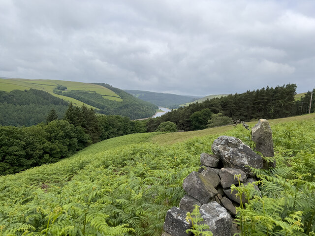
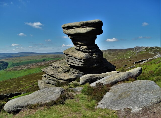
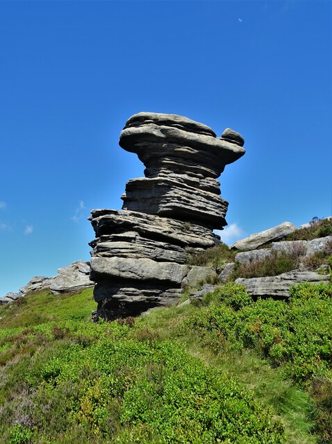
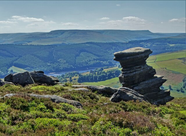
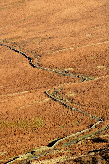
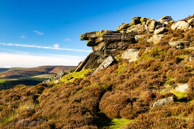
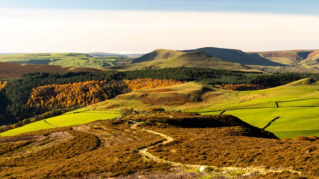
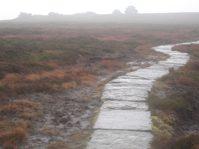
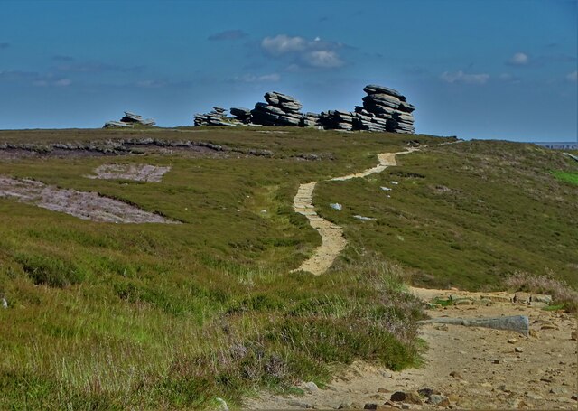
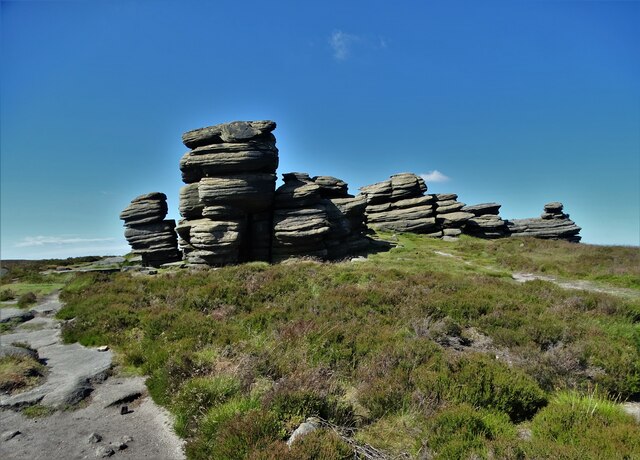
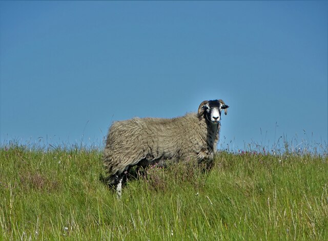
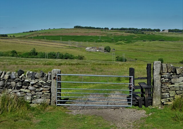
The moorland of Derwent Moors is characterized by its rolling hills, heather-covered expanses, and scattered clumps of trees. This rugged terrain offers breathtaking panoramic views, especially from higher vantage points. Walking trails crisscross the moors, allowing hikers and nature enthusiasts to explore the area's rich biodiversity.

Wildlife thrives in Derwent Moors, with various species calling the area home. Birdwatchers flock to the moors to catch a glimpse of rare and migratory birds, such as curlews, lapwings, and merlins. The moors also provide a habitat for small mammals like rabbits, voles, and weasels.

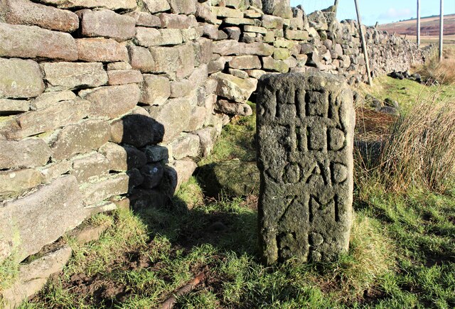
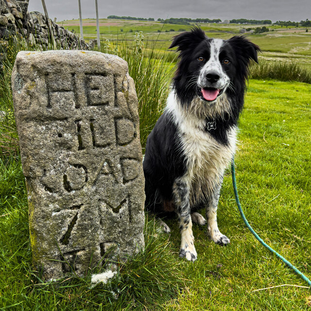
Derwent Moors holds historical significance as well. The area is dotted with remnants of past civilizations, including ancient burial grounds and stone circles, attesting to its long-standing human presence. The moors have also been a source of inspiration for artists and writers throughout history, capturing the essence of its ethereal beauty.

Visitors to Derwent Moors can partake in a range of activities, such as hiking, birdwatching, and photography. The area is well-equipped with visitor centers, parking facilities, and amenities for a comfortable and enjoyable experience. Whether seeking solitude in nature or exploring its cultural heritage, Derwent Moors offers a truly captivating and immersive experience for all who visit.

If you have any feedback on the listing, please let us know in the comments section below.

Derwent Moors Images

Images are sourced within 2km of 53.390867/-1.6871705 or Grid Reference SK2088. Thanks to Geograph Open Source API. All images are credited.

View across to Derwent Reservoir A view from the hillside across to the local reservoir.
View across to Derwent Reservoir
A view from the hillside across to the local reservoir.
The Salt Cellar on Derwent Edge Looking north to Howden Moors and to where The River Derwent begins its journey.
The Salt Cellar on Derwent Edge
Looking north to Howden Moors and to where The River Derwent begins its journey.
Another view of The Salt Cellar On Derwent Edge
Another view of The Salt Cellar
On Derwent Edge
The Salt Cellar above the Derwent Valley With a view towards Kinder Plateau
The Salt Cellar above the Derwent Valley
With a view towards Kinder Plateau
Ladybower Reservoir Looking across the reservoir.
Ladybower Reservoir
Looking across the reservoir.
Bridleway
Bridleway
The Salt Cellar
The Salt Cellar
White Tor White Tor on Derwent Edge.
White Tor
White Tor on Derwent Edge.
Whinstone Lee Tor View from <a href="https://www.geograph.org.uk/photo/7650036">SK2087 : Hurkling Stones</a> looking down to Whinstone Lee Tor (in the foreground).  In the middle distance is <a href="https://www.geograph.org.uk/photo/7649449">SK1886 : Crook Hill</a> and beyond the woodland above Ladybower Reservoir, the peaks of <a href="https://www.geograph.org.uk/photo/4522426">SK1585 : Lose Hill</a>, <a href="https://www.geograph.org.uk/photo/7603095">SK1283 : Mam Tor</a> and <a href="https://www.geograph.org.uk/photo/7603618">SK1183 : Lord's Seat</a> are visible.
Whinstone Lee Tor
View from SK2087 : Hurkling Stones looking down to Whinstone Lee Tor (in the foreground). In the middle distance is SK1886 : Crook Hill and beyond the woodland above Ladybower Reservoir, the peaks of SK1585 : Lose Hill, SK1283 : Mam Tor and SK1183 : Lord's Seat are visible.
Cakes of Bread These are some of the many strangely eroded rocks on Derwent Edge in the High Peak of Derbyshire. They stand about 4m (12ft) tall at an elevation of 507m (1650ft). Obviously lots of work has gone into making an excellent pathway through the rough and boggy terrain. Photo looking due south.
Cakes of Bread
These are some of the many strangely eroded rocks on Derwent Edge in the High Peak of Derbyshire. They stand about 4m (12ft) tall at an elevation of 507m (1650ft). Obviously lots of work has gone into making an excellent pathway through the rough and boggy terrain. Photo looking due south.
Cakes of Bread These are some of the many strangely eroded rocks on Derwent Edge in the High Peak of Derbyshire. They stand about 4m (12ft) tall at an elevation of 507m (1650ft). Photo looking north-east from the main path.
Cakes of Bread
These are some of the many strangely eroded rocks on Derwent Edge in the High Peak of Derbyshire. They stand about 4m (12ft) tall at an elevation of 507m (1650ft). Photo looking north-east from the main path.
Sheepfold marker stone
Sheffield Milestone A partially damaged Milestone showing the distance to the City of Sheffield.
Sheffield Milestone
A partially damaged Milestone showing the distance to the City of Sheffield.
Path to The Wheelstones on Derwent Edge
The Wheelstones seen from the south
Sheep above Highshaw Clough
Looking towards Moscar House
Track to Moscar House
Show me another place!

Derwent Moors is located at Grid Ref: SK2088 (Lat: 53.390867, Lng: -1.6871705)

Administrative County: Derbyshire

District: High Peak

Police Authority: Derbyshire

What 3 Words

///votes.zealous.compliant. Near Hope Valley, Derbyshire

Nearby Locations

Derwent Moors Wheel Stones

Related Wikis

Hordron Edge stone circle

Hordron Edge stone circle, also known as 'The Seven Stones of Hordron' is a Bronze Age stone circle (grid reference SK2152486851) in Derbyshire, England...

Derwent Edge

Derwent Edge is a Millstone Grit escarpment that lies above the Upper Derwent Valley in the Peak District National Park in the English county of Derbyshire...

Ladybower Reservoir

Ladybower Reservoir is a large Y-shaped, artificial reservoir, the lowest of three in the Upper Derwent Valley in Derbyshire, England. The River Ashop...

Moscar Cross

Moscar Cross is the name of a standing stone (or "guide stoop") and surrounding area in the Peak District on the border between Derbyshire and Sheffield...

Birchinlee

Birchinlee is the site of "Tin Town", a village built by the Derwent Valley Water Board for the workers (and their families) who constructed the Derwent...

Derwent, Derbyshire

Derwent was a village 'drowned' in 1944 when the Ladybower Reservoir in Derbyshire, England was created. The village of Ashopton, Derwent Woodlands church...

River Ashop

The River Ashop is a river in the Derbyshire Peak District, England. Its source is on the eastern slopes of Mill Hill, three miles south east of Glossop...

Derwent Woodlands War Memorial

Derwent Woodlands War Memorial is a 20th-century grade II listed war memorial near the Ladybower Reservoir, Derbyshire. == History == The war memorial...

Nearby Amenities

Located within 500m of 53.390867,-1.6871705
Hunting Stand
Lat/Long: 53.3891126/-1.689373
Hunting Stand
Lat/Long: 53.3890386/-1.6904463
Hunting Stand
Lat/Long: 53.3889635/-1.6916273
Hunting Stand
Lat/Long: 53.3888922/-1.6926723
Hunting Stand
Lat/Long: 53.3888163/-1.6937306
Hunting Stand
Hunting Stand: grouse_butt
Lat/Long: 53.3882279/-1.6835579
Hunting Stand
Hunting Stand: grouse_butt
Lat/Long: 53.3882129/-1.6825241
Hunting Stand
Hunting Stand: grouse_butt
Lat/Long: 53.3882439/-1.681536
Hunting Stand
Hunting Stand: grouse_butt
Lat/Long: 53.3882663/-1.6845895
The data included in this document is from www.openstreetmap.org. The data is made available under ODbL.

Have you been to Derwent Moors?

Leave your review of Derwent Moors below (or comments, questions and feedback).