Beamish South Moor

Downs, Moorland in Durham

England

Beamish South Moor

St.Andrew's Church, Stanley, Co. Durham For a tragic story associated with the church see:
<span class="nowrap"><a title="http://www.thisisthenortheast.co.uk/the_north_east/news/campaigns/memorial/pages/160202_1.html" rel="nofollow ugc noopener" href="http://www.thisisthenortheast.co.uk/the_north_east/news/campaigns/memorial/pages/160202_1.html">Link</a><img style="margin-left:2px;" alt="External link" title="External link - shift click to open in new window" src="https://s1.geograph.org.uk/img/external.png" width="10" height="10"/></span>
St.Andrew's Church, Stanley, Co. Durham Credit: Alan Fearon

Beamish South Moor is a picturesque area located in Durham, England. It is known for its stunning downs and moorland, which attract nature enthusiasts and hikers alike. The moorland stretches over a vast area, providing visitors with an opportunity to explore its diverse landscapes.

The downs in Beamish South Moor offer breathtaking views of the surrounding countryside, with rolling hills that are covered in heather and grasses. It is a haven for wildlife, with a variety of birds, mammals, and plant species calling this area home. Visitors can often spot kestrels, buzzards, and curlews soaring above the moorlands.

The moorland itself is a mixture of open spaces and wooded areas, providing a rich habitat for a wide range of flora and fauna. The heathland is home to a variety of plants, such as heather, gorse, and bilberry, which add vibrant colors to the landscape. The woods are filled with ancient oak and beech trees, creating a tranquil atmosphere.

For those who enjoy outdoor activities, Beamish South Moor offers numerous walking trails and paths that allow visitors to explore the area at their own pace. The trails vary in difficulty, catering to both beginners and experienced hikers. Along the way, there are information boards that provide insights into the local history and wildlife.

Overall, Beamish South Moor is a natural gem in Durham, offering visitors a chance to immerse themselves in the beauty of downs and moorland. Whether for a leisurely walk or a more adventurous hike, this area provides a peaceful retreat in the heart of nature.

If you have any feedback on the listing, please let us know in the comments section below.

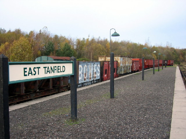
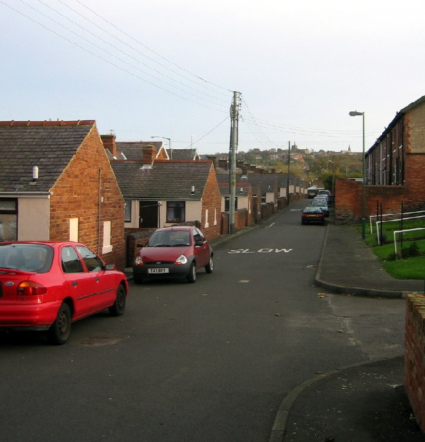
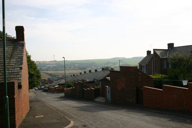
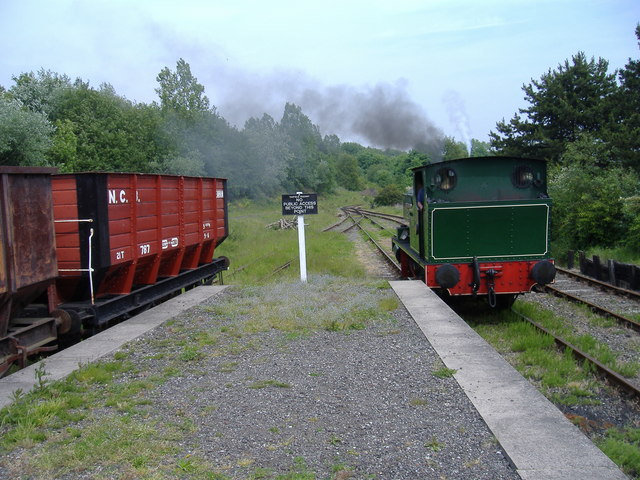
Beamish South Moor Images

Images are sourced within 2km of 54.877302/-1.6813704 or Grid Reference NZ2053. Thanks to Geograph Open Source API. All images are credited.

St.Andrew's Church, Stanley, Co. Durham For a tragic story associated with the church see:
<span class="nowrap"><a title="http://www.thisisthenortheast.co.uk/the_north_east/news/campaigns/memorial/pages/160202_1.html" rel="nofollow ugc noopener" href="http://www.thisisthenortheast.co.uk/the_north_east/news/campaigns/memorial/pages/160202_1.html">Link</a><img style="margin-left:2px;" alt="External link" title="External link - shift click to open in new window" src="https://s1.geograph.org.uk/img/external.png" width="10" height="10"/></span>
St.Andrew's Church, Stanley, Co. Durham
For a tragic story associated with the church see: LinkExternal link
East Tanfield Station, Tanfield Railway The southern terminus of the world's oldest working railway.
East Tanfield Station, Tanfield Railway
The southern terminus of the world's oldest working railway.
Back street in Tanfield Lea, Co. Durham Handsomely restored (but with the old coal holes still visible) these single storey houses must have looked rather different when the local colliery was open. St. Andrew's, Stanley, can just be seen on the horizon.
Back street in Tanfield Lea, Co. Durham
Handsomely restored (but with the old coal holes still visible) these single storey houses must have looked rather different when the local colliery was open. St. Andrew's, Stanley, can just be seen on the horizon.
Tanfield Lea Methodist Church and Hall Two splendid buildings in  a small village
Tanfield Lea Methodist Church and Hall
Two splendid buildings in a small village
Asda View of one of the large prominent buildings when travelling through Stanley.
Asda
View of one of the large prominent buildings when travelling through Stanley.
South Stanley, Co. Durham Taken near Tweed Terrace, view to South.
South Stanley, Co. Durham
Taken near Tweed Terrace, view to South.
The Louisa Centre, Stanley Council owned sports and leisure centre
The Louisa Centre, Stanley
Council owned sports and leisure centre
Stanley Front Street looking towards the Imperial Hotel
Stanley Bus Station
Stanley Bus Station
Christ Church United Reformed Church, Stanley
Stanley Police Station
St Joseph's Roman Catholic Church
The Salvation Army Hall, Stanley
The Church of St Andrew, Stanley
LampLight Arts Centre, Stanley A sixties building refurbished in 1991. Currently displaying wonderful landscapes in watercolours by local artist George Hutchinson.
LampLight Arts Centre, Stanley
A sixties building refurbished in 1991. Currently displaying wonderful landscapes in watercolours by local artist George Hutchinson.
Indoor Bowls Centre, Stanley On a freezing December day I can appreciate this as a good idea.
Indoor Bowls Centre, Stanley
On a freezing December day I can appreciate this as a good idea.
Beware of trains At a foot crossing on the Tanfield Railway.
Beware of trains
At a foot crossing on the Tanfield Railway.
East Tanfield Renishaw Ironworks No 6 backs onto a passenger train.
East Tanfield
Renishaw Ironworks No 6 backs onto a passenger train.
Show me another place!

Beamish South Moor is located at Grid Ref: NZ2053 (Lat: 54.877302, Lng: -1.6813704)

Unitary Authority: County Durham

Police Authority: Durham

What 3 Words

///worlds.reviewed.wake. Near Stanley, Co. Durham

Related Wikis

Kip Hill

Kip Hill is a village in County Durham, in England. It is situated directly to the north of Stanley, near Shield Row. It has two pubs, the Blue Bell Inn...

West Stanley Pit disasters

The West Stanley Pit disasters refers to two explosions at the West Stanley colliery (variously known as West Stanley pit or Burns pit). West Stanley colliery...

West Stanley railway station

West Stanley railway station was a railway station on the North Eastern Railway serving the town of Stanley in County Durham, England. == History == The...

North Durham Academy

North Durham Academy is a secondary school with academy status based in Stanley in County Durham, England. The school was formed in September 2011, when...

Beamish Hall

Beamish Hall is a mid-18th-century country house, now converted to a hotel, which stands in 24 acres (97,000 m2) of grounds near the town of Stanley, County...

No Place

No Place is a small village near the town of Stanley in County Durham, England, east of Stanley and west of Beamish. Situated to the south of the A693...

Stanley, County Durham

Stanley is a former colliery town and civil parish in County Durham, England. Centred on a hilltop between Chester-le-Street and Consett, the town lies...

Shield Row

Shield Row is a village in County Durham, in England. It is situated immediately to the north of Stanley. To the north is Tanfield village. Pubs include...

Nearby Amenities

Located within 500m of 54.877302,-1.6813704
Bus Stop
Shield Row School
Bus: yes
Naptan AtcoCode: 13001503A
Naptan Bearing: N
Naptan CommonName: Shield Row School
Naptan Indicator: north bound
Naptan Landmark: between 4 and 5
Naptan NaptanCode: duragajt
Naptan Notes: Pelaw Avenue- at corner with Ryton Crescent- Stanley
Naptan Street: Pelaw Avenue
Naptan Verified: no
Public Transport: platform
Source: naptan_import
Lat/Long: 54.8775563/-1.6872984
Bus Stop
Shield Row School
Bench: no
Bus: yes
Naptan AtcoCode: 13001503E
Naptan Bearing: S
Naptan CommonName: Shield Row School
Naptan Indicator: south bound
Naptan Landmark: opp no 6
Naptan NaptanCode: duragajw
Naptan Notes: Opposite 6 Pelaw Avenue- Stanley
Naptan Street: Pelaw Avenue
Naptan Verified: no
Public Transport: platform
Shelter: yes
Source: naptan_import
Lat/Long: 54.8771703/-1.6870196
Bus Stop
Hillside Gardens
Bench: yes
Bus: yes
Naptan AtcoCode: 13001504D
Naptan Bearing: SE
Naptan CommonName: Hillside Gardens
Naptan Indicator: south east bound
Naptan Landmark: Landmark not known
Naptan NaptanCode: duragama
Naptan Notes: On Pelaw Avenue- opposite 69 Wylam Road- Stanley
Naptan Street: Pelaw Avenue
Naptan Verified: no
Public Transport: platform
Shelter: yes
Source: naptan_import
Lat/Long: 54.8761668/-1.6846897
Bus Stop
Hillside Gardens
Naptan AtcoCode: 13001504H
Naptan Bearing: NW
Naptan CommonName: Hillside Gardens
Naptan Indicator: north west bound
Naptan Landmark: Landmark not known
Naptan NaptanCode: duragamd
Naptan Notes: On Pelaw Avenue- north of 64 Wylam Way- Stanley
Naptan Street: Pelaw Avenue
Naptan Verified: no
Shelter: yes
Source: naptan_import
Lat/Long: 54.8762138/-1.6854997
Bus Stop
The Hill Top
Bus: yes
Naptan AtcoCode: 13001548D
Naptan Bearing: SE
Naptan CommonName: The Hill Top
Naptan Indicator: south east bound
Naptan Landmark: adj entrance to pub car park
Naptan NaptanCode: duragjdt
Naptan Notes: Stop is missing - temporarily removed but not replaced
Naptan Street: East Street
Naptan Verified: no
Public Transport: platform
Source: naptan_import
Lat/Long: 54.8746629/-1.6800574
Bus Stop
The Hill Top
Bus: yes
Naptan AtcoCode: 13001548H
Naptan Bearing: NW
Naptan CommonName: The Hill Top
Naptan Indicator: north west bound
Naptan Landmark: opp entrance to pub car park
Naptan NaptanCode: duragjdw
Naptan Notes: Stop is missing - demolished in accident
Naptan Street: East Street
Naptan Verified: no
Public Transport: platform
Source: naptan_import
Lat/Long: 54.8747622/-1.6802124
Bus Stop
East Street
Bus: yes
Naptan AtcoCode: 13001799E
Naptan Bearing: S
Naptan CommonName: East Street
Naptan Indicator: south bound
Naptan Landmark: Landmark not known
Naptan NaptanCode: durajpdt
Naptan Notes: 37 East Street- Stanley
Naptan Street: East Street
Naptan Verified: no
Public Transport: platform
Source: naptan_import
Lat/Long: 54.8730202/-1.6793286
Noexit: yes
Lat/Long: 54.876704/-1.6835603
Noexit: yes
Lat/Long: 54.8757433/-1.6877559
Noexit: yes
Lat/Long: 54.8790326/-1.6879457
Noexit: yes
Lat/Long: 54.8791014/-1.6867397
Noexit: yes
Lat/Long: 54.8732214/-1.6784799
Noexit: yes
Lat/Long: 54.8745821/-1.67667
Noexit: yes
Lat/Long: 54.8750846/-1.6822763
Noexit: yes
Lat/Long: 54.8744252/-1.6823268
Noexit: yes
Lat/Long: 54.8742771/-1.6821015
Noexit: yes
Lat/Long: 54.8739262/-1.6827129
Noexit: yes
Lat/Long: 54.8738855/-1.682563
Noexit: yes
Lat/Long: 54.8734067/-1.6800952
Noexit: yes
Lat/Long: 54.8754257/-1.6843864
Noexit: yes
Lat/Long: 54.8745305/-1.6779511
Barrier: entrance
Lat/Long: 54.8754133/-1.6876658
Log
Artwork Type: sculpture
Tourism: artwork
Lat/Long: 54.8753945/-1.6881532
Pine Feature
Artwork Type: sculpture
Tourism: artwork
Lat/Long: 54.8754912/-1.6882351
Stones
Artwork Type: sculpture
Tourism: artwork
Lat/Long: 54.8753618/-1.6882226
Bench
Tree Leaves
Capacity: 7
Lat/Long: 54.8754272/-1.6880964
Playground: basketswing
Lat/Long: 54.8754978/-1.6883885
Bench
Lat/Long: 54.8755377/-1.6884317
Bench
Lat/Long: 54.8755383/-1.6884681
Noexit: yes
Lat/Long: 54.8748551/-1.6789368
Noexit: yes
Lat/Long: 54.8730455/-1.6833939
Noexit: yes
Lat/Long: 54.8754544/-1.6809807
Turning Circle
Lat/Long: 54.8773099/-1.6841534
Power: pole
Lat/Long: 54.8811835/-1.6812784
Power: pole
Lat/Long: 54.8805693/-1.681053
Power: pole
Lat/Long: 54.8798812/-1.6807821
Power: pole
Lat/Long: 54.8791837/-1.6799292
Power: pole
Lat/Long: 54.8786189/-1.6786927
Power: pole
Lat/Long: 54.878068/-1.6775259
Power: pole
Lat/Long: 54.8775788/-1.6764396
Power: pole
Lat/Long: 54.8771059/-1.6745313
Give Way
Direction: forward
Lat/Long: 54.8797432/-1.6875153
Give Way
Direction: forward
Lat/Long: 54.8769193/-1.6868079
Noexit: yes
Lat/Long: 54.8791412/-1.6882229
Give Way
Direction: forward
Lat/Long: 54.8760064/-1.6844796
Give Way
Direction: forward
Lat/Long: 54.8763297/-1.6860635
Noexit: yes
Lat/Long: 54.8765696/-1.6836803
Give Way
Direction: forward
Lat/Long: 54.8763222/-1.6855986
Generator Method: photovoltaic
Generator Output Electricity: yes
Generator Source: solar
Generator Type: solar_photovoltaic_panel
Power: generator
Lat/Long: 54.8770542/-1.6867554
Post Box
Post Box Type: lamp
Ref: DH9 264
Royal Cypher: EIIR
Royal Cypher Wikidata: Q33102113
Source: survey
Lat/Long: 54.8768435/-1.6867487
Generator Method: photovoltaic
Generator Output Electricity: yes
Generator Source: solar
Generator Type: solar_photovoltaic_panel
Power: generator
Lat/Long: 54.8761616/-1.6872205
Generator Method: photovoltaic
Generator Output Electricity: yes
Generator Source: solar
Generator Type: solar_photovoltaic_panel
Power: generator
Lat/Long: 54.875866/-1.6870566
Generator Method: photovoltaic
Generator Orientation: 180
Generator Output Electricity: yes
Generator Solar Modules: 16
Generator Source: solar
Generator Type: solar_photovoltaic_panel
Location: roof
Power: generator
Lat/Long: 54.8749028/-1.6820671
Generator Method: photovoltaic
Generator Orientation: 180
Generator Output Electricity: yes
Generator Solar Modules: 16
Generator Source: solar
Generator Type: solar_photovoltaic_panel
Location: roof
Power: generator
Lat/Long: 54.8752736/-1.6820848
Give Way
Direction: backward
Lat/Long: 54.8753908/-1.6801012
Noexit: yes
Lat/Long: 54.8749917/-1.6803969
Generator Method: photovoltaic
Generator Orientation: 180
Generator Output Electricity: yes
Generator Solar Modules: 16
Generator Source: solar
Generator Type: solar_photovoltaic_panel
Location: roof
Power: generator
Lat/Long: 54.8753795/-1.6812928
Generator Method: photovoltaic
Generator Orientation: 180
Generator Output Electricity: yes
Generator Solar Modules: 16
Generator Source: solar
Generator Type: solar_photovoltaic_panel
Location: roof
Power: generator
Lat/Long: 54.874406/-1.6796467
Generator Method: photovoltaic
Generator Orientation: 180
Generator Output Electricity: yes
Generator Solar Modules: 16
Generator Source: solar
Generator Type: solar_photovoltaic_panel
Location: roof
Power: generator
Lat/Long: 54.8735945/-1.6794038
Noexit: yes
Lat/Long: 54.880059/-1.6859298
Noexit: yes
Lat/Long: 54.8802194/-1.6858881
Noexit: yes
Lat/Long: 54.8756647/-1.687622
Give Way
Direction: backward
Lat/Long: 54.8746758/-1.6752667
Noexit: yes
Lat/Long: 54.8732372/-1.6826761
Traffic Calming: cushion
Lat/Long: 54.8772041/-1.6870938
Traffic Calming: cushion
Lat/Long: 54.8777569/-1.687233
Traffic Calming: cushion
Lat/Long: 54.8782153/-1.687314
The data included in this document is from www.openstreetmap.org. The data is made available under ODbL.

Have you been to Beamish South Moor?

Leave your review of Beamish South Moor below (or comments, questions and feedback).