Common Moor

Downs, Moorland in Hampshire New Forest

England

Common Moor

Road to Picket Post Road to Picket Post passing the parking at Vereley
Road to Picket Post Credit: Shaun Ferguson

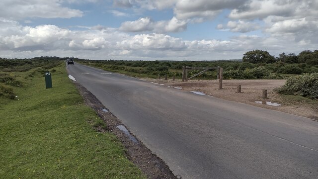
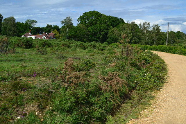
Common Moor is a picturesque area located in Hampshire, England. Situated in the eastern part of the county, it is a popular destination for nature enthusiasts and outdoor adventurers alike. Common Moor is part of the larger Hampshire Downs, a range of rolling hills and expansive grasslands.

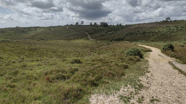
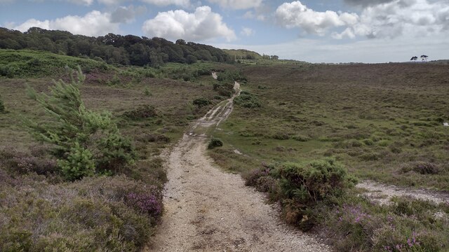
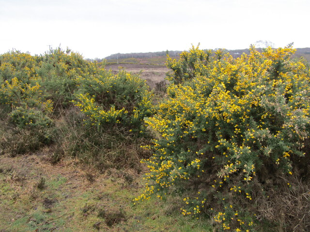
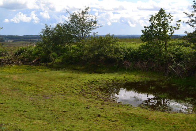
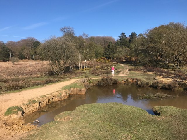
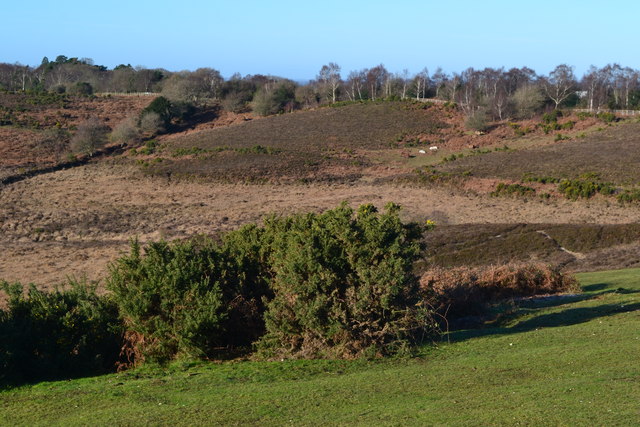
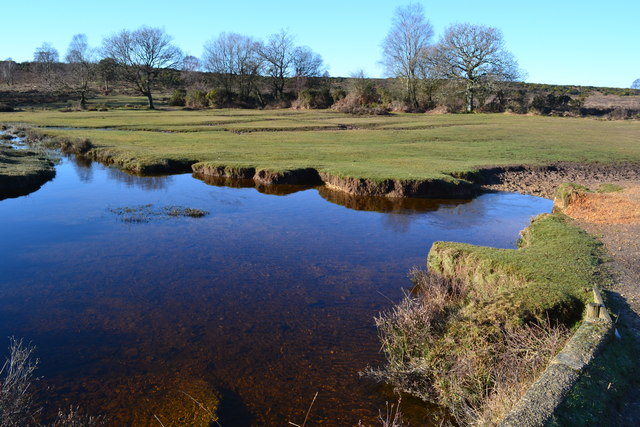
The moorland at Common Moor is characterized by its open, heather-covered landscapes, dotted with gorse and bracken. This unique habitat supports a diverse range of wildlife, including various bird species such as curlews, skylarks, and buzzards. Visitors to Common Moor can often spot rabbits and foxes, as well as rare reptiles like adders and smooth snakes.

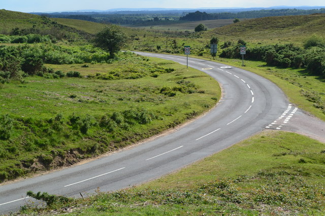
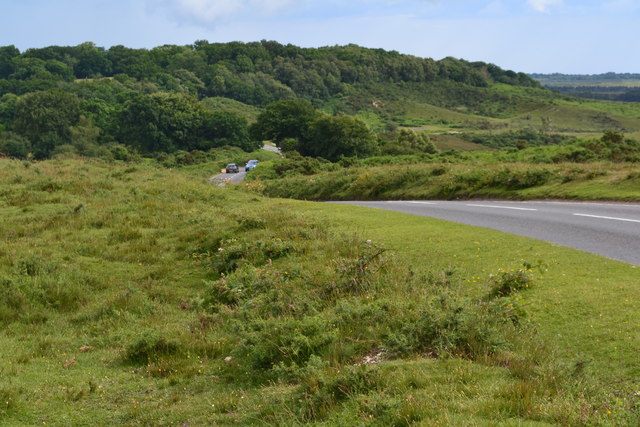
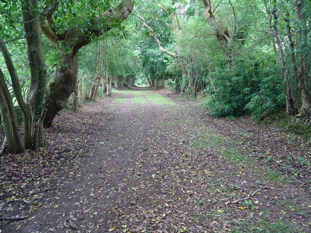
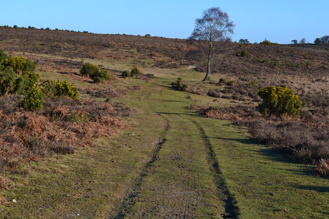
The area is crisscrossed by a network of footpaths, making it ideal for walkers and hikers looking to explore the countryside. These paths offer stunning panoramic views of the surrounding countryside, with the distant silhouette of the South Downs visible on clear days.

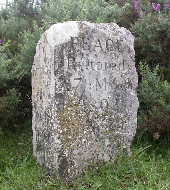
In addition to its natural beauty, Common Moor has historical significance as well. Evidence of Bronze Age settlements has been discovered in the area, adding to its archaeological importance. The moorland also played a role in World War II, as it was used as a training ground for troops preparing for the D-Day landings.

Overall, Common Moor offers visitors a chance to immerse themselves in the tranquility and natural splendor of the Hampshire Downs. Whether it's a leisurely stroll or a more challenging hike, this area provides a welcome escape from the bustle of modern life.

If you have any feedback on the listing, please let us know in the comments section below.

Common Moor Images

Images are sourced within 2km of 50.839694/-1.7096899 or Grid Reference SU2004. Thanks to Geograph Open Source API. All images are credited.

Road to Picket Post Road to Picket Post passing the parking at Vereley
Road to Picket Post
Road to Picket Post passing the parking at Vereley
Track towards Broad Bottom From Vereley Hill car park the track swings to the left towards Broad Bottom
Track towards Broad Bottom
From Vereley Hill car park the track swings to the left towards Broad Bottom
Path towards Church Moor Near Fort Hill the path towards Church Moor
Path towards Church Moor
Near Fort Hill the path towards Church Moor
Old Guide Stone, Burley Street Peace guidestone by the UC road, in parish of Burley (New Forest District), Burley Street, junction of Castle Hill and Verely Hill, on raised bank.
In 1902 a Benchmark on the stone represented 241 m ASL. Views of the two other faces see <a href="https://www.geograph.org.uk/photo/6043440">SU1904 : Old Guide Stone, Burley Street, Burley Parish</a>.

Inscription reads: To / Ringwood / Rest and be thankful // 
PEACE / Restored / 27th March / 1802 // To / Crow

Grade II listed. List Entry Number: 1094926 <span class="nowrap"><a title="https://historicengland.org.uk/listing/the-list/list-entry/1094926" rel="nofollow ugc noopener" href="https://historicengland.org.uk/listing/the-list/list-entry/1094926">Link</a><img style="margin-left:2px;" alt="External link" title="External link - shift click to open in new window" src="https://s1.geograph.org.uk/img/external.png" width="10" height="10"/></span>

Milestone Society National ID: HA_RILY03P
Old Guide Stone, Burley Street
Peace guidestone by the UC road, in parish of Burley (New Forest District), Burley Street, junction of Castle Hill and Verely Hill, on raised bank. In 1902 a Benchmark on the stone represented 241 m ASL. Views of the two other faces see SU1904 : Old Guide Stone, Burley Street, Burley Parish. Inscription reads: To / Ringwood / Rest and be thankful // PEACE / Restored / 27th March / 1802 // To / Crow Grade II listed. List Entry Number: 1094926 LinkExternal link Milestone Society National ID: HA_RILY03P
Vales Moor - Heathland Gorse and heather abound in the New Forest by the Smugglers Road car park.
<span class="nowrap"><a title="www.newforesrnpa.gov.uk" rel="nofollow ugc noopener" href="http://www.newforesrnpa.gov.uk">Link</a><img style="margin-left:2px;" alt="External link" title="External link - shift click to open in new window" src="https://s1.geograph.org.uk/img/external.png" width="10" height="10"/></span>
Vales Moor - Heathland
Gorse and heather abound in the New Forest by the Smugglers Road car park. LinkExternal link
Road junction near Little Castle Common
View towards Castle Hill
Track near Burley Croft
Small pond beside the road on Vereley Hill
Ford at Ridley Bottom This ford on Mill Lawn Brook is found at Ridley Bottom.
Ford at Ridley Bottom
This ford on Mill Lawn Brook is found at Ridley Bottom.
Footpath towards Burley The direct route from Castle Hill.
Footpath towards Burley
The direct route from Castle Hill.
Milestone above Burley Street One of a number erected in 1802 by Thomas Eyre marking the Peace of Amiens. Thankfully the stones outlasted the peace. This one is on a high bank in a grass triangle on the edge of heathland.
Milestone above Burley Street
One of a number erected in 1802 by Thomas Eyre marking the Peace of Amiens. Thankfully the stones outlasted the peace. This one is on a high bank in a grass triangle on the edge of heathland.
View northwest from Picket Post car park
Track on Picket Plain
Pool below footbridge on Mill Lawn Brook
Old Guide Stone, Burley Street, Burley Parish Peace guidestone by the UC road, in parish of Burley (New Forest District), Burley Street, junction of Castle Hill and Verely Hill, on raised bank.

Inscription reads:-
: To / Ringwood / Rest and be thankful : : PEACE / Restored / 27th March / 1802 :

Grade II listed. List Entry Number: 1094926
<span class="nowrap"><a title="https://historicengland.org.uk/listing/the-list/list-entry/1094926" rel="nofollow ugc noopener" href="https://historicengland.org.uk/listing/the-list/list-entry/1094926">Link</a><img style="margin-left:2px;" alt="External link" title="External link - shift click to open in new window" src="https://s1.geograph.org.uk/img/external.png" width="10" height="10"/></span>

Surveyed

Milestone Society National ID: HA_RILY03P
Old Guide Stone, Burley Street, Burley Parish
Peace guidestone by the UC road, in parish of Burley (New Forest District), Burley Street, junction of Castle Hill and Verely Hill, on raised bank. Inscription reads:- : To / Ringwood / Rest and be thankful : : PEACE / Restored / 27th March / 1802 : Grade II listed. List Entry Number: 1094926 LinkExternal link Surveyed Milestone Society National ID: HA_RILY03P
Old Milestone on Vales Moor, Burley parish Carved stone post by the UC road, in parish of BURLEY (NEW FOREST District), Vales Moor, Knaves Ash; 100m West of Vales Moor Car Park, by the road, on South side of road. Burley tombstone, erected by an unknown authority in the 19th century. 

Inscription reads:-
TO
RINGWOOD
3
LYMINGTON
11
MILES
BURLEY
2

Grade II listed.  
List Entry Number: 1095032 <span class="nowrap"><a title="https://historicengland.org.uk/listing/the-list/list-entry/1095032" rel="nofollow ugc noopener" href="https://historicengland.org.uk/listing/the-list/list-entry/1095032">Link</a><img style="margin-left:2px;" alt="External link" title="External link - shift click to open in new window" src="https://s1.geograph.org.uk/img/external.png" width="10" height="10"/></span>

Milestone Society National ID: HA_RILY03
Old Milestone on Vales Moor, Burley parish
Carved stone post by the UC road, in parish of BURLEY (NEW FOREST District), Vales Moor, Knaves Ash; 100m West of Vales Moor Car Park, by the road, on South side of road. Burley tombstone, erected by an unknown authority in the 19th century. Inscription reads:- TO RINGWOOD 3 LYMINGTON 11 MILES BURLEY 2 Grade II listed. List Entry Number: 1095032 LinkExternal link Milestone Society National ID: HA_RILY03
Old Milestone on Picket Plain, east of Ringwood Carved stone post by the UC road, in parish of BURLEY (NEW FOREST District), Picket Plain, on open grass verge, on West side of road. Burley tombstone erected by an unknown authority in the 19th century. 

Inscription reads:-
: To / London / 89 : : To / RINGWOOD / 3 / LYMINGTON / 11 / Miles : : To / London / 89 :

Grade II listed.
List Entry Number: 1156433 <span class="nowrap"><a title="https://historicengland.org.uk/listing/the-list/list-entry/1156433" rel="nofollow ugc noopener" href="https://historicengland.org.uk/listing/the-list/list-entry/1156433">Link</a><img style="margin-left:2px;" alt="External link" title="External link - shift click to open in new window" src="https://s1.geograph.org.uk/img/external.png" width="10" height="10"/></span>

Milestone Society National ID: HA_RILY03A
Old Milestone on Picket Plain, east of Ringwood
Carved stone post by the UC road, in parish of BURLEY (NEW FOREST District), Picket Plain, on open grass verge, on West side of road. Burley tombstone erected by an unknown authority in the 19th century. Inscription reads:- : To / London / 89 : : To / RINGWOOD / 3 / LYMINGTON / 11 / Miles : : To / London / 89 : Grade II listed. List Entry Number: 1156433 LinkExternal link Milestone Society National ID: HA_RILY03A
Show me another place!

Common Moor is located at Grid Ref: SU2004 (Lat: 50.839694, Lng: -1.7096899)

Administrative County: Hampshire

District: New Forest

Police Authority: Hampshire

What 3 Words

///dispenser.bedrock.croaking. Near Burley, Hampshire

Related Wikis

Castle Hill, Hampshire

Castle Hill is the site of an Iron Age univallate hillfort located in the civil parish of Burley in the New Forest national park in Hampshire, England...

Burley, Hampshire

Burley is a village and civil parish in the New Forest, Hampshire, England. It has ancient origins and is now somewhat tourist-orientated. == The village... ==

Picket Post

Picket Post is a road junction and service area in the New Forest National Park of Hampshire, England. It lies on the A31 road. == Facilities == Picket...

Picket Hill

Picket Hill is a hamlet next to Picket Post in the New Forest National Park of Hampshire, England. It lies on the outskirts of Ringwood.

Shobley

Shobley is a small hamlet in the New Forest National Park of Hampshire, England. Its nearest town is Ringwood, which lies approximately 1.8 miles (2.9...

Forest Corner

Forest Corner is a village in the New Forest National Park of Hampshire, England. It is on the A31 road travelling between Southampton and Bournemouth...

Linford, Hampshire

Linford is a hamlet in the New Forest district of Hampshire, England, close to the market town of Ringwood. It is about 1.5 miles east of Ringwood. It...
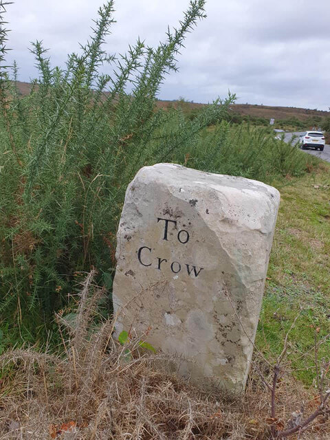
Crow, Hampshire

Crow is a small village situated in the New Forest National Park in Hampshire, England. Its nearest town is Ringwood, which lies approximately 1 mile...

Nearby Amenities

Located within 500m of 50.839694,-1.7096899
Burley Street
Is In: Hampshire, England, UK
Place: hamlet
Lat/Long: 50.8381851/-1.7143006
Bus Stop
Burley Street
Bench: no
Bin: no
Bus: yes
Naptan AtcoCode: 1900HA080907
Naptan Bearing: SE
Naptan CommonName: Burley Street
Naptan Crossing: Coach Hill Lane
Naptan NaptanCode: hamadtaw
Naptan Street: Ringwood Road
Naptan Verified: no
Public Transport: platform
Shelter: no
Source: naptan_import
Tactile Paving: no
Lat/Long: 50.8376895/-1.714049
Bus Stop
Burley Street
Bench: no
Bin: no
Bus: yes
Naptan AtcoCode: 1900HA080908
Naptan Bearing: W
Naptan CommonName: Burley Street
Naptan Crossing: Randalls Lane
Naptan NaptanCode: hamadtam
Naptan Street: Ringwood Road
Naptan Verified: no
Public Transport: platform
Shelter: no
Source: naptan_import
Tactile Paving: no
Lat/Long: 50.8376733/-1.7148018
Post Box
Collection Plate: CP1
Collection Times: Mo-Fr 17:00; Sa 10:15
Operator: Royal Mail
Operator Wikidata: Q638098
Post Box Type: wall
Ref: BH24 12
Royal Cypher: GR
Royal Cypher Wikidata: Q33102273
Lat/Long: 50.8375737/-1.7141404
Historic: milestone
Lat/Long: 50.8376374/-1.7155178
Box Berry Hill
Ele: 62
Natural: peak
Lat/Long: 50.8429682/-1.706756
Black Hill
Ele: 63
Natural: peak
Lat/Long: 50.8396316/-1.7053321
Access: yes
Archaeological Site: tumulus
Historic: archaeological_site
Lat/Long: 50.8396168/-1.7053907
The data included in this document is from www.openstreetmap.org. The data is made available under ODbL.

Have you been to Common Moor?

Leave your review of Common Moor below (or comments, questions and feedback).