Blackhole Moor

Downs, Moorland in Yorkshire

England

Blackhole Moor

Cakes of Bread on Blackhole Moor
Cakes of Bread on Blackhole Moor Credit: Neil Theasby

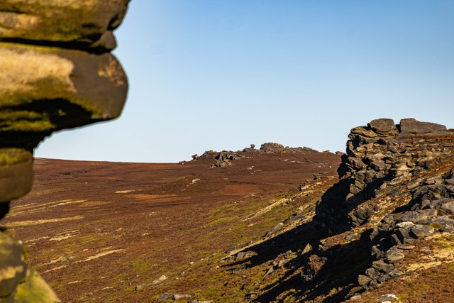
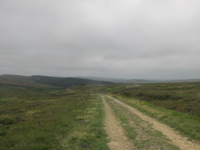
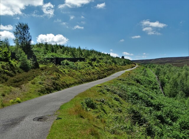
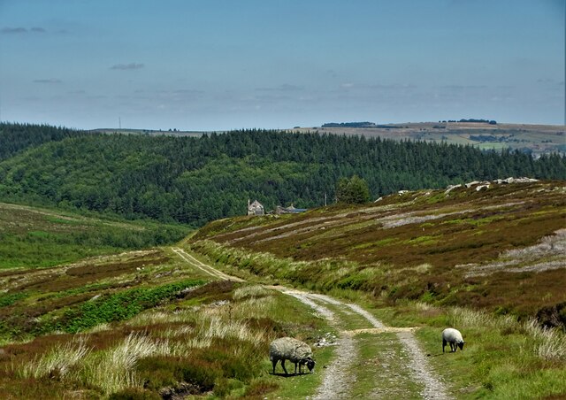
Blackhole Moor is a picturesque area located in the county of Yorkshire, England. Situated amidst the renowned Yorkshire Downs and Moorland, it offers visitors a unique and captivating experience. Spanning over vast stretches of land, Blackhole Moor features a diverse landscape consisting of rolling hills, heather-clad moors, and enchanting valleys.

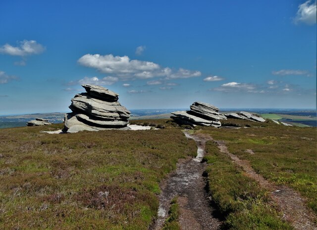
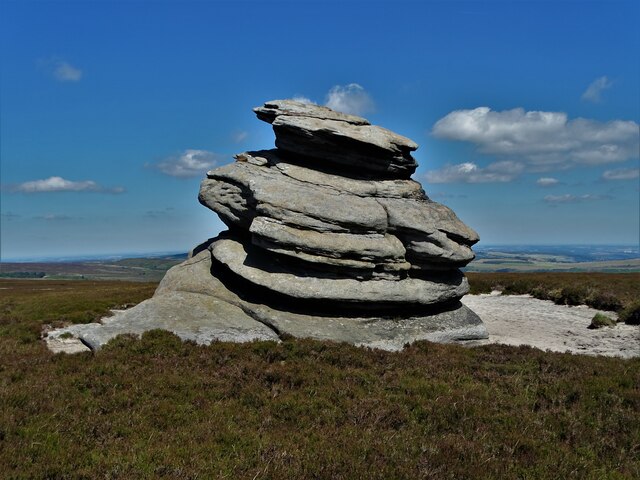
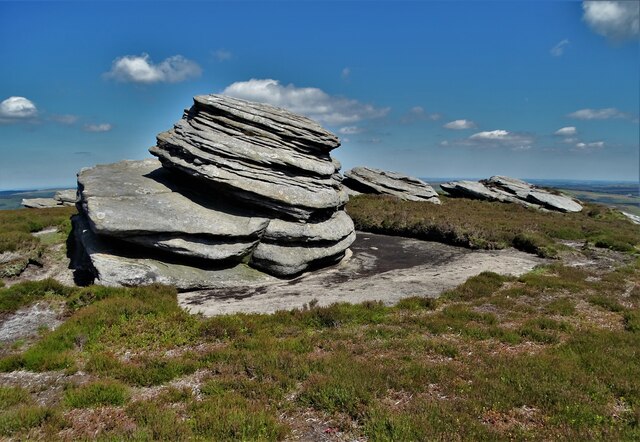
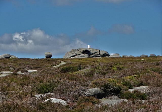
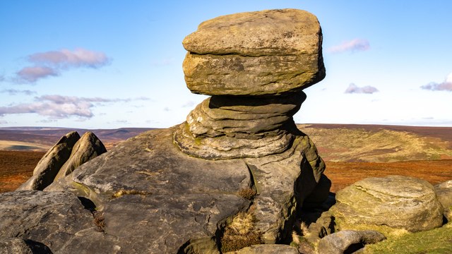
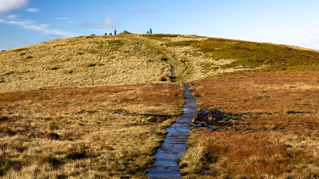
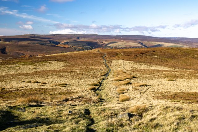
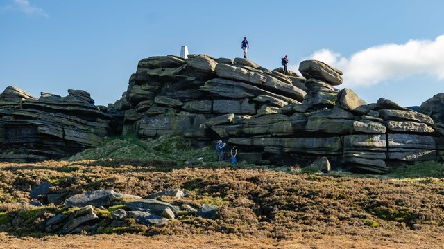
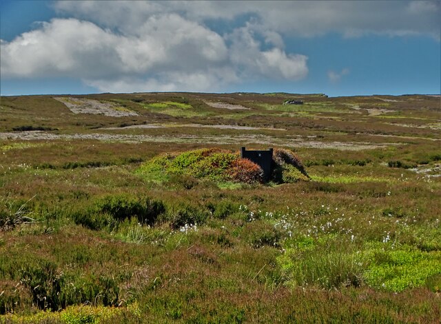
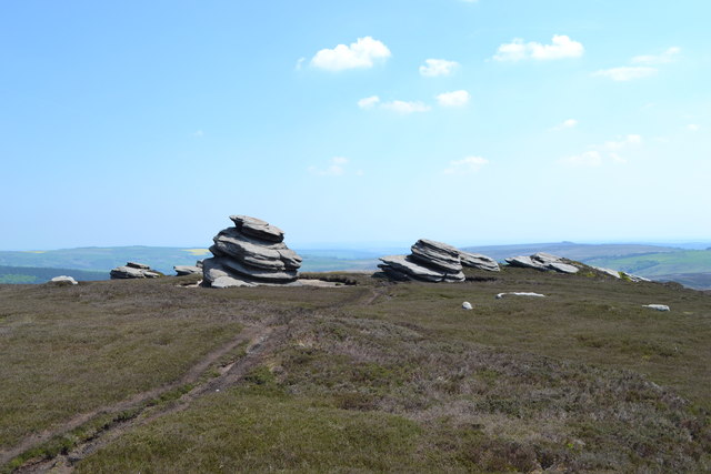
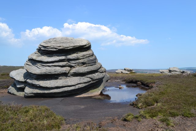
The moorland of Blackhole Moor is particularly captivating, with its rugged terrain and wild beauty. Visitors can explore the moors through various walking trails, immersing themselves in the tranquil and untouched surroundings. The area is home to a rich variety of flora and fauna, including heather, cotton grass, and numerous bird species, making it a perfect spot for nature enthusiasts and birdwatchers.

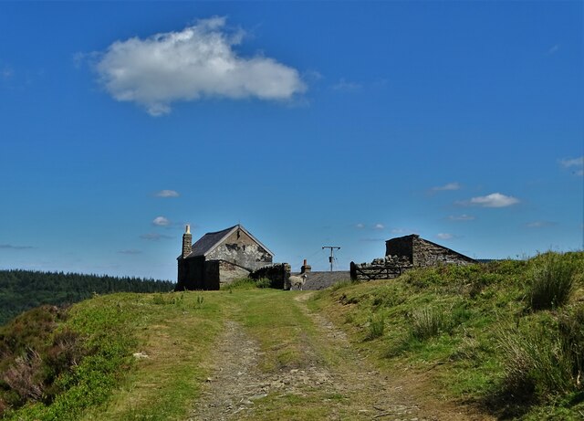
In addition to its natural beauty, Blackhole Moor offers a glimpse into the region's history and heritage. The area is dotted with ancient stone circles, burial mounds, and remnants of medieval settlements, providing a fascinating insight into the past. Visitors can embark on historical walks and guided tours to learn more about the area's rich cultural significance.

For those seeking adventurous activities, Blackhole Moor also offers opportunities for cycling, horse riding, and even rock climbing. The challenging terrain and breathtaking views make it an ideal destination for outdoor enthusiasts.

With its stunning scenery, rich biodiversity, and historical significance, Blackhole Moor is a must-visit destination for anyone looking to explore the beauty of Yorkshire's Downs and Moorland.

If you have any feedback on the listing, please let us know in the comments section below.

Blackhole Moor Images

Images are sourced within 2km of 53.407149/-1.6957607 or Grid Reference SK2090. Thanks to Geograph Open Source API. All images are credited.

Cakes of Bread on Blackhole Moor
The largest outcrop - Cakes of Bread On the edge of Blackhole Moor
The largest outcrop - Cakes of Bread
On the edge of Blackhole Moor
At Cakes of Bread The closest outcrop is the second largest in this eye-catching moorland arrangement. One can only wonder how ancient people related to such stones in millennia gone by.
At Cakes of Bread
The closest outcrop is the second largest in this eye-catching moorland arrangement. One can only wonder how ancient people related to such stones in millennia gone by.
View north to Back Tor The rock formation on Derwent Edge is topped by a triangulation pillar.
View north to Back Tor
The rock formation on Derwent Edge is topped by a triangulation pillar.
Lost Lad Path leading up to Lost Lad.
Lost Lad
Path leading up to Lost Lad.
Lost Lad View from Lost Lad looking northwest over Howden Moor.
Lost Lad
View from Lost Lad looking northwest over Howden Moor.
Back Tor View from the Salt Cellar looking along Derwent Edge, past Dovestone Tor, towards <a href="https://www.geograph.org.uk/photo/7649461">SK1990 : Back Tor</a>.
Back Tor
View from the Salt Cellar looking along Derwent Edge, past Dovestone Tor, towards SK1990 : Back Tor.
The Foulstone Road Looking back downhill on the way up to Back Tor.
The Foulstone Road
Looking back downhill on the way up to Back Tor.
Foulstone Road It leads to Foulstone Delf and Derwent Moors. The area is under the control of Fitzwilliam Wentworth Estates - mostly for the purposes of grouse shooting.
Foulstone Road
It leads to Foulstone Delf and Derwent Moors. The area is under the control of Fitzwilliam Wentworth Estates - mostly for the purposes of grouse shooting.
Summer cloud over Foulstone Delf This moorland property is part of the Fitzwilliam-Wentworth Estates and is almost certainly connected with grouse shooting and rearing of game birds.
Summer cloud over Foulstone Delf
This moorland property is part of the Fitzwilliam-Wentworth Estates and is almost certainly connected with grouse shooting and rearing of game birds.
Looking back along Foulstone Road To Foulstone Delf - the property to the right of the track
Looking back along Foulstone Road
To Foulstone Delf - the property to the right of the track
Grouse butt No.10 on Foulstone Moor From here, during the shooting season, men with shotguns blast grouse out of the sky. They call it sport.
Grouse butt No.10 on Foulstone Moor
From here, during the shooting season, men with shotguns blast grouse out of the sky. They call it sport.
Flagstone Path Approaching Back Tor The path also marks the county boundary here with South Yorkshire to the right and Derbyshire to the left.
Flagstone Path Approaching Back Tor
The path also marks the county boundary here with South Yorkshire to the right and Derbyshire to the left.
Flagstone Path near the Cakes of Bread Looking north towards Back Tor which is visible on the left horizon. The white bags contain small loose boulders which will presumably be used to shore up the eroded pathside. The path here also marks the county boundary.
Flagstone Path near the Cakes of Bread
Looking north towards Back Tor which is visible on the left horizon. The white bags contain small loose boulders which will presumably be used to shore up the eroded pathside. The path here also marks the county boundary.
Cakes of Bread seen from the west
At Cakes of Bread east of Derwent Edge
Show me another place!

Blackhole Moor is located at Grid Ref: SK2090 (Lat: 53.407149, Lng: -1.6957607)

Division: West Riding

Unitary Authority: Sheffield

Police Authority: South Yorkshire

What 3 Words

///purified.flicks.nurture. Near Bradfield, South Yorkshire

Nearby Locations

Blackhole Moor

Related Wikis

Derwent Edge

Derwent Edge is a Millstone Grit escarpment that lies above the Upper Derwent Valley in the Peak District National Park in the English county of Derbyshire...

Lost Lad

Lost Lad is a hill, 518 metres (1,699 ft) high on the Derwent Edge in the Peak District in the county of Derbyshire in England. It is a subpeak of Back...

Strines Reservoir

Strines Reservoir is a water storage reservoir situated at 53.4099°N 1.6557°W / 53.4099; -1.6557 (Strines_Reservoir), 8 miles (13 km) west of the centre...

Derwent Woodlands War Memorial

Derwent Woodlands War Memorial is a 20th-century grade II listed war memorial near the Ladybower Reservoir, Derbyshire. == History == The war memorial...

Sugworth Hall

Sugworth Hall is an English country house on Sugworth Road in Bradfield Dale, near Sheffield, England. It is situated approximately 8 miles (13 km) west...

Ladybower Reservoir

Ladybower Reservoir is a large Y-shaped, artificial reservoir, the lowest of three in the Upper Derwent Valley in Derbyshire, England. The River Ashop...

Derwent Reservoir (Derbyshire)

Derwent Reservoir is the middle of three reservoirs in the Upper Derwent Valley in the north of Derbyshire, England. It lies approximately 10 mi (16 km...

Moscar Cross

Moscar Cross is the name of a standing stone (or "guide stoop") and surrounding area in the Peak District on the border between Derbyshire and Sheffield...

Nearby Amenities

Located within 500m of 53.407149,-1.6957607
Natural: rock
Lat/Long: 53.4077571/-1.7023089
Natural: rock
Lat/Long: 53.4077036/-1.7020316
Cakes Of Bread
Natural: rock
Lat/Long: 53.407569/-1.7029036
Natural: rock
Lat/Long: 53.4073856/-1.7025091
Natural: rock
Lat/Long: 53.4074301/-1.7027631
The data included in this document is from www.openstreetmap.org. The data is made available under ODbL.

Have you been to Blackhole Moor?

Leave your review of Blackhole Moor below (or comments, questions and feedback).