Carleton Green
Downs, Moorland in Yorkshire Richmondshire
England
Carleton Green
Carleton Green is a small picturesque village located in the county of Yorkshire, England. Situated on the edge of the Yorkshire Downs and surrounded by vast Moorland, the village offers breathtaking natural beauty and tranquility.
The village itself is characterized by its charming stone-built houses, many of which date back several centuries, giving it a distinctive historic feel. It is home to a tight-knit community of friendly and welcoming residents who take great pride in their village.
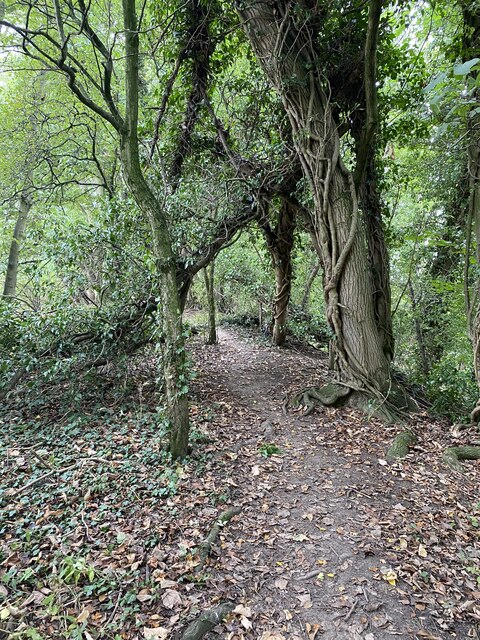
The Yorkshire Downs, with its rolling hills and sweeping vistas, provide a stunning backdrop to Carleton Green. The area is a haven for outdoor enthusiasts, offering numerous hiking and cycling trails that wind through the lush green countryside. It is not uncommon to spot grazing sheep or wild ponies while exploring the Downs.
The nearby Moorland is another prominent feature of Carleton Green. Its rugged and wild landscape is a unique ecosystem that supports a wide variety of flora and fauna. Visitors can enjoy birdwatching, as the Moorland is home to several rare species, including the red grouse and golden plover.
Despite its rural setting, Carleton Green is well-connected to nearby towns and cities. The village has a regular bus service, allowing residents easy access to amenities and services. Additionally, there are several quaint country pubs and local shops that cater to both locals and visitors.
In conclusion, Carleton Green in Yorkshire is a picturesque village nestled between the Yorkshire Downs and Moorland. Its natural beauty, historic charm, and friendly community make it an ideal destination for those seeking a peaceful retreat in the heart of the English countryside.
If you have any feedback on the listing, please let us know in the comments section below.
Carleton Green Images
Images are sourced within 2km of 54.50744/-1.6960362 or Grid Reference NZ1912. Thanks to Geograph Open Source API. All images are credited.
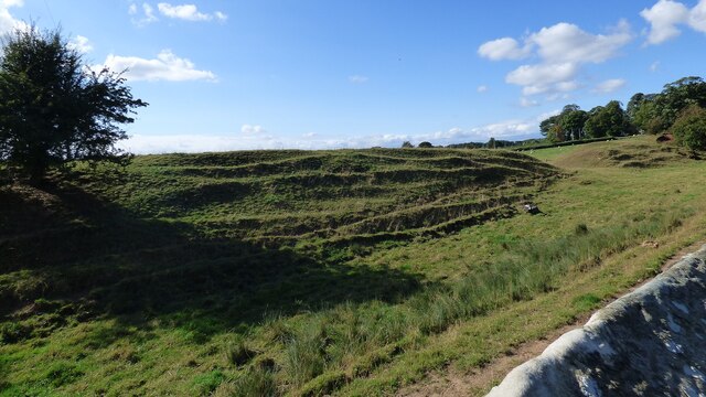


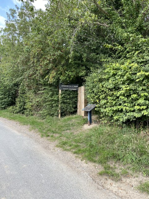
![Stanwick Fortifications [1] The entrance from the minor road.
Stanwick Iron Age Fortifications is a huge Iron Age hill fort, sometimes regarded as an oppidum, located in Richmondshire, North Yorkshire, some 7 miles west of Darlington. Over 5½ miles of ditches and ramparts enclosed approximately 740 acres of land, the stronghold of the Brigantes kingdom during the early stages of the Roman occupation of Britain. The features now visible are the excavated remains of only a small part of the site. A Scheduled Ancient Monument with much detail at: <span class="nowrap"><a title="https://historicengland.org.uk/listing/the-list/list-entry/1016199" rel="nofollow ugc noopener" href="https://historicengland.org.uk/listing/the-list/list-entry/1016199">Link</a><img style="margin-left:2px;" alt="External link" title="External link - shift click to open in new window" src="https://s1.geograph.org.uk/img/external.png" width="10" height="10"/></span>](https://s3.geograph.org.uk/geophotos/07/31/89/7318911_73599a8b.jpg)
![Stanwick Fortifications [2] The path along the top of the bank leads to the excavated section.
Stanwick Iron Age Fortifications is a huge Iron Age hill fort, sometimes regarded as an oppidum, located in Richmondshire, North Yorkshire, some 7 miles west of Darlington. Over 5½ miles of ditches and ramparts enclosed approximately 740 acres of land, the stronghold of the Brigantes kingdom during the early stages of the Roman occupation of Britain. The features now visible are the excavated remains of only a small part of the site. A Scheduled Ancient Monument with much detail at: <span class="nowrap"><a title="https://historicengland.org.uk/listing/the-list/list-entry/1016199" rel="nofollow ugc noopener" href="https://historicengland.org.uk/listing/the-list/list-entry/1016199">Link</a><img style="margin-left:2px;" alt="External link" title="External link - shift click to open in new window" src="https://s1.geograph.org.uk/img/external.png" width="10" height="10"/></span>](https://s0.geograph.org.uk/geophotos/07/31/89/7318912_d9704843.jpg)
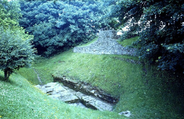
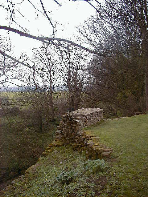
![Stanwick Fortifications [3] A short section of the wall that once protected the site has been reconstructed. Here it is seen from the top of the bank.
Stanwick Iron Age Fortifications is a huge Iron Age hill fort, sometimes regarded as an oppidum, located in Richmondshire, North Yorkshire, some 7 miles west of Darlington. Over 5½ miles of ditches and ramparts enclosed approximately 740 acres of land, the stronghold of the Brigantes kingdom during the early stages of the Roman occupation of Britain. The features now visible are the excavated remains of only a small part of the site. A Scheduled Ancient Monument with much detail at: <span class="nowrap"><a title="https://historicengland.org.uk/listing/the-list/list-entry/1016199" rel="nofollow ugc noopener" href="https://historicengland.org.uk/listing/the-list/list-entry/1016199">Link</a><img style="margin-left:2px;" alt="External link" title="External link - shift click to open in new window" src="https://s1.geograph.org.uk/img/external.png" width="10" height="10"/></span>](https://s2.geograph.org.uk/geophotos/07/31/89/7318914_5dc55241.jpg)
![Stanwick Fortifications [4] The path along the top of the bank continues beyond the reconstructed section of wall seen at <a href="https://www.geograph.org.uk/photo/7318914">NZ1712 : Stanwick Fortifications [3]</a>.
Stanwick Iron Age Fortifications is a huge Iron Age hill fort, sometimes regarded as an oppidum, located in Richmondshire, North Yorkshire, some 7 miles west of Darlington. Over 5½ miles of ditches and ramparts enclosed approximately 740 acres of land, the stronghold of the Brigantes kingdom during the early stages of the Roman occupation of Britain. The features now visible are the excavated remains of only a small part of the site. A Scheduled Ancient Monument with much detail at: <span class="nowrap"><a title="https://historicengland.org.uk/listing/the-list/list-entry/1016199" rel="nofollow ugc noopener" href="https://historicengland.org.uk/listing/the-list/list-entry/1016199">Link</a><img style="margin-left:2px;" alt="External link" title="External link - shift click to open in new window" src="https://s1.geograph.org.uk/img/external.png" width="10" height="10"/></span>](https://s3.geograph.org.uk/geophotos/07/31/89/7318915_1beafcbd.jpg)
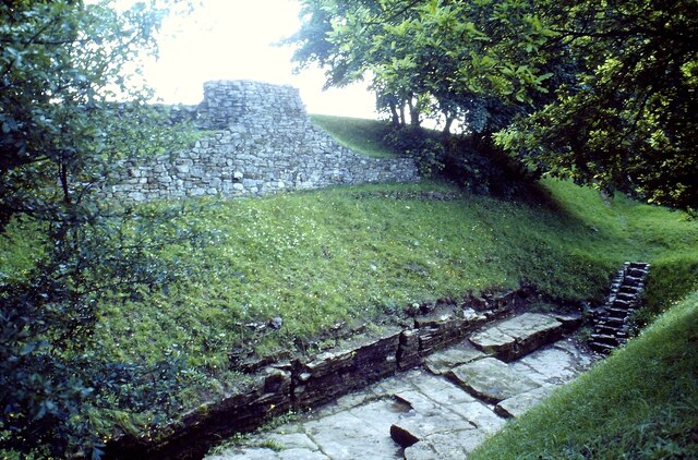
![Stanwick Fortifications [5] The reconstructed section of wall is seen from the ditch. This view illustrates the formidable barrier created by the wall and bank.
Stanwick Iron Age Fortifications is a huge Iron Age hill fort, sometimes regarded as an oppidum, located in Richmondshire, North Yorkshire, some 7 miles west of Darlington. Over 5½ miles of ditches and ramparts enclosed approximately 740 acres of land, the stronghold of the Brigantes kingdom during the early stages of the Roman occupation of Britain. The features now visible are the excavated remains of only a small part of the site. A Scheduled Ancient Monument with much detail at: <span class="nowrap"><a title="https://historicengland.org.uk/listing/the-list/list-entry/1016199" rel="nofollow ugc noopener" href="https://historicengland.org.uk/listing/the-list/list-entry/1016199">Link</a><img style="margin-left:2px;" alt="External link" title="External link - shift click to open in new window" src="https://s1.geograph.org.uk/img/external.png" width="10" height="10"/></span>](https://s0.geograph.org.uk/geophotos/07/31/89/7318916_39f8799d.jpg)
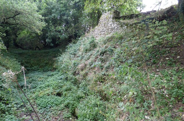
![Stanwick Fortifications [6] A view along the broad ditch that runs outside the bank.
Stanwick Iron Age Fortifications is a huge Iron Age hill fort, sometimes regarded as an oppidum, located in Richmondshire, North Yorkshire, some 7 miles west of Darlington. Over 5½ miles of ditches and ramparts enclosed approximately 740 acres of land, the stronghold of the Brigantes kingdom during the early stages of the Roman occupation of Britain. The features now visible are the excavated remains of only a small part of the site. A Scheduled Ancient Monument with much detail at: <span class="nowrap"><a title="https://historicengland.org.uk/listing/the-list/list-entry/1016199" rel="nofollow ugc noopener" href="https://historicengland.org.uk/listing/the-list/list-entry/1016199">Link</a><img style="margin-left:2px;" alt="External link" title="External link - shift click to open in new window" src="https://s1.geograph.org.uk/img/external.png" width="10" height="10"/></span>](https://s1.geograph.org.uk/geophotos/07/31/89/7318917_87e8b787.jpg)
Carleton Green is located at Grid Ref: NZ1912 (Lat: 54.50744, Lng: -1.6960362)
Division: North Riding
Administrative County: North Yorkshire
District: Richmondshire
Police Authority: North Yorkshire
What 3 Words
///puff.bravest.reputable. Near High Coniscliffe, Co. Durham
Nearby Locations
Related Wikis

Stanwick St John
Stanwick St John is a village, civil parish, former manor and ecclesiastical parish in the Richmondshire district of North Yorkshire, (formerly "North...
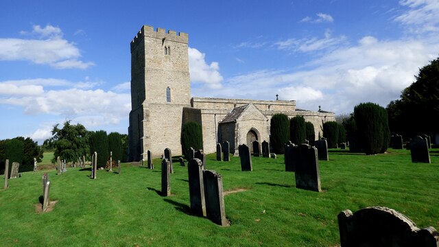
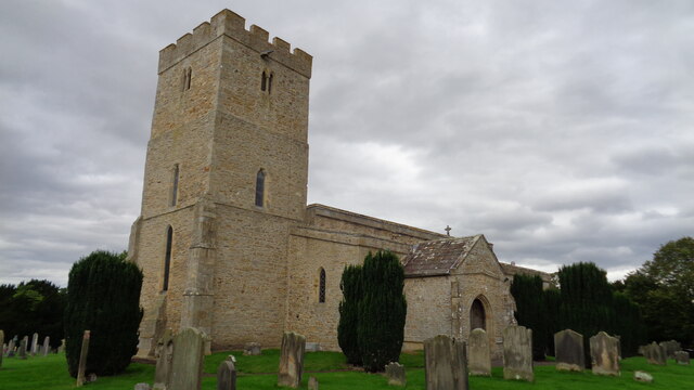
St John the Baptist's Church, Stanwick
St John the Baptist's Church is a redundant Anglican church in the village of Stanwick St John, North Yorkshire, England. It is recorded in the National...

Aldbrough St John
Aldbrough St John is a village and civil parish (called just Aldbrough) in the Richmondshire district in North Yorkshire, England. The parish has a population...

Stanwick Park
Stanwick Park (also known as Stanwick Hall) was a Palladian country house at Stanwick St John in North Yorkshire, England. == History == It was re-built...
Stanwick Iron Age Fortifications
Stanwick Iron Age Fortifications (also known as 'Stanwick Camp'), a huge Iron Age hill fort, sometimes but not always considered an oppidum, comprising...

Eppleby
Eppleby is a village and civil parish in the Richmondshire district of North Yorkshire, England. It is located about 7 miles (11 km) north of Richmond...

Manfield
Manfield is a village and civil parish in the Richmondshire district of North Yorkshire, England. It is a parish in the wapentake of Gilling East. The...

Forcett
Forcett is a village in the Richmondshire district of North Yorkshire, England. It lies near the border with County Durham, on the B6274 road about 8 miles...
Nearby Amenities
Located within 500m of 54.50744,-1.6960362Have you been to Carleton Green?
Leave your review of Carleton Green below (or comments, questions and feedback).