Balblair
Settlement in Aberdeenshire
Scotland
Balblair

Balblair is a picturesque village situated in the heart of Aberdeenshire, Scotland. Nestled between the towns of Tain and Dornoch, it is surrounded by stunning landscapes and offers a tranquil and idyllic setting. The village is located on the north bank of the Balblair Burn, which flows into the Dornoch Firth.
Balblair is renowned for its rich history, dating back to the 18th century. The village is home to several historic buildings, including the Balblair Distillery, which was established in 1790 and is one of the oldest working distilleries in Scotland. The distillery produces a range of fine single malt whiskies, which are highly regarded by whisky enthusiasts worldwide.
In addition to its historical significance, Balblair is also known for its natural beauty. The surrounding countryside offers breathtaking views of rolling hills, lush green fields, and the sparkling waters of the Dornoch Firth. Outdoor enthusiasts can enjoy a variety of activities, including hiking, fishing, and birdwatching.
The village itself is small but charming, with a close-knit community. It has a few amenities, including a local pub and a small grocery store, ensuring that residents have the essentials nearby. For more extensive amenities, the larger towns of Tain and Dornoch are just a short drive away.
Overall, Balblair is a hidden gem in Aberdeenshire, offering a perfect blend of history, natural beauty, and a peaceful way of life. Whether you are a history buff, a whisky connoisseur, or simply seeking a tranquil escape, Balblair has something to offer everyone.
If you have any feedback on the listing, please let us know in the comments section below.
Balblair Images
Images are sourced within 2km of 57.143905/-2.4973827 or Grid Reference NJ7006. Thanks to Geograph Open Source API. All images are credited.


Balblair is located at Grid Ref: NJ7006 (Lat: 57.143905, Lng: -2.4973827)
Unitary Authority: Aberdeenshire
Police Authority: North East
What 3 Words
///hoaxes.purifier.accompany. Near Sauchen, Aberdeenshire
Nearby Locations
Related Wikis

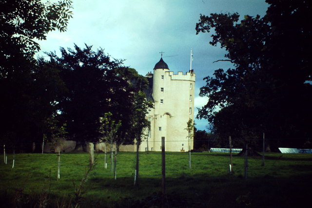
Midmar Castle
Midmar Castle is a 16th-century castle in Aberdeenshire, Scotland, located 12 kilometres (7.5 mi) west of Westhill and 3.5 kilometres (2.2 mi) west of...

Midmar
Midmar is a historic settlement in Aberdeenshire, lying north of Banchory and southwest of Inverurie. It is noted for its three stone circles and various...
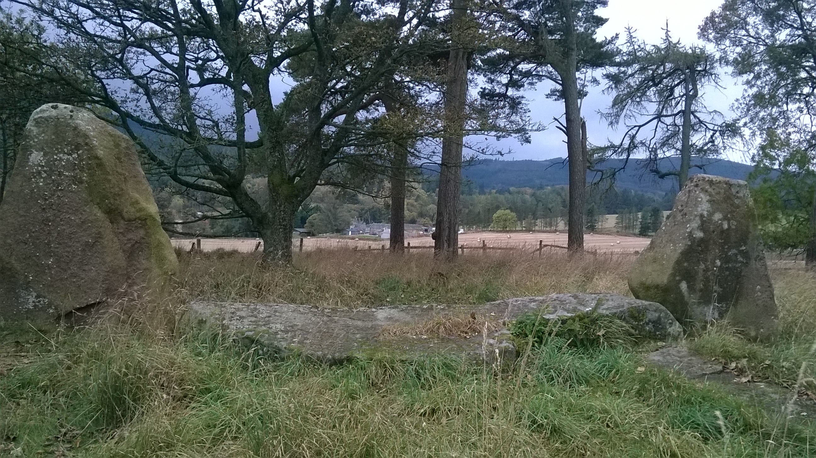
Sunhoney
Sunhoney is a stone circle of the recumbent type, which is common in the Grampian region, in particular at the River Dee. Sunhoney is situated about 2...

Corsindae House
Corsindae House is a 16th-century castle, originally L-plan, about 8 miles (13 km) north of Banchory, Aberdeenshire, Scotland, and 1 mile (1.6 km) north...

Echt, Aberdeenshire
Echt (Scottish Gaelic: Eicht) is an Aberdeenshire crossroads village in northeast Scotland with a population of approximately 300 people. Echt has a number...

Hill of Fare
The Hill of Fare is a small hill in Aberdeenshire, Scotland. It is located about 5 km (3 miles) northeast of the village of Torphins. The hill is long...

Sauchen
Sauchen is a village in Aberdeenshire, Scotland that lies 3 miles (5 km) west of Dunecht and 10 miles (16 km) west of Aberdeen. The village has around...
Dunecht estate
The Dunecht Estate is one of the largest private estates in Aberdeenshire, Scotland at 53,000 acres (210 km2). It is owned by The Hon Charles Anthony...
Nearby Amenities
Located within 500m of 57.143905,-2.4973827Have you been to Balblair?
Leave your review of Balblair below (or comments, questions and feedback).