Lower Lodge Range

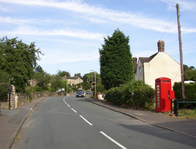
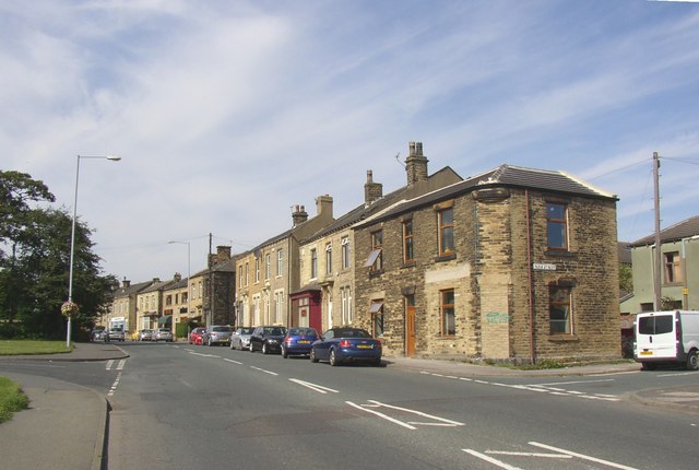
Downs, Moorland in Yorkshire

England

Lower Lodge Range

Oakwell Hall Country Park Parts of Oakwell Hall date from the 15th century but the present building is largely due to John Batt in 1583, with some further modifications in the 17th century. In the 19th century it was used as a boarding school. When Charlotte Bronte lived at nearby Hartshead, she allegedly used Oakwell as the basis for 'Fieldhead' in the novel 'Shirley' (Fieldhead is in fact a local name for part of Birstall). The hall and its outbuildings are listed grade I (list entry 11344609) and now operated as a museum by Kirklees council (open at weekends). 

The grounds, along with the site of a former colliery and railway line, form Oakwell Country Park covering 45 hectares of woodland and open fields, which has a separate free car park. There are nature trails and a mountain bike route.
Oakwell Hall Country Park Credit: habiloid

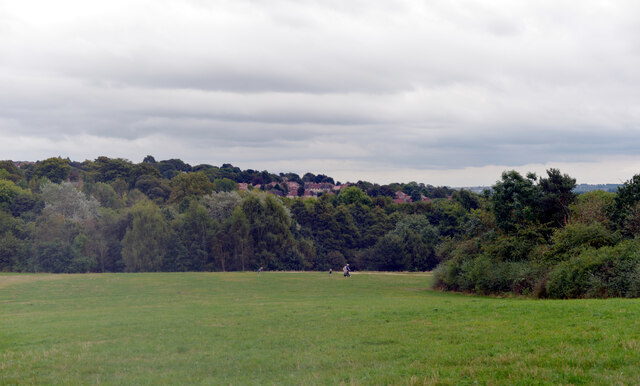
Lower Lodge Range is a picturesque area located in Yorkshire, England. Situated amidst the stunning landscape of the Yorkshire Downs and Moorland, it offers breathtaking views and a tranquil environment for visitors to enjoy.

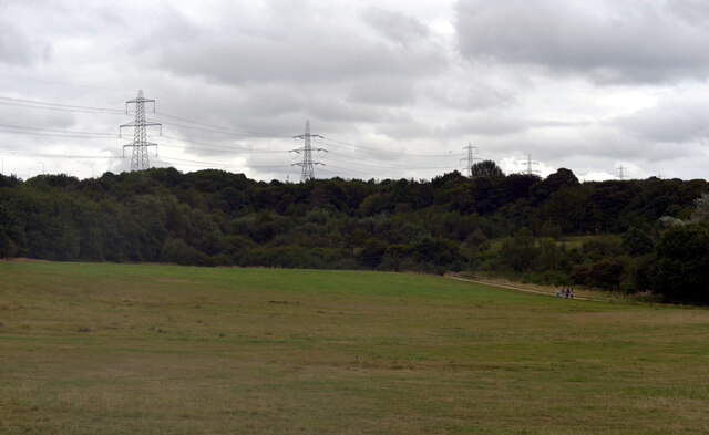
Covering a vast expanse of rolling hills and lush green fields, Lower Lodge Range is a haven for nature enthusiasts and outdoor lovers. The area is characterized by its diverse ecosystem, featuring a variety of flora and fauna. Visitors can expect to encounter heather-covered moorlands, ancient woodlands, and meandering streams, lending a sense of serenity to the surroundings.

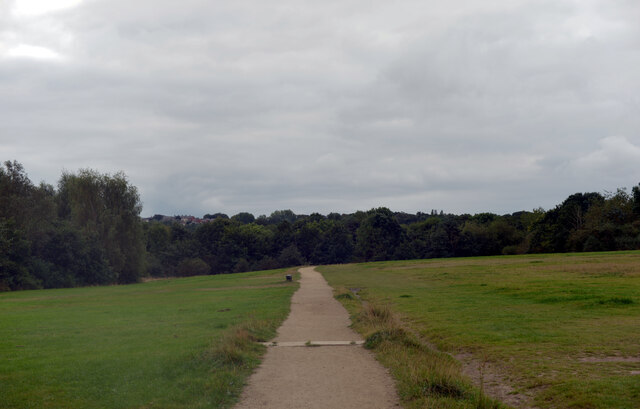
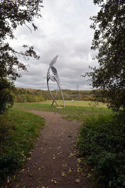
The range is known for its extensive network of walking trails, making it a popular destination for hikers of all abilities. From leisurely strolls to more challenging treks, there is something for everyone. The trails provide an opportunity to explore the region's natural beauty up close, with stunning vistas and wildlife sightings along the way.

For history enthusiasts, Lower Lodge Range offers a glimpse into the past through its historical landmarks and sites. The area is home to several ancient ruins, including medieval castles and stone circles, serving as a reminder of Yorkshire's rich cultural heritage.

Visitors to Lower Lodge Range can also enjoy various outdoor activities such as birdwatching, cycling, and picnicking. The area's wide-open spaces and fresh air make it an ideal spot for those seeking relaxation and a break from the hustle and bustle of city life.

In conclusion, Lower Lodge Range in Yorkshire offers a perfect blend of natural beauty, history, and outdoor activities. Its idyllic setting amidst the Yorkshire Downs and Moorland makes it a must-visit destination for those seeking a tranquil escape in the heart of nature.

If you have any feedback on the listing, please let us know in the comments section below.

Lower Lodge Range Images

Images are sourced within 2km of 53.740631/-1.7052154 or Grid Reference SE1927. Thanks to Geograph Open Source API. All images are credited.

Oakwell Hall Country Park Parts of Oakwell Hall date from the 15th century but the present building is largely due to John Batt in 1583, with some further modifications in the 17th century. In the 19th century it was used as a boarding school. When Charlotte Bronte lived at nearby Hartshead, she allegedly used Oakwell as the basis for 'Fieldhead' in the novel 'Shirley' (Fieldhead is in fact a local name for part of Birstall). The hall and its outbuildings are listed grade I (list entry 11344609) and now operated as a museum by Kirklees council (open at weekends). 

The grounds, along with the site of a former colliery and railway line, form Oakwell Country Park covering 45 hectares of woodland and open fields, which has a separate free car park. There are nature trails and a mountain bike route.
Oakwell Hall Country Park
Parts of Oakwell Hall date from the 15th century but the present building is largely due to John Batt in 1583, with some further modifications in the 17th century. In the 19th century it was used as a boarding school. When Charlotte Bronte lived at nearby Hartshead, she allegedly used Oakwell as the basis for 'Fieldhead' in the novel 'Shirley' (Fieldhead is in fact a local name for part of Birstall). The hall and its outbuildings are listed grade I (list entry 11344609) and now operated as a museum by Kirklees council (open at weekends). The grounds, along with the site of a former colliery and railway line, form Oakwell Country Park covering 45 hectares of woodland and open fields, which has a separate free car park. There are nature trails and a mountain bike route.
Path, Oakwell Hall Country Park Parts of Oakwell Hall date from the 15th century but the present building is largely due to John Batt in 1583, with some further modifications in the 17th century. In the 19th century it was used as a boarding school. When Charlotte Bronte lived at nearby Hartshead, she allegedly used Oakwell as the basis for 'Fieldhead' in the novel 'Shirley' (Fieldhead is in fact a local name for part of Birstall). The hall and its outbuildings are listed grade I (list entry 11344609) and now operated as a museum by Kirklees council (open at weekends). 

The grounds, along with the site of a former colliery and railway line, form Oakwell Country Park covering 45 hectares of woodland and open fields, which has a separate free car park. There are nature trails and a mountain bike route.
Path, Oakwell Hall Country Park
Parts of Oakwell Hall date from the 15th century but the present building is largely due to John Batt in 1583, with some further modifications in the 17th century. In the 19th century it was used as a boarding school. When Charlotte Bronte lived at nearby Hartshead, she allegedly used Oakwell as the basis for 'Fieldhead' in the novel 'Shirley' (Fieldhead is in fact a local name for part of Birstall). The hall and its outbuildings are listed grade I (list entry 11344609) and now operated as a museum by Kirklees council (open at weekends). The grounds, along with the site of a former colliery and railway line, form Oakwell Country Park covering 45 hectares of woodland and open fields, which has a separate free car park. There are nature trails and a mountain bike route.
"Fiddlehead and Fernblades" by Adrian Moakes, Oakwell Hall Country Park "Fiddlehead and Fernblades" is a sculpture by Adrian Moakes (2008). It stands at the highest point of the colliery field of Oakwell Hall Country park, Birstall. The colliery field is the landscape site of Gomersal Pit which closed in 1973. The sculpture depicts ferns which formed the coal mined there.
It is 6.5m high and is formed from galvanized tubular and sheet steel. It was officially opened on 19th October 2008.
"Fiddlehead and Fernblades" by Adrian Moakes, Oakwell Hall Country Park
"Fiddlehead and Fernblades" is a sculpture by Adrian Moakes (2008). It stands at the highest point of the colliery field of Oakwell Hall Country park, Birstall. The colliery field is the landscape site of Gomersal Pit which closed in 1973. The sculpture depicts ferns which formed the coal mined there. It is 6.5m high and is formed from galvanized tubular and sheet steel. It was officially opened on 19th October 2008.
Benchmark Monk Ings, Bronte Way, Oakwell Benchmark, further description here <span class="nowrap"><a title="https://www.bench-marks.org.uk/bm169027" rel="nofollow ugc noopener" href="https://www.bench-marks.org.uk/bm169027">Link</a><img style="margin-left:2px;" alt="External link" title="External link - shift click to open in new window" src="https://s1.geograph.org.uk/img/external.png" width="10" height="10"/></span>
Benchmark Monk Ings, Bronte Way, Oakwell
Benchmark, further description here LinkExternal link
Benchmark Monk Ings, Bronte Way, Oakwell Benchmark, description here <span class="nowrap"><a title="https://www.bench-marks.org.uk/bm169029" rel="nofollow ugc noopener" href="https://www.bench-marks.org.uk/bm169029">Link</a><img style="margin-left:2px;" alt="External link" title="External link - shift click to open in new window" src="https://s1.geograph.org.uk/img/external.png" width="10" height="10"/></span>
Benchmark Monk Ings, Bronte Way, Oakwell
Benchmark, description here LinkExternal link
Benchmark West Lane, Gomersal Benchmark description here <span class="nowrap"><a title="https://www.bench-marks.org.uk/bm164639" rel="nofollow ugc noopener" href="https://www.bench-marks.org.uk/bm164639">Link</a><img style="margin-left:2px;" alt="External link" title="External link - shift click to open in new window" src="https://s1.geograph.org.uk/img/external.png" width="10" height="10"/></span>
Benchmark West Lane, Gomersal
Benchmark description here LinkExternal link
Benchmark at No.24 Scott Lane, Gomersall Benchmark description here <span class="nowrap"><a title="https://www.bench-marks.org.uk/bm169030" rel="nofollow ugc noopener" href="https://www.bench-marks.org.uk/bm169030">Link</a><img style="margin-left:2px;" alt="External link" title="External link - shift click to open in new window" src="https://s1.geograph.org.uk/img/external.png" width="10" height="10"/></span>
Benchmark at No.24 Scott Lane, Gomersall
Benchmark description here LinkExternal link
Oakwell Hall Country Park Sculpture On the site of an old colliery, a modern sculpture Fiddlehead & Fernblades by Adrian Moakes
Oakwell Hall Country Park Sculpture
On the site of an old colliery, a modern sculpture Fiddlehead & Fernblades by Adrian Moakes
Fallen tree in Oakwell Hall Country Park
Oakwell Hall Country Park, Birstall Parts of Oakwell Hall date from the 15th century but the present building is largely due to John Batt in 1583, with some further modifications in the 17th century. In the 19th century it was used as a boarding school. When Charlotte Bronte lived at nearby Hartshead, she allegedly used Oakwell as the basis for 'Fieldhead' in the novel 'Shirley' (Fieldhead is in fact a local name for part of Birstall). The hall and its outbuildings are listed grade I (list entry 11344609) and now operated as a museum by Kirklees council (open at weekends). 

The grounds, along with the site of a former colliery and railway line, form Oakwell Country Park covering 45 hectares of woodland and open fields, which has a separate free car park. There are nature trails and a mountain bike route.
Oakwell Hall Country Park, Birstall
Parts of Oakwell Hall date from the 15th century but the present building is largely due to John Batt in 1583, with some further modifications in the 17th century. In the 19th century it was used as a boarding school. When Charlotte Bronte lived at nearby Hartshead, she allegedly used Oakwell as the basis for 'Fieldhead' in the novel 'Shirley' (Fieldhead is in fact a local name for part of Birstall). The hall and its outbuildings are listed grade I (list entry 11344609) and now operated as a museum by Kirklees council (open at weekends). The grounds, along with the site of a former colliery and railway line, form Oakwell Country Park covering 45 hectares of woodland and open fields, which has a separate free car park. There are nature trails and a mountain bike route.
Oakwell Beck, Oakwell Hall Country Park, Birstall Parts of Oakwell Hall date from the 15th century but the present building is largely due to John Batt in 1583, with some further modifications in the 17th century. In the 19th century it was used as a boarding school. When Charlotte Bronte lived at nearby Hartshead, she allegedly used Oakwell as the basis for 'Fieldhead' in the novel 'Shirley' (Fieldhead is in fact a local name for part of Birstall). The hall and its outbuildings are listed grade I (list entry 11344609) and now operated as a museum by Kirklees council (open at weekends). 

The grounds, along with the site of a former colliery and railway line, form Oakwell Country Park covering 45 hectares of woodland and open fields, which has a separate free car park. There are nature trails and a mountain bike route.
Oakwell Beck, Oakwell Hall Country Park, Birstall
Parts of Oakwell Hall date from the 15th century but the present building is largely due to John Batt in 1583, with some further modifications in the 17th century. In the 19th century it was used as a boarding school. When Charlotte Bronte lived at nearby Hartshead, she allegedly used Oakwell as the basis for 'Fieldhead' in the novel 'Shirley' (Fieldhead is in fact a local name for part of Birstall). The hall and its outbuildings are listed grade I (list entry 11344609) and now operated as a museum by Kirklees council (open at weekends). The grounds, along with the site of a former colliery and railway line, form Oakwell Country Park covering 45 hectares of woodland and open fields, which has a separate free car park. There are nature trails and a mountain bike route.
Factory, Heathfield Lane, Birkenshaw This is now occupied by Status who produce light bulbs and other electrical goods.  It was built for Park House Healthcare.
Factory, Heathfield Lane, Birkenshaw
This is now occupied by Status who produce light bulbs and other electrical goods. It was built for Park House Healthcare.
Housing estate road off Heathfield Lane, Birkenshaw This road leads up to a vacant plot that will presumably be built on eventually, but the tops of borehole tubes suggest that there might be difficulties. There is a small hill on the left that looks artificial, but old maps don't help.
Housing estate road off Heathfield Lane, Birkenshaw
This road leads up to a vacant plot that will presumably be built on eventually, but the tops of borehole tubes suggest that there might be difficulties. There is a small hill on the left that looks artificial, but old maps don't help.
Vacant site off Heathfield Lane, Birkenshaw This is adjacent to a large recent housing development, and the site will presumably be built on eventually. There is a capped borehole tube at bottom left and another in the far corner of the field.
Vacant site off Heathfield Lane, Birkenshaw
This is adjacent to a large recent housing development, and the site will presumably be built on eventually. There is a capped borehole tube at bottom left and another in the far corner of the field.
Bridleway from Heathfield Lane to Bradford Road (1) This bridleway went to Latham Lane, but was severed by the motorway.
Bridleway from Heathfield Lane to Bradford Road (1)
This bridleway went to Latham Lane, but was severed by the motorway.
Bridleway from Bradford Road to Heathfield Lane (2) Here the bridleway is approaching Bradford Road.
Bridleway from Bradford Road to Heathfield Lane (2)
Here the bridleway is approaching Bradford Road.
Electricity transmission pylon, Gomersal
Show me another place!

Lower Lodge Range is located at Grid Ref: SE1927 (Lat: 53.740631, Lng: -1.7052154)

Division: West Riding

Unitary Authority: Kirklees

Police Authority: West Yorkshire

What 3 Words

///friday.grabs.bucket. Near Cleckheaton, West Yorkshire

Nearby Locations

Lower Lodge Range

Related Wikis

Drub, West Yorkshire

Drub is a hamlet in the Kirklees district, in the county of West Yorkshire, England. It is located between Cleckheaton, Birkenshaw, and Gomersal and is...

Birkenshaw, West Yorkshire

Birkenshaw is a village in the borough of Kirklees in the county of West Yorkshire, England. It lies at the crossroads between the A58 Leeds to Halifax...

BBG Academy

BBG Academy (formerly Birkenshaw Middle School) is a mixed secondary school located in Birkenshaw, West Yorkshire, England.Birkenshaw Middle School was...

Gomersal

Gomersal is a town in Kirklees in West Yorkshire, England. It is south of Bradford, south west of Leeds. east of Cleckheaton and north of Heckmondwike...

Gomersal railway station

Gomersal railway station served the town of Gomersal, West Yorkshire, England, from 1900 to 1953 on the Leeds New Line. == History == The station was opened...
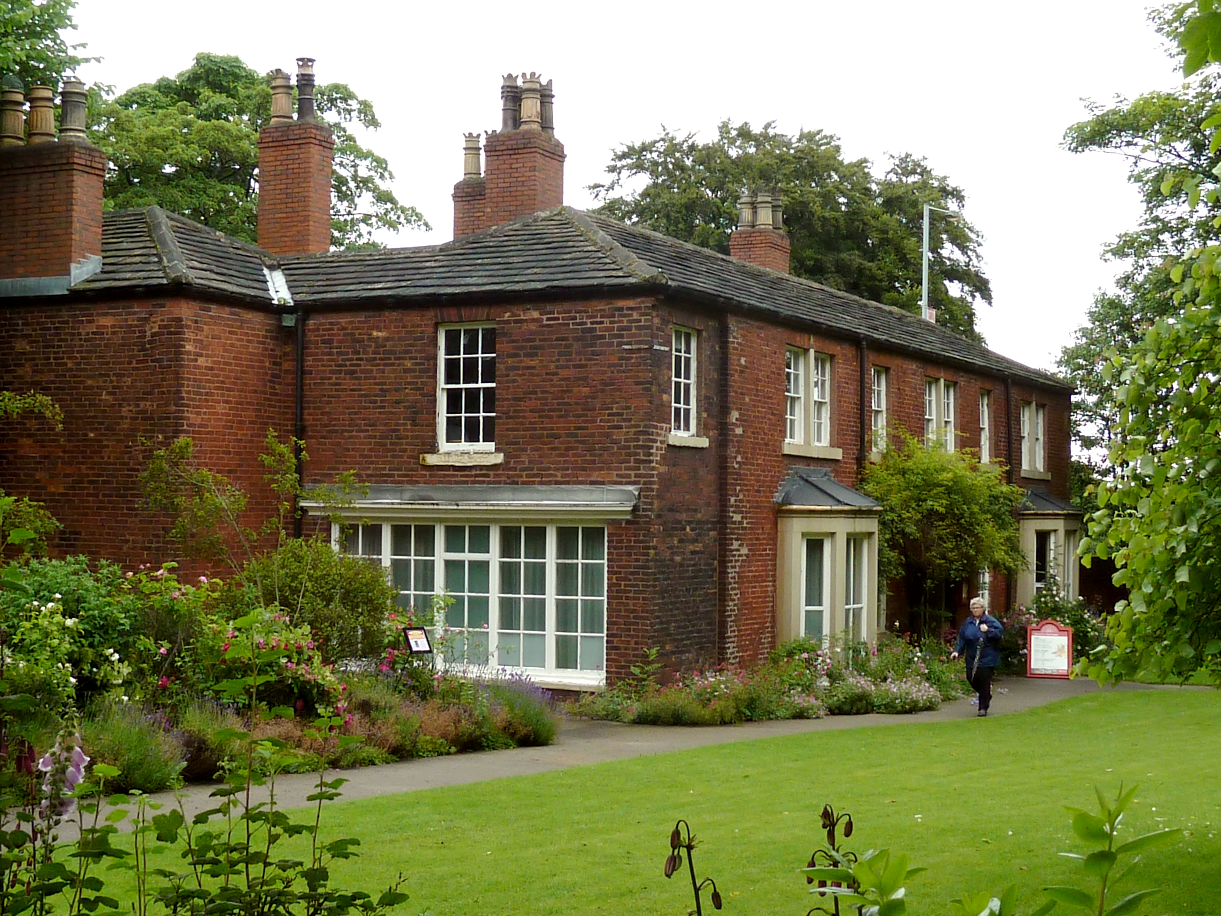
Red House Museum

Red House Museum was a historic house museum, built in 1660 and renovated in the Georgian era. It closed to the public at the end of 2016 but remains as...

Cleckheaton Spen railway station

Cleckheaton Spen railway station served the town of Cleckheaton, West Yorkshire, England, from 1900 to 1953 on the Leeds New Line. It is one of two disused...

Whitechapel Church, Cleckheaton

Whitechapel Church, is an unusual church building located approximately half a mile north of Cleckheaton, West Yorkshire, England. It was built in 1820...

Nearby Amenities

Located within 500m of 53.740631,-1.7052154
Power: tower
Lat/Long: 53.7404537/-1.6996083
Bus Stop
Whitehall Road West Motorway Bridge
Local Ref: 45015446
Naptan AtcoCode: 450015446
Naptan Bearing: NE
Naptan CommonName: Whitehall Road West Motorway Bridge
Naptan Crossing: Adj M62 Motorway Bridge
Naptan Indicator: Stop 45015446
Naptan Landmark: Lodge Garage
Naptan Notes: OSR taken place 211005
Naptan PlusbusZoneRef: LEEDS
Naptan ShortCommonName: Whitehall Road West
Naptan Street: Whitehall Road West
Naptan Verified: no
Source: naptan_import
Lat/Long: 53.7441195/-1.7005753
Bus Stop
Whitehall Road West Hunsworth Farm
Local Ref: 45015447
Naptan AtcoCode: 450015447
Naptan Bearing: NE
Naptan CommonName: Whitehall Road West Hunsworth Farm
Naptan Crossing: Twixt Hunsworth Lane & M62 Motorway Bridge
Naptan Indicator: Stop 45015447
Naptan Landmark: Hunsworth Lodge Farm
Naptan PlusbusZoneRef: LEEDS
Naptan ShortCommonName: Hunsworth Farm
Naptan Street: Whitehall Road West
Naptan Verified: no
Source: naptan_import
Lat/Long: 53.741652/-1.706996
Bus Stop
Whitehall Road West Hunsworth Farm
Local Ref: 45026470
Naptan AtcoCode: 450026470
Naptan Bearing: NE
Naptan CommonName: Whitehall Road West Hunsworth Farm
Naptan Crossing: Twixt Drub Lane & M62 Motorway Bridge
Naptan Indicator: Stop 45026470
Naptan Landmark: Hunsworth Lodge Farm
Naptan PlusbusZoneRef: LEEDS
Naptan ShortCommonName: Hunsworth Farm
Naptan Street: Whitehall Road West
Source: naptan_import
Towards: Brighouse, Cleckheaton
Lat/Long: 53.7416783/-1.7067381
Barrier: stile
Lat/Long: 53.7438352/-1.7071747
Barrier: stile
Lat/Long: 53.7423843/-1.7079953
Barrier: kissing_gate
Foot: yes
Material: wood
Lat/Long: 53.7387243/-1.7120606
Power: tower
Source: Bing
Lat/Long: 53.7414653/-1.6986487
Power: tower
Source: Bing
Lat/Long: 53.741335/-1.6992707
Power: tower
Source: Bing
Lat/Long: 53.7397042/-1.6988309
Power: tower
Source: Bing
Lat/Long: 53.7409829/-1.6989116
Drub War Memorial
Historic: memorial
Lat/Long: 53.738686/-1.7032373
Halifax Bomber Memorial
Historic: memorial
Lat/Long: 53.7392304/-1.7043089
Leisure: picnic_table
Lat/Long: 53.7394288/-1.7038424
Barrier: stile
Foot: yes
Lat/Long: 53.7405996/-1.7080067
Barrier: kissing_gate
Lat/Long: 53.7371765/-1.7080477
Barrier: stile
Lat/Long: 53.7396232/-1.7037796
Barrier: stile
Lat/Long: 53.7411715/-1.7036294
Barrier: stile
Material: wood
Stile: stepover
Lat/Long: 53.7386268/-1.7108672
Barrier: stile
Lat/Long: 53.7448509/-1.7033345
The data included in this document is from www.openstreetmap.org. The data is made available under ODbL.

Have you been to Lower Lodge Range?

Leave your review of Lower Lodge Range below (or comments, questions and feedback).