Stanwick Park

Downs, Moorland in Yorkshire Richmondshire

England

Stanwick Park

Stanwick Oppidum This short length of the extensive defences has been excavated and reconstructed <span class="nowrap"><a title="https://historicengland.org.uk/listing/the-list/list-entry/1016199" rel="nofollow ugc noopener" href="https://historicengland.org.uk/listing/the-list/list-entry/1016199">Link</a><img style="margin-left:2px;" alt="External link" title="External link - shift click to open in new window" src="https://s1.geograph.org.uk/img/external.png" width="10" height="10"/></span>
Stanwick Oppidum Credit: Sandy Gerrard

Stanwick Park is a picturesque location situated in the county of Yorkshire, England. Spanning across the scenic landscape of the Yorkshire Downs and Moorland, this vast park offers visitors a blend of natural beauty, historical significance, and recreational opportunities.

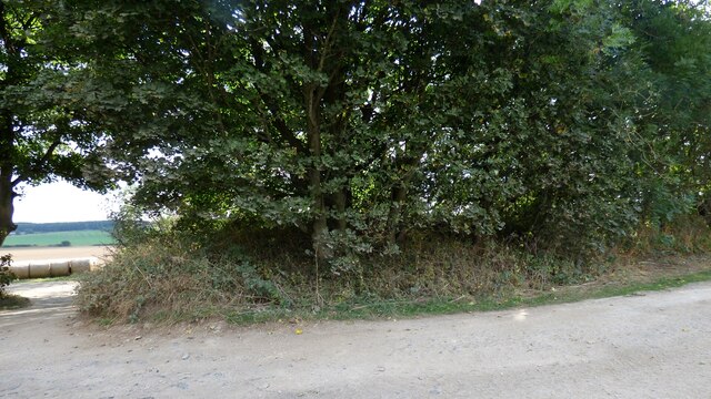
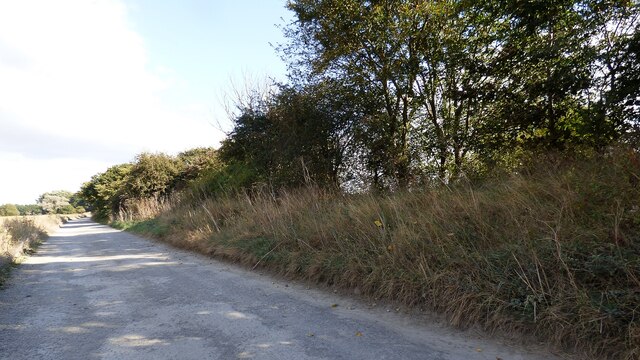
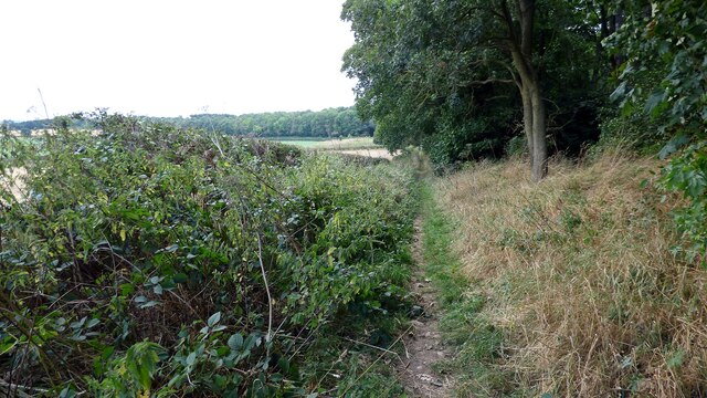
Covering an area of approximately 500 acres, Stanwick Park is a haven for nature enthusiasts. The park boasts diverse habitats, including rolling hills, heather-covered moorland, and tranquil lakes. The rich biodiversity of the park is home to a variety of flora and fauna, making it a perfect destination for wildlife spotting and birdwatching.

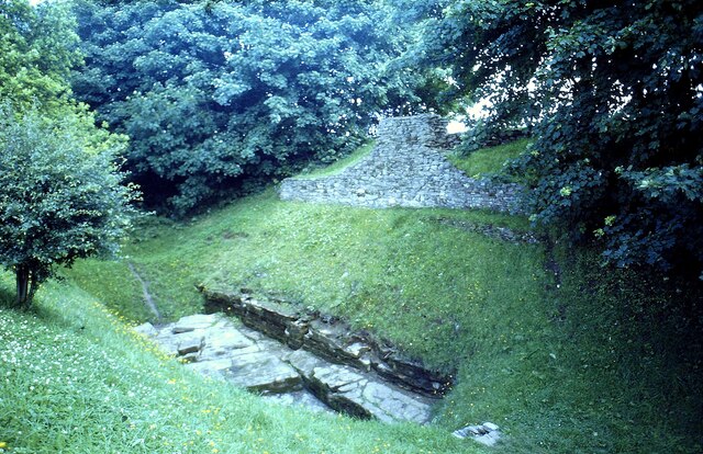
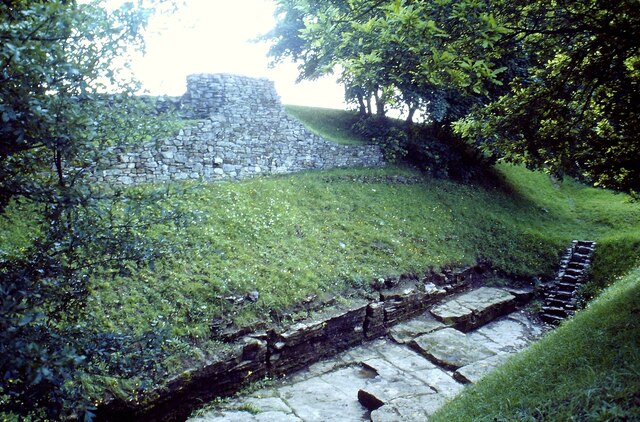
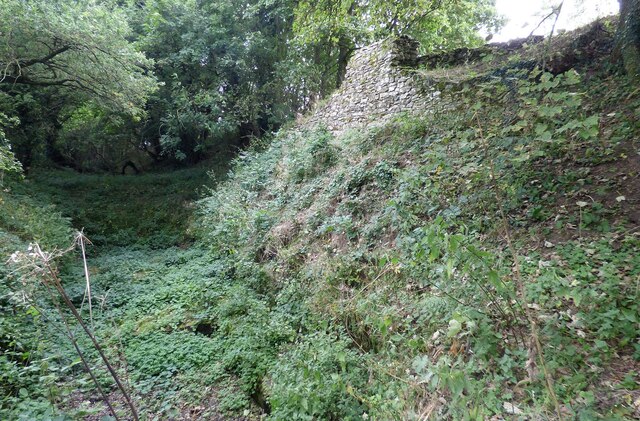
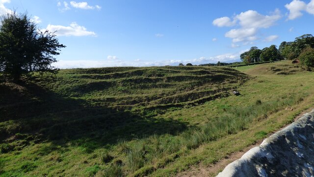
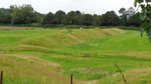
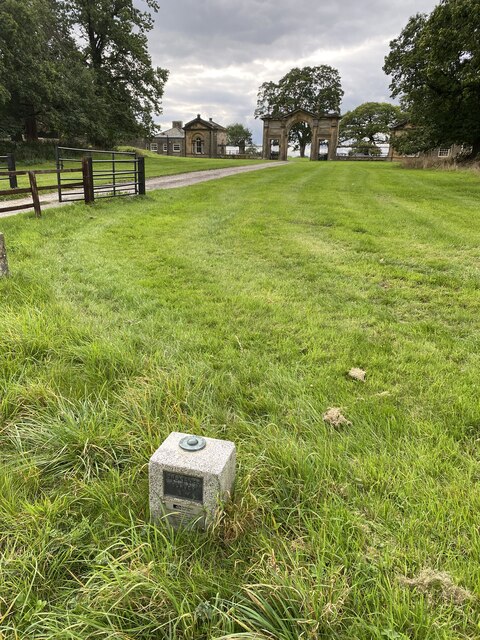
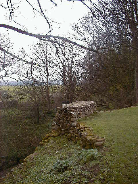
In addition to its natural wonders, Stanwick Park holds great historical importance. The remains of an Iron Age hillfort, known as Stanwick Camp, can be found within the park's boundaries. These ancient earthworks, dating back to the 1st century BC, provide a glimpse into the region's past and offer an intriguing site for exploration.

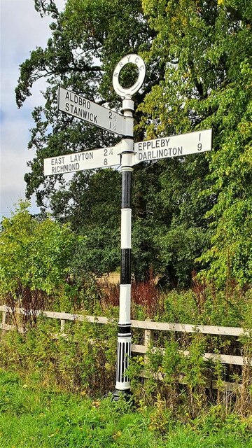
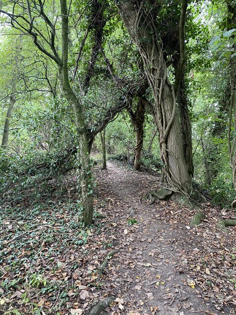
Visitors to Stanwick Park can enjoy a plethora of outdoor activities. The park offers numerous walking trails, ranging from gentle strolls to more challenging hikes, allowing visitors to immerse themselves in the stunning surroundings. Cyclists can also explore the park's network of cycling routes, while anglers can indulge in fishing in the park's lakes.

The park provides ample facilities for visitors, including picnic areas, parking, and information boards detailing the park's history and wildlife. Whether seeking a peaceful retreat, an adventure-filled day out, or a chance to delve into history, Stanwick Park offers a memorable experience for all who visit.

If you have any feedback on the listing, please let us know in the comments section below.

Stanwick Park Images

Images are sourced within 2km of 54.500777/-1.7128701 or Grid Reference NZ1811. Thanks to Geograph Open Source API. All images are credited.

Stanwick Oppidum This short length of the extensive defences has been excavated and reconstructed <span class="nowrap"><a title="https://historicengland.org.uk/listing/the-list/list-entry/1016199" rel="nofollow ugc noopener" href="https://historicengland.org.uk/listing/the-list/list-entry/1016199">Link</a><img style="margin-left:2px;" alt="External link" title="External link - shift click to open in new window" src="https://s1.geograph.org.uk/img/external.png" width="10" height="10"/></span>
Stanwick Oppidum
This short length of the extensive defences has been excavated and reconstructed LinkExternal link
Stanwick Oppidum In the 1970's the rock-cut ditch was clearly visible <span class="nowrap"><a title="https://historicengland.org.uk/listing/the-list/list-entry/1016199" rel="nofollow ugc noopener" href="https://historicengland.org.uk/listing/the-list/list-entry/1016199">Link</a><img style="margin-left:2px;" alt="External link" title="External link - shift click to open in new window" src="https://s1.geograph.org.uk/img/external.png" width="10" height="10"/></span>
Stanwick Oppidum
In the 1970's the rock-cut ditch was clearly visible LinkExternal link
Stanwick Oppidum The excavated and restored section of this extensive Iron-Age defended settlement <span class="nowrap"><a title="https://historicengland.org.uk/listing/the-list/list-entry/1016199" rel="nofollow ugc noopener" href="https://historicengland.org.uk/listing/the-list/list-entry/1016199">Link</a><img style="margin-left:2px;" alt="External link" title="External link - shift click to open in new window" src="https://s1.geograph.org.uk/img/external.png" width="10" height="10"/></span>
Stanwick Oppidum
The excavated and restored section of this extensive Iron-Age defended settlement LinkExternal link
Rampart and ditch at Stanwick Oppidum <span class="nowrap"><a title="https://historicengland.org.uk/listing/the-list/list-entry/1016199" rel="nofollow ugc noopener" href="https://historicengland.org.uk/listing/the-list/list-entry/1016199">Link</a><img style="margin-left:2px;" alt="External link" title="External link - shift click to open in new window" src="https://s1.geograph.org.uk/img/external.png" width="10" height="10"/></span>
Rampart and ditch at Stanwick Oppidum
Church of St John the Baptist, Stanwick A 13th century Church, heavily restored 1868 by Anthony Salvin <span class="nowrap"><a title="https://historicengland.org.uk/listing/the-list/list-entry/1167219" rel="nofollow ugc noopener" href="https://historicengland.org.uk/listing/the-list/list-entry/1167219">Link</a><img style="margin-left:2px;" alt="External link" title="External link - shift click to open in new window" src="https://s1.geograph.org.uk/img/external.png" width="10" height="10"/></span>
Church of St John the Baptist, Stanwick
A 13th century Church, heavily restored 1868 by Anthony Salvin LinkExternal link
Stanwick Oppidum A length of well preserved rampart <span class="nowrap"><a title="https://historicengland.org.uk/listing/the-list/list-entry/1016199" rel="nofollow ugc noopener" href="https://historicengland.org.uk/listing/the-list/list-entry/1016199">Link</a><img style="margin-left:2px;" alt="External link" title="External link - shift click to open in new window" src="https://s1.geograph.org.uk/img/external.png" width="10" height="10"/></span>
Stanwick Oppidum
A length of well preserved rampart LinkExternal link
Stanwick Oppidum and field wall Oppidum earthwork amongst the trees in background and ditch behind the wall in the foreground <span class="nowrap"><a title="https://historicengland.org.uk/listing/the-list/list-entry/1016199" rel="nofollow ugc noopener" href="https://historicengland.org.uk/listing/the-list/list-entry/1016199">Link</a><img style="margin-left:2px;" alt="External link" title="External link - shift click to open in new window" src="https://s1.geograph.org.uk/img/external.png" width="10" height="10"/></span>
Stanwick Oppidum and field wall
Oppidum earthwork amongst the trees in background and ditch behind the wall in the foreground LinkExternal link
Stanwick Oppidum A length of rampart situated next to the track leading to Park House Farm <span class="nowrap"><a title="https://historicengland.org.uk/listing/the-list/list-entry/1016199" rel="nofollow ugc noopener" href="https://historicengland.org.uk/listing/the-list/list-entry/1016199">Link</a><img style="margin-left:2px;" alt="External link" title="External link - shift click to open in new window" src="https://s1.geograph.org.uk/img/external.png" width="10" height="10"/></span>
Stanwick Oppidum
A length of rampart situated next to the track leading to Park House Farm LinkExternal link
Stanwick Oppidum Length of oppidum rampart next to the track leading to Park House Farm <span class="nowrap"><a title="https://historicengland.org.uk/listing/the-list/list-entry/1016199" rel="nofollow ugc noopener" href="https://historicengland.org.uk/listing/the-list/list-entry/1016199">Link</a><img style="margin-left:2px;" alt="External link" title="External link - shift click to open in new window" src="https://s1.geograph.org.uk/img/external.png" width="10" height="10"/></span>
Stanwick Oppidum
Length of oppidum rampart next to the track leading to Park House Farm LinkExternal link
Bridleway at Hillhouse Plantation
East Gateway and Lodges To Forcett Hall
East Gateway and Lodges
To Forcett Hall
Church of St John the Baptist
Earthworks at Stanwick Camp View towards Forcett Park of a much reduced earthwork
Earthworks at Stanwick Camp
View towards Forcett Park of a much reduced earthwork
Well near St John's Church
Direction Sign – Signpost at Forcett Located on the northwest side of the T junction in the village in Forcett parish. 3 arms and annulus finial. It stood on the south side of the junction until 2021, see <a title="https://www.geograph.org.uk/photo/6836140," href="https://www.geograph.org.uk/photo/6836140,">Link</a> but it has been restored and moved across the road.

Milestone Society National ID: YN_NZ1712
Direction Sign – Signpost at Forcett
Located on the northwest side of the T junction in the village in Forcett parish. 3 arms and annulus finial. It stood on the south side of the junction until 2021, see Link but it has been restored and moved across the road. Milestone Society National ID: YN_NZ1712
Fundamental Benchmark Forcett <span class="nowrap"><a title="https://www.bench-marks.org.uk/bm1063" rel="nofollow ugc noopener" href="https://www.bench-marks.org.uk/bm1063">Link</a><img style="margin-left:2px;" alt="External link" title="External link - shift click to open in new window" src="https://s1.geograph.org.uk/img/external.png" width="10" height="10"/></span>
<span class="nowrap"><a title="https://trigpointing.uk/trig/7222" rel="nofollow ugc noopener" href="https://trigpointing.uk/trig/7222">Link</a><img style="margin-left:2px;" alt="External link" title="External link - shift click to open in new window" src="https://s1.geograph.org.uk/img/external.png" width="10" height="10"/></span>

Also known as an FBM or mini trig point however this is not a trig point and is nothing to do with triangulation

<span class="nowrap"><a title="https://trigpointing.uk/wiki/FBM" rel="nofollow ugc noopener" href="https://trigpointing.uk/wiki/FBM">Link</a><img style="margin-left:2px;" alt="External link" title="External link - shift click to open in new window" src="https://s1.geograph.org.uk/img/external.png" width="10" height="10"/></span>
An underground chamber topped with a short granite pillar. The pillar contains an easily accessible height reference point, but the accurately measured level is underground where it is less likely to be disturbed. There are approximately 207 FBMs across the country and whilst a few have fallen into disuse, most have been incorporated into the National GPS Network as Passive Stations.
For a detailed breakdown of the different types of FBM, see Ian Richardson's FBM styles - A Pictorial Guide.
Fundamental Benchmark Forcett
LinkExternal link LinkExternal link Also known as an FBM or mini trig point however this is not a trig point and is nothing to do with triangulation LinkExternal link An underground chamber topped with a short granite pillar. The pillar contains an easily accessible height reference point, but the accurately measured level is underground where it is less likely to be disturbed. There are approximately 207 FBMs across the country and whilst a few have fallen into disuse, most have been incorporated into the National GPS Network as Passive Stations. For a detailed breakdown of the different types of FBM, see Ian Richardson's FBM styles - A Pictorial Guide.
OS Forcett FBM Aux 1 - Berntsen <span class="nowrap"><a title="https://trigpointing.uk/trig/595" rel="nofollow ugc noopener" href="https://trigpointing.uk/trig/595">Link</a><img style="margin-left:2px;" alt="External link" title="External link - shift click to open in new window" src="https://s1.geograph.org.uk/img/external.png" width="10" height="10"/></span>
<span class="nowrap"><a title="https://trigpointing.uk/wiki/Berntsen" rel="nofollow ugc noopener" href="https://trigpointing.uk/wiki/Berntsen">Link</a><img style="margin-left:2px;" alt="External link" title="External link - shift click to open in new window" src="https://s1.geograph.org.uk/img/external.png" width="10" height="10"/></span>
OS Forcett FBM Aux 1 - Berntsen
Stanwick Camp - Iron Age Fortifications <span class="nowrap"><a title="https://www.english-heritage.org.uk/visit/places/stanwick-iron-age-fortifications/history/" rel="nofollow ugc noopener" href="https://www.english-heritage.org.uk/visit/places/stanwick-iron-age-fortifications/history/">Link</a><img style="margin-left:2px;" alt="External link" title="External link - shift click to open in new window" src="https://s1.geograph.org.uk/img/external.png" width="10" height="10"/></span>
Stanwick Camp - Iron Age Fortifications
Show me another place!

Stanwick Park is located at Grid Ref: NZ1811 (Lat: 54.500777, Lng: -1.7128701)

Division: North Riding

Administrative County: North Yorkshire

District: Richmondshire

Police Authority: North Yorkshire

What 3 Words

///warbler.available.erupted. Near High Coniscliffe, Co. Durham

Related Wikis

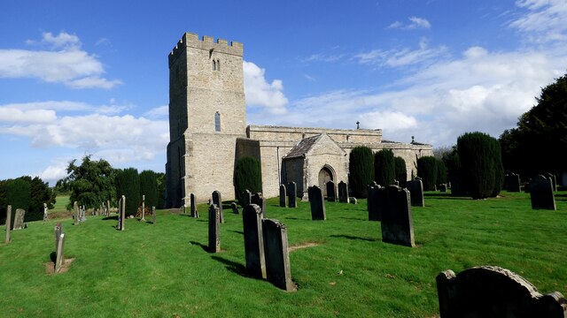
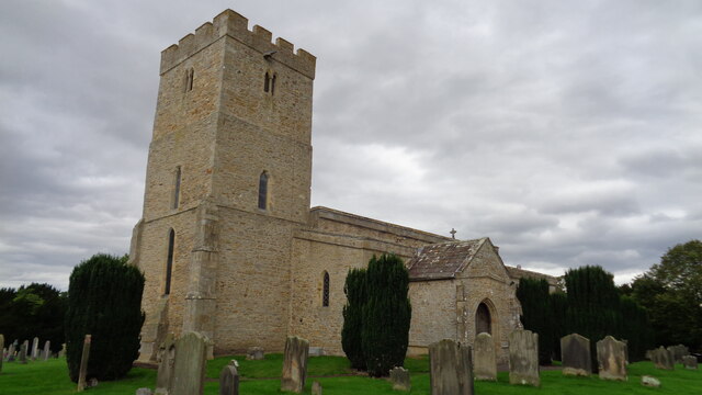
St John the Baptist's Church, Stanwick

St John the Baptist's Church is a redundant Anglican church in the village of Stanwick St John, North Yorkshire, England. It is recorded in the National...
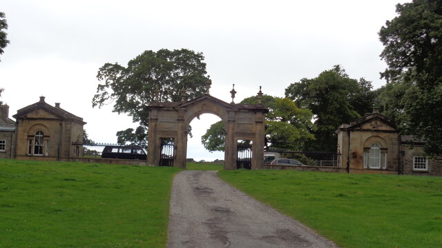
Stanwick Park

Stanwick Park (also known as Stanwick Hall) was a Palladian country house at Stanwick St John in North Yorkshire, England. == History == It was re-built...

Stanwick St John

Stanwick St John is a village, civil parish, former manor and ecclesiastical parish in the Richmondshire district of North Yorkshire, (formerly "North...

Stanwick Iron Age Fortifications

Stanwick Iron Age Fortifications (also known as 'Stanwick Camp'), a huge Iron Age hill fort, sometimes but not always considered an oppidum, comprising...

Forcett Hall

Forcett Hall is an English country house in the village of Forcett, North Yorkshire, England, some 6.5 miles (10 km) west of Darlington. It is a Grade...

Eppleby

Eppleby is a village and civil parish in the Richmondshire district of North Yorkshire, England. It is located about 7 miles (11 km) north of Richmond...

Aldbrough St John

Aldbrough St John is a village and civil parish (called just Aldbrough) in the Richmondshire district in North Yorkshire, England. The parish has a population...

Forcett

Forcett is a village in the Richmondshire district of North Yorkshire, England. It lies near the border with County Durham, on the B6274 road about 8 miles...

Nearby Amenities

Located within 500m of 54.500777,-1.7128701
Stanwick Iron Age Fortifications
Historic: archaeological_site
Website: https://www.pastscape.org.uk/hob.aspx?hob_id=21862
Wikidata: Q15242545
Wikipedia: en:Stanwick Iron Age Fortifications
Lat/Long: 54.4987941/-1.719081
Henah Hill
Natural: peak
Source: NLS - OS 1:25k 1st Series 1937-61
Lat/Long: 54.5008027/-1.7083776
Stanwick St John
Place: hamlet
Lat/Long: 54.4976839/-1.7152217
The data included in this document is from www.openstreetmap.org. The data is made available under ODbL.

Have you been to Stanwick Park?

Leave your review of Stanwick Park below (or comments, questions and feedback).