Dob Park

Downs, Moorland in Yorkshire Harrogate

England

Dob Park

Snowden Crags Northward view, Crag House in the middle distance, High Snowden beyond.
Snowden Crags Credit: David Spencer

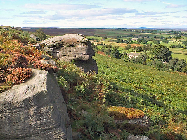
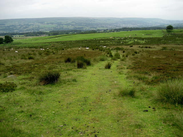
Dob Park is a picturesque estate located in the heart of Yorkshire, England. Nestled amidst the stunning landscape of the Yorkshire Downs and Moorland, it spans several acres of lush greenery and offers a tranquil retreat for nature enthusiasts.

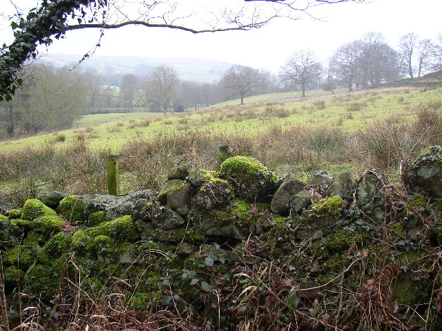
The estate is renowned for its diverse flora and fauna, with a wide array of plant species and wildlife thriving in this natural haven. The rolling hills and expansive meadows provide a breathtaking backdrop, making it a popular destination for hikers, walkers, and photographers alike.

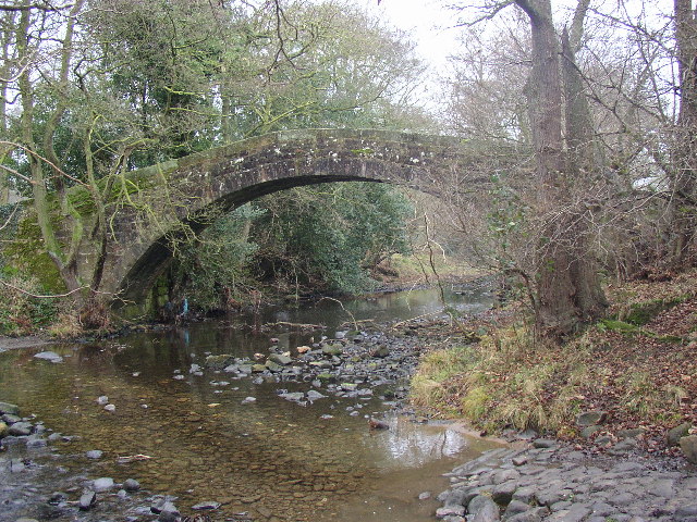
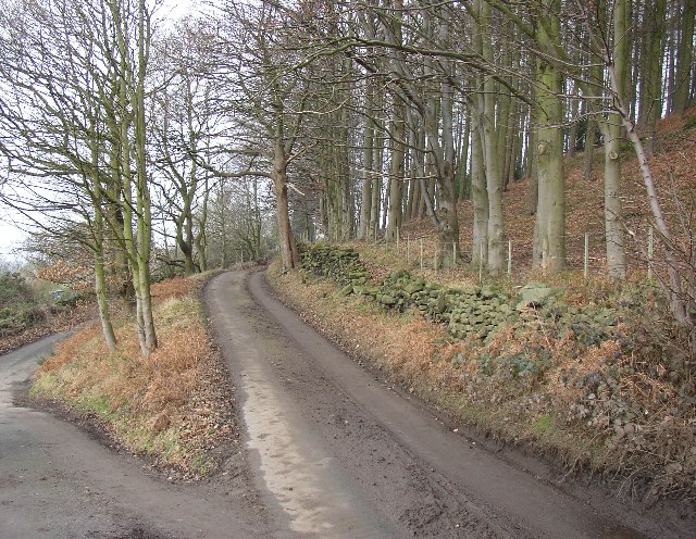
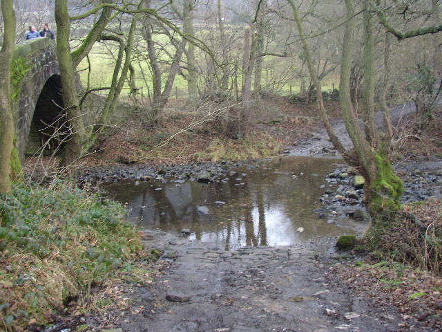
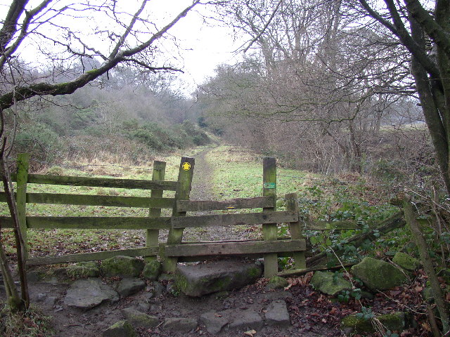
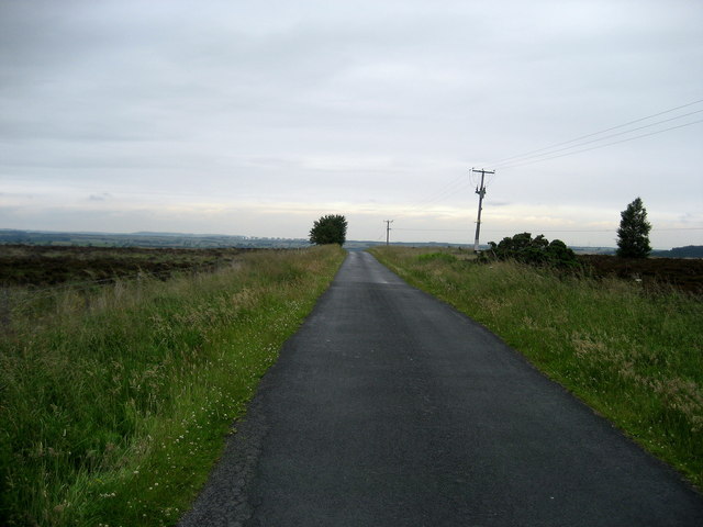
Dob Park boasts an extensive network of walking trails, allowing visitors to explore the estate at their own pace. The trails wind through woodlands, across babbling brooks, and up to panoramic viewpoints, offering stunning vistas of the surrounding countryside.

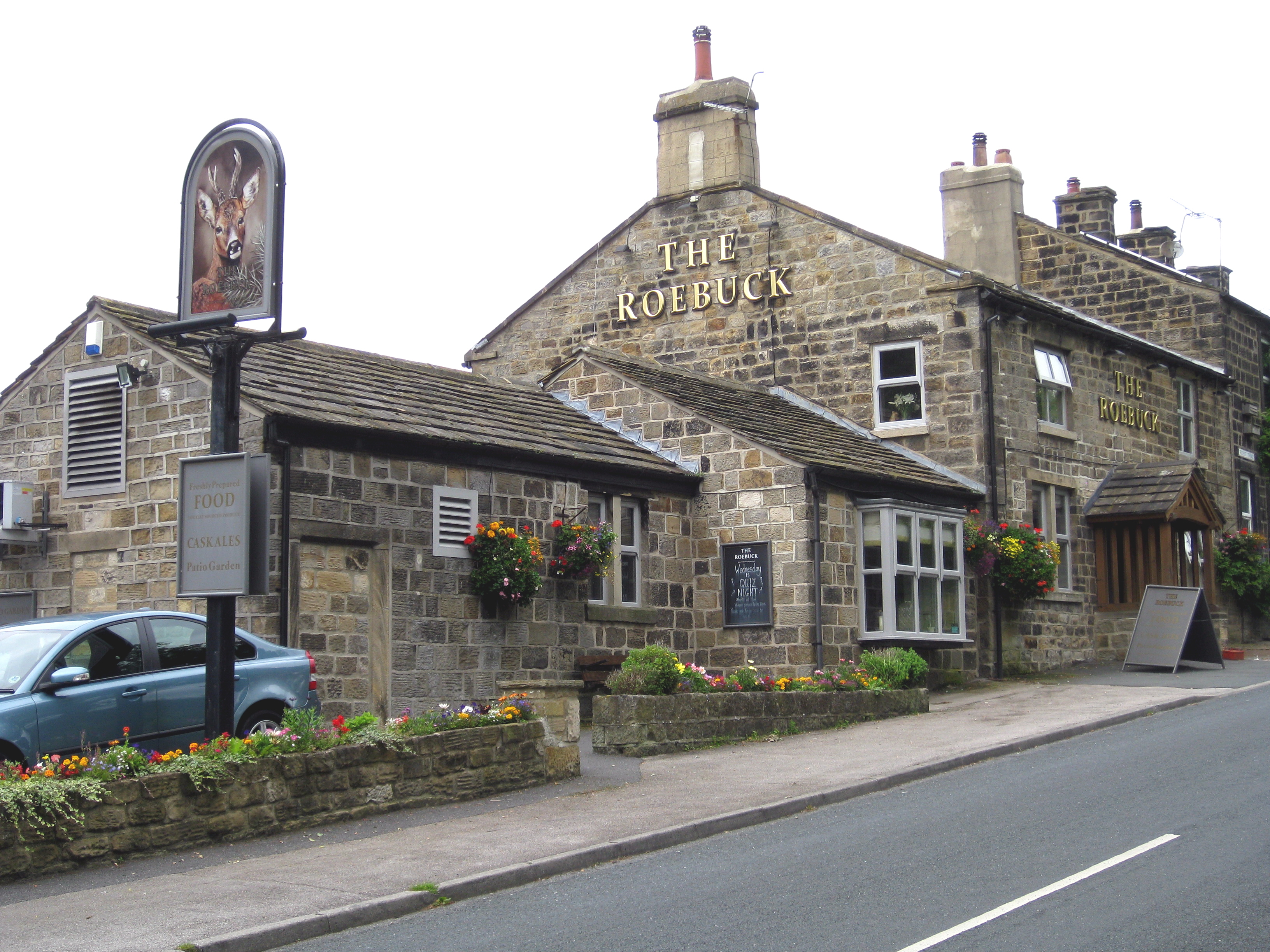
In addition to its natural beauty, Dob Park is also home to a variety of historical and cultural landmarks. The estate features an impressive 17th-century manor house, which is a testament to the area's rich heritage. Visitors can take guided tours of the house, marveling at its grand architecture and learning about the fascinating stories of its previous inhabitants.

For those seeking a peaceful retreat, Dob Park offers a range of accommodation options, including charming cottages and bed and breakfasts. These provide a comfortable base from which to explore the estate and its surroundings.

Overall, Dob Park is a haven of natural beauty, offering a harmonious blend of stunning landscapes, rich biodiversity, and historical allure.

If you have any feedback on the listing, please let us know in the comments section below.

Dob Park Images

Images are sourced within 2km of 53.948424/-1.7171767 or Grid Reference SE1850. Thanks to Geograph Open Source API. All images are credited.

Snowden Crags Northward view, Crag House in the middle distance, High Snowden beyond.
Snowden Crags
Northward view, Crag House in the middle distance, High Snowden beyond.
Old quarry, Snowden Carr The farmer has shrewdly sheltered two beehives in the bottom.  Eastward view with Hunter's Stones microwave tower (at Norwood Edge) in the distance.
Old quarry, Snowden Carr
The farmer has shrewdly sheltered two beehives in the bottom. Eastward view with Hunter's Stones microwave tower (at Norwood Edge) in the distance.
Snowden Carr Rock-strewn heather moorland sloping down to the east.  Eastward view with the entirely innocuous ( <span class="nowrap"><a title="http://duncan.gn.apc.org/menwith.htm" rel="nofollow ugc noopener" href="http://duncan.gn.apc.org/menwith.htm">Link</a><img style="margin-left:2px;" alt="External link" title="External link - shift click to open in new window" src="https://s1.geograph.org.uk/img/external.png" width="10" height="10"/></span> ) Hunter's Stones microwave tower in the distance.
Snowden Carr
Rock-strewn heather moorland sloping down to the east. Eastward view with the entirely innocuous ( LinkExternal link ) Hunter's Stones microwave tower in the distance.
Tree of Life Stone, Snowden Carr Prehistoric cup marked rock carving (possibly Bronze Age).  Despite the stone's modern name, it is not known whether the carving was intended to depict a tree.
Tree of Life Stone, Snowden Carr
Prehistoric cup marked rock carving (possibly Bronze Age). Despite the stone's modern name, it is not known whether the carving was intended to depict a tree.
Tree of Life Stone, Snowden Carr (detail) Detail of the prehistoric cup marked rock carving.
Tree of Life Stone, Snowden Carr (detail)
Detail of the prehistoric cup marked rock carving.
Low Snowden and Washburn Farm Looking northeastwards from Snowden Carr Road. Swinsty Reservoir beyond.
Low Snowden and Washburn Farm
Looking northeastwards from Snowden Carr Road. Swinsty Reservoir beyond.
Dob Park Seen from Snowden Carr Road, this farmland is the former site of Dob Park.  Dob Park Woods lie to the left and the ruined Dob Park Lodge is the speck on the skyline centre-right and just outside the gridsquare.
Dob Park
Seen from Snowden Carr Road, this farmland is the former site of Dob Park. Dob Park Woods lie to the left and the ruined Dob Park Lodge is the speck on the skyline centre-right and just outside the gridsquare.
Dob Park Bridge, Norwood This magnificent packhorse bridge is on an unsurfaced lane from Norwood southwards towards Otley.  Vehicles have to use the rather rough ford.
Dob Park Bridge, Norwood
This magnificent packhorse bridge is on an unsurfaced lane from Norwood southwards towards Otley. Vehicles have to use the rather rough ford.
Sword Point House, Norwood A house in an enviable position with a view across the Washburn valley.  Sword Point is the name of a sharp ridge up beyond the wood on the right.
Sword Point House, Norwood
A house in an enviable position with a view across the Washburn valley. Sword Point is the name of a sharp ridge up beyond the wood on the right.
Road junction near Dob Park, Norwood, North Yorkshire This is a triangular junction, although the lane to the left (not visible in the photo) down to Dob Park Packhorse Bridge is not fit for modern traffic (other than bicycles!).  The wood is called Hanging Bank.
Road junction near Dob Park, Norwood, North Yorkshire
This is a triangular junction, although the lane to the left (not visible in the photo) down to Dob Park Packhorse Bridge is not fit for modern traffic (other than bicycles!). The wood is called Hanging Bank.
Dob Park Ford, Norwood, North Yorkshire This is the ford alongside the packhorse bridge.  The river is the Washburn.
Dob Park Ford, Norwood, North Yorkshire
This is the ford alongside the packhorse bridge. The river is the Washburn.
Footpath near Dob Park Bridge, Norwood, North Yorkshire This well-used public footpath follows the north-east bank of the River Washburn (looking to the south-east).
Footpath near Dob Park Bridge, Norwood, North Yorkshire
This well-used public footpath follows the north-east bank of the River Washburn (looking to the south-east).
Mossy wall and wet field, Norwood, North Yorkshire This is taken looking westward from the lane to Dob Park Bridge.
Mossy wall and wet field, Norwood, North Yorkshire
This is taken looking westward from the lane to Dob Park Bridge.
Arthur Adamson Memorial Bridge across Timble Gill Beck
Box-car on the top of Shooting House Hill An unattractive replacement for the stone built shooting house on whose foundations this dilapidated box-car sits. It's presumably still used as a shooting box for the grouse on Askwith Moor.
Box-car on the top of Shooting House Hill
An unattractive replacement for the stone built shooting house on whose foundations this dilapidated box-car sits. It's presumably still used as a shooting box for the grouse on Askwith Moor.
Snowden Carr Road Leads off the ridge, descending to Dob Park.
Snowden Carr Road
Leads off the ridge, descending to Dob Park.
Askwith Moor Road Part of the road that utilises the broad ridge of Snowden Carr between Otley and Blubberhouses.
Askwith Moor Road
Part of the road that utilises the broad ridge of Snowden Carr between Otley and Blubberhouses.
Stoop Hill Walking across a section of moorland from Askwith Moor Road towards Moorside Farm.
Stoop Hill
Walking across a section of moorland from Askwith Moor Road towards Moorside Farm.
Show me another place!

Dob Park is located at Grid Ref: SE1850 (Lat: 53.948424, Lng: -1.7171767)

Division: West Riding

Administrative County: North Yorkshire

District: Harrogate

Police Authority: North Yorkshire

What 3 Words

///decanter.bars.strategy. Near Otley, West Yorkshire

Nearby Locations

Dobpark Wood Dob Park

Related Wikis

Snowden Crags

Snowden Crags is a prehistoric archaeological site on Askwith Moor in North Yorkshire, England. Local antiquarian Eric Cowling recorded a stone circle...

Newall with Clifton

Newall with Clifton (historically also spelt Newell with Clifton) is a civil parish in North Yorkshire, England. It lies two miles north of Otley in West...

Askwith

Askwith is a village and civil parish in North Yorkshire, England, with a population of 220 (2001 census), increasing to 240 at the 2011 Census. The village...

Timble

Timble is a village in the Harrogate district of North Yorkshire, England. It is situated on the slopes of the Washburn valley, north of Otley and close...

Nearby Amenities

Located within 500m of 53.948424,-1.7171767
Dobpark Lodge
HE Ref: 1015630
Description: Roofless 3-storey high ruin. Distinctive local landmark. C17th park lodge built for built for Sir Mauger Vavasour
Historic: ruins
Listed Status: Grade II
Ruins: hunting_lodge
Lat/Long: 53.9478181/-1.7107292
Low Park
Building: residential
Historic: house
Lat/Long: 53.9511237/-1.7121077
Barrier: entrance
Source: Bing
Lat/Long: 53.9505741/-1.7226647
Barrier: entrance
Source: Bing
Lat/Long: 53.9487931/-1.7242201
Barrier: stile
Lat/Long: 53.9487999/-1.7244459
Barrier: entrance
Source: Bing
Lat/Long: 53.9486167/-1.7215817
Barrier: entrance
Source: Bing
Lat/Long: 53.9487149/-1.7235372
Barrier: entrance
Source: Bing
Lat/Long: 53.9491389/-1.7204812
Barrier: stile
Lat/Long: 53.9517162/-1.719341
Historic: boundary_stone
Source: NLS-OS-NatGrid-110k-1940-60
Lat/Long: 53.9475261/-1.7245579
Historic: boundary_stone
Source: NLS-OS-NatGrid-110k-1940-60
Lat/Long: 53.9481834/-1.7244527
Historic: boundary_stone
Source: NLS-OS-NatGrid-110k-1940-60
Lat/Long: 53.9510367/-1.723294
Historic: boundary_stone
Source: NLS-OS-NatGrid-110k-1940-60
Lat/Long: 53.9524989/-1.7191902
Generator Source: wind
Power: generator
Source: survey
Lat/Long: 53.9496934/-1.7203088
Information: route_marker
Lat/Long: 53.9508117/-1.7202945
Power: pole
Lat/Long: 53.948803/-1.7243949
Power: pole
Lat/Long: 53.9496017/-1.7240033
Power: pole
Lat/Long: 53.9504769/-1.7235352
The data included in this document is from www.openstreetmap.org. The data is made available under ODbL.

Have you been to Dob Park?

Leave your review of Dob Park below (or comments, questions and feedback).