Mid Dale

Downs, Moorland in Shetland

Scotland

Mid Dale

Peat hags on Sneugans Moorland above the Dale of Walls.
Peat hags on Sneugans Credit: Julian Paren

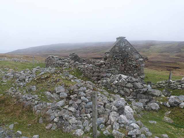
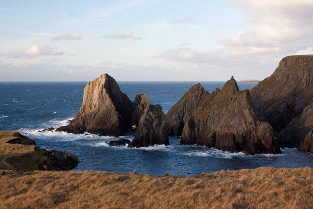
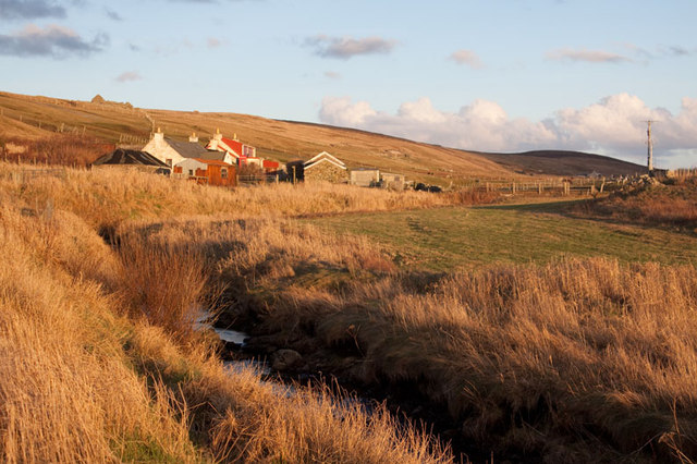
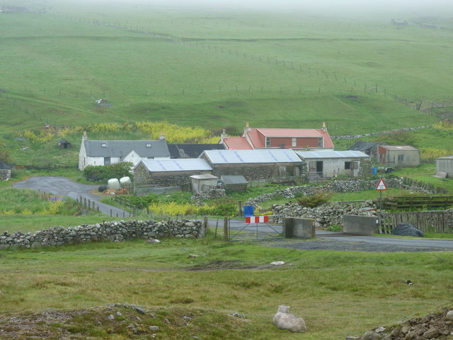
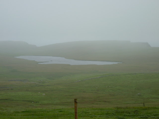
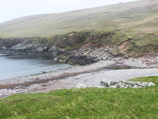
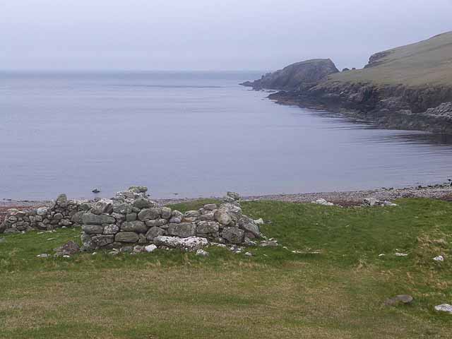
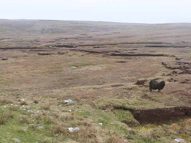
Mid Dale is a picturesque area located in the Shetland Islands, known for its stunning natural beauty and diverse landscape. Situated in the central part of Shetland, Mid Dale is primarily characterized by its downs and moorland. The region is known for its rolling hills, heather-covered landscapes, and breathtaking views.

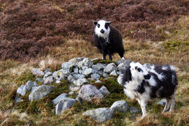
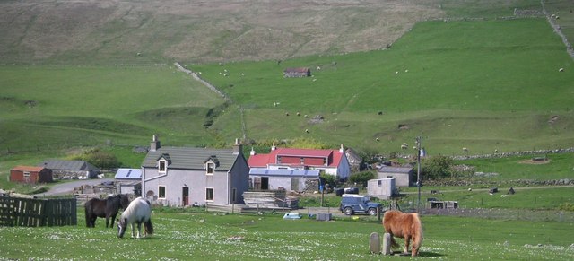
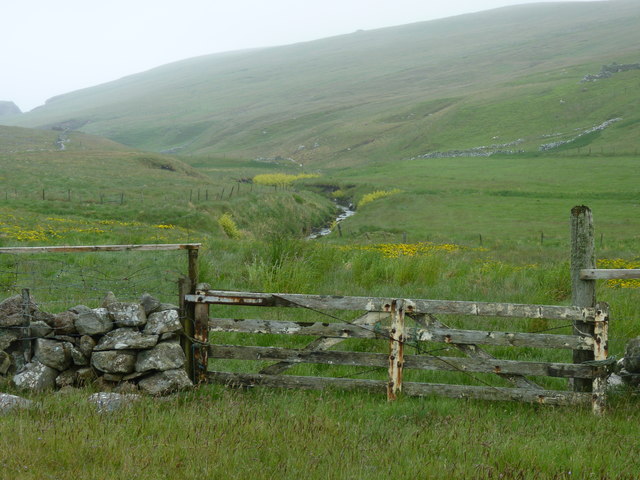
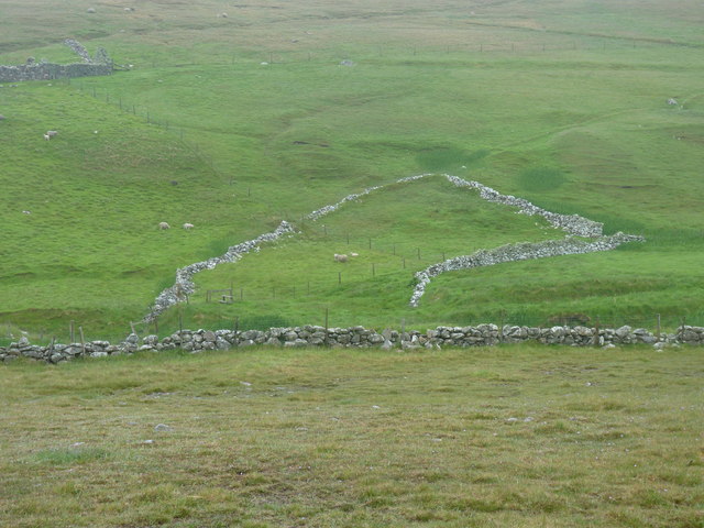
The downs in Mid Dale are vast stretches of open grassland, often interspersed with rocky outcrops and scattered with wildflowers. These downs provide grazing areas for livestock and are also home to a variety of bird species, including the iconic Shetland ponies.

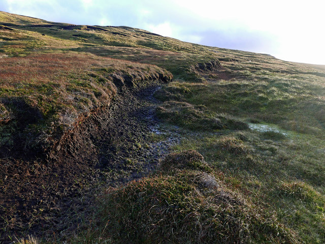
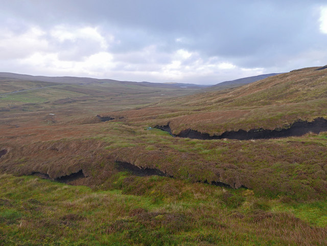
The moorland in Mid Dale offers a stark contrast to the downs, with its rugged terrain and dense vegetation. Here, visitors can find heather-clad hills and peat bogs, creating a unique and diverse ecosystem. The moorland is a haven for wildlife, including various species of birds, mammals, and insects.

Mid Dale is a paradise for nature enthusiasts and hikers, offering numerous walking trails and paths that allow visitors to explore the area's natural wonders. The region also boasts several viewpoints, providing panoramic vistas of the surrounding countryside and coastline.

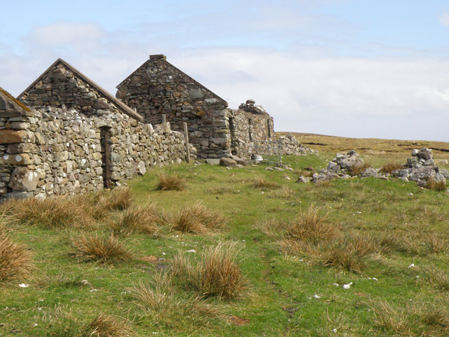
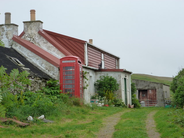
In addition to its natural beauty, Mid Dale is also home to a small community of residents who embrace a rural lifestyle. The area is dotted with traditional Shetland crofts and farmsteads, adding to its charm and authenticity.

Overall, Mid Dale in Shetland offers visitors a chance to immerse themselves in the tranquility and splendor of the Scottish countryside, with its downs and moorland providing a captivating backdrop for exploration and relaxation.

If you have any feedback on the listing, please let us know in the comments section below.

Mid Dale Images

Images are sourced within 2km of 60.262129/-1.6651319 or Grid Reference HU1853. Thanks to Geograph Open Source API. All images are credited.

Peat hags on Sneugans Moorland above the Dale of Walls.
Peat hags on Sneugans
Moorland above the Dale of Walls.
Moorland above the Burn of Dale Looking back to the head of the valley leading to Dale of Walls.
Moorland above the Burn of Dale
Looking back to the head of the valley leading to Dale of Walls.
'Panda' sheep, Dale of Walls
Ruins at Litlapund
Ruins at Litlapund
Ruined cottage at Litlapund See also <a href="https://www.geograph.org.uk/photo/1297262">HU2053 : Ruins at Litlapund</a>. A day of very low cloud.
Ruined cottage at Litlapund
See also HU2053 : Ruins at Litlapund. A day of very low cloud.
Dale of Walls: Loch of Goster and view of Foula The island of Foula is faintly visible on the horizon as we look out to sea over the Loch of Goster.
Dale of Walls: Loch of Goster and view of Foula
The island of Foula is faintly visible on the horizon as we look out to sea over the Loch of Goster.
Dale of Walls: telephone box and cottage This very isolated telephone box cannot surely see much use - well, attempted use, I should say: I lifted the handset and could get no tone whatsoever!
Dale of Walls: telephone box and cottage
This very isolated telephone box cannot surely see much use - well, attempted use, I should say: I lifted the handset and could get no tone whatsoever!
Horses at Dale
Horses at Dale
Cley Stacks, Shetland Islands Cley Stacks across Coppa Wick, Shetland Islands
Cley Stacks, Shetland Islands
Cley Stacks across Coppa Wick, Shetland Islands
Netherdale, Shetland Islands Netherdale crofts in the Dale of Walls, Shetland Islands
Netherdale, Shetland Islands
Netherdale crofts in the Dale of Walls, Shetland Islands
Beach at Voe of Dale, Dale of Walls
Gate to a view of the Burn of Dale It's easy to post photos of Shetland only when it is sunny - so here is one showing a more realistic view!
Gate to a view of the Burn of Dale
It's easy to post photos of Shetland only when it is sunny - so here is one showing a more realistic view!
Cattle grid,and Netherdale beyond
Remains of an enclosure at Swinland, Dale of Walls
Looking across rough pasture to the Loch of Goster and cliff edges beyond
Beach at the head of the Voe of Dale
Voe of Dale
Voe of Dale
Scord of Simlifield Peat bog and black sheep.
Scord of Simlifield
Peat bog and black sheep.
Show me another place!

Mid Dale is located at Grid Ref: HU1853 (Lat: 60.262129, Lng: -1.6651319)

Unitary Authority: Shetland Islands

Police Authority: Highlands and Islands

What 3 Words

///juniors.reconnect.ally. Near Walls, Shetland Islands

Nearby Locations

Blouk Field Mid Dale

Related Wikis

Sandness

Sandness (the "d" is not pronounced locally) is a headland and district in the west of Shetland Mainland, Scotland. Sandness was a civil parish, which...

Bousta

Bousta is a settlement on Mainland, in Shetland, Scotland. Bousta is situated in the parish of Walls and Sandness.Scott's Hawkweed is native to the pastures...

Forewick Holm

Forewick Holm is a 1-hectare (2.5-acre) island in the Sound of Papa in the Shetland islands, Scotland. Located between Papa Stour and the Sandness peninsula...

Papa Stour Airstrip

Papa Stour Airstrip is a small airstrip in the village of Biggings on the island of Papa Stour. Shetland, Scotland. == History == Papa Stour Airstrip opened...

Nearby Amenities

Located within 500m of 60.262129,-1.6651319
Punds
Place: locality
Lat/Long: 60.2599464/-1.6726486
Power: pole
Lat/Long: 60.258419/-1.6686909
Power: pole
Lat/Long: 60.2586001/-1.6675056
Power: pole
Lat/Long: 60.2587904/-1.6662277
Power: pole
Lat/Long: 60.2589532/-1.665144
Power: pole
Lat/Long: 60.2591308/-1.6639425
Power: pole
Lat/Long: 60.2593074/-1.6627363
Power: pole
Lat/Long: 60.2594954/-1.6615324
Power: pole
Lat/Long: 60.2596432/-1.660481
Power: pole
Lat/Long: 60.2597888/-1.6595082
Power: pole
Lat/Long: 60.2599688/-1.6582928
Power: pole
Lat/Long: 60.2601613/-1.6569965
The data included in this document is from www.openstreetmap.org. The data is made available under ODbL.

Have you been to Mid Dale?

Leave your review of Mid Dale below (or comments, questions and feedback).