Burnt Heath

Downs, Moorland in Yorkshire Harrogate

England

Burnt Heath

Greygarth Monument Erected to celebrate Queen Victoria's Diamond Jubilee in 1897.  This spot affords tremendous views on a clear day, particularly to the east, over the Vale of York to the White Horse of Kilburn and the North York Moors.
Greygarth Monument Credit: Chris Heaton

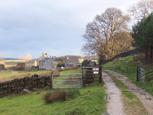
Burnt Heath is a picturesque area located in the county of Yorkshire, England. Nestled amidst the beautiful Yorkshire Downs and Moorland, it offers a stunning natural landscape that attracts both locals and tourists alike.

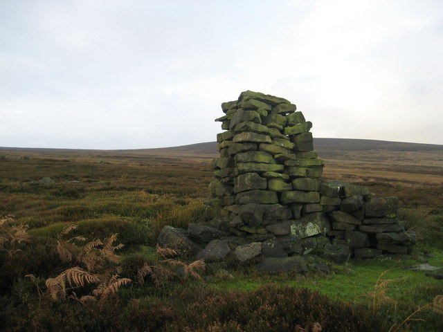
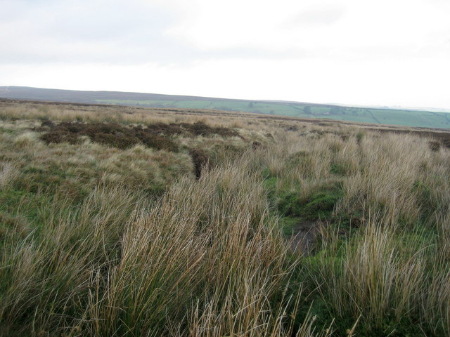
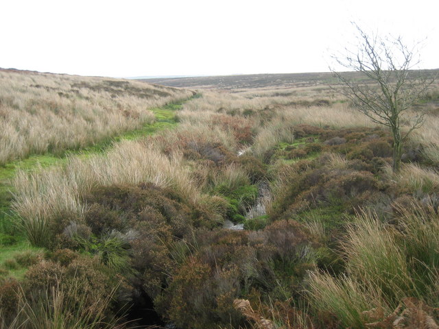
The heath is characterized by its rolling hills, vast open spaces, and vibrant vegetation. It is mainly covered with heather, giving it a stunning purple hue during the summer months. The heath is also home to a variety of wildlife and bird species, making it a haven for nature enthusiasts and bird watchers.

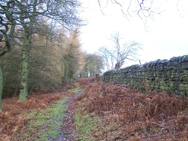
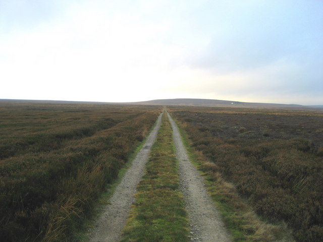
The terrain of Burnt Heath is diverse, ranging from gentle slopes to rugged terrain with rocky outcrops. This makes it an ideal destination for hikers and walkers who can explore the various trails that crisscross the area. One of the most popular routes is the Burnt Heath Circular Walk, offering breathtaking views of the surrounding countryside.

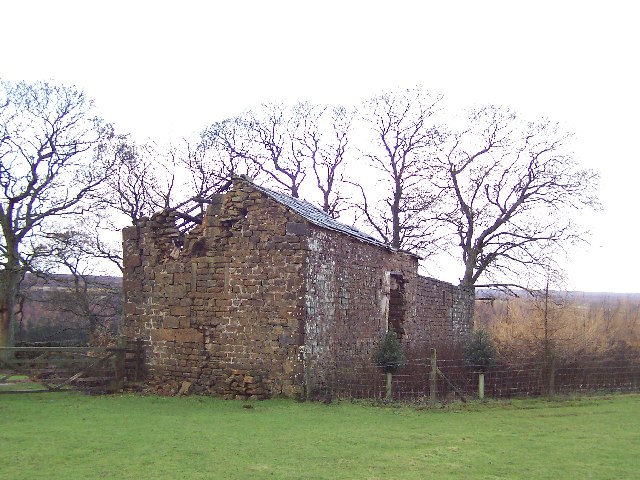
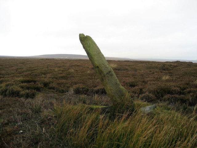
The heath is also rich in history. It is believed that the area has been inhabited since ancient times, with evidence of prehistoric settlements discovered nearby. The remnants of stone circles and burial mounds can still be seen, adding to the allure of the place.

Visitors to Burnt Heath can enjoy a peaceful and tranquil atmosphere, away from the hustle and bustle of city life. It is a perfect spot for picnics, nature photography, or simply immersing oneself in the beauty of the surroundings. With its stunning landscapes and rich history, Burnt Heath is a gem in the heart of Yorkshire that should not be missed.

If you have any feedback on the listing, please let us know in the comments section below.
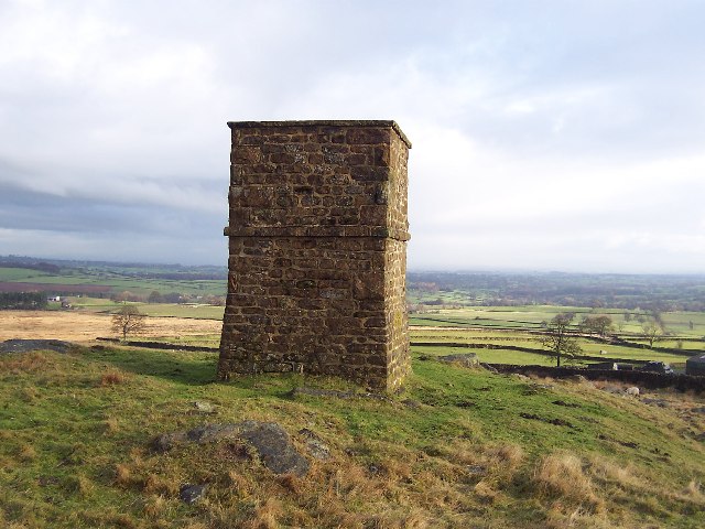
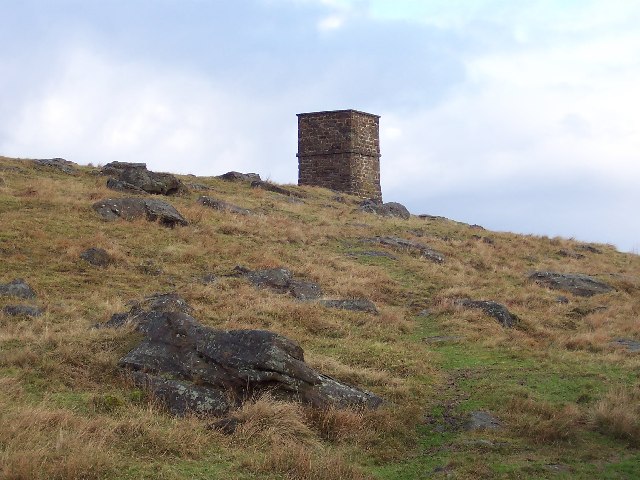
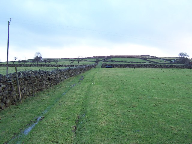
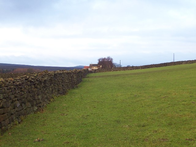
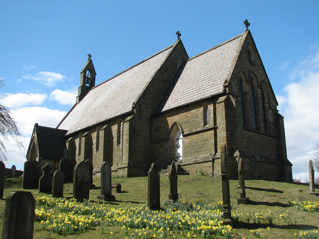
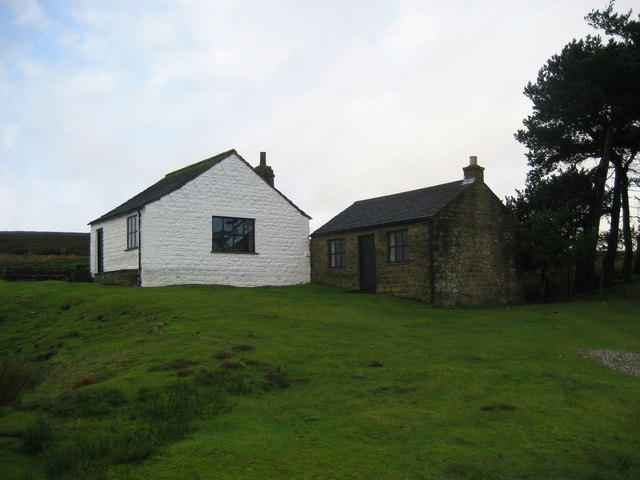
Burnt Heath Images

Images are sourced within 2km of 54.129526/-1.7252805 or Grid Reference SE1870. Thanks to Geograph Open Source API. All images are credited.

Greygarth Monument Erected to celebrate Queen Victoria's Diamond Jubilee in 1897.  This spot affords tremendous views on a clear day, particularly to the east, over the Vale of York to the White Horse of Kilburn and the North York Moors.
Greygarth Monument
Erected to celebrate Queen Victoria's Diamond Jubilee in 1897. This spot affords tremendous views on a clear day, particularly to the east, over the Vale of York to the White Horse of Kilburn and the North York Moors.
Approach to Greygarth Monument There is a right of way over Greygarth Hill to reach the monument from the west.
Approach to Greygarth Monument
There is a right of way over Greygarth Hill to reach the monument from the west.
Green Lane leading away from Dallowgill to Greygarth Pleasant preamble through upland pastures near Greygarth.
Green Lane leading away from Dallowgill to Greygarth
Pleasant preamble through upland pastures near Greygarth.
Approaching Bents House Crossing upland pastures from the east, above the valley of Dallowgill to reach the farm known as Bents House
Approaching Bents House
Crossing upland pastures from the east, above the valley of Dallowgill to reach the farm known as Bents House
Dallow Collection of houses that make up the hamlet of Dallow, from the west.
Dallow
Collection of houses that make up the hamlet of Dallow, from the west.
Abandoned Farm Buildings, Dallowgill Close to Bents House, and above the wooded cleft of Dallowgill.
Abandoned Farm Buildings, Dallowgill
Close to Bents House, and above the wooded cleft of Dallowgill.
Woods in Dallowgill
Woods in Dallowgill
Art near Stang Brae, Dallowgill Supplemental, I agree.  The area around Dallowgill has several of these mosaics in odd places, almost like a treasure hunt.  Someone with an artistic flair has gone to much trouble.
Art near Stang Brae, Dallowgill
Supplemental, I agree. The area around Dallowgill has several of these mosaics in odd places, almost like a treasure hunt. Someone with an artistic flair has gone to much trouble.
Saint Peter's Church, Dallowgill. A springtime view of a secluded chapel within Southern Nidderdale.
Saint Peter's Church, Dallowgill.
A springtime view of a secluded chapel within Southern Nidderdale.
Saint Peter's Church Lovely little church far from any large concentrations of population.
Saint Peter's Church
Lovely little church far from any large concentrations of population.
Mechanised Shepherd, Dallow Moor Modern shepherd herding his sheep off the moor, and following this track to Harper Hill
Mechanised Shepherd, Dallow Moor
Modern shepherd herding his sheep off the moor, and following this track to Harper Hill
Kettlestang Shooting House Very isolated location on the wilderness of Dallowgill Moor
Kettlestang Shooting House
Very isolated location on the wilderness of Dallowgill Moor
Rudimentary Shelter, Dallowgill Moor This very rough stone construction can be found above South Gill Beck, just off the access track to Kettlestang Shooting House
Rudimentary Shelter, Dallowgill Moor
This very rough stone construction can be found above South Gill Beck, just off the access track to Kettlestang Shooting House
Bogs Dike This tiny watercourse is almost hidden by moorland vegetation.  Plenty of grouse in this location.
Bogs Dike
This tiny watercourse is almost hidden by moorland vegetation. Plenty of grouse in this location.
Tracks on Harper Hill Junction of tracks - the one to the left leads to Dallow Moor, while the other one heads for Wake Hill
Tracks on Harper Hill
Junction of tracks - the one to the left leads to Dallow Moor, while the other one heads for Wake Hill
Boundary Stone, Dallowgill Moor Beside the access track to Kettlestang Shooting House, this particular stone has leaned a long way from the intended perpendicular
Boundary Stone, Dallowgill Moor
Beside the access track to Kettlestang Shooting House, this particular stone has leaned a long way from the intended perpendicular
Access Track, Dallowgill Moor Track leading to Kettlestang Shooting House
Access Track, Dallowgill Moor
Track leading to Kettlestang Shooting House
South Gill Beck Small watercourse on Dallowgill Moor
South Gill Beck
Small watercourse on Dallowgill Moor
Show me another place!

Burnt Heath is located at Grid Ref: SE1870 (Lat: 54.129526, Lng: -1.7252805)

Division: West Riding

Administrative County: North Yorkshire

District: Harrogate

Police Authority: North Yorkshire

What 3 Words

///opera.obtain.firming. Near Pateley Bridge, North Yorkshire

Related Wikis

Dallowgill

Dallowgill (historically also Dallaghill) is a village in Harrogate district in North Yorkshire, England. It consists of a number of scattered settlements...

High and Low Bishopside

High and Low Bishopside is a civil parish in Nidderdale in the Harrogate district, in the county of North Yorkshire, England. It includes the town of Pateley...

Wath-in-Nidderdale

Wath, sometimes known as Wath-in-Nidderdale to distinguish it from other places named Wath, is a village in the Harrogate district of North Yorkshire,...

Wath-in-Nidderdale railway station

Wath-in-Nidderdale railway station, was one of two intermediate stations on the Nidd Valley Light Railway, in Wath-in-Nidderdale, Yorkshire, England. The...

Have you been to Burnt Heath?

Leave your review of Burnt Heath below (or comments, questions and feedback).