Askwith Moor

Downs, Moorland in Yorkshire Harrogate

England

Askwith Moor

Snowden Crags Northward view, Crag House in the middle distance, High Snowden beyond.
Snowden Crags Credit: David Spencer

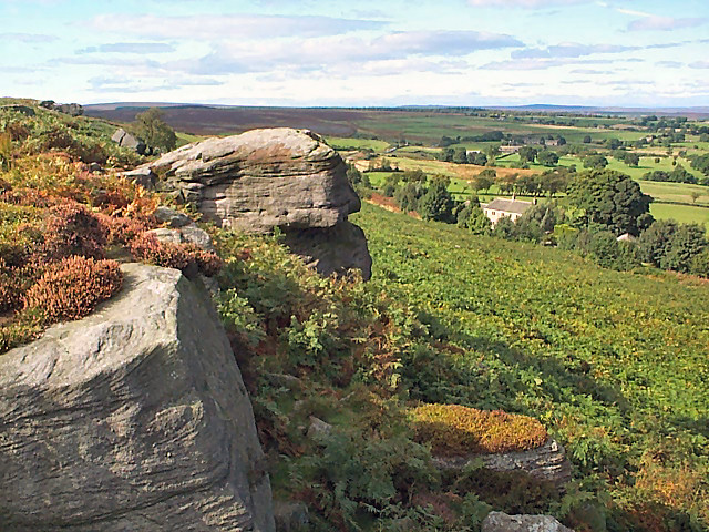
Askwith Moor is a picturesque area located in the county of Yorkshire, England. Situated within the Yorkshire Dales National Park, it is known for its stunning natural beauty and rich historical significance. Covering an area of approximately 1,700 acres, Askwith Moor is characterized by its rolling hills, expansive moorland, and breathtaking views of the surrounding countryside.

The moorland of Askwith Moor is home to a diverse range of flora and fauna, making it an important conservation site. Visitors can expect to see a variety of plant species, including heather, bracken, and wildflowers, which create a vibrant and colorful landscape, especially during the summer months. The area also provides a habitat for several bird species, such as curlews, lapwings, and red grouse, making it a popular destination for birdwatchers.

In addition to its natural beauty, Askwith Moor holds historical significance. The area contains several ancient settlements, including prehistoric burial mounds and stone circles, providing evidence of human activity in the area dating back thousands of years. These archaeological sites offer a glimpse into the lives and traditions of earlier civilizations.

Visitors to Askwith Moor can explore the area through a network of well-maintained footpaths and trails. Hiking and walking are popular activities, allowing visitors to enjoy the tranquility of the moorland and take in the stunning views of the Yorkshire landscape. The area also offers opportunities for photography, wildlife spotting, and picnicking.

Overall, Askwith Moor is a captivating destination that combines natural beauty, historical significance, and recreational activities, offering visitors a unique and memorable experience in the heart of Yorkshire.

If you have any feedback on the listing, please let us know in the comments section below.
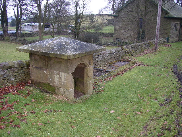
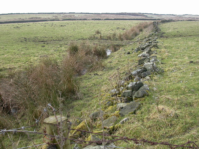
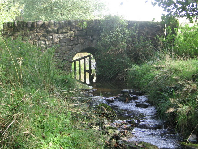
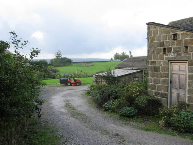
Askwith Moor Images

Images are sourced within 2km of 53.957506/-1.7430838 or Grid Reference SE1651. Thanks to Geograph Open Source API. All images are credited.

Snowden Crags Northward view, Crag House in the middle distance, High Snowden beyond.
Snowden Crags
Northward view, Crag House in the middle distance, High Snowden beyond.
Old quarry, Snowden Carr The farmer has shrewdly sheltered two beehives in the bottom.  Eastward view with Hunter's Stones microwave tower (at Norwood Edge) in the distance.
Old quarry, Snowden Carr
The farmer has shrewdly sheltered two beehives in the bottom. Eastward view with Hunter's Stones microwave tower (at Norwood Edge) in the distance.
Snowden Carr Rock-strewn heather moorland sloping down to the east.  Eastward view with the entirely innocuous ( <span class="nowrap"><a title="http://duncan.gn.apc.org/menwith.htm" rel="nofollow ugc noopener" href="http://duncan.gn.apc.org/menwith.htm">Link</a><img style="margin-left:2px;" alt="External link" title="External link - shift click to open in new window" src="https://s1.geograph.org.uk/img/external.png" width="10" height="10"/></span> ) Hunter's Stones microwave tower in the distance.
Snowden Carr
Rock-strewn heather moorland sloping down to the east. Eastward view with the entirely innocuous ( LinkExternal link ) Hunter's Stones microwave tower in the distance.
Tree of Life Stone, Snowden Carr Prehistoric cup marked rock carving (possibly Bronze Age).  Despite the stone's modern name, it is not known whether the carving was intended to depict a tree.
Tree of Life Stone, Snowden Carr
Prehistoric cup marked rock carving (possibly Bronze Age). Despite the stone's modern name, it is not known whether the carving was intended to depict a tree.
Tree of Life Stone, Snowden Carr (detail) Detail of the prehistoric cup marked rock carving.
Tree of Life Stone, Snowden Carr (detail)
Detail of the prehistoric cup marked rock carving.
Low Snowden and Washburn Farm Looking northeastwards from Snowden Carr Road. Swinsty Reservoir beyond.
Low Snowden and Washburn Farm
Looking northeastwards from Snowden Carr Road. Swinsty Reservoir beyond.
Dob Park Seen from Snowden Carr Road, this farmland is the former site of Dob Park.  Dob Park Woods lie to the left and the ruined Dob Park Lodge is the speck on the skyline centre-right and just outside the gridsquare.
Dob Park
Seen from Snowden Carr Road, this farmland is the former site of Dob Park. Dob Park Woods lie to the left and the ruined Dob Park Lodge is the speck on the skyline centre-right and just outside the gridsquare.
The western end of Timble Village Here there is a little green with an information board about the area (although in the village it only mentions an old oak).  To the left a little lane leads down to some houses and a farm.
The western end of Timble Village
Here there is a little green with an information board about the area (although in the village it only mentions an old oak). To the left a little lane leads down to some houses and a farm.
The old lane to Blubberhouses Moor, Great Timble This is shown as a through road to Bolton Bridge on Thomas Jeffreys's map of 1775.  Now it leads to a track over the moor that has been ruined by motor vehicles but has now had a traffic order to prohibit such abuse.  The brick building belongs to Sourby Old Farm.
The old lane to Blubberhouses Moor, Great Timble
This is shown as a through road to Bolton Bridge on Thomas Jeffreys's map of 1775. Now it leads to a track over the moor that has been ruined by motor vehicles but has now had a traffic order to prohibit such abuse. The brick building belongs to Sourby Old Farm.
The lane to the SE from Timble village This lane starts at the western end of the village and leads to High Field Farm and footpaths beyond it.  This view is looking E from a point just beyond a track to the N leading to the Timble Inn.
The lane to the SE from Timble village
This lane starts at the western end of the village and leads to High Field Farm and footpaths beyond it. This view is looking E from a point just beyond a track to the N leading to the Timble Inn.
New road sign at Sourby, Great Timble, Yorkshire This lane leads to Blubberhouses Moor, across which is an ancient highway to Beamsley and Bolton Bridge.  This has recently had traffic regulation orders imposed on it, for 5 years, due to the severe damage caused by recreational motorbikes and 4x4s.  (see also SE1653, which starts at the first telephone pole)
New road sign at Sourby, Great Timble, Yorkshire
This lane leads to Blubberhouses Moor, across which is an ancient highway to Beamsley and Bolton Bridge. This has recently had traffic regulation orders imposed on it, for 5 years, due to the severe damage caused by recreational motorbikes and 4x4s. (see also SE1653, which starts at the first telephone pole)
Sourby Old Farm, Great Timble, Yorkshire A typical Yorkshire Dales stone-built farmhouse.
Sourby Old Farm, Great Timble, Yorkshire
A typical Yorkshire Dales stone-built farmhouse.
Timble Village, Great Timble, North Yorkshire On the left is the Village Institute, and opposite it, out of sight, the Timble Inn.
Timble Village, Great Timble, North Yorkshire
On the left is the Village Institute, and opposite it, out of sight, the Timble Inn.
Village well, Great Timble, North Yorkshire This well looks to have been made (in the 18C?) by a benelovent Lord of the Manor.  There are what look to be filled-up water troughs next to it.
Village well, Great Timble, North Yorkshire
This well looks to have been made (in the 18C?) by a benelovent Lord of the Manor. There are what look to be filled-up water troughs next to it.
The Eastern slopes of Ellarcarr Pike The photograph is taken from the Otley to Blubberhouses road close to the entrance to Shaw Hall.
The Eastern slopes of Ellarcarr Pike
The photograph is taken from the Otley to Blubberhouses road close to the entrance to Shaw Hall.
Gateway to Shaw Hall An impressive gateway from the Otley to Blubberhouses Road.
Gateway to Shaw Hall
An impressive gateway from the Otley to Blubberhouses Road.
Hundwith Beck The public footpath crosses this bridge before 
being re-routed through the plantation.
Hundwith Beck
The public footpath crosses this bridge before being re-routed through the plantation.
Whin Hill Farm The entrance to the non-working farm. 
Mown paths through meadows and a lake provide the perfect hide-away!
Whin Hill Farm
The entrance to the non-working farm. Mown paths through meadows and a lake provide the perfect hide-away!
Show me another place!

Askwith Moor is located at Grid Ref: SE1651 (Lat: 53.957506, Lng: -1.7430838)

Division: West Riding

Administrative County: North Yorkshire

District: Harrogate

Police Authority: North Yorkshire

What 3 Words

///restore.interests.chest. Near Burley in Wharfedale, West Yorkshire

Related Wikis

Snowden Crags

Snowden Crags is a prehistoric archaeological site on Askwith Moor in North Yorkshire, England. Local antiquarian Eric Cowling recorded a stone circle...

Fewston

Fewston is a village and civil parish in the Harrogate district of North Yorkshire, England. It is situated north of Otley and close to Swinsty and Fewston...

Timble

Timble is a village in the Harrogate district of North Yorkshire, England. It is situated on the slopes of the Washburn valley, north of Otley and close...
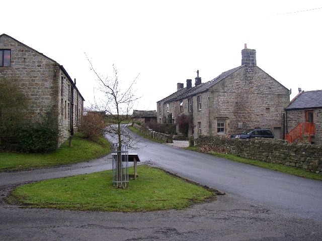
Askwith

Askwith is a village and civil parish in North Yorkshire, England, with a population of 220 (2001 census), increasing to 240 at the 2011 Census. The village...

Nearby Amenities

Located within 500m of 53.957506,-1.7430838
Alt Name: Shooting House Hill
Ele: 300.8
Man Made: survey_point
Natural: peak
Ref: S7875
Source: survey
Source Alt Name: OS 1:25k
Source Name: NLS-OS-NatGrid-110k-1940-60
Lat/Long: 53.955381/-1.7408512
Askwith Moor
Natural: moor
Source: NPE
Lat/Long: 53.9552449/-1.7485462
Askwith Moor
Natural: moor
Source: NPE
Lat/Long: 53.9534535/-1.7442205
Back Well
Natural: spring
Source: OS 1:25k
Lat/Long: 53.9582983/-1.7432917
The data included in this document is from www.openstreetmap.org. The data is made available under ODbL.

Have you been to Askwith Moor?

Leave your review of Askwith Moor below (or comments, questions and feedback).