Carle Moor

Downs, Moorland in Yorkshire Harrogate

England

Carle Moor

North Gill Beck, Dallowgill
North Gill Beck, Dallowgill Credit: Terry Box

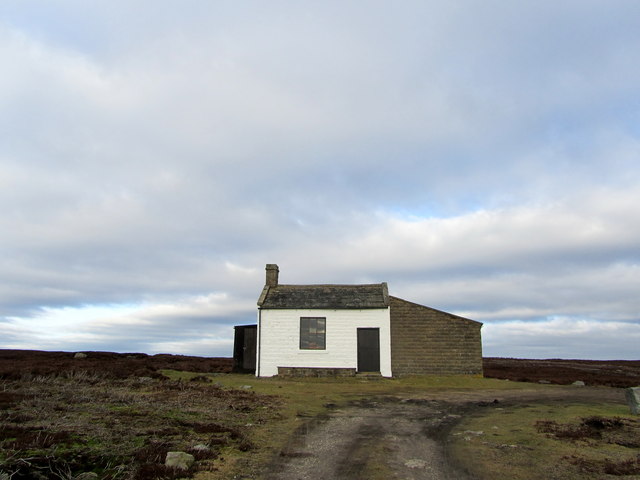
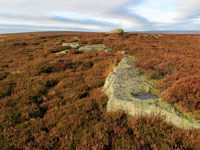
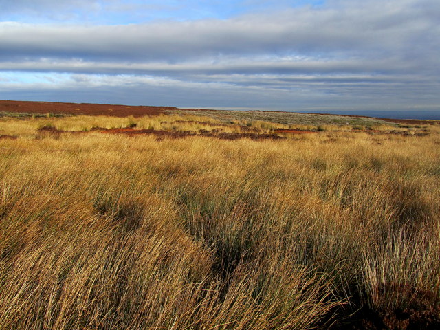
Carle Moor is a picturesque area located in Yorkshire, England, known for its stunning downs and moorland landscapes. Situated in the northern part of the county, it stretches across several miles of rolling hills and open countryside. The moorland is characterized by its expansive heather-covered hills, scattered with rocky outcrops and patches of dense woodland.

Carle Moor is a haven for wildlife enthusiasts, as it is home to a variety of bird species, including grouse, curlew, and golden plover. The moorland also supports a diverse range of plant life, with vibrant displays of purple heather dominating the landscape during the summer months.

The area is a popular destination for outdoor activities, such as hiking, cycling, and horse riding. Numerous trails crisscross the moor, offering breathtaking views of the surrounding countryside. These paths are suitable for all levels of fitness and provide a chance to immerse oneself in the tranquility of the natural surroundings.

Carle Moor is also steeped in history, with evidence of Bronze Age settlements and ancient burial sites scattered throughout the area. The remnants of stone circles and burial mounds serve as a reminder of the rich cultural heritage of the region.

Visitors to Carle Moor can experience the beauty of the Yorkshire countryside, enjoy a peaceful retreat from the bustling city life, and discover the history and wildlife that make this moorland so special.

If you have any feedback on the listing, please let us know in the comments section below.

Carle Moor Images

Images are sourced within 2km of 54.162466/-1.7421081 or Grid Reference SE1674. Thanks to Geograph Open Source API. All images are credited.

North Gill Beck, Dallowgill
Track on Near Toady Bank Track leaving the road to Ramsgill at Near Toady Bank over the wilderness of Kirkby Malzeard Moor
Track on Near Toady Bank
Track leaving the road to Ramsgill at Near Toady Bank over the wilderness of Kirkby Malzeard Moor
Moorland Road to Ramsgill The sign at the beginning of this road near Greygarth informs drivers it is unsuitable for motor vehicles - the road, indeed, degenerates into a rough track about a mile further on.
Moorland Road to Ramsgill
The sign at the beginning of this road near Greygarth informs drivers it is unsuitable for motor vehicles - the road, indeed, degenerates into a rough track about a mile further on.
Far Toady Bank Looking over a large expanse of moorland wilderness
Far Toady Bank
Looking over a large expanse of moorland wilderness
The Shooting Lodge on Carle Moor Lonely and isolated building of Carle Moor, visible for miles around especially from the south.
The Shooting Lodge on Carle Moor
Lonely and isolated building of Carle Moor, visible for miles around especially from the south.
Maiden Crags This seems rather a grand name for a line of small gritstone outcrops scattered along the moor - perhaps Maiden Stones would be more appropriate
Maiden Crags
This seems rather a grand name for a line of small gritstone outcrops scattered along the moor - perhaps Maiden Stones would be more appropriate
Black Dike or Gutter The location of the watercourse is indicated by the rushes that choke the little dike
Black Dike or Gutter
The location of the watercourse is indicated by the rushes that choke the little dike
Looking towards Carle Tower As seen from the ruined sheep shelter above Black Dike - I was intending to visit the sighting tower, but thick heather and two deep chasms persuaded me otherwise
Looking towards Carle Tower
As seen from the ruined sheep shelter above Black Dike - I was intending to visit the sighting tower, but thick heather and two deep chasms persuaded me otherwise
Ruined Stone Shelter on Kirkby Malzeard Moor Located high above Black Dike, this structure now resembles a badly constructed grouse butt
Ruined Stone Shelter on Kirkby Malzeard Moor
Located high above Black Dike, this structure now resembles a badly constructed grouse butt
Kirkby Malzeard Moor Managed grouse moor on the eastern flanks of the Pennines. Colourful moorland contrasts with a threatening sky.
Kirkby Malzeard Moor
Managed grouse moor on the eastern flanks of the Pennines. Colourful moorland contrasts with a threatening sky.
Hawset Ford This ford is found on the Carlesmoor Beck at Hawset.
Hawset Ford
This ford is found on the Carlesmoor Beck at Hawset.
Ford at Hawset This is one of a number of minor fords on the track at Hawset.
Ford at Hawset
This is one of a number of minor fords on the track at Hawset.
Olly's grouse butt and memorial cairn This grouse butt on Dallowgill Moor is that used by Frederick Oliver [Olly] Robinson, 2nd Marquess of Ripon on the day he died aged 71. More detail on other photos for this square.
Olly's grouse butt and memorial cairn
This grouse butt on Dallowgill Moor is that used by Frederick Oliver [Olly] Robinson, 2nd Marquess of Ripon on the day he died aged 71. More detail on other photos for this square.
Memorial Stone on the moor Shown as a memorial stone on the OS map, although I would describe it as a cairn. It marks the spot where Frederick Oliver Robinson, 2nd Marquess of Ripon died aged 71 on the 22nd September 1923, having spent the morning on a successful grouse shoot. More details on the close up of the cairn.
Memorial Stone on the moor
Shown as a memorial stone on the OS map, although I would describe it as a cairn. It marks the spot where Frederick Oliver Robinson, 2nd Marquess of Ripon died aged 71 on the 22nd September 1923, having spent the morning on a successful grouse shoot. More details on the close up of the cairn.
Close up of memorial stone The inscription is becoming hard to decipher after nearly 100 years of wind, rain and the growth of lichen. It commemorates the death of Frederick Oliver Robinson, second Marquess of Ripon on the 22nd of September 1923 who collapsed here after a successful morning's grouse shoot. It appears that the marquess was quite a shot and anything that was fur or feather was in danger if he was nearby with his gun. On the morning he died he had shot 52 grouse, but his lifetime total of bird kills is phenomenal with [according to Wikipedia] 556,000 bird kills which included 241,000 pheasants. Obviously a conservationist of the old school.
Close up of memorial stone
The inscription is becoming hard to decipher after nearly 100 years of wind, rain and the growth of lichen. It commemorates the death of Frederick Oliver Robinson, second Marquess of Ripon on the 22nd of September 1923 who collapsed here after a successful morning's grouse shoot. It appears that the marquess was quite a shot and anything that was fur or feather was in danger if he was nearby with his gun. On the morning he died he had shot 52 grouse, but his lifetime total of bird kills is phenomenal with [according to Wikipedia] 556,000 bird kills which included 241,000 pheasants. Obviously a conservationist of the old school.
The valley of North Gill Beck Several small stream draining from the heather moorland combine to form North Gill Beck, a steep sided valley soon being carved out of the moorside. looking downstream where heather moorland gives way to a tree filled gill.
The valley of North Gill Beck
Several small stream draining from the heather moorland combine to form North Gill Beck, a steep sided valley soon being carved out of the moorside. looking downstream where heather moorland gives way to a tree filled gill.
Nearing the crest of Sandy Hill Part of the old track over the moor from Ilton and Kirkby Malzeard towards Lofthouse and Ramsgill in Nidderdale. It seemed prudent not to proceed much further due to the sounds of gunfire over the hill.
Nearing the crest of Sandy Hill
Part of the old track over the moor from Ilton and Kirkby Malzeard towards Lofthouse and Ramsgill in Nidderdale. It seemed prudent not to proceed much further due to the sounds of gunfire over the hill.
Downhill towards the vale The track and county road over the moor from upper Nidderdale towards Ilton and Kirkby Malzeard with the Vale of Mowbray far below and the line of the Hambleton Hills in the distance. This is part of a medieval route linking granges in Nidderdale with their abbeys at Byland and Fountains and with the market that was established in Kirkby Malzeard in 1307.  A glance at the map will show Fountains Earth Moor a short way to the south west as that abbey owned much of this land but granted rights [for a fee] to Byland to bring goods and beasts this way.
Downhill towards the vale
The track and county road over the moor from upper Nidderdale towards Ilton and Kirkby Malzeard with the Vale of Mowbray far below and the line of the Hambleton Hills in the distance. This is part of a medieval route linking granges in Nidderdale with their abbeys at Byland and Fountains and with the market that was established in Kirkby Malzeard in 1307. A glance at the map will show Fountains Earth Moor a short way to the south west as that abbey owned much of this land but granted rights [for a fee] to Byland to bring goods and beasts this way.
Show me another place!

Carle Moor is located at Grid Ref: SE1674 (Lat: 54.162466, Lng: -1.7421081)

Division: West Riding

Administrative County: North Yorkshire

District: Harrogate

Police Authority: North Yorkshire

What 3 Words

///improve.struts.clearcut. Near Pateley Bridge, North Yorkshire

Nearby Locations

Carle Moor

Related Wikis

Dallowgill

Dallowgill (historically also Dallaghill) is a village in Harrogate district in North Yorkshire, England. It consists of a number of scattered settlements...

Roundhill Reservoir

Roundhill Reservoir is situated near Leighton Reservoir in North Yorkshire, England. It was constructed by Harrogate Corporation early in the 20th century...

Leighton Reservoir

Leighton Reservoir is a reservoir which drains via the River Burn to the River Ure in North Yorkshire, England. It neighbours Roundhill Reservoir and is...

Ilton, North Yorkshire

Ilton is a village in North Yorkshire, England, 3 miles south-west of Masham. It is the principal settlement in the civil parish of Ilton cum Pott, in...

Nearby Amenities

Located within 500m of 54.162466,-1.7421081
Carle Moor
Is In: UK,Yorkshire,North Yorkshire,Nidderdale
Is In Country: UK
Is In County: North Yorkshire
Is In Historical County: Yorkshire
Natural: moor
Source: NPE
Lat/Long: 54.1614232/-1.7352941
The data included in this document is from www.openstreetmap.org. The data is made available under ODbL.

Have you been to Carle Moor?

Leave your review of Carle Moor below (or comments, questions and feedback).