Barton Down

Downs, Moorland in Wiltshire

England

Barton Down

The Wessex Ridgeway path on Manton Down On the Manton Park racehorse training estate.
The Wessex Ridgeway path on Manton Down Credit: Tim Heaton

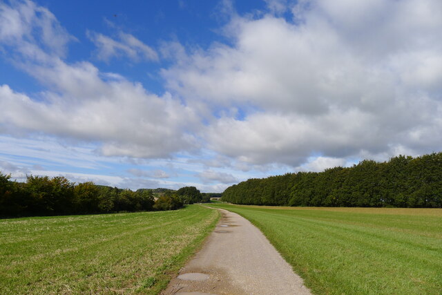
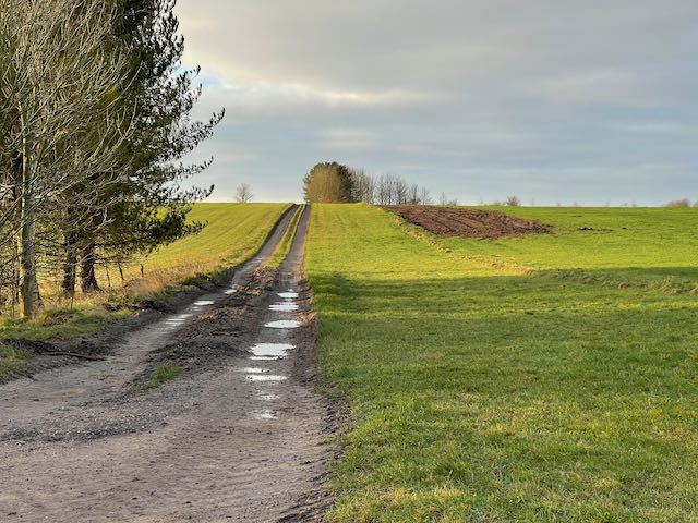
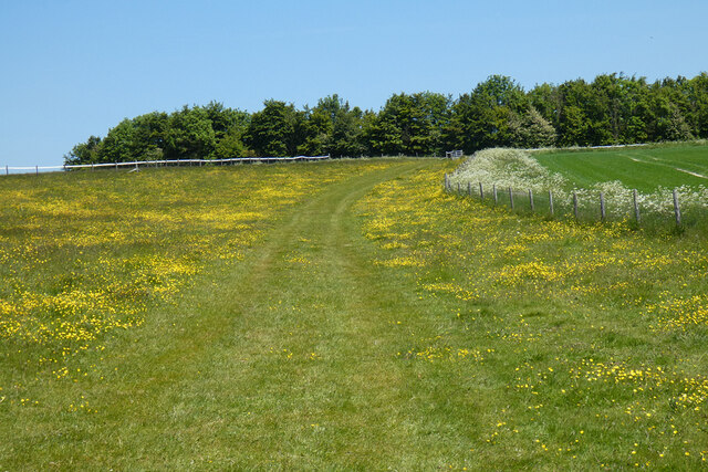
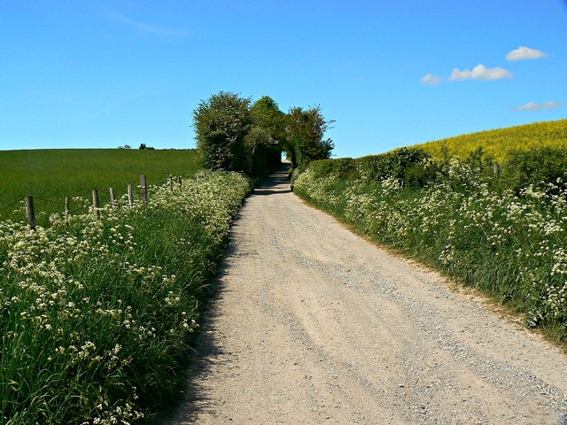
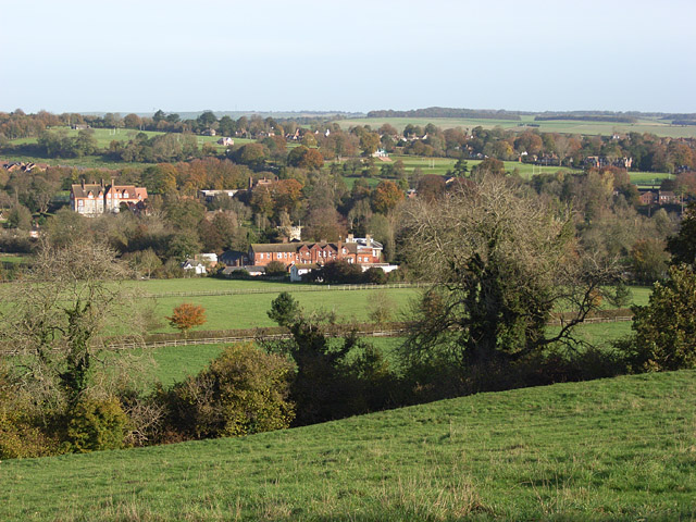
Barton Down is a picturesque area located in the county of Wiltshire, England. It is situated on the southern edge of the Salisbury Plain, encompassing a vast expanse of downs and moorland. The region is well-known for its natural beauty, offering visitors stunning panoramic views of the surrounding countryside.

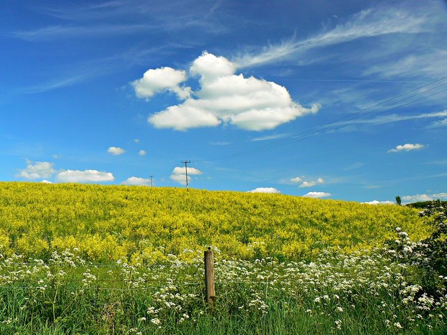
Covering an area of approximately 500 hectares, Barton Down is characterized by its rolling hills, open grasslands, and scattered patches of woodland. The downland is predominantly composed of chalk, resulting in a unique ecosystem that supports a diverse range of flora and fauna. Wildflowers such as harebells, rock rose, and cowslips can be found dotting the landscape, creating a vibrant display during the summer months.

The area is also home to several species of birds, including the stone curlew, skylark, and yellowhammer. These avian residents, along with a variety of insects and small mammals, make Barton Down a popular destination for wildlife enthusiasts and nature lovers.

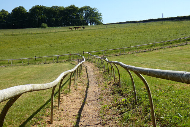
Aside from its natural beauty, Barton Down also holds historical significance. The remains of ancient settlements and burial mounds can be found within the area, providing insight into the region's rich past. The downland has been grazed by livestock for centuries, playing an important role in the local agricultural practices and shaping the landscape over time.

Barton Down is a tranquil and idyllic location, offering visitors an opportunity to immerse themselves in the beauty of the English countryside while exploring its diverse natural and historical features.

If you have any feedback on the listing, please let us know in the comments section below.
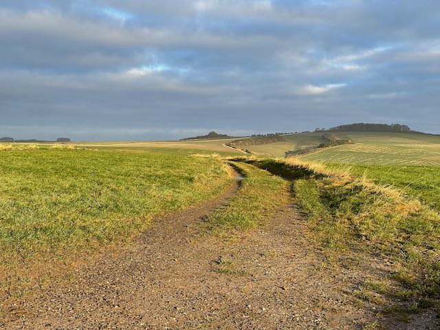
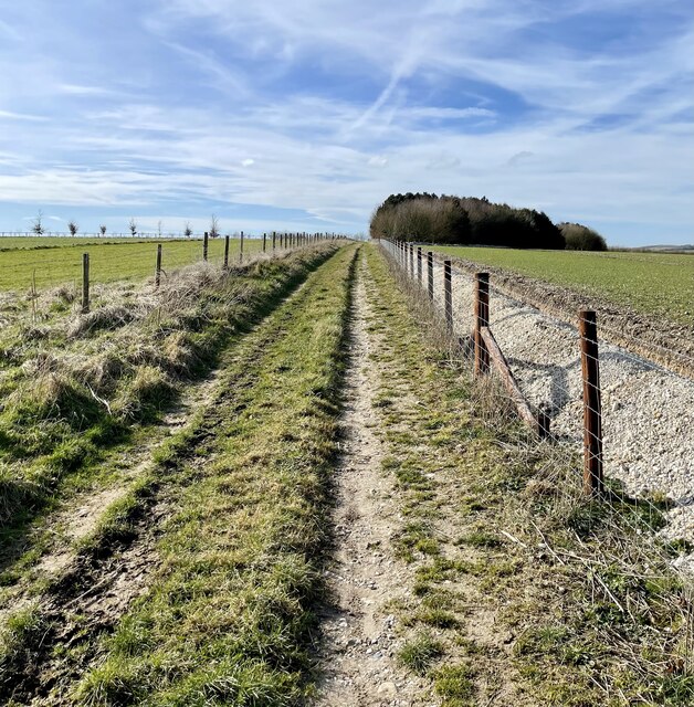
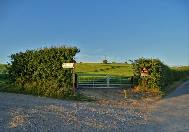
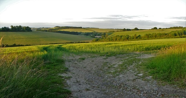
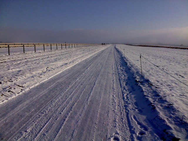
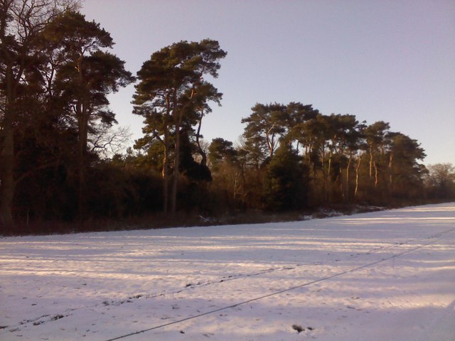
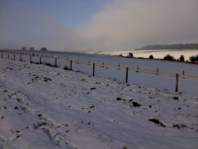
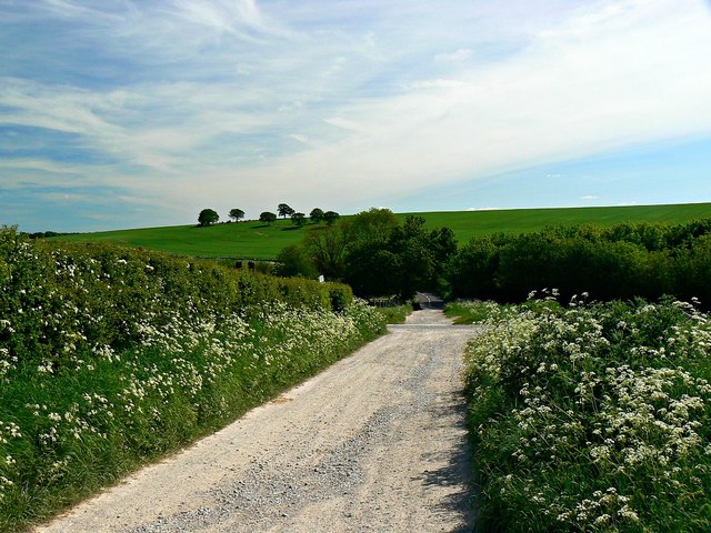
Barton Down Images

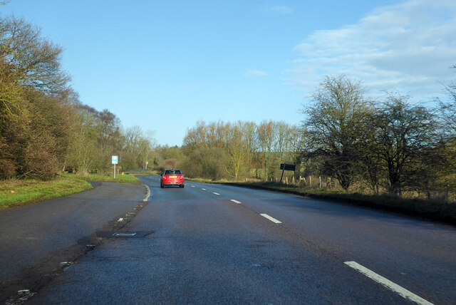
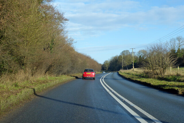
Images are sourced within 2km of 51.437076/-1.7593968 or Grid Reference SU1670. Thanks to Geograph Open Source API. All images are credited.

The Wessex Ridgeway path on Manton Down On the Manton Park racehorse training estate.
The Wessex Ridgeway path on Manton Down
On the Manton Park racehorse training estate.
A346 towards Swindon
A346 towards Swindon From Marlborough.
A346 towards Swindon
From Marlborough.
Bridleway heading South Southwest Bridleway across Marlborough Downs
Bridleway heading South Southwest
Bridleway across Marlborough Downs
Bridleway heading Northwest Bridleway above Ogbourne St Andrew
Bridleway heading Northwest
Bridleway above Ogbourne St Andrew
Bridleway heading up from Ogbourne St Andrew Looking up bridleway towards where a barn used to stand just to the left of the track opposite the clump of trees.  Barn can be seen in older pictures <a href="https://www.geograph.org.uk/photo/4048387">SU1772 : Barn near Ogbourne Down</a>
Bridleway heading up from Ogbourne St Andrew
Looking up bridleway towards where a barn used to stand just to the left of the track opposite the clump of trees. Barn can be seen in older pictures SU1772 : Barn near Ogbourne Down
East of Rockley On the edge of Marlborough Downs
East of Rockley
On the edge of Marlborough Downs
View to Rough Down from Wessex Ridgeway
Pasture, Preshute A bridleway on the eastern part of access land on the Fyfield Downs.
Pasture, Preshute
A bridleway on the eastern part of access land on the Fyfield Downs.
Pasture, Ogbourne St Andrew Horse-grazed paddocks to the west of Ogbourne Maizey.
Pasture, Ogbourne St Andrew
Horse-grazed paddocks to the west of Ogbourne Maizey.
Old Milestone by Rockley Godcake, Marlborough Road Carved stone post by the UC road, in parish of Ogbourne St Andrew (Kennet District), Rockley Godcake, on grass triangle at junction off Marlborough Road, on West side of road. Erected by an unknown authority in the 19th century.

Inscription reads:-
: LoDN / 77 : : S / A / R / U / M / 30 : : BATH / 31 : : SWDN 11 :

Grade II listed.
List Entry Number: 1182378 <span class="nowrap"><a title="https://historicengland.org.uk/listing/the-list/list-entry/1182378" rel="nofollow ugc noopener" href="https://historicengland.org.uk/listing/the-list/list-entry/1182378">Link</a><img style="margin-left:2px;" alt="External link" title="External link - shift click to open in new window" src="https://s1.geograph.org.uk/img/external.png" width="10" height="10"/></span>

Milestone Society National ID: WI_MLWB02A
Old Milestone by Rockley Godcake, Marlborough Road
Carved stone post by the UC road, in parish of Ogbourne St Andrew (Kennet District), Rockley Godcake, on grass triangle at junction off Marlborough Road, on West side of road. Erected by an unknown authority in the 19th century. Inscription reads:- : LoDN / 77 : : S / A / R / U / M / 30 : : BATH / 31 : : SWDN 11 : Grade II listed. List Entry Number: 1182378 LinkExternal link Milestone Society National ID: WI_MLWB02A
Gallops, Barton Down, near Marlborough Training gallops run to the left of the track for a mile or two along the top of Barton Down, as you walk the Wessex Ridgeway towards Avebury.
Gallops, Barton Down, near Marlborough
Training gallops run to the left of the track for a mile or two along the top of Barton Down, as you walk the Wessex Ridgeway towards Avebury.
Wessex Ridgeway, Barton Down, Marlborough Training gallops run alongside the Wessex Ridgeway on top of Barton Down. The two walkers and their dog are returning home to Marlborough for lunch on New Year's Eve.
Wessex Ridgeway, Barton Down, Marlborough
Training gallops run alongside the Wessex Ridgeway on top of Barton Down. The two walkers and their dog are returning home to Marlborough for lunch on New Year's Eve.
Fir trees beside the Wessex Ridgeway, Barton Down, Marlborough A band of magnificent fir trees hides Manton House from sight as you walk towards Avebury along the Wessex Ridgeway.
Fir trees beside the Wessex Ridgeway, Barton Down, Marlborough
A band of magnificent fir trees hides Manton House from sight as you walk towards Avebury along the Wessex Ridgeway.
View north from Barton Down after snow View from the bridlepath alongside the gallops on Barton Down after the snowfall of December 2010, taken just as the early morning fog was lifting.
View north from Barton Down after snow
View from the bridlepath alongside the gallops on Barton Down after the snowfall of December 2010, taken just as the early morning fog was lifting.
South along a byway towards Rockley The byway leads from Barbury on the southern edge of Swindon to the minor road from Broad Hinton to Marlborough visible in the distance and marked by the white lines. Crossing the image from right to left is the even more minor road to Ogbourne Maizey.
South along a byway towards Rockley
The byway leads from Barbury on the southern edge of Swindon to the minor road from Broad Hinton to Marlborough visible in the distance and marked by the white lines. Crossing the image from right to left is the even more minor road to Ogbourne Maizey.
Byway to Barbury from Rockley The byway heads north for about 5 kilometres to the southern boundary of the Borough of Swindon. It should be driveable in a 4x4 or a specialist motor-cycle with care.
Byway to Barbury from Rockley
The byway heads north for about 5 kilometres to the southern boundary of the Borough of Swindon. It should be driveable in a 4x4 or a specialist motor-cycle with care.
Oilseed rape in a field near Rockley The OSR crop is protected by a fence and some cow parsley.
Oilseed rape in a field near Rockley
The OSR crop is protected by a fence and some cow parsley.
Show me another place!

Barton Down is located at Grid Ref: SU1670 (Lat: 51.437076, Lng: -1.7593968)

Unitary Authority: Wiltshire

Police Authority: Wiltshire

What 3 Words

///arrives.consoled.microfilm. Near Fyfield, Wiltshire

Nearby Locations

Barton Down

Related Wikis

Preshute

Preshute is a civil parish immediately west and northwest of Marlborough in Wiltshire, England. Unusually for a Wiltshire parish, it does not take its...

Ogbourne Maizey

Ogbourne Maizey is a hamlet in Wiltshire, England 1.6 miles (2.6 km) north of the town of Marlborough and 0.4 miles (0.64 km) south of the village of Ogbourne...

The Devil's Den

The Devil's Den or Devil's Den is a dolmen burial chamber on Fyfield Hill near Marlborough, Wiltshire, England. The chamber is part of a neolithic passage...

Manton, Wiltshire

Manton is a small village in Wiltshire, England, on the western outskirts of Marlborough just off the A4 Bath Road. == History == A settlement of twelve...

Nearby Amenities

Located within 500m of 51.437076,-1.7593968
Fixme: Name?
Historic: archaeological_site
Historic Place: village
Lat/Long: 51.4330194/-1.7572711
The data included in this document is from www.openstreetmap.org. The data is made available under ODbL.

Have you been to Barton Down?

Leave your review of Barton Down below (or comments, questions and feedback).