Ashes

Downs, Moorland in Yorkshire Richmondshire

England

Ashes

Stanwick Oppidum Length of oppidum rampart next to the track leading to Park House Farm <span class="nowrap"><a title="https://historicengland.org.uk/listing/the-list/list-entry/1016199" rel="nofollow ugc noopener" href="https://historicengland.org.uk/listing/the-list/list-entry/1016199">Link</a><img style="margin-left:2px;" alt="External link" title="External link - shift click to open in new window" src="https://s1.geograph.org.uk/img/external.png" width="10" height="10"/></span>
Stanwick Oppidum Credit: Sandy Gerrard

Ashes, Yorkshire is a picturesque region located in the northern part of England. It encompasses both the Yorkshire Downs and Moorland, offering diverse landscapes and stunning natural beauty.

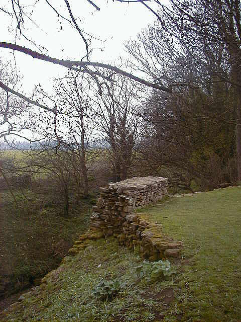
The Yorkshire Downs, also known as the Yorkshire Dales, are a series of rolling hills and valleys that stretch across a vast area. This region is renowned for its lush green meadows, picturesque villages, and charming stone walls. The landscape is dotted with sheep grazing peacefully, and it is a popular destination for hikers and nature lovers. The Downs also feature several breathtaking waterfalls, such as Aysgarth Falls and Hardraw Force, which attract visitors from far and wide.

In contrast, the Yorkshire Moorland showcases a more rugged and wild environment. Its vast expanses of heather-covered moors are a sight to behold, especially when they burst into a vibrant purple hue during late summer. This terrain is home to an array of wildlife, including red grouse, curlews, and golden plovers. The Moorland is also scattered with ancient stone structures, such as standing stones and burial mounds, providing a glimpse into the region's rich history.

Ashes, Yorkshire is a haven for outdoor enthusiasts, offering a multitude of activities such as hiking, cycling, and birdwatching. The region is also famous for its traditional pubs and tea rooms, where visitors can sample locally produced delicacies such as Yorkshire pudding and Wensleydale cheese.

In conclusion, Ashes, Yorkshire is a breathtaking destination that combines the charm of the Yorkshire Downs with the rugged beauty of the Moorland. It offers an escape from the hustle and bustle of city life, allowing visitors to immerse themselves in the tranquility and natural splendor of this idyllic region.

If you have any feedback on the listing, please let us know in the comments section below.
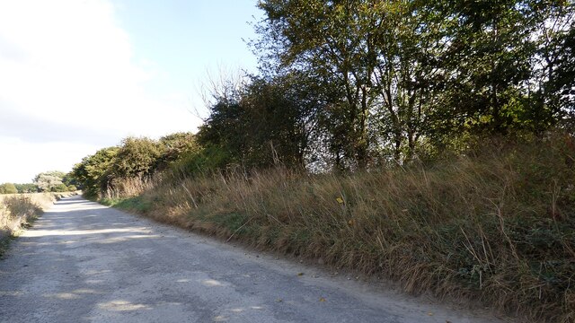
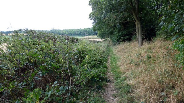
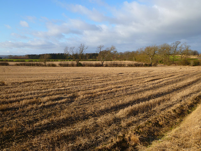
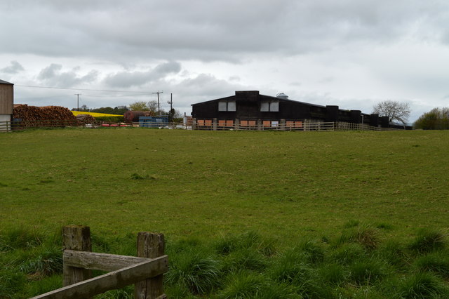
Ashes Images

Images are sourced within 2km of 54.484877/-1.7486675 or Grid Reference NZ1609. Thanks to Geograph Open Source API. All images are credited.

Stanwick Oppidum Length of oppidum rampart next to the track leading to Park House Farm <span class="nowrap"><a title="https://historicengland.org.uk/listing/the-list/list-entry/1016199" rel="nofollow ugc noopener" href="https://historicengland.org.uk/listing/the-list/list-entry/1016199">Link</a><img style="margin-left:2px;" alt="External link" title="External link - shift click to open in new window" src="https://s1.geograph.org.uk/img/external.png" width="10" height="10"/></span>
Stanwick Oppidum
Length of oppidum rampart next to the track leading to Park House Farm LinkExternal link
Bridleway at Hillhouse Plantation
Field and hedges near East Layton
Farmland, West Layton The second tree shown in <a title="https://www.geograph.org.uk/photo/2758874" href="https://www.geograph.org.uk/photo/2758874">Link</a> has gone.
Farmland, West Layton
The second tree shown in Link has gone.
Farmland, East Layton Arable fields beside the bridleway passing along the western perimeter of Forcett Quarry.
Farmland, East Layton
Arable fields beside the bridleway passing along the western perimeter of Forcett Quarry.
Footpath, Carkin Fields The footpath runs beside the well maintained hedge.
Footpath, Carkin Fields
The footpath runs beside the well maintained hedge.
Footpath near Stanwick-St-John The footpath leaves the B6274 to follow the course of a linear earthwork.
Footpath near Stanwick-St-John
The footpath leaves the B6274 to follow the course of a linear earthwork.
Farmland, West Layton A footpath crosses this arable field as it heads towards Sorrowful Hill from the road near White House.
Farmland, West Layton
A footpath crosses this arable field as it heads towards Sorrowful Hill from the road near White House.
Farmland, Carkin A cereal crop growing well to the west of the B6274.
Farmland, Carkin
A cereal crop growing well to the west of the B6274.
Farmland, West Layton Beeches in a crop of oil-seed rape to the east of Collier Lane.
Farmland, West Layton
Beeches in a crop of oil-seed rape to the east of Collier Lane.
Farmland, East Layton Fields of stubble beside the access road to Forcett Quarry.
Farmland, East Layton
Fields of stubble beside the access road to Forcett Quarry.
Farmland, East Layton Beeches and arable land beside the footpath above New House.
Farmland, East Layton
Beeches and arable land beside the footpath above New House.
Road, Carkin The East Layton to Forcett road in arable farmland at Carkin Fields.
Road, Carkin
The East Layton to Forcett road in arable farmland at Carkin Fields.
Footpath on track adjacent to a section of Stanwick Earthworks
Looking Towards Hergill Plantation
Oak Lodge, Carkin Fields At the entrance to Carkin Fields Farm
Oak Lodge, Carkin Fields
At the entrance to Carkin Fields Farm
Agricultural Buildings near Forcett Park These sheds appear to be poultry related
Agricultural Buildings near Forcett Park
These sheds appear to be poultry related
Agricultural Buildings near Forcett Park These sheds seem to be for poultry rearing
Agricultural Buildings near Forcett Park
These sheds seem to be for poultry rearing
Show me another place!

Ashes is located at Grid Ref: NZ1609 (Lat: 54.484877, Lng: -1.7486675)

Division: North Riding

Administrative County: North Yorkshire

District: Richmondshire

Police Authority: North Yorkshire

What 3 Words

///tedious.modern.blackmail. Near Hutton Magna, Co. Durham

Related Wikis

East Layton

East Layton is a village and civil parish in the Richmondshire district of North Yorkshire, England, close to the border with County Durham and a few miles...

Carkin

Carkin is a civil parish in North Yorkshire, England. It was created from the separation of the parish of Forcett and Carkin into "Carkin" and "Forcett...

West Layton

West Layton is a village and civil parish in the Richmondshire district of North Yorkshire, England, close to the border with County Durham and a few miles...

Forcett Hall

Forcett Hall is an English country house in the village of Forcett, North Yorkshire, England, some 6.5 miles (10 km) west of Darlington. It is a Grade...

Stanwick Park

Stanwick Park (also known as Stanwick Hall) was a Palladian country house at Stanwick St John in North Yorkshire, England. == History == It was re-built...

Stanwick Iron Age Fortifications

Stanwick Iron Age Fortifications (also known as 'Stanwick Camp'), a huge Iron Age hill fort, sometimes but not always considered an oppidum, comprising...

Forcett

Forcett is a village in the Richmondshire district of North Yorkshire, England. It lies near the border with County Durham, on the B6274 road about 8 miles...

St John the Baptist's Church, Stanwick

St John the Baptist's Church is a redundant Anglican church in the village of Stanwick St John, North Yorkshire, England. It is recorded in the National...

Nearby Amenities

Located within 500m of 54.484877,-1.7486675
East Layton
Is In: UK,England,Yorkshire,North Yorkshire
Place: hamlet
Lat/Long: 54.484333/-1.7487337
Post Box
Lat/Long: 54.4837955/-1.74787
The data included in this document is from www.openstreetmap.org. The data is made available under ODbL.

Have you been to Ashes?

Leave your review of Ashes below (or comments, questions and feedback).