Blake Moor

Downs, Moorland in Derbyshire Derbyshire Dales

England

Blake Moor

Parsley Hay Cycle Centre <span class="nowrap"><a title="https://www.peakdistrict.gov.uk/visiting/cycle/bike-hire-centres/parsleyhay" rel="nofollow ugc noopener" href="https://www.peakdistrict.gov.uk/visiting/cycle/bike-hire-centres/parsleyhay">Link</a><img style="margin-left:2px;" alt="External link" title="External link - shift click to open in new window" src="https://s1.geograph.org.uk/img/external.png" width="10" height="10"/></span>
Parsley Hay Cycle Centre Credit: Philip Cornwall

Blake Moor is a picturesque area located in Derbyshire, England, known for its stunning Downs and Moorland landscapes. Covering an area of approximately 100 square kilometers, it is a popular destination for nature enthusiasts and hikers alike.

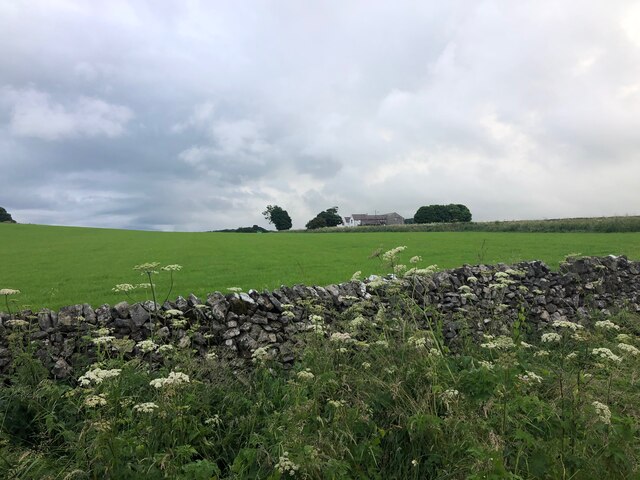
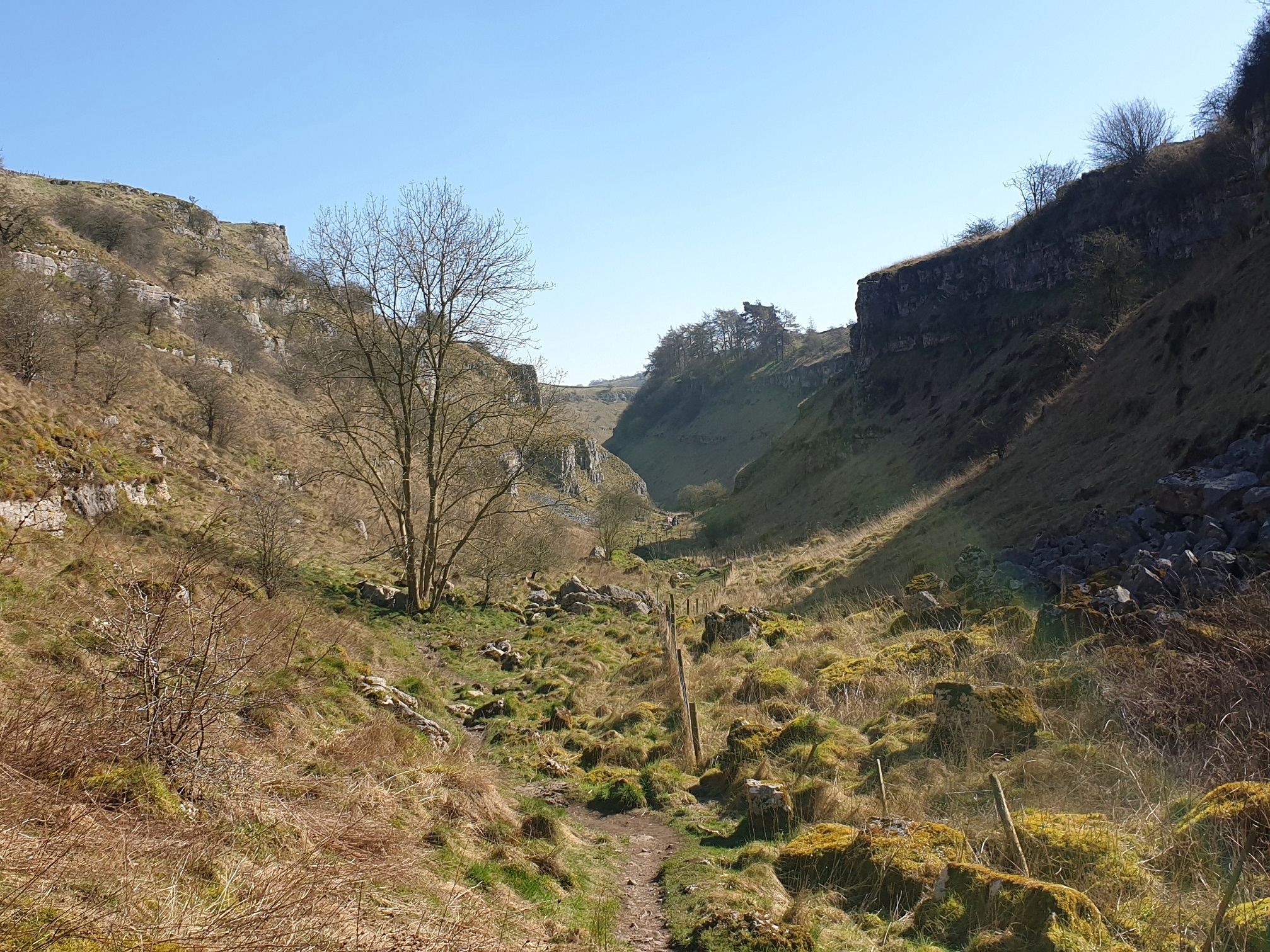
The Moorland in Blake Moor is characterized by its vast expanses of open grasslands, heather, and gorse. The rugged terrain offers breathtaking views of rolling hills and rocky outcrops, creating an idyllic setting for outdoor activities. The area boasts a diverse range of flora and fauna, including various species of birds, small mammals, and wildflowers.

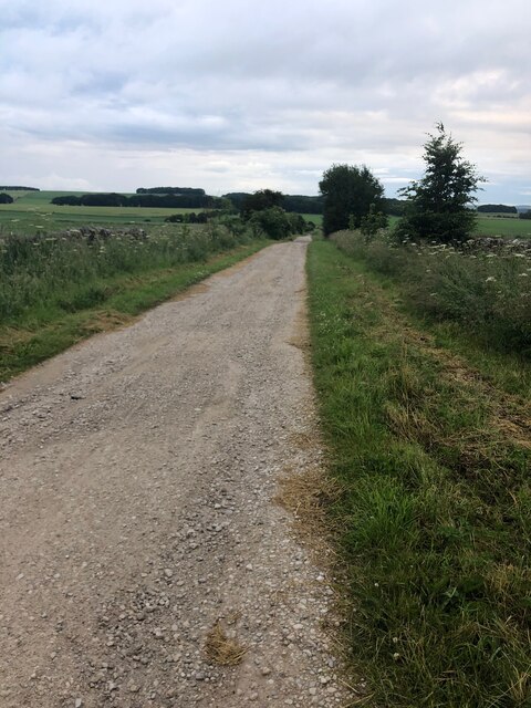
The Downs in Blake Moor are equally impressive, with their gentle slopes and panoramic vistas. These grassy uplands are perfect for leisurely walks and picnics, providing visitors with a tranquil escape from the hustle and bustle of daily life. The Downs are particularly renowned for their scenic beauty during the summer months when the landscape is adorned with vibrant colors.

The moorland and downs in Blake Moor have a rich history, with evidence of human activity dating back thousands of years. Ancient burial mounds, stone circles, and remnants of old settlements can still be found scattered throughout the area, offering glimpses into its past. Archaeological enthusiasts can explore these historical landmarks, immersing themselves in the heritage of the region.

Overall, Blake Moor is a captivating destination that showcases the natural beauty and cultural significance of Derbyshire. Its Downs and Moorland landscapes, coupled with its rich history, make it a must-visit location for those seeking an authentic and memorable experience in the heart of England's countryside.

If you have any feedback on the listing, please let us know in the comments section below.

Blake Moor Images

Images are sourced within 2km of 53.16246/-1.7691943 or Grid Reference SK1562. Thanks to Geograph Open Source API. All images are credited.

Parsley Hay Cycle Centre <span class="nowrap"><a title="https://www.peakdistrict.gov.uk/visiting/cycle/bike-hire-centres/parsleyhay" rel="nofollow ugc noopener" href="https://www.peakdistrict.gov.uk/visiting/cycle/bike-hire-centres/parsleyhay">Link</a><img style="margin-left:2px;" alt="External link" title="External link - shift click to open in new window" src="https://s1.geograph.org.uk/img/external.png" width="10" height="10"/></span>
Parsley Hay Cycle Centre
Pennine Bridleway SE of Parsley Hay
Gate on Pennine Bridleway where it crosses track near Arbor Low Meadows Farm
Gate on Pennine Bridleway where it intersects Green Lane
View across pasture to the Jug and Glass Inn from Green Lane The Jug and Glass Inn is located on the A515
View across pasture to the Jug and Glass Inn from Green Lane
The Jug and Glass Inn is located on the A515
Green Lane A well maintained track near Caskinlow Farm
Green Lane
A well maintained track near Caskinlow Farm
View from Tissington Trail looking NW towards Long Dale This is a 13 mile leisure track from Ashbourne in the south to Parsley Hay in the north, where it joins the High Peak Trail. It is in joint usage as a cycling trail, a bridleway and a walking route. 
The Tissington Trail used to be part of the former railway between Ashbourne and Buxton.
The Pennine Bridleway has adopted part of the northern portion of the  route.
View from Tissington Trail looking NW towards Long Dale
This is a 13 mile leisure track from Ashbourne in the south to Parsley Hay in the north, where it joins the High Peak Trail. It is in joint usage as a cycling trail, a bridleway and a walking route. The Tissington Trail used to be part of the former railway between Ashbourne and Buxton. The Pennine Bridleway has adopted part of the northern portion of the route.
Glamping Pods in field adjacent to Tissington Trail at New Vincent Farm New Vincent Farm is visible in the mid-ground.
Glamping Pods in field adjacent to Tissington Trail at New Vincent Farm
New Vincent Farm is visible in the mid-ground.
Arbor Low henge - flat stones One of the earliest sites in England to have been designated a scheduled ancient monument, and one of the few to have been given a fully detailed description by Historic England (list entry 1011087), the henge consists of a stone circle within an elliptical bank and ditch (40m by 52m) with two entrances and a later bowl barrow. The immediate surrounding area contains a number of other tumuli, barrows and ancient earthworks. The dating is roughly Late Neolithic to Late Bronze Age (c.2400-1500BC).  

The stone circle itself originally comprised 41-43 upright limestone slabs, with some further stones at the centre representing a burial chamber (more than one burial was found during excavations at the site). The stones have at some time in the past been laid flat on the ground. An interpretation board on site attributes this to mediaeval superstition or religious persecution, but someone we met on site who seemed to know it well said he believed it was a more recent (19th century?) action.
Arbor Low henge - flat stones
One of the earliest sites in England to have been designated a scheduled ancient monument, and one of the few to have been given a fully detailed description by Historic England (list entry 1011087), the henge consists of a stone circle within an elliptical bank and ditch (40m by 52m) with two entrances and a later bowl barrow. The immediate surrounding area contains a number of other tumuli, barrows and ancient earthworks. The dating is roughly Late Neolithic to Late Bronze Age (c.2400-1500BC). The stone circle itself originally comprised 41-43 upright limestone slabs, with some further stones at the centre representing a burial chamber (more than one burial was found during excavations at the site). The stones have at some time in the past been laid flat on the ground. An interpretation board on site attributes this to mediaeval superstition or religious persecution, but someone we met on site who seemed to know it well said he believed it was a more recent (19th century?) action.
Arbor Low henge - ditch and bank One of the earliest sites in England to have been designated a scheduled ancient monument, and one of the few to have been given a fully detailed description by Historic England (list entry 1011087), the henge consists of a stone circle within an elliptical bank and ditch (40m by 52m) with two entrances and a later bowl barrow. The immediate surrounding area contains a number of other tumuli, barrows and ancient earthworks. The dating is roughly Late Neolithic to Late Bronze Age (c.2400-1500BC).  

The ditch and bank are seen here from the top of the bank.  The site was fully excavated c.1902, so the exact profile of the bank is probably not original.
Arbor Low henge - ditch and bank
One of the earliest sites in England to have been designated a scheduled ancient monument, and one of the few to have been given a fully detailed description by Historic England (list entry 1011087), the henge consists of a stone circle within an elliptical bank and ditch (40m by 52m) with two entrances and a later bowl barrow. The immediate surrounding area contains a number of other tumuli, barrows and ancient earthworks. The dating is roughly Late Neolithic to Late Bronze Age (c.2400-1500BC). The ditch and bank are seen here from the top of the bank. The site was fully excavated c.1902, so the exact profile of the bank is probably not original.
Arbor Low henge - VR boundary stone The boundary stones around the henge are not ancient, but were added around the time the site was excavated c.1902 (at the end of the Victorian era). Some of them therefore have the initials VR, and some GR, for Victoria and her successor King George.
Arbor Low henge - VR boundary stone
The boundary stones around the henge are not ancient, but were added around the time the site was excavated c.1902 (at the end of the Victorian era). Some of them therefore have the initials VR, and some GR, for Victoria and her successor King George.
Field scabious Flowers growing on the bank of Arbor Low henge.
Field scabious
Flowers growing on the bank of Arbor Low henge.
Approaching the entrance to Arbor Low henge  The elliptical henge originally had two opposite entrances, but this is the one used by visitors approaching on the permitted route through Upper Oldhams Farm.
Approaching the entrance to Arbor Low henge
The elliptical henge originally had two opposite entrances, but this is the one used by visitors approaching on the permitted route through Upper Oldhams Farm.
View from Arbor Low towards Gib Hill  Gib Hill is a burial mound or barrow, somewhat camouflaged in this view against a distant hill (roughly in the centre of the picture, a bit to the left of the cow in the foreground).  The two sites are believed to be associated but are separately scheduled.
View from Arbor Low towards Gib Hill
Gib Hill is a burial mound or barrow, somewhat camouflaged in this view against a distant hill (roughly in the centre of the picture, a bit to the left of the cow in the foreground). The two sites are believed to be associated but are separately scheduled.
Upper Oldhams Farm A beef farm close to Arbor Low henge. There is no public right of way through this farm or its surrounding fields, but visitors are invited to contribute £1 by way of purchasing a temporary right of passage to the henge.
Upper Oldhams Farm
A beef farm close to Arbor Low henge. There is no public right of way through this farm or its surrounding fields, but visitors are invited to contribute £1 by way of purchasing a temporary right of passage to the henge.
Track to Upper Oldhams Farm A beef farm close to Arbor Low henge. There is no public right of way through this farm or its surrounding fields, but visitors are invited to contribute £1 by way of purchasing a temporary right of passage to the henge.
Track to Upper Oldhams Farm
A beef farm close to Arbor Low henge. There is no public right of way through this farm or its surrounding fields, but visitors are invited to contribute £1 by way of purchasing a temporary right of passage to the henge.
Signs to Arbor Low and Upper Oldhams A beef farm close to Arbor Low henge. There is no public right of way through this farm or its surrounding fields, but visitors are invited to contribute £1 by way of purchasing a temporary right of passage to the henge, and the English Heritage car park is part way up this track.
Signs to Arbor Low and Upper Oldhams
A beef farm close to Arbor Low henge. There is no public right of way through this farm or its surrounding fields, but visitors are invited to contribute £1 by way of purchasing a temporary right of passage to the henge, and the English Heritage car park is part way up this track.
Minor road below Arbor Low Note the rosebay-willowherb growing in the verge.  This plant seems to be generally less abundant than it was when I was young, but we saw quite a bit of it in Derbyshire on this occasion.
Minor road below Arbor Low
Note the rosebay-willowherb growing in the verge. This plant seems to be generally less abundant than it was when I was young, but we saw quite a bit of it in Derbyshire on this occasion.
Show me another place!

Blake Moor is located at Grid Ref: SK1562 (Lat: 53.16246, Lng: -1.7691943)

Administrative County: Derbyshire

District: Derbyshire Dales

Police Authority: Derbyshire

What 3 Words

///wedge.coil.swanky. Near Newhaven, Derbyshire

Related Wikis

Newhaven Tunnel

Newhaven Tunnel was a railway tunnel located on the Cromford and High Peak Railway near the village of Newhaven in Derbyshire. Mostly used for moving mineral...

Gib Hill

Gib Hill is a large burial mound in the Peak District, Derbyshire, England. It is thought to be a Neolithic oval barrow with an Early Bronze Age round...

Arbor Low

Arbor Low is a well-preserved Neolithic henge in the Derbyshire Peak District, England. It lies on a Carboniferous Limestone plateau known as the White...

Parsley Hay railway station

Parsley Hay railway station served Parsley Hay, a hamlet within Hartington Middle Quarter civil parish, about 9.3 miles (15 km) south east of Buxton, Derbyshire...

Hartington railway station

Hartington railway station opened in 1899 about two miles away from the village it served - Hartington (grid reference SK129604) in Derbyshire, south...

Lathkill Dale

Lathkill Dale is the valley of the River Lathkill near Bakewell, Derbyshire in the Peak District of England. The river emerges into the dale from springs...

Hartington Nether Quarter

Hartington Nether Quarter is a civil parish in the Derbyshire Dales district of Derbyshire, England. The parish was created from the subdivision of the...

Friden, Derbyshire

Friden is a hamlet in the civil parish of Hartington Nether Quarter, Derbyshire, England. It is 11 miles (18 km) south-east of Buxton, just off the Newhaven...

Related Videos

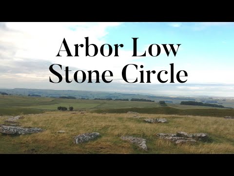
Arbor Low Stone Circle | Week in The Peaks 2021 - PART 3

arborlow #stonecircle #peakdistrict #derbyshire #bakewell Join as we discover a fascinating neolithic stone circle in the Peak ...
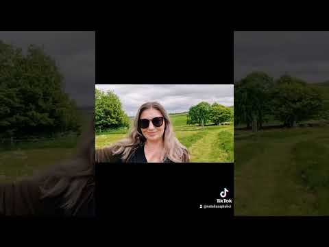
Camping day 🏕

A perfect weekend in Derbyshire, camping . #camping #Derbyshire #summer #me #green #grass #nature #peace #явмоменте ...

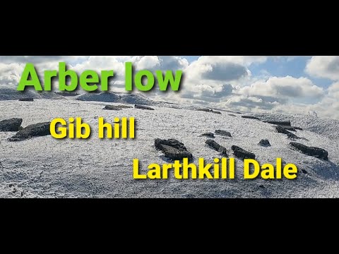
Lathkill Dale - arber low - Gib hill

a little walk out with sheffladoutdoors starting at arber low an ancient site known as the Stonehenge of the north its probably one of ...

Parsley Hay Circular - Ethel Bagging Hike

I have a quick shufty round Carder Low & Pilsbury Hill early on a Sunday morning. Lovely.

Nearby Amenities

Located within 500m of 53.16246,-1.7691943
The data included in this document is from www.openstreetmap.org. The data is made available under ODbL.

Have you been to Blake Moor?

Leave your review of Blake Moor below (or comments, questions and feedback).