Kex Gill Moor

Downs, Moorland in Yorkshire Harrogate

England

Kex Gill Moor

Thruscross Rocking Moor The buildings at Hard Ing taken from the track to Rocking Hall near to Green Sike.
Thruscross Rocking Moor Credit: Mick Melvin

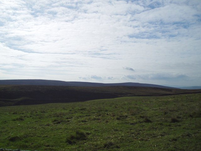
Kex Gill Moor is a picturesque area located in the county of Yorkshire, England. It is situated in the beautiful Yorkshire Dales National Park, renowned for its stunning landscapes and diverse wildlife. Kex Gill Moor is a mixture of downs and moorland, offering a unique combination of rolling hills, open grasslands, and heather-covered moors.

The area is characterized by its rich biodiversity, with a variety of plant and animal species calling it home. Heather dominates the moorland, creating a purple-hued spectacle during the summer months. The downs, on the other hand, are characterized by lush green grasses, providing a perfect grazing ground for livestock.

Kex Gill Moor is a haven for outdoor enthusiasts, offering numerous walking and hiking trails that cater to all levels of ability. Explorers can traverse the undulating terrain, taking in breathtaking views of the surrounding countryside and the picturesque villages that dot the landscape. The area also boasts an extensive network of bridleways, making it a popular destination for horse riders and cyclists.

History enthusiasts will find Kex Gill Moor intriguing, as it has been inhabited for centuries. The remnants of ancient settlements, burial mounds, and stone circles can still be found scattered throughout the area, offering glimpses into its past.

In summary, Kex Gill Moor is a stunning and diverse landscape in Yorkshire, offering a blend of downs and moorland. With its beautiful scenery, abundant wildlife, and rich historical heritage, it is a true gem within the Yorkshire Dales National Park.

If you have any feedback on the listing, please let us know in the comments section below.

Kex Gill Moor Images

Images are sourced within 2km of 53.998128/-1.7983758 or Grid Reference SE1355. Thanks to Geograph Open Source API. All images are credited.

Thruscross Rocking Moor The buildings at Hard Ing taken from the track to Rocking Hall near to Green Sike.
Thruscross Rocking Moor
The buildings at Hard Ing taken from the track to Rocking Hall near to Green Sike.
Spittal Ings House A farm on the Dales Way link near Thruscross reservoir
Spittal Ings House
A farm on the Dales Way link near Thruscross reservoir
Brandrith crags Blubberhouses A view to Brandrith Crags across Redshaw gill, prior to the CRoW act it was difficult to get permission to climb here
Brandrith crags Blubberhouses
A view to Brandrith Crags across Redshaw gill, prior to the CRoW act it was difficult to get permission to climb here
Blubberhouses Quarry Processing Plant. This quarry opened in the mid 1980's and less than 20 years later it is closed.
Blubberhouses Quarry
Processing Plant. This quarry opened in the mid 1980's and less than 20 years later it is closed.
Blubberhouses Quarry The quarry itself. This quarry opened in the mid 1980's and less than 20 years later it is closed.
Blubberhouses Quarry
The quarry itself. This quarry opened in the mid 1980's and less than 20 years later it is closed.
A59 on Kex Gill Moor
Kexgill Farm
Kexgill Farm
Black Hill Farm
Black Hill Farm
Track across the moor. Track leading west from Spittle Ings House. This is the route of the Dales Way Link path that connects Harrogate with the Dales Way proper near Bolton Priory.
Track across the moor.
Track leading west from Spittle Ings House. This is the route of the Dales Way Link path that connects Harrogate with the Dales Way proper near Bolton Priory.
Ramsgill Head, looking towards Beamsley Beacon
Looking past Cold Moss Stoup to Rocking Hall Cold Moss Stoup is an ancient finger of gritstone pointing the way on through the heather.  The shooting lodge of Rocking Hall can be seen on the skyline above Rocking Moor.
Looking past Cold Moss Stoup to Rocking Hall
Cold Moss Stoup is an ancient finger of gritstone pointing the way on through the heather. The shooting lodge of Rocking Hall can be seen on the skyline above Rocking Moor.
The confluence of Black Sike and the beck draining Willow Bog The rush-filled stream junction with an adjacent boundary stone well-hidden from view. Black Sike marks the eastern boundary of the Yorkshire Dales National Park hereabouts.
The confluence of Black Sike and the beck draining Willow Bog
The rush-filled stream junction with an adjacent boundary stone well-hidden from view. Black Sike marks the eastern boundary of the Yorkshire Dales National Park hereabouts.
Old road across the moor This track and bridleway marks the original line of the 1777 Skipton to Harrogate turnpike across Kex Moor. The route was abandoned around 1827 when a new line along the valley of Hall Beck [now A59] was constructed. This new road is still closed by the occasional rock fall or landslip. The Menwith Hill 'golf balls' can be seen in the distance.
Old road across the moor
This track and bridleway marks the original line of the 1777 Skipton to Harrogate turnpike across Kex Moor. The route was abandoned around 1827 when a new line along the valley of Hall Beck [now A59] was constructed. This new road is still closed by the occasional rock fall or landslip. The Menwith Hill 'golf balls' can be seen in the distance.
Golf Balls & Wind Turbines Part of the Old Turnpike Road across Blubbehouses Moor. This is a similar view to Gordon Hatton's photograph, SE1455; Old road across the moor, showing Menwith Hill in the distance but including the four recently erected wind turbines at Knabs Ridge. Eventually there will be eight turbines on this site.
Golf Balls & Wind Turbines
Part of the Old Turnpike Road across Blubbehouses Moor. This is a similar view to Gordon Hatton's photograph, SE1455; Old road across the moor, showing Menwith Hill in the distance but including the four recently erected wind turbines at Knabs Ridge. Eventually there will be eight turbines on this site.
Crag near Blubberhouses Quarry This crag overlooks the A59 west of Blubberhouses.
Crag near Blubberhouses Quarry
This crag overlooks the A59 west of Blubberhouses.
The Kex Gill road Until around 1980, this was a minor road leading from the A59 towards Thruscross, but the opening of the nearby silica sand quarry also meant the construction of a new road link to the A59 and the closure of this stretch.  The road is on the line of the original York to Lancaster turnpike, but is now slowly being reclaimed by nature.
The Kex Gill road
Until around 1980, this was a minor road leading from the A59 towards Thruscross, but the opening of the nearby silica sand quarry also meant the construction of a new road link to the A59 and the closure of this stretch. The road is on the line of the original York to Lancaster turnpike, but is now slowly being reclaimed by nature.
Kexgill Farm The farm stands close to the moor edge at 285m, and is just within the Wharfe catchment. The first photo of the farm taken from within the square.
Kexgill Farm
The farm stands close to the moor edge at 285m, and is just within the Wharfe catchment. The first photo of the farm taken from within the square.
Looking west along A59 From this point near its junction with Kex Gill Road, the A59 drops down a long hill to Bolton Bridge. Until the 1970's this was a tortuous stretch of road with numerous bends and narrow sections, but since improvement [much of it two lanes up and one down] it has become a fast road where North Yorkshire traffic police like to lurk and catch those who speed by at 80mph.
Looking west along A59
From this point near its junction with Kex Gill Road, the A59 drops down a long hill to Bolton Bridge. Until the 1970's this was a tortuous stretch of road with numerous bends and narrow sections, but since improvement [much of it two lanes up and one down] it has become a fast road where North Yorkshire traffic police like to lurk and catch those who speed by at 80mph.
Show me another place!

Kex Gill Moor is located at Grid Ref: SE1355 (Lat: 53.998128, Lng: -1.7983758)

Division: West Riding

Administrative County: North Yorkshire

District: Harrogate

Police Authority: North Yorkshire

What 3 Words

///begins.poses.loves. Near Ilkley, West Yorkshire

Nearby Locations

Deft Hill Kex Gill Moor

Related Wikis

Kex Gill Bypass

The Kex Gill Bypass is a future stretch of A-road across Kex Gill Moor to Blubberhouses in North Yorkshire, England. The route is part of the A59 road...

Thruscross Reservoir

Thruscross Reservoir is the northernmost of four reservoirs in the Washburn valley, lying north of Otley and west of Harrogate in North Yorkshire, England...

Thruscross

Thruscross is a small settlement and civil parish in the Harrogate district of North Yorkshire, England. It lies in the Washburn Valley, 11 miles (18...

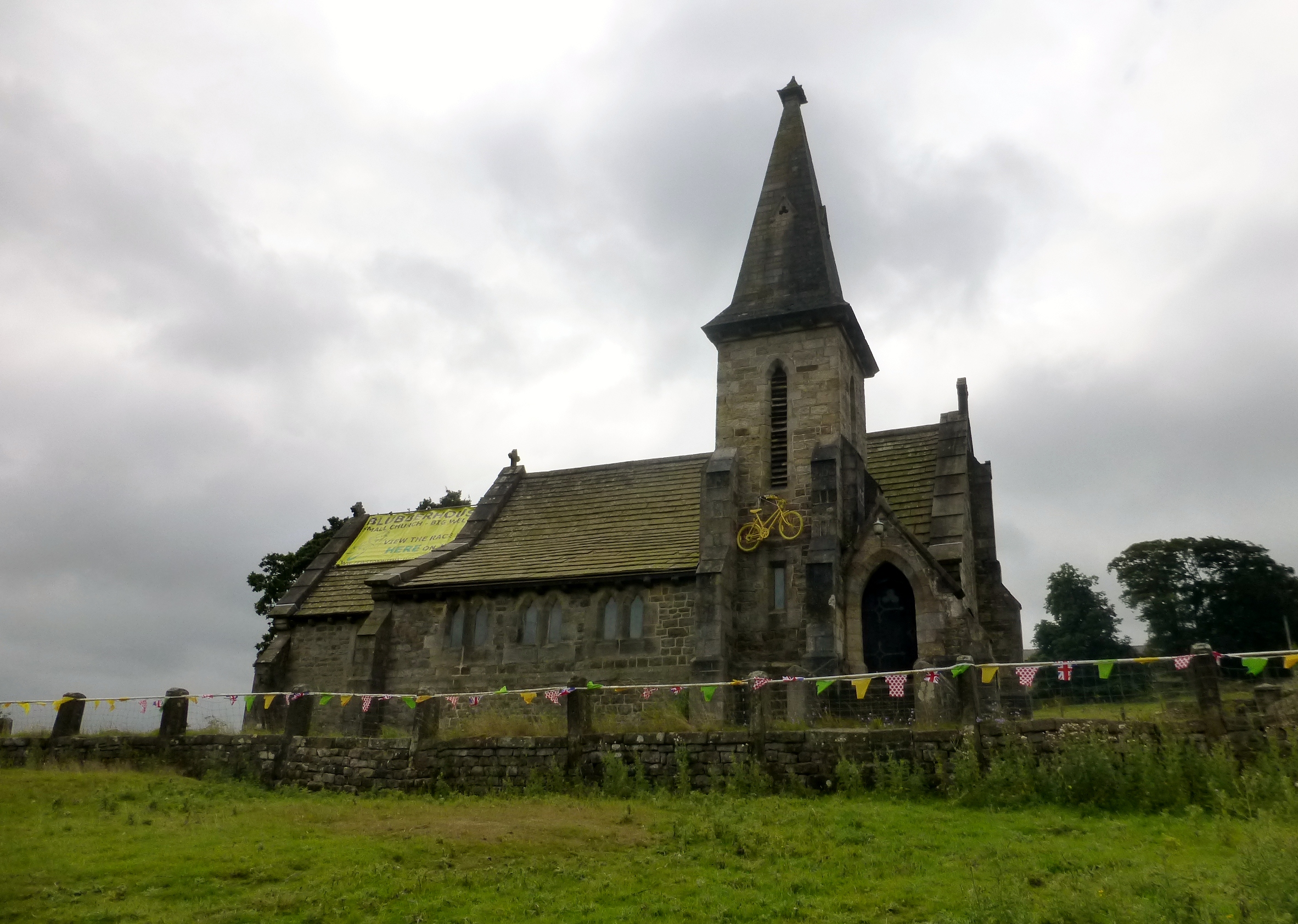
St Andrew's Church, Blubberhouses

St Andrew's Church is the parish church of Blubberhouses, a village in North Yorkshire in England. The church was commissioned by Louisa Frankland Russell...

Nearby Amenities

Located within 500m of 53.998128,-1.7983758
Hunting Stand
Hunting Stand: hide
Raised: no
Source: Bing
Lat/Long: 53.9962321/-1.8024503
Hunting Stand
Hunting Stand: hide
Raised: no
Source: Bing
Lat/Long: 53.9963772/-1.8026944
Hunting Stand
Hunting Stand: hide
Raised: no
Source: Bing
Lat/Long: 53.9966578/-1.8031584
Hunting Stand
Hunting Stand: hide
Raised: no
Source: Bing
Lat/Long: 53.9965238/-1.8029251
Little Hills
Description: What is special about this location? Very old lead mining perhaps?
Place: locality
Source: OS 1854
Lat/Long: 53.9943445/-1.7995432
The data included in this document is from www.openstreetmap.org. The data is made available under ODbL.

Have you been to Kex Gill Moor?

Leave your review of Kex Gill Moor below (or comments, questions and feedback).