Blackden Moor

Downs, Moorland in Derbyshire High Peak

England

Blackden Moor

River Ashop Footbridge crossing the River Ashop in Woodlands Valley.
River Ashop Credit: Peter McDermott

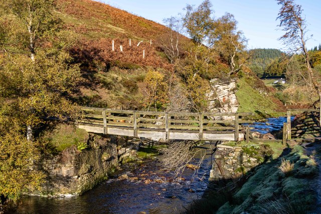
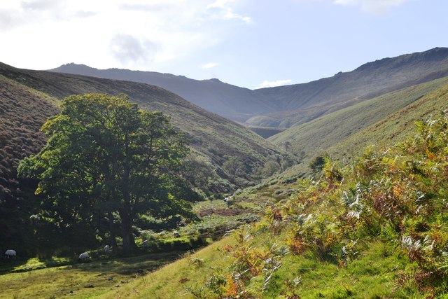
Blackden Moor is a picturesque area located in Derbyshire, England. Situated between the towns of Buxton and Chapel-en-le-Frith, it is renowned for its stunning natural beauty and diverse landscape. The moorland covers an expansive area, offering visitors a unique combination of rolling hills, heather-covered moors, and rocky outcrops.

One of the defining features of Blackden Moor is its rich biodiversity. The area is home to a variety of plant and animal species, making it an important conservation site. Rare bird species such as the red grouse and golden plover can be spotted here, along with other wildlife like hares and deer. The moorland also supports a diverse range of flora, including heather, bilberry, and cotton grass.

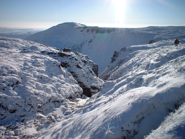
The landscape of Blackden Moor is characterized by its undulating terrain and dramatic vistas. Visitors can enjoy breathtaking views of the surrounding countryside from the top of the moor, with the rugged gritstone edges of the Peak District National Park visible in the distance. The area is a haven for outdoor enthusiasts, offering ample opportunities for hiking, birdwatching, and photography.

In addition to its natural beauty, Blackden Moor holds historical significance. The moor is dotted with ancient burial mounds and stone circles, providing a glimpse into its prehistoric past. It is believed that the area was once inhabited by early settlers, who left behind these intriguing remnants of their culture.

Overall, Blackden Moor is a captivating destination for nature lovers and history enthusiasts alike. Its stunning landscapes, diverse wildlife, and historical heritage make it a must-visit location in Derbyshire.

If you have any feedback on the listing, please let us know in the comments section below.

Blackden Moor Images

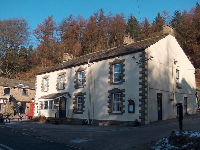
Images are sourced within 2km of 53.395678/-1.818675 or Grid Reference SK1288. Thanks to Geograph Open Source API. All images are credited.

River Ashop Footbridge crossing the River Ashop in Woodlands Valley.
River Ashop
Footbridge crossing the River Ashop in Woodlands Valley.
"The Snake Pass Inn" February 2012
Looking back along Fair Brook to Kinder Scout
Ashop River Footbridge Wooden bridge on one of the many footpaths to Kinder Scout this one is via Fair Brook.
Ashop River Footbridge
Wooden bridge on one of the many footpaths to Kinder Scout this one is via Fair Brook.
Fly agaric - in the Woodlands Valley
A57 Snake Road in Woodlands Valley
Footbridge over the River Ashop
Snake Inn across Woodlands Valley
Grassland and Moorland above Snake Pictured from the path at Oyster Clough.
Grassland and Moorland above Snake
Pictured from the path at Oyster Clough.
River Ashop Confluence of Fair Beck with the River Ashop.
River Ashop
Confluence of Fair Beck with the River Ashop.
The Snake Pass Inn The Snake Pass Inn alongside the A57.
The Snake Pass Inn
The Snake Pass Inn alongside the A57.
The  Snake  Pass  Inn  A57 Coffee stop
The Snake Pass Inn A57
Coffee stop
Oyster  Clough On the footpath across Cowms Moor to Alport Bridge
Oyster Clough
On the footpath across Cowms Moor to Alport Bridge
Ford  on  footpath  over  Cowms  Moor Water from a spring higher up not a problem crossing
Ford on footpath over Cowms Moor
Water from a spring higher up not a problem crossing
Looking  down  into  the  Woodlands  Valley From the footpath to Alport Bridge over Cowms Moor
Looking down into the Woodlands Valley
From the footpath to Alport Bridge over Cowms Moor
Old Milestone by the A57, Snake Road, opposite Snake Inn Carved stone post by the A57, in parish of HOPE WOODLANDS (HIGH PEAK District), Snake Road, opposite Snake Inn, on the verge in front of wire fence, on South side of road. Snake Pass block, erected by the Sheffield & Glossop turnpike trust in the 19th century. 

Inscription reads:-
: MANC / 21 : : SHEFF / 17 : 

Grade II Listed. List Entry Number:1203888
<span class="nowrap"><a title="https://historicengland.org.uk/listing/the-list/list-entry/1203888" rel="nofollow ugc noopener" href="https://historicengland.org.uk/listing/the-list/list-entry/1203888">Link</a><img style="margin-left:2px;" alt="External link" title="External link - shift click to open in new window" src="https://s1.geograph.org.uk/img/external.png" width="10" height="10"/></span>

Milestone Society National ID: DE_SFMC17.
Old Milestone by the A57, Snake Road, opposite Snake Inn
Carved stone post by the A57, in parish of HOPE WOODLANDS (HIGH PEAK District), Snake Road, opposite Snake Inn, on the verge in front of wire fence, on South side of road. Snake Pass block, erected by the Sheffield & Glossop turnpike trust in the 19th century. Inscription reads:- : MANC / 21 : : SHEFF / 17 : Grade II Listed. List Entry Number:1203888 LinkExternal link Milestone Society National ID: DE_SFMC17.
Snake Pass Inn Dating from 1821, the Snake Pass Inn is roughly half-way between Glossop and Ladybower Reservoir on the A57, the Snake Pass Road. It was closed when I passed in early August 2018, though I suspect this is only temporary.
Snake Pass Inn
Dating from 1821, the Snake Pass Inn is roughly half-way between Glossop and Ladybower Reservoir on the A57, the Snake Pass Road. It was closed when I passed in early August 2018, though I suspect this is only temporary.
Woodland beside Snake Road (A57)
Show me another place!

Blackden Moor is located at Grid Ref: SK1288 (Lat: 53.395678, Lng: -1.818675)

Administrative County: Derbyshire

District: High Peak

Police Authority: Derbyshire

What 3 Words

///kingdom.dumplings.barman. Near High Peak, Derbyshire

Nearby Locations

Blackden Moor

Related Wikis

Dark Peak

The Dark Peak is the higher and wilder part of the Peak District in England, mostly forming the northern section but also extending south into its eastern...

Hope Woodlands

Hope Woodlands is an extensive civil parish in the High Peak district of Derbyshire in England. The parish covers the Woodlands Valley, the western Upper...

River Alport

The River Alport flows for 5.6 miles (9 km) in the Dark Peak of the Peak District in Derbyshire, England. Its source is on Bleaklow, 3 miles (4.8 km)...

Grindslow Knoll

Grindslow Knoll is a hill in the Dark Peak area of the Peak District National Park in Derbyshire, England. It is joined to Kinder Scout by a high col though...

Nearby Amenities

Located within 500m of 53.395678,-1.818675
Blackden Moor
Place: locality
Source: Bing
Lat/Long: 53.3948973/-1.8230241
Wood Moor
Place: locality
Source: Bing
Lat/Long: 53.399081/-1.8213319
Ford: yes
Lat/Long: 53.3920349/-1.8200793
The data included in this document is from www.openstreetmap.org. The data is made available under ODbL.

Have you been to Blackden Moor?

Leave your review of Blackden Moor below (or comments, questions and feedback).