Cold Moss

Downs, Moorland in Yorkshire Harrogate

England

Cold Moss

Harry's Dam Harry's Dam is a man made fishpond.
Harry's Dam Credit: Mick Melvin

Cold Moss is a rural area located in the heart of Yorkshire, England. It is characterized by its stunning natural beauty, featuring both downs and moorland landscapes. The region is renowned for its cold climate and is often covered in a thick layer of mist, giving it a mystical and enchanting ambiance.

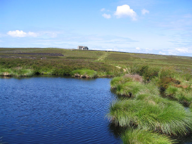
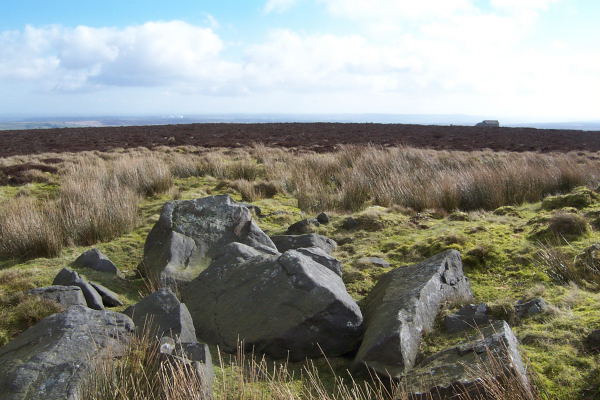
The downs of Cold Moss are vast grassy plains that stretch for miles, offering panoramic views of the surrounding countryside. These downs are perfect for long walks and hikes, allowing visitors to immerse themselves in the tranquility of nature. The moorland, on the other hand, is a rugged and wild terrain, covered in heather and scattered with rocky outcrops. It provides a unique habitat for a variety of wildlife, including birds of prey such as kestrels and buzzards.

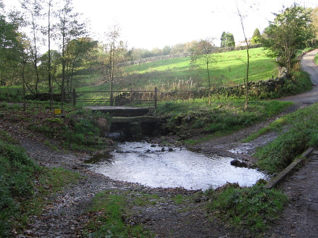
Despite its remote location, Cold Moss has a rich history. The area was once home to small farming communities, and remnants of their stone cottages can still be seen today. The picturesque village of Cold Moss is the main settlement in the area, with its charming cottages and traditional pubs attracting tourists and locals alike.

The weather in Cold Moss is typically cool and damp, with frequent rainfall throughout the year. This climate supports the growth of moss and lichens, which thrive in the moist environment. As a result, the area is covered in a carpet of vibrant green moss, adding to its natural charm.

Overall, Cold Moss offers a unique and idyllic countryside experience. Its downs and moorland, combined with its rich history and cold climate, make it a must-visit destination for nature enthusiasts and those seeking a peaceful retreat.

If you have any feedback on the listing, please let us know in the comments section below.

Cold Moss Images

Images are sourced within 2km of 54.006026/-1.8197896 or Grid Reference SE1156. Thanks to Geograph Open Source API. All images are credited.
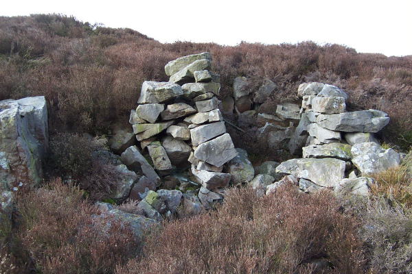
Harry's Dam Harry's Dam is a man made fishpond.
Harry's Dam
Harry's Dam is a man made fishpond.
Thruscross Rocking Moor The buildings at Hard Ing taken from the track to Rocking Hall near to Green Sike.
Thruscross Rocking Moor
The buildings at Hard Ing taken from the track to Rocking Hall near to Green Sike.
Rocking Hall Rocking Hall is a very well built stone shooting hut, in the land census of 1822 it is described as (a Shooting Box of Mr. Nicholson)
Rocking Hall
Rocking Hall is a very well built stone shooting hut, in the land census of 1822 it is described as (a Shooting Box of Mr. Nicholson)
Spittal Ings House A farm on the Dales Way link near Thruscross reservoir
Spittal Ings House
A farm on the Dales Way link near Thruscross reservoir
A59 on Kex Gill Moor
Kexgill Farm
Kexgill Farm
Capelshaw Beck Ford through the beck at Bramley Head.
The beck flows into Thruscross Reservoir to the east.
Capelshaw Beck
Ford through the beck at Bramley Head. The beck flows into Thruscross Reservoir to the east.
Black Hill Farm
Black Hill Farm
Hazelwood Moor atop Winhaugh Mile upon mile of heather and boggy, grassy tussocks
Hazelwood Moor atop Winhaugh
Mile upon mile of heather and boggy, grassy tussocks
A makeshift grouse butt Embedded into a small hillock this grouse butt is well comouflaged if a little derelict!
A makeshift grouse butt
Embedded into a small hillock this grouse butt is well comouflaged if a little derelict!
A Triangular Marker Stone Standing about 2 feet tall this triangular stone stands alone in burnt grouse moorland
A Triangular Marker Stone
Standing about 2 feet tall this triangular stone stands alone in burnt grouse moorland
Brown Bank Head Looking East from Brown Bank Head the building on the right horizon is 'Rocking Hall' and the large white balls on the left horizon are at the Menwith Hill (a US army base)
Brown Bank Head
Looking East from Brown Bank Head the building on the right horizon is 'Rocking Hall' and the large white balls on the left horizon are at the Menwith Hill (a US army base)
Rocking Hall and the Rocking Stone looking north
The Rocking Stone at Rocking Hall looking north
Erosion on the top surface of the Rocking Stone
Thruscross Reservoir and Menwith Hill Radomes looking east from Rocking Hall
Track across the moor. Track leading west from Spittle Ings House. This is the route of the Dales Way Link path that connects Harrogate with the Dales Way proper near Bolton Priory.
Track across the moor.
Track leading west from Spittle Ings House. This is the route of the Dales Way Link path that connects Harrogate with the Dales Way proper near Bolton Priory.
Rocking Hall There are two isolated buildings here on the moor top. One is a shooting house for the Devonshire estate, and the other [pictured] appears to be a store. The setting is 'atmospheric', and on a wild day these rather forbidding buildings would appear to be an ideal location for a 'Hammer' horror film.  Note the grotesque carved face on the gable end.
Rocking Hall
There are two isolated buildings here on the moor top. One is a shooting house for the Devonshire estate, and the other [pictured] appears to be a store. The setting is 'atmospheric', and on a wild day these rather forbidding buildings would appear to be an ideal location for a 'Hammer' horror film. Note the grotesque carved face on the gable end.
Show me another place!

Cold Moss is located at Grid Ref: SE1156 (Lat: 54.006026, Lng: -1.8197896)

Division: West Riding

Administrative County: North Yorkshire

District: Harrogate

Police Authority: North Yorkshire

What 3 Words

///recoup.quilting.strange. Near Addingham, West Yorkshire

Nearby Locations

Cold Moss Low Moor

Related Wikis

Nearby Amenities

Located within 500m of 54.006026,-1.8197896
Low Moor
Natural: moor
Source: NPE
Lat/Long: 54.0080102/-1.8232877
Middle Moor
Natural: moor
Source: OS 1:25k
Lat/Long: 54.0091817/-1.8199297
Black Bank
Man Made: survey_point
Natural: peak
Source: OS 1:25k
Lat/Long: 54.0033304/-1.8244787
Cold Moss Stoop
Note: approx location only
Place: locality
Source: OS sheet 152, publ 1854
Lat/Long: 54.0041026/-1.8186652
The data included in this document is from www.openstreetmap.org. The data is made available under ODbL.

Have you been to Cold Moss?

Leave your review of Cold Moss below (or comments, questions and feedback).