Normanton Down
Downs, Moorland in Wiltshire
England
Normanton Down

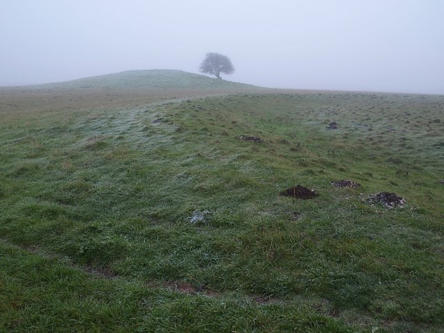
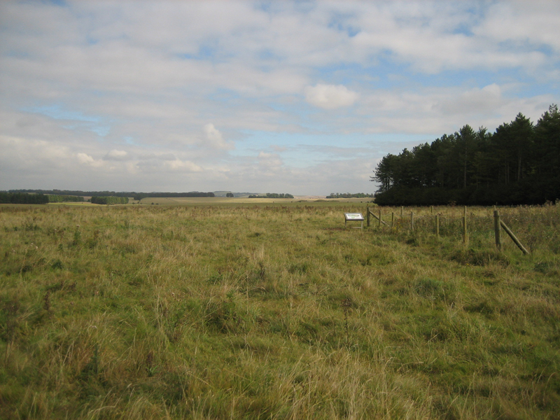
Normanton Down is a well-known archaeological site located in Wiltshire, England. Situated on the edge of the Salisbury Plain, this area encompasses a mix of downs and moorland, making it a unique and diverse landscape. The site covers an area of approximately 100 hectares and is of significant historical importance.
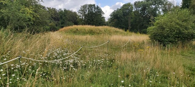
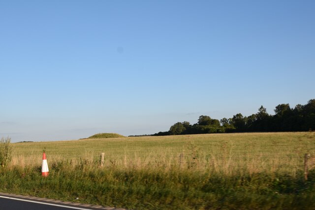
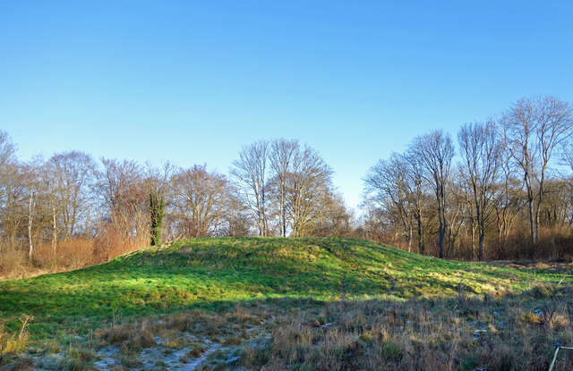
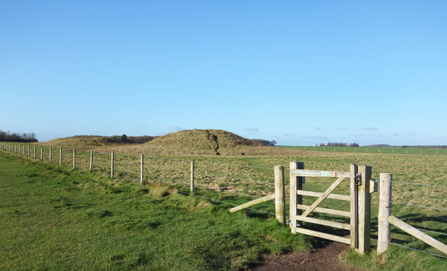
Normanton Down is renowned for its Neolithic and Bronze Age monuments. The most notable feature is the impressive collection of over 40 round barrows, which are burial mounds dating back to 2600-1600 BC. These barrows are scattered across the landscape and provide valuable insights into the burial practices and beliefs of the ancient inhabitants.
In addition to the barrows, there are also evidence of settlement remains in the form of hut circles and enclosures. These structures indicate that Normanton Down was once a thriving community, with evidence of occupation spanning several millennia.
The site has been subject to extensive archaeological investigations, including excavations and surveys, which have uncovered a wealth of artifacts and information. These findings have contributed significantly to our understanding of the prehistoric period in this region.
Normanton Down is also a designated Site of Special Scientific Interest (SSSI) due to its rich biodiversity. The area supports a variety of plant species, including orchids, and is home to several bird species such as skylarks and stonechats.
Due to its historical and ecological significance, Normanton Down is protected by law and managed by relevant authorities to ensure its preservation for future generations to appreciate and study.
If you have any feedback on the listing, please let us know in the comments section below.
Normanton Down Images
Images are sourced within 2km of 51.169229/-1.8321344 or Grid Reference SU1141. Thanks to Geograph Open Source API. All images are credited.


Normanton Down is located at Grid Ref: SU1141 (Lat: 51.169229, Lng: -1.8321344)
Unitary Authority: Wiltshire
Police Authority: Wiltshire
What 3 Words
///sprays.desktop.trending. Near Amesbury, Wiltshire
Nearby Locations
Related Wikis

Normanton Down Barrows
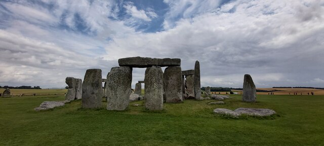
Normanton Down is a Neolithic and Bronze Age barrow cemetery, about 0.6 miles (1 km) south of Stonehenge in Wiltshire, England. The burials date from...
Bush Barrow
Bush Barrow is a site of the early British Bronze Age Wessex culture (c. 2000 BC), at the western end of the Normanton Down Barrows cemetery in Wiltshire...
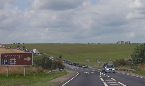
Stonehenge road tunnel
The Stonehenge road tunnel is a planned tunnel in Wiltshire, England, drawn up by National Highways to upgrade the A303 road. It would move the A303 into...

Heelstone Ditch
Heelstone Ditch is a roughly circular feature surrounding the Heel Stone at Stonehenge. It is not known if there was an intended relationship between the...
Stonehenge Landscape
The Stonehenge Landscape is a property of The National Trust, located on Salisbury Plain in Wiltshire, England. The estate (formerly known as Stonehenge...

Excavations at Stonehenge
Records of archaeological excavations at the Stonehenge site date back to the early 17th century. == Early research == The first known excavations at Stonehenge...

Altar Stone (Stonehenge)
The Altar Stone is a recumbent central megalith at Stonehenge in England, dating to Stonehenge phase 3i, around 2600 BCE. It is identified as Stone 80...
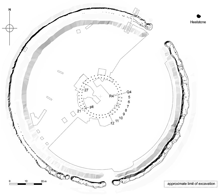
Q and R Holes
The Q and R Holes are a series of concentric sockets which currently represent the earliest known evidence for a stone structure on the site of Stonehenge...
Nearby Amenities
Located within 500m of 51.169229,-1.8321344Have you been to Normanton Down?
Leave your review of Normanton Down below (or comments, questions and feedback).