Harton

Settlement in Shropshire

England

Harton

Field, Hope Dale Between the two long limestone ridges which run from near the Wrekin to the Radnor Forest.
Field, Hope Dale Credit: Richard Webb

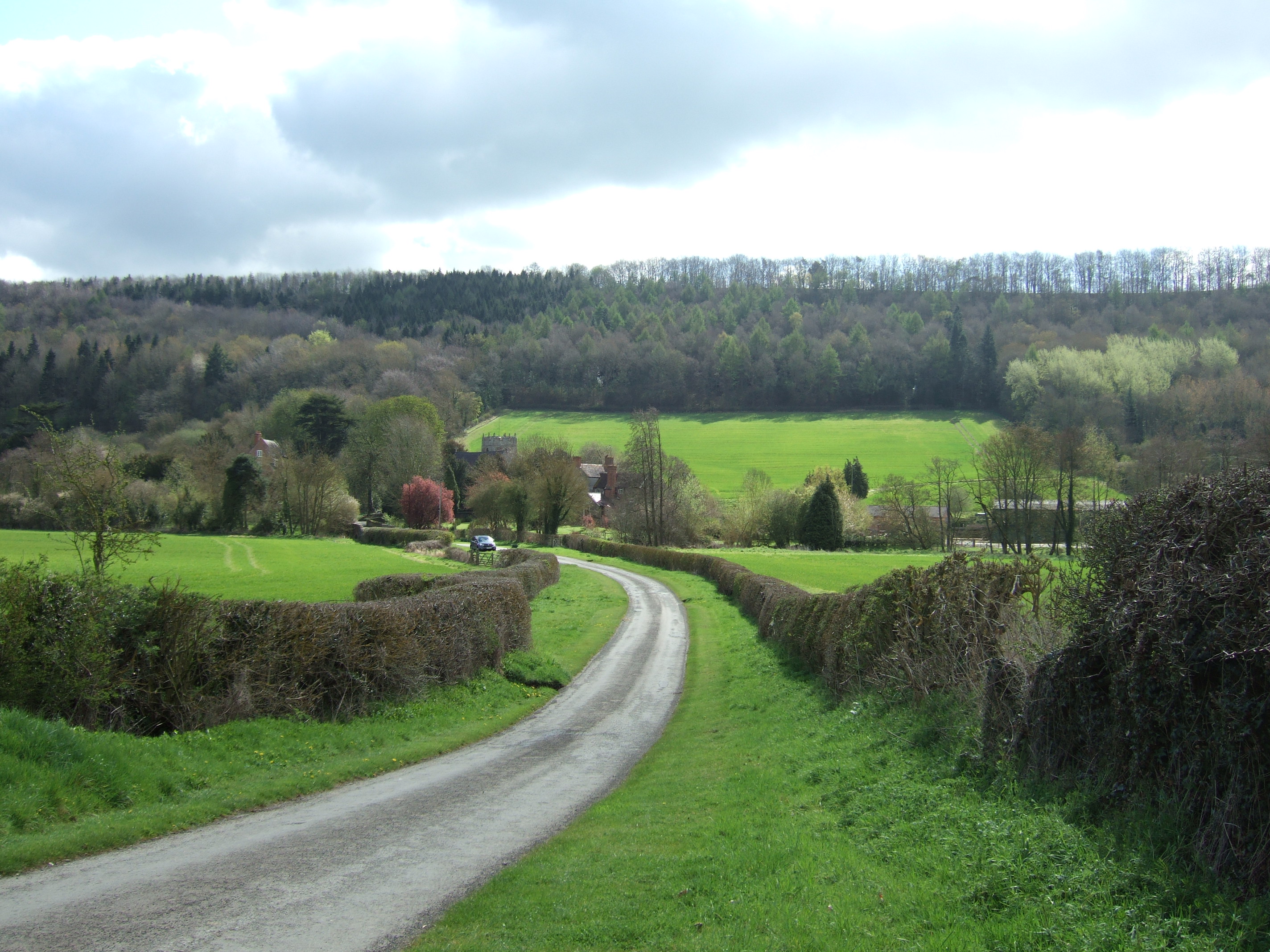
Harton is a small village located in the county of Shropshire, England. Situated in the picturesque countryside, it is nestled between the towns of Bridgnorth and Much Wenlock. With a population of around 500 residents, Harton exudes a peaceful and rural atmosphere, making it an ideal destination for those seeking a tranquil retreat.

The village is renowned for its charming architecture, with many of its buildings dating back to the 17th and 18th centuries. The local church, St. Peter's, is a prominent feature, displaying stunning medieval stonework and stained glass windows.

Harton benefits from its beautiful natural surroundings, offering stunning views of rolling hills and meandering streams. The village is surrounded by lush farmland, contributing to its agricultural heritage. The nearby Harton Farm is home to a variety of livestock, including cattle and sheep, adding to the rural ambience.

Despite its small size, Harton boasts a strong sense of community. The village organizes various social events throughout the year, including summer fetes and Christmas markets, providing opportunities for residents and visitors to come together and celebrate.

For those looking to explore beyond the village, the surrounding area offers ample opportunities for outdoor activities. The nearby Long Mynd and Wenlock Edge provide scenic walking trails, while the historic market town of Bridgnorth is just a short drive away, offering a range of shops, restaurants, and cultural attractions.

In summary, Harton is a picturesque and idyllic village in the heart of Shropshire, offering a peaceful retreat from the hustle and bustle of city life. With its charming architecture, stunning countryside, and strong community spirit, it is a hidden gem well worth visiting.

If you have any feedback on the listing, please let us know in the comments section below.
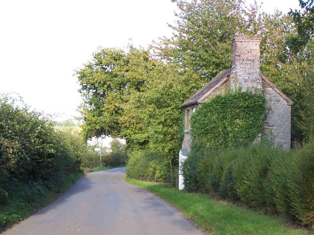
Harton Images

Images are sourced within 2km of 52.493275/-2.762044 or Grid Reference SO4888. Thanks to Geograph Open Source API. All images are credited.

Field, Hope Dale Between the two long limestone ridges which run from near the Wrekin to the Radnor Forest.
Field, Hope Dale
Between the two long limestone ridges which run from near the Wrekin to the Radnor Forest.
On the field edge path The soil is so dry it resembles plaster.
On the field edge path
The soil is so dry it resembles plaster.
Small car park at Harton Hollow Nature Reserve Wenlock Edge was formed 425 million years ago as a coral reef in a shallow sea. The thickly wooded limestone escarpment stretches in an unbroken line for 18 miles (30 km) between Ironbridge and Craven Arms in Shropshire.
Small car park at Harton Hollow Nature Reserve
Wenlock Edge was formed 425 million years ago as a coral reef in a shallow sea. The thickly wooded limestone escarpment stretches in an unbroken line for 18 miles (30 km) between Ironbridge and Craven Arms in Shropshire.
Picnic area next to the car park At the Harton Hollow Nature Reserve.
Picnic area next to the car park
At the Harton Hollow Nature Reserve.
Farmland next to the Harton Hollow Nature Reserve
Countryside view near Wenlock Edge Looking east from the picnic area at the Harton Hollow Nature Reserve, on the horizon is Brown Clee Hill, about 7 miles away.
Countryside view near Wenlock Edge
Looking east from the picnic area at the Harton Hollow Nature Reserve, on the horizon is Brown Clee Hill, about 7 miles away.
Information board at Harton Hollow Nature Reserve Wenlock Edge was formed 425 million years ago as a coral reef in a shallow sea. The thickly wooded limestone escarpment stretches in an unbroken line for 18 miles (30 km) between Ironbridge and Craven Arms in Shropshire.
Information board at Harton Hollow Nature Reserve
Wenlock Edge was formed 425 million years ago as a coral reef in a shallow sea. The thickly wooded limestone escarpment stretches in an unbroken line for 18 miles (30 km) between Ironbridge and Craven Arms in Shropshire.
Path through Harton Hollow Wood
Path along the edge of Harton Hollow Wood Wenlock Edge was formed 425 million years ago as a coral reef in a shallow sea. The thickly wooded limestone escarpment stretches in an unbroken line for 18 miles (30 km) between Ironbridge and Craven Arms in Shropshire.
Path along the edge of Harton Hollow Wood
Wenlock Edge was formed 425 million years ago as a coral reef in a shallow sea. The thickly wooded limestone escarpment stretches in an unbroken line for 18 miles (30 km) between Ironbridge and Craven Arms in Shropshire.
Path through Harton Hollow Wood Wenlock Edge was formed 425 million years ago as a coral reef in a shallow sea. The thickly wooded limestone escarpment stretches in an unbroken line for 18 miles (30 km) between Ironbridge and Craven Arms in Shropshire.
Path through Harton Hollow Wood
Wenlock Edge was formed 425 million years ago as a coral reef in a shallow sea. The thickly wooded limestone escarpment stretches in an unbroken line for 18 miles (30 km) between Ironbridge and Craven Arms in Shropshire.
Hope Dale viewed from Harton Hollow Wood On the horizon is Brown Clee Hill, about 7 miles away.
Hope Dale viewed from Harton Hollow Wood
On the horizon is Brown Clee Hill, about 7 miles away.
Briarhill Wood at Wenlock Edge
Path crossing the Harton Hollow Way Wenlock Edge was formed 425 million years ago as a coral reef in a shallow sea. The thickly wooded limestone escarpment stretches in an unbroken line for 18 miles (30 km) between Ironbridge and Craven Arms in Shropshire.
Path crossing the Harton Hollow Way
Wenlock Edge was formed 425 million years ago as a coral reef in a shallow sea. The thickly wooded limestone escarpment stretches in an unbroken line for 18 miles (30 km) between Ironbridge and Craven Arms in Shropshire.
Harton Hollow Way in Burwood Coppice Wenlock Edge was formed 425 million years ago as a coral reef in a shallow sea. The thickly wooded limestone escarpment stretches in an unbroken line for 18 miles (30 km) between Ironbridge and Craven Arms in Shropshire.
Harton Hollow Way in Burwood Coppice
Wenlock Edge was formed 425 million years ago as a coral reef in a shallow sea. The thickly wooded limestone escarpment stretches in an unbroken line for 18 miles (30 km) between Ironbridge and Craven Arms in Shropshire.
Burwood Coppice at Wenlock Edge Wenlock Edge was formed 425 million years ago as a coral reef in a shallow sea. The thickly wooded limestone escarpment stretches in an unbroken line for 18 miles (30 km) between Ironbridge and Craven Arms in Shropshire.
Burwood Coppice at Wenlock Edge
Wenlock Edge was formed 425 million years ago as a coral reef in a shallow sea. The thickly wooded limestone escarpment stretches in an unbroken line for 18 miles (30 km) between Ironbridge and Craven Arms in Shropshire.
Path through Burwood Coppice Wenlock Edge was formed 425 million years ago as a coral reef in a shallow sea. The thickly wooded limestone escarpment stretches in an unbroken line for 18 miles (30 km) between Ironbridge and Craven Arms in Shropshire.
Path through Burwood Coppice
Wenlock Edge was formed 425 million years ago as a coral reef in a shallow sea. The thickly wooded limestone escarpment stretches in an unbroken line for 18 miles (30 km) between Ironbridge and Craven Arms in Shropshire.
Harton Wood at Wenloc Edge Wenlock Edge was formed 425 million years ago as a coral reef in a shallow sea. The thickly wooded limestone escarpment stretches in an unbroken line for 18 miles (30 km) between Ironbridge and Craven Arms in Shropshire.
Harton Wood at Wenloc Edge
Wenlock Edge was formed 425 million years ago as a coral reef in a shallow sea. The thickly wooded limestone escarpment stretches in an unbroken line for 18 miles (30 km) between Ironbridge and Craven Arms in Shropshire.
Show me another place!

Harton is located at Grid Ref: SO4888 (Lat: 52.493275, Lng: -2.762044)

Unitary Authority: Shropshire

Police Authority: West Mercia

What 3 Words

///dimension.modest.nags. Near Church Stretton, Shropshire

Related Wikis

Harton Road railway station

Harton Road railway station was a station in Eaton-under-Heywood, Shropshire, England. The station was opened in 1867 and closed in 1951.When it originally...

Ludlow (UK Parliament constituency)

Ludlow is a constituency in Shropshire represented in the House of Commons of the UK Parliament since 2005 by Philip Dunne, a member of the Conservative...

Eaton-under-Heywood

Eaton-under-Heywood is a civil parish in Shropshire, England. The population of the civil parish at the 2011 census was 171.It is named after the small...

Birtley, Shropshire

Birtley is a hamlet in Shropshire, England. It is situated a short distance to the west of the village of Ticklerton, in countryside to the south-east...

Nearby Amenities

Located within 500m of 52.493275,-2.762044
Harton Farm
Place: farm
Lat/Long: 52.4928344/-2.7644258
Harton
Place: hamlet
Lat/Long: 52.4943534/-2.7628898
The data included in this document is from www.openstreetmap.org. The data is made available under ODbL.

Have you been to Harton?

Leave your review of Harton below (or comments, questions and feedback).