Bromley Park

Downs, Moorland in Staffordshire East Staffordshire

England

Bromley Park

Hart's Farm Flat, fertile East Staffordshire.
The patches of woodland form a backdrop along with a sunny early November sky.
Hart's Farm Credit: Jonathan Billinger

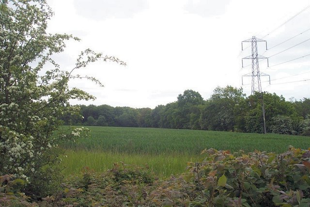
Bromley Park is a picturesque and sprawling area located in the county of Staffordshire, England. Known for its natural beauty and diverse landscapes, it encompasses both downs and moorland, offering visitors a unique and varied experience.

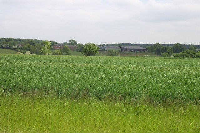
The downs of Bromley Park feature rolling hills and expansive grasslands, providing ample space for outdoor activities such as picnicking, walking, and kite flying. With its panoramic views of the surrounding countryside, this area is a popular spot for nature enthusiasts and photographers alike.

The moorland within Bromley Park is characterized by its rugged terrain, heather-covered hills, and scattered patches of woodland. It is home to a variety of wildlife, including red grouse, curlews, and rare species of plants and flowers. The moorland is a haven for hikers and nature lovers who can explore its winding trails and immerse themselves in the tranquility of this untouched landscape.

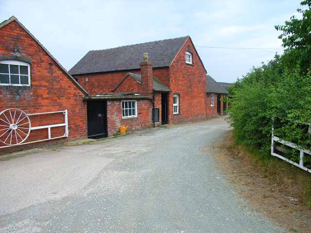
Visitors to Bromley Park can also enjoy the park's amenities, including picnic areas, children's playgrounds, and designated cycling routes. The park is well-maintained, with clean facilities and ample parking, making it an ideal destination for families and outdoor enthusiasts.

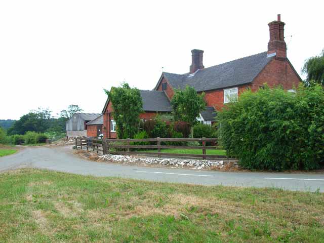
Overall, Bromley Park in Staffordshire is a hidden gem, offering a harmonious blend of downs and moorland landscapes. Its breathtaking views, abundant wildlife, and recreational opportunities make it a must-visit destination for those seeking a peaceful and natural retreat.

If you have any feedback on the listing, please let us know in the comments section below.
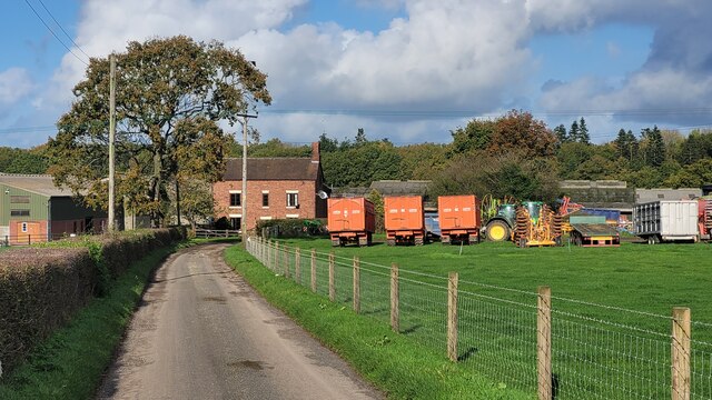
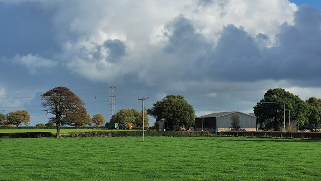
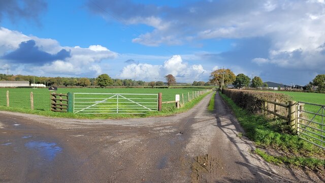
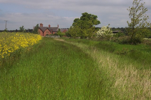
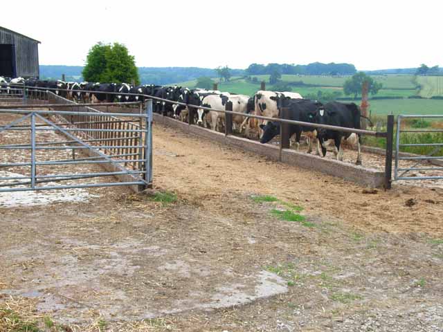
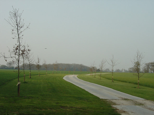
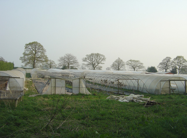
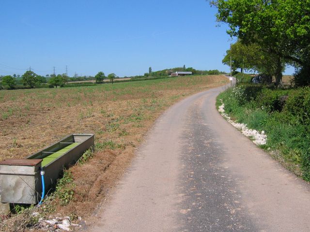
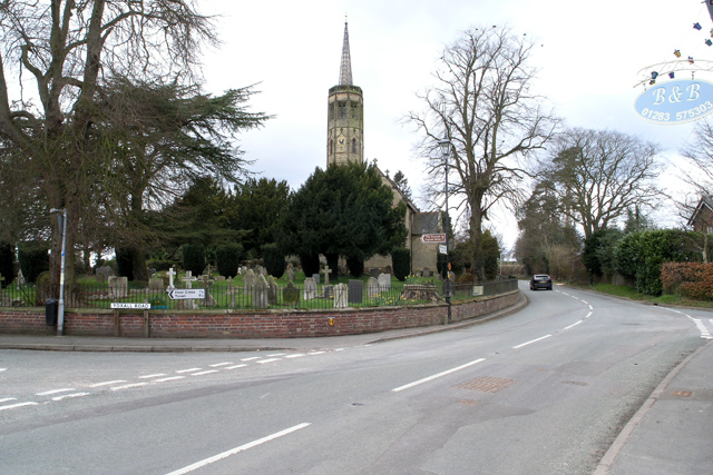
Bromley Park Images

Images are sourced within 2km of 52.829658/-1.8371111 or Grid Reference SK1125. Thanks to Geograph Open Source API. All images are credited.

Hart's Farm Flat, fertile East Staffordshire.
The patches of woodland form a backdrop along with a sunny early November sky.
Hart's Farm
Flat, fertile East Staffordshire. The patches of woodland form a backdrop along with a sunny early November sky.
Park Farm Two large farm units one field apart. This is Park Farm photographed from the same spot as <a href="https://www.geograph.org.uk/photo/7331944">SK1026 : Hart's Farm</a> was taken.
Park Farm
Two large farm units one field apart. This is Park Farm photographed from the same spot as SK1026 : Hart's Farm was taken.
Farm tracks To the left to Hart's Farm, to the right to Park Farm.
Both are public rights of way.
Farm tracks
To the left to Hart's Farm, to the right to Park Farm. Both are public rights of way.
Old Milepost by the B5234, Abbots Bromley parish Cast iron post by the B5234, in parish of ABBOTS BROMLEY (EAST STAFFORDSHIRE District), roadside, in front of hedge, on South side of road. Lathe iron casting, erected by the County Council in the 19th/20th century. 

Inscription reads:-
: ABBOTS - / BROMLEY 1 : : ABBOTS / BROMLEY : : NEWBOROUGH 2½ / BURTON 10 : 
: Chas. Lathe, Tipton. :

Grade II listed.  
List Entry Number: 1038408 <span class="nowrap"><a title="https://historicengland.org.uk/listing/the-list/list-entry/1038408" rel="nofollow ugc noopener" href="https://historicengland.org.uk/listing/the-list/list-entry/1038408">Link</a><img style="margin-left:2px;" alt="External link" title="External link - shift click to open in new window" src="https://s1.geograph.org.uk/img/external.png" width="10" height="10"/></span>

Milestone Society National ID: ST_ASBT01.
Old Milepost by the B5234, Abbots Bromley parish
Cast iron post by the B5234, in parish of ABBOTS BROMLEY (EAST STAFFORDSHIRE District), roadside, in front of hedge, on South side of road. Lathe iron casting, erected by the County Council in the 19th/20th century. Inscription reads:- : ABBOTS - / BROMLEY 1 : : ABBOTS / BROMLEY : : NEWBOROUGH 2½ / BURTON 10 : : Chas. Lathe, Tipton. : Grade II listed. List Entry Number: 1038408 LinkExternal link Milestone Society National ID: ST_ASBT01.
Park Lodge Large and Handsome Lodge
Park Lodge
Large and Handsome Lodge
Pylon and Woods
Pylon and Woods
Duns Field Farm
Duns Field Farm
Farm on Thorney Lanes near Abbots Bromley
The appropriately-named Three Lanes End Farm On Thorney Lanes, near Abbots Bromley
The appropriately-named Three Lanes End Farm
On Thorney Lanes, near Abbots Bromley
Woodland at Roost Hill It is interesting to contrast the attitude of private forestry operators (as here, no public access) with that of the Forestry Commission who regard public access and recreation as part of their responsibilities.
Woodland at Roost Hill
It is interesting to contrast the attitude of private forestry operators (as here, no public access) with that of the Forestry Commission who regard public access and recreation as part of their responsibilities.
Pound Farm Where Thorney Lanes crosses the B5234 road from Abbots Bromley to Burton-upon-Trent
Pound Farm
Where Thorney Lanes crosses the B5234 road from Abbots Bromley to Burton-upon-Trent
Waiting for milking time, Holt Hill
Slate House Farm, Bromley Wood, near Abbots Bromley, Staffordshire. Slate House Farm is situated alongside the B5234, Abbots Bromley to Burton upon Trent road, in the hamlet of Bromley Wood. It is a dairy farm with 60 Holstein-Friesian milk cows. Brickwork in the gable end of the barn facing, proudly states the age of the building as 1859. The white farm sign on the end of the barn tells us that the farm not only supplies farm assured milk to the Dairy Crest creamery but also that food standards are assured with the 'little red tractor' symbol. It may be coincidence but the farmer has a new red Massey Ferguson tractor parked in the farmyard!
Slate House Farm, Bromley Wood, near Abbots Bromley, Staffordshire.
Slate House Farm is situated alongside the B5234, Abbots Bromley to Burton upon Trent road, in the hamlet of Bromley Wood. It is a dairy farm with 60 Holstein-Friesian milk cows. Brickwork in the gable end of the barn facing, proudly states the age of the building as 1859. The white farm sign on the end of the barn tells us that the farm not only supplies farm assured milk to the Dairy Crest creamery but also that food standards are assured with the 'little red tractor' symbol. It may be coincidence but the farmer has a new red Massey Ferguson tractor parked in the farmyard!
Fields of maize near Newborough, Staffordshire. Fields of maize look remarkably healthy in the early evening sunshine, despite a heatwave and lack of rain over the previous few weeks! The view is from the B5234 looking south-west. The edge of Birch Wood is on the left and Barn Farm can be clearly seen on the ridge in the middle distance. The cooling towers of Rugeley Power Station can just be picked out in the far distance, with Cannock Chase beyond.
Fields of maize near Newborough, Staffordshire.
Fields of maize look remarkably healthy in the early evening sunshine, despite a heatwave and lack of rain over the previous few weeks! The view is from the B5234 looking south-west. The edge of Birch Wood is on the left and Barn Farm can be clearly seen on the ridge in the middle distance. The cooling towers of Rugeley Power Station can just be picked out in the far distance, with Cannock Chase beyond.
Field of wheat near Newborough, Staffordshire. Early evening sunshine casts long shadows over a field of ripening wheat. The view is looking from just off the B5234 near Parkgate Farm, north-eastwards towards Noah's Ark Farm on Chantry Lane, which can clearly be seen on the skyline.
Field of wheat near Newborough, Staffordshire.
Early evening sunshine casts long shadows over a field of ripening wheat. The view is looking from just off the B5234 near Parkgate Farm, north-eastwards towards Noah's Ark Farm on Chantry Lane, which can clearly be seen on the skyline.
New farm drive, Bromley Park Farm One day this will have matured into the sort of avenue that was common in the nineteenth century.
New farm drive, Bromley Park Farm
One day this will have matured into the sort of avenue that was common in the nineteenth century.
Beech Nurseries, near Bromley Wood
Lane to Field House Farm The lane is also a bridleway although I'm not sure whether horses would like crossing the cattle grid near the start of the lane. Note the pylons which also cross this grid square.
Lane to Field House Farm
The lane is also a bridleway although I'm not sure whether horses would like crossing the cattle grid near the start of the lane. Note the pylons which also cross this grid square.
Show me another place!

Bromley Park is located at Grid Ref: SK1125 (Lat: 52.829658, Lng: -1.8371111)

Administrative County: Staffordshire

District: East Staffordshire

Police Authority: Staffordshire

What 3 Words

///differ.copies.flamed. Near Abbots Bromley, Staffordshire

Nearby Locations

Bromley Park

Related Wikis

Newborough, Staffordshire

Newborough is a village and civil parish in the county of Staffordshire, England. It is located 3 miles (5 km) south west of Hanbury and 8 miles (13 km...

Marchington Woodlands

Marchington Woodlands is a village and former civil parish, now in the parish of Marchington, in the East Staffordshire district, in the county of Staffordshire...
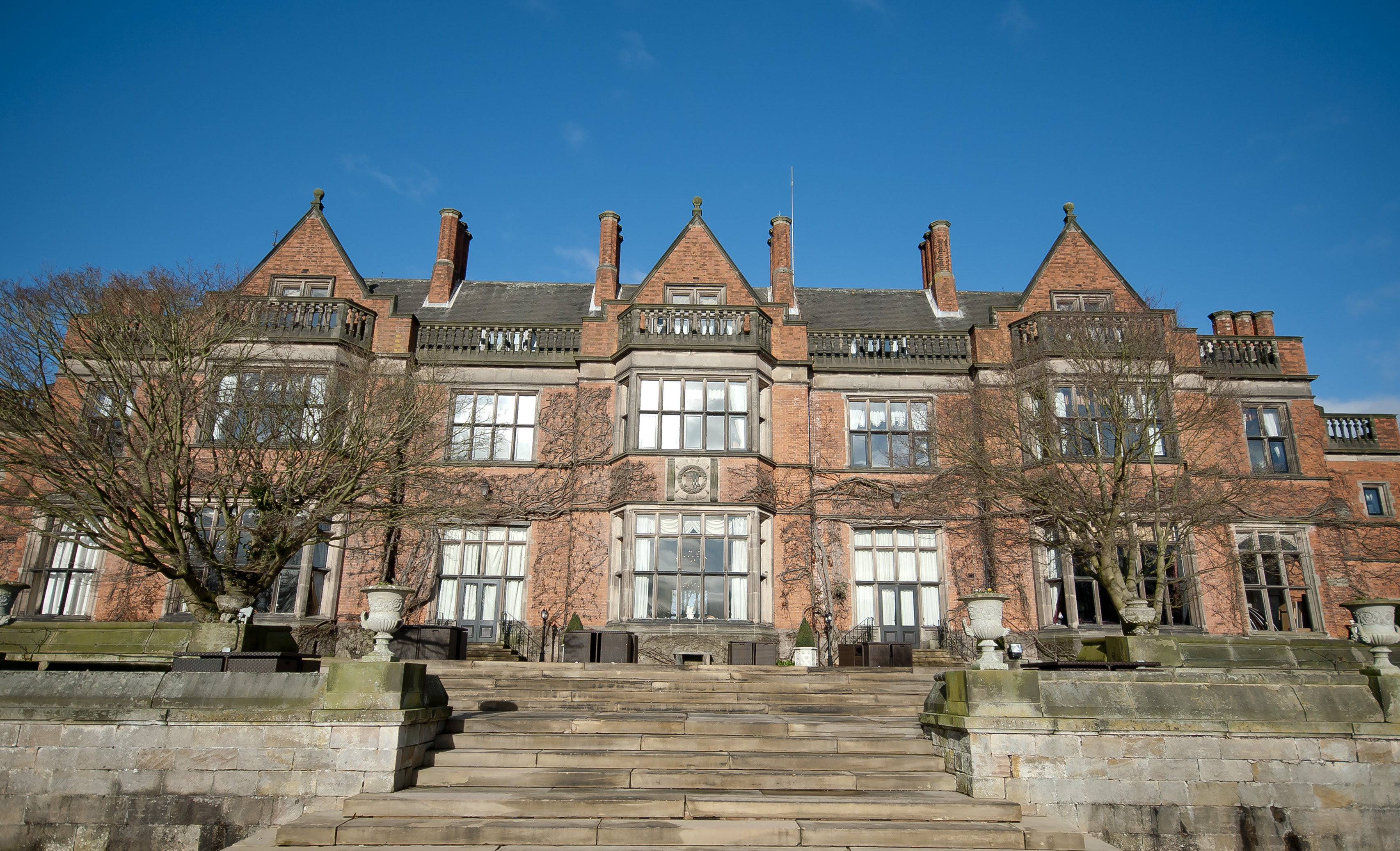
Hoar Cross Hall

Hoar Cross Hall is a 19th-century country mansion near the villages of Hoar Cross and Hamstall Ridware, Staffordshire. England. The Grade II listed building...

Church of the Holy Angels, Hoar Cross

The Church of the Holy Angels is an Anglican church in Hoar Cross, Staffordshire, England. It is a Grade I listed building. == History == It was built...

Abbots Bromley School

Abbots Bromley School (previously the School of S. Mary and S. Anne, Abbots Bromley before becoming Abbots Bromley School for Girls) was a coeducational...

Abbots Bromley

Abbots Bromley is a village and civil parish in the East Staffordshire district of Staffordshire and lies approximately 9.8 miles (15.8 km) east of Stafford...

RAF Abbots Bromley

RAF Abbots Bromley is a former Royal Air Force Relief Landing Ground (RLG) located 0.7 miles (1.1 km) north-west of the village of Abbots Bromley, Staffordshire...

Bagot's Wood

Bagot's Wood is the largest extant piece of the ancient Needwood Forest, located near to Abbots Bromley, in Staffordshire, England. The forest derives...

Nearby Amenities

Located within 500m of 52.829658,-1.8371111
Power: tower
Source: Bing
Lat/Long: 52.8324191/-1.8391796
Power: tower
Source: Bing
Lat/Long: 52.8307208/-1.8364223
Power: tower
Source: Bing
Lat/Long: 52.8288834/-1.8333597
The data included in this document is from www.openstreetmap.org. The data is made available under ODbL.

Have you been to Bromley Park?

Leave your review of Bromley Park below (or comments, questions and feedback).