Caldbergh Moor

Downs, Moorland in Yorkshire Richmondshire

England

Caldbergh Moor

On Foss Rakes An extensive view of moorland seen just off the "Red Way"
On Foss Rakes Credit: Chris Heaton

Caldbergh Moor is a picturesque area located in the heart of Yorkshire, England. It is part of the larger Yorkshire Dales National Park and is characterized by its rolling hills, vast moorland, and breathtaking views. The moor is situated in the northern part of the park, near the village of Caldbergh.

Covering an area of approximately 5 square miles, Caldbergh Moor is home to a diverse range of flora and fauna. The heather-covered hillsides create a vibrant purple blanket during the summer months, providing a stunning contrast against the green landscape. The moorland is also dotted with small streams and peat bogs, adding to its unique charm.

The area is a haven for wildlife enthusiasts, offering the chance to spot a variety of species. Birdwatchers can observe red grouse, curlews, and golden plovers, among others. The moorland is also home to smaller mammals such as rabbits, hares, and weasels.

Visitors to Caldbergh Moor can explore the area through a network of footpaths and bridleways. There are several walking routes, catering to different abilities and interests. These paths lead to scenic viewpoints, ancient burial mounds, and remnants of historic settlements, giving visitors a glimpse into the area's rich history and heritage.

Caldbergh Moor is a tranquil and unspoiled destination, offering a peaceful escape from the hustle and bustle of everyday life. Whether it is hiking, birdwatching, or simply enjoying the stunning natural beauty, this moorland is a must-visit for nature lovers and outdoor enthusiasts alike.

If you have any feedback on the listing, please let us know in the comments section below.

Caldbergh Moor Images

Images are sourced within 2km of 54.24285/-1.835118 or Grid Reference SE1083. Thanks to Geograph Open Source API. All images are credited.

On Foss Rakes An extensive view of moorland seen just off the "Red Way"
On Foss Rakes
An extensive view of moorland seen just off the "Red Way"
Red Way Seen here descending towards Caldbergh - part of an ancient thoroughfare that linked Coverdale with Colsterdale.
Red Way
Seen here descending towards Caldbergh - part of an ancient thoroughfare that linked Coverdale with Colsterdale.
Gate across The Red Way
Small Waterfall on Barnley Beck The upper reaches of this particular watercourse
Small Waterfall on Barnley Beck
The upper reaches of this particular watercourse
Upper Reaches of Barnley Beck Lively watercourse flowing off Barnley Moss towards Colsterdale
Upper Reaches of Barnley Beck
Lively watercourse flowing off Barnley Moss towards Colsterdale
Red Way Ford This is a second ford on the byway leading up from Caldbergh.
Red Way Ford
This is a second ford on the byway leading up from Caldbergh.
Hollow Way on Moorland Track The Red Way is an ancient route linking Coverdale and Colsterdale.  Just below the present track is this old hollow way.
Hollow Way on Moorland Track
The Red Way is an ancient route linking Coverdale and Colsterdale. Just below the present track is this old hollow way.
A 'Boulder' Sheep This Swaledale ewe kindly posed on the rock for the photographer.  Ulfers Crags above Ulfers Gill in Caldbergh parish.
A 'Boulder' Sheep
This Swaledale ewe kindly posed on the rock for the photographer. Ulfers Crags above Ulfers Gill in Caldbergh parish.
New plantation at Ulfers Gill A plantation of broadleaved trees [middle distance]on access land above Caldbergh.
New plantation at Ulfers Gill
A plantation of broadleaved trees [middle distance]on access land above Caldbergh.
Ulfers Gill The short section of bridleway that heads westwards into this grid square is soon lost on the ground.  Its purpose is unclear, but other similar paths/tracks on the moors are often 'turf roads' leading to areas where peat was once gathered for fuel.
Ulfers Gill
The short section of bridleway that heads westwards into this grid square is soon lost on the ground. Its purpose is unclear, but other similar paths/tracks on the moors are often 'turf roads' leading to areas where peat was once gathered for fuel.
Riders Approaching A group of five trials bike riders on the Red Way track above Caldbergh. The use of trials bikes on tracks, bridleways and green lanes in the dales is a contentious issue. These riders are unlikely to be breaking any rules as this route may well be a BOAT, RUPP or county road.
Riders Approaching
A group of five trials bike riders on the Red Way track above Caldbergh. The use of trials bikes on tracks, bridleways and green lanes in the dales is a contentious issue. These riders are unlikely to be breaking any rules as this route may well be a BOAT, RUPP or county road.
Photographer's dilemma. According to the 1:50000 map I could be standing exactly at the junction of 4 squares. The 1:25000 map would confirm that I'm about 10m within the chosen square and looking at the junction of the LRT which goes left towards a shooting house, and a 'mystery status' track [possibly a county road] that heads straight on towards Colsterdale.
Photographer's dilemma.
According to the 1:50000 map I could be standing exactly at the junction of 4 squares. The 1:25000 map would confirm that I'm about 10m within the chosen square and looking at the junction of the LRT which goes left towards a shooting house, and a 'mystery status' track [possibly a county road] that heads straight on towards Colsterdale.
On Barnley Moss A makeshift animal bridge containing a trap has been erected over a clough on Barnley Moss a large expanse of heather moorland. I'm not sure what the intended catch is, stoats or weasels probably. The clough is discernible on the 1:25,000 map as a niche in the 450m index contour and actually had running water in it.
On Barnley Moss
A makeshift animal bridge containing a trap has been erected over a clough on Barnley Moss a large expanse of heather moorland. I'm not sure what the intended catch is, stoats or weasels probably. The clough is discernible on the 1:25,000 map as a niche in the 450m index contour and actually had running water in it.
Animal Trap on Peat Moss On a ridge leading up to East Scafton Moor and looking back towards Caldbergh Moor the gamekeeper has set a trap on this grouse moor. Presumably for stoats or weasels the trap contained a metal spring trap inside the tunnel.
Animal Trap on Peat Moss
On a ridge leading up to East Scafton Moor and looking back towards Caldbergh Moor the gamekeeper has set a trap on this grouse moor. Presumably for stoats or weasels the trap contained a metal spring trap inside the tunnel.
Moor Gate on Red Way The last gate before the track Red Way climbs Caldbergh Moor.
Moor Gate on Red Way
The last gate before the track Red Way climbs Caldbergh Moor.
Red Way Higher up the moor the track becomes known as Red Way so I assume the same name applies as it crosses the intake fields which is largely devoted to sheep pasture. In the distance the barn with the red doors and shutters is Ings which is just outside the square.
Red Way
Higher up the moor the track becomes known as Red Way so I assume the same name applies as it crosses the intake fields which is largely devoted to sheep pasture. In the distance the barn with the red doors and shutters is Ings which is just outside the square.
Bell Heather on Red Way Just inside the square looking out. A close call.
Bell Heather on Red Way
Just inside the square looking out. A close call.
Red Way Access to Calbergh Moor from the village.
Red Way
Access to Calbergh Moor from the village.
Show me another place!

Caldbergh Moor is located at Grid Ref: SE1083 (Lat: 54.24285, Lng: -1.835118)

Division: North Riding

Administrative County: North Yorkshire

District: Richmondshire

Police Authority: North Yorkshire

What 3 Words

///allergy.heartless.robes. Near Leyburn, North Yorkshire

Related Wikis

East Scrafton

East Scrafton is a hamlet in the Yorkshire Dales in the Richmondshire district of North Yorkshire, England. It is about 3 miles (5 km) south-west of Leyburn...

Caldbergh

Caldbergh (Caldeber in the Domesday Book) is a hamlet within the Yorkshire Dales, North Yorkshire, England. It lies about four miles south of Leyburn....

Caldbergh with East Scrafton

Caldbergh with East Scrafton is a civil parish in the Richmondshire district of North Yorkshire, England. The parish includes the settlements of Caldbergh...

Colsterdale

Colsterdale is the valley of the River Burn, a tributary of the River Ure, in the Yorkshire Dales in North Yorkshire, England. It gives its name to a hamlet...
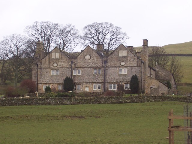
Braithwaite Hall

Braithwaite Hall is a 17th-century manor house in Coverdale in the Yorkshire Dales in England. It lies 1.8 miles (2.9 km) west of the village of East...

Coverham

Coverham is a village in Coverdale in the Yorkshire Dales in North Yorkshire, England. It lies 2 miles (3.2 km) west of the town of Middleham. == History... ==

Holy Trinity Church, Coverham

Holy Trinity Church is a redundant Anglican church in the village of Coverham, North Yorkshire, England. It is recorded in the National Heritage List...

Coverham Abbey

Coverham Abbey, North Yorkshire, England, was a Premonstratensian monastery that was founded at Swainby in 1190 by Helewisia, daughter of the Chief Justiciar...

Nearby Amenities

Located within 500m of 54.24285,-1.835118
Caldberg Moor
Natural: moor
Source: NPE
Lat/Long: 54.2427047/-1.8355444
The data included in this document is from www.openstreetmap.org. The data is made available under ODbL.

Have you been to Caldbergh Moor?

Leave your review of Caldbergh Moor below (or comments, questions and feedback).