Cross Gill Moor

Downs, Moorland in Yorkshire Harrogate

England

Cross Gill Moor

Prosperous Smelt Mill, Merryfield Built around 1800 the mill smelted the lead ore produced from the Prosperous and Providence Mines. The crown cog wheel standing proud in front of the mill rises up from Smelt Mill Shaft where an underground 20 foot diameter waterwheel supplied power to the mill. The pinion shaft lies in the now blocked shaft.
Prosperous Smelt Mill, Merryfield Credit: Malcolm Street

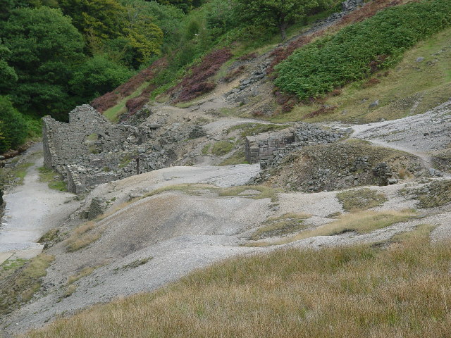
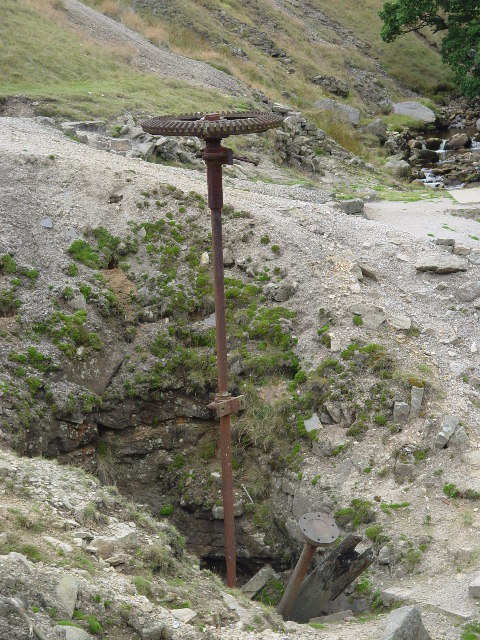
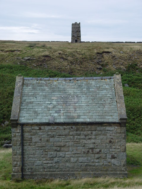
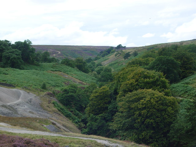
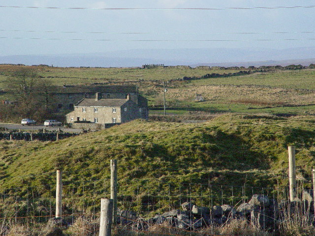
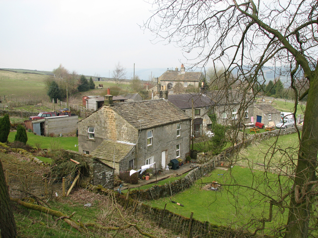
Cross Gill Moor is a picturesque area located in the county of Yorkshire, England. Known for its stunning natural beauty, it encompasses a combination of downs and moorland landscapes. Stretching over a vast area, it offers visitors a diverse range of habitats and breathtaking views.

The moorland section of Cross Gill Moor is characterized by its rolling hills covered in heather, creating a vibrant purple carpet during the summer months. This area is home to a variety of flora and fauna, including birds such as curlews and lapwings, as well as small mammals like hares and voles. Walking through the moorland, visitors can enjoy the tranquility of the surroundings and may even spot the occasional sheep or wild pony grazing peacefully.

The downs section of Cross Gill Moor offers a more grassy landscape, with gentle slopes and expansive views. Here, visitors can take leisurely walks along well-maintained paths, enjoying the fresh air and panoramic vistas. The downs are dotted with scattered patches of woodland, providing shelter for a diverse range of bird species, such as woodpeckers and thrushes.

Cross Gill Moor is a haven for nature enthusiasts, providing ample opportunities for hiking, birdwatching, and photography. The area is also popular with cyclists and horse riders, who can explore the vast network of bridleways and trails.

With its stunning natural beauty and diverse ecosystems, Cross Gill Moor is a must-visit destination for those seeking to immerse themselves in Yorkshire's countryside. Whether it's the vibrant colors of the heather-covered moorland or the sweeping views from the downs, this area offers a truly unique and unforgettable experience.

If you have any feedback on the listing, please let us know in the comments section below.

Cross Gill Moor Images

Images are sourced within 2km of 54.089822/-1.8489639 or Grid Reference SE0966. Thanks to Geograph Open Source API. All images are credited.

Prosperous Smelt Mill, Merryfield Built around 1800 the mill smelted the lead ore produced from the Prosperous and Providence Mines. The crown cog wheel standing proud in front of the mill rises up from Smelt Mill Shaft where an underground 20 foot diameter waterwheel supplied power to the mill. The pinion shaft lies in the now blocked shaft.
Prosperous Smelt Mill, Merryfield
Built around 1800 the mill smelted the lead ore produced from the Prosperous and Providence Mines. The crown cog wheel standing proud in front of the mill rises up from Smelt Mill Shaft where an underground 20 foot diameter waterwheel supplied power to the mill. The pinion shaft lies in the now blocked shaft.
Smelt Mill Shaft, Merryfield The crown cog on the drive shaft can here be clearly seen, along with the pinion shaft lying in the mine shaft. These transferred the power from the underground waterwheel to the mill.
Smelt Mill Shaft, Merryfield
The crown cog on the drive shaft can here be clearly seen, along with the pinion shaft lying in the mine shaft. These transferred the power from the underground waterwheel to the mill.
Surveying Tower, Hardcastle Moor The surveying tower was used in the driving of the aqueduct tunnel under Greenhow Hill abt 1900. The tunnel is part of a long aqueduct from Scar House Reservoir to Bradford. In the foreground is No1 Well Shaft, one of 3 access points in the tunnel which is 3.5 miles long and reaches its greatest depth below the ground surface at No2 Shaft, Craven Cross, Greenhow, where it is 600 feet down. This is deeper than any of the mines reached. For further information see <span class="nowrap"><a title="http://www.greenhow-hill.org.uk/mining/bcww.html" rel="nofollow ugc noopener" href="http://www.greenhow-hill.org.uk/mining/bcww.html">Link</a><img style="margin-left:2px;" alt="External link" title="External link - shift click to open in new window" src="https://s1.geograph.org.uk/img/external.png" width="10" height="10"/></span>
Surveying Tower, Hardcastle Moor
The surveying tower was used in the driving of the aqueduct tunnel under Greenhow Hill abt 1900. The tunnel is part of a long aqueduct from Scar House Reservoir to Bradford. In the foreground is No1 Well Shaft, one of 3 access points in the tunnel which is 3.5 miles long and reaches its greatest depth below the ground surface at No2 Shaft, Craven Cross, Greenhow, where it is 600 feet down. This is deeper than any of the mines reached. For further information see LinkExternal link
The valley of Ashfoldside Beck Looking up from Prosperous Smelt Mill.
The valley of Ashfoldside Beck
Looking up from Prosperous Smelt Mill.
New Shaft Engine House at Merryfield Hole This housed a steam engine which was used to pump water out of the mine shaft surrounded by a fence to the left of it.
New Shaft Engine House at Merryfield Hole
This housed a steam engine which was used to pump water out of the mine shaft surrounded by a fence to the left of it.
Lily Green, Greenhow The mound in the foreground is an old mine shaft for the Prim or Prime Gap Vein which was worked for lead.
Lily Green, Greenhow
The mound in the foreground is an old mine shaft for the Prim or Prime Gap Vein which was worked for lead.
Nidderdale Way footpath to bridge over Ashfold Side Beck
Footbridge over Ashfold Side Beck
Nidderdale Way leading to footpath over Ashfold Side Beck
Ford at Branstone Beck
Grouse Butt No. 7 on Flout Hill
Shooting Box
Shooting Box
Round Hill Shooting Box
Round Hill Swamp from Hollin Crags
Hollin Crags gritstone outcrop
Danger - Deep Mine Shaft One of the many old mine shafts in the area. This one clearly marked.
Danger - Deep Mine Shaft
One of the many old mine shafts in the area. This one clearly marked.
Smelt Mill by Ashfold Side Beck Part of the Providence Lead Mining complex, long abandoned.  The cog wheel above the shaft still sticks vertically and defiantly into the air.  Nidderdale Way walkers are obliged to pass through here as part of their education.
Smelt Mill by Ashfold Side Beck
Part of the Providence Lead Mining complex, long abandoned. The cog wheel above the shaft still sticks vertically and defiantly into the air. Nidderdale Way walkers are obliged to pass through here as part of their education.
Part of Providence Lead Mines Long abandoned.  I am not sure of the purpose of this structure, but it is above and apart from the rest of the complex.  The Nidderdale Way passes by, but no explanation is offered to walkers.
Part of Providence Lead Mines
Long abandoned. I am not sure of the purpose of this structure, but it is above and apart from the rest of the complex. The Nidderdale Way passes by, but no explanation is offered to walkers.
Show me another place!

Cross Gill Moor is located at Grid Ref: SE0966 (Lat: 54.089822, Lng: -1.8489639)

Division: West Riding

Administrative County: North Yorkshire

District: Harrogate

Police Authority: North Yorkshire

What 3 Words

///fillings.couple.barefoot. Near Pateley Bridge, North Yorkshire

Related Wikis

Greenhow

Greenhow is a village in North Yorkshire, England, often referred to as Greenhow Hill. The term how derives from the Old Norse word haugr meaning a hill...

Stump Cross Caverns

Stump Cross Caverns is a limestone cave system between Wharfedale and Nidderdale in North Yorkshire, England. == Geography == The caverns at Stump Cross...

Heathfield, North Yorkshire

Heathfield is a hamlet in the civil parish of Stonebeck Down in upper Nidderdale, in North Yorkshire, England. It lies on a broad terrace on the west...

Grimwith Reservoir

Grimwith Reservoir is located in the Yorkshire Dales in North Yorkshire, England. It was originally built by the Bradford Corporation as one of eleven...

Nearby Amenities

Located within 500m of 54.089822,-1.8489639
Cross Gill Moor
Is In: UK,Yorkshire,North Yorkshire,Nidderdale
Is In Country: UK
Is In County: North Yorkshire
Is In Historical County: Yorkshire
Natural: moor
Source: NPE
Lat/Long: 54.0889242/-1.8473576
Peat House Hill
Is In Country: UK
Is In County: North Yorkshire
Is In Historical County: Yorkshire
Natural: peak
Lat/Long: 54.0907191/-1.8469182
Snotty Bess Well
Is In Country: UK
Is In County: North Yorkshire
Is In Historical County: Yorkshire
Natural: spring
Lat/Long: 54.092934/-1.8541494
Historic: mine_shaft
Mineral: lead
Source: Bing
Lat/Long: 54.0940645/-1.8477085
Historic: mine_shaft
Mineral: lead
Source: Bing
Lat/Long: 54.0932654/-1.8455305
Historic: mine_shaft
Mineral: lead
Source: Bing
Lat/Long: 54.0939135/-1.8471506
Historic: mine_shaft
Mineral: lead
Source: Bing
Lat/Long: 54.0935363/-1.8462494
The data included in this document is from www.openstreetmap.org. The data is made available under ODbL.

Have you been to Cross Gill Moor?

Leave your review of Cross Gill Moor below (or comments, questions and feedback).