Winterbourne Stoke Down

Downs, Moorland in Wiltshire

England

Winterbourne Stoke Down

Shuttle Buses, Stonehenge Coach Park Stonehenge itself is 2 kms away from the Visitor Centre and parking areas. There are buses to ferry visitors around but on a quiet January weekday it isn't very busy and these two are not being used today.
Shuttle Buses, Stonehenge Coach Park Credit: Des Blenkinsopp

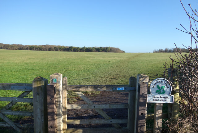
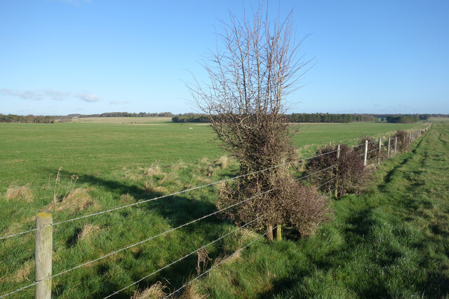
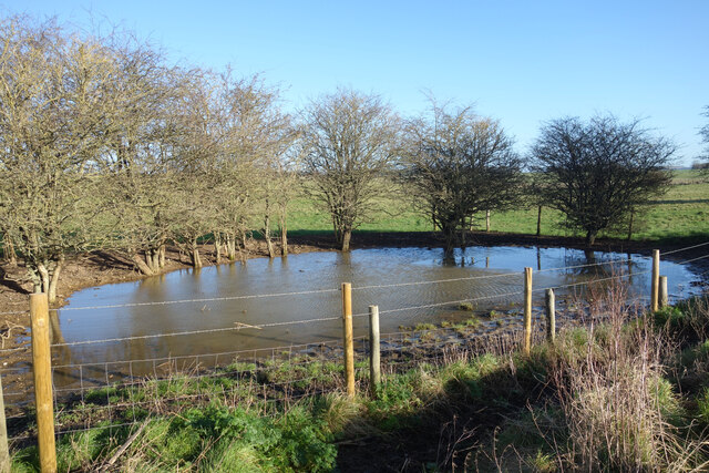
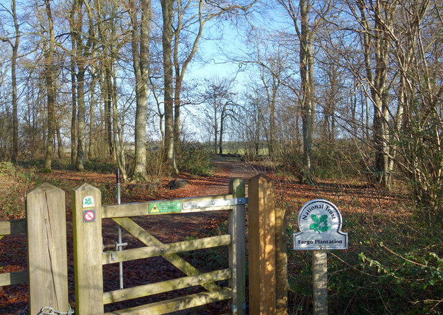
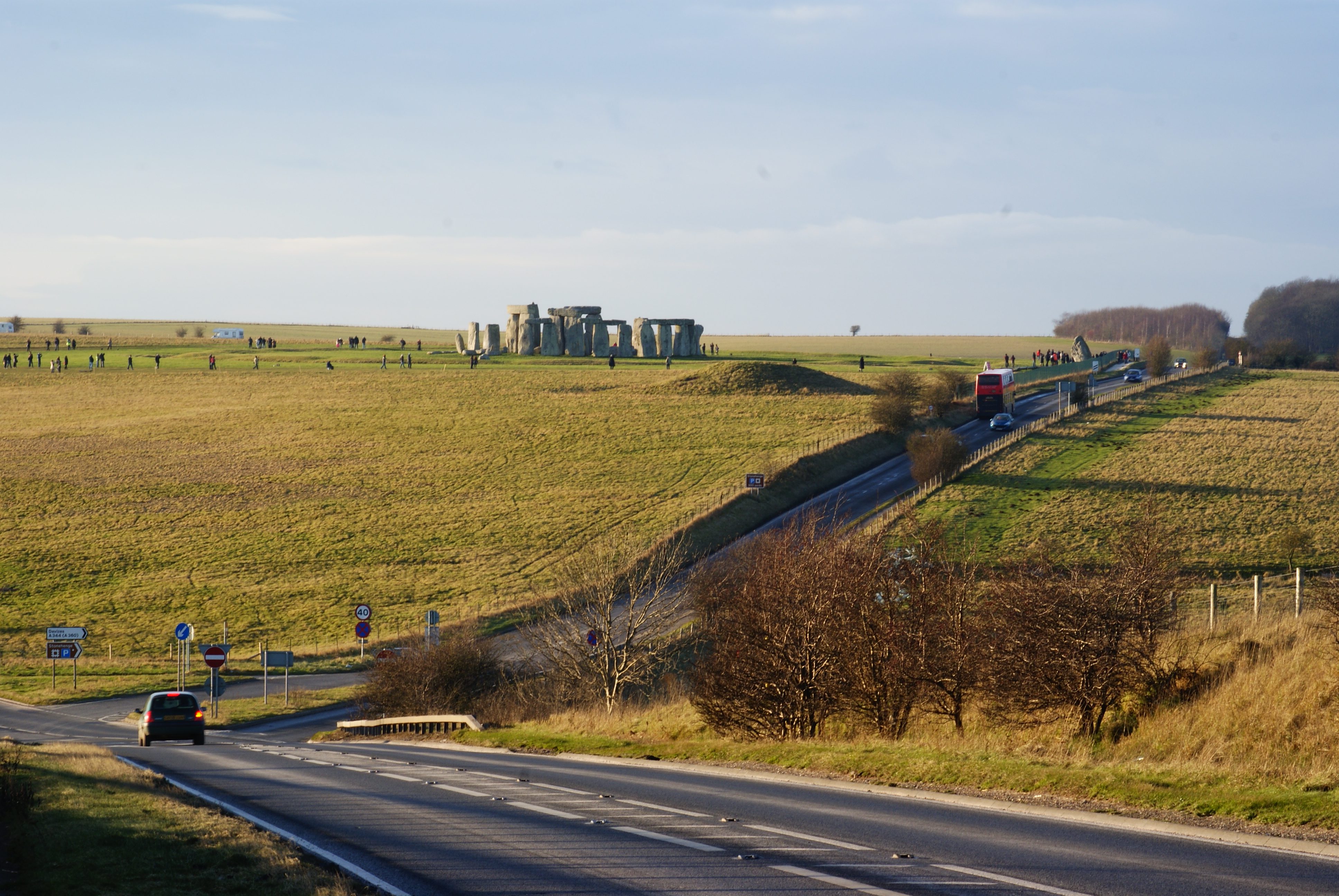
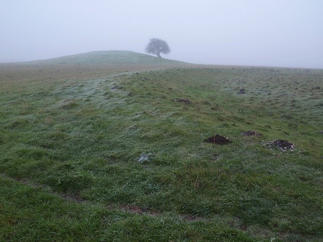
Winterbourne Stoke Down is a prominent natural feature located in Wiltshire, England. It is part of the larger Salisbury Plain and stretches over an area of approximately 5 square kilometers. The down is characterized by its rolling hills, open grasslands, and scattered shrubs, making it a significant landscape within the region.

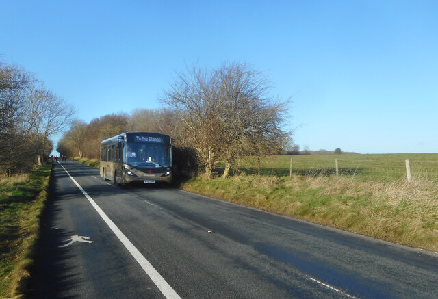
The down is situated in close proximity to the village of Winterbourne Stoke, from which it derives its name. It is accessible to visitors and locals alike, offering ample opportunities for outdoor activities such as walking, hiking, and birdwatching. The down's diverse flora and fauna attract nature enthusiasts, with species such as skylarks, meadow pipits, and various butterflies being commonly spotted in the area.

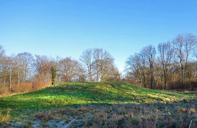
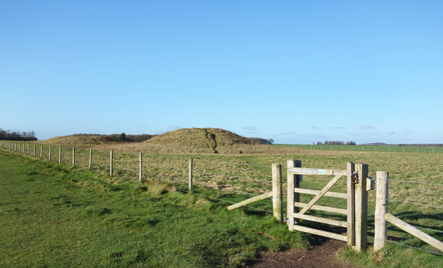
Winterbourne Stoke Down is also known for its archaeological significance. The down is home to several ancient burial mounds and barrows, showcasing its long history of human occupation. These archaeological sites provide valuable insights into the area's past, further adding to its cultural importance.

Due to its location on Salisbury Plain, Winterbourne Stoke Down experiences a typical English climate, with mild summers and cool winters. The down is often subject to strong winds due to its exposed position, adding an element of wildness to the landscape.

Overall, Winterbourne Stoke Down is a captivating natural and historical site, offering visitors a chance to explore the beauty of the Wiltshire countryside while immersing themselves in its rich cultural heritage.

If you have any feedback on the listing, please let us know in the comments section below.

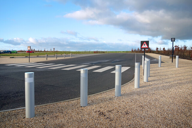
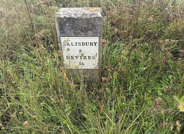
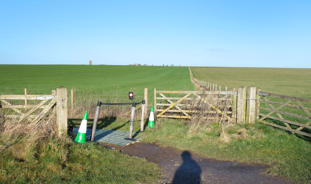
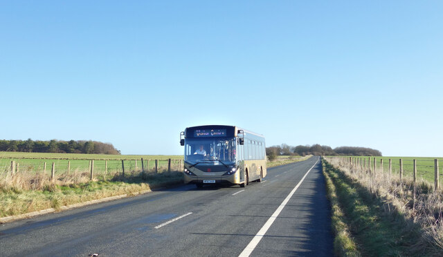
Winterbourne Stoke Down Images

Images are sourced within 2km of 51.180639/-1.8588031 or Grid Reference SU0942. Thanks to Geograph Open Source API. All images are credited.

Shuttle Buses, Stonehenge Coach Park Stonehenge itself is 2 kms away from the Visitor Centre and parking areas. There are buses to ferry visitors around but on a quiet January weekday it isn't very busy and these two are not being used today.
Shuttle Buses, Stonehenge Coach Park
Stonehenge itself is 2 kms away from the Visitor Centre and parking areas. There are buses to ferry visitors around but on a quiet January weekday it isn't very busy and these two are not being used today.
Crossing at the Coach Park A midweek afternoon in January and the big parking area for tour buses is almost deserted.
Crossing at the Coach Park
A midweek afternoon in January and the big parking area for tour buses is almost deserted.
Stonehenge Visitor Centre Driveway The way in and out for cars at the Stonehenge Visitor Centre which is situated 2 kms away from the stones themselves. Separate parking for coaches is beyond the trees in the distance.
Stonehenge Visitor Centre Driveway
The way in and out for cars at the Stonehenge Visitor Centre which is situated 2 kms away from the stones themselves. Separate parking for coaches is beyond the trees in the distance.
Old Milestone by the A360, Airman's Corner, Winterbourne Stoke parish Metal plate attached to stone post by the A360, in parish of WINTERBOURNE STOKE (SALISBURY District), Airman's Corner; 25m South of junction, moved when junction was re-made (was at SU 097 429), on West side of road. Salisbury plate, erected by the Fisherton, Wilton, Heytesbury, Willoughby Hedge & Redhone turnpike trust in the 19th century. 

Inscription reads:-
SALISBURY
9
DEVIZES
14 

Milestone Society National ID: WI_DZSA14.
Old Milestone by the A360, Airman's Corner, Winterbourne Stoke parish
Metal plate attached to stone post by the A360, in parish of WINTERBOURNE STOKE (SALISBURY District), Airman's Corner; 25m South of junction, moved when junction was re-made (was at SU 097 429), on West side of road. Salisbury plate, erected by the Fisherton, Wilton, Heytesbury, Willoughby Hedge & Redhone turnpike trust in the 19th century. Inscription reads:- SALISBURY 9 DEVIZES 14 Milestone Society National ID: WI_DZSA14.
A Wiltshire Gate I don't know how the name came about, but these moveable barriers are often called Wiltshire Gates.
This one is in its home county on National Trust access land near to Stonehenge.
Buildings at Greenland Farm are just visible on the horizon.
A Wiltshire Gate
I don't know how the name came about, but these moveable barriers are often called Wiltshire Gates. This one is in its home county on National Trust access land near to Stonehenge. Buildings at Greenland Farm are just visible on the horizon.
Edge of the Access Land The fields all around Stonehenge are full of other prehistoric sites. Burial mounds and ceremonial avenues are preserved in an open grassland setting by the National Trust, with visitor access permitted. Elsewhere is just ordinary farmland. A very open landscape with only a few trees.
Edge of the Access Land
The fields all around Stonehenge are full of other prehistoric sites. Burial mounds and ceremonial avenues are preserved in an open grassland setting by the National Trust, with visitor access permitted. Elsewhere is just ordinary farmland. A very open landscape with only a few trees.
Stonehenge Visitor Centre Opened in 2013 on a site some 2 kms away from the stones, the centre replaces a much humbler collection of buildings including a tunnel which were right beside the henge itself.
Stonehenge Visitor Centre
Opened in 2013 on a site some 2 kms away from the stones, the centre replaces a much humbler collection of buildings including a tunnel which were right beside the henge itself.
The Old A344 Formerly a main road forming the long side of a triangle of roads around Stonehenge, the A344, which was only ever 3 kms long, was closed in June 2013 as part of a big Stonehenge enhancement project. The Mayor of nearby Amesbury was one of the last people to use it. <span class="nowrap"><a title="https://www.bbc.co.uk/news/uk-england-wiltshire-23630368" rel="nofollow ugc noopener" href="https://www.bbc.co.uk/news/uk-england-wiltshire-23630368">Link</a><img style="margin-left:2px;" alt="External link" title="External link - shift click to open in new window" src="https://s1.geograph.org.uk/img/external.png" width="10" height="10"/></span>
Most of the western end has been retained for use by the bus service, seen here, between the henge and the visitor centre. It's also used by visitors who want to do the 2 km walk rather than go on the bus.
A brief Wikipedia summary is on <span class="nowrap"><a title="https://en.wikipedia.org/wiki/A344_road_(England)" rel="nofollow ugc noopener" href="https://en.wikipedia.org/wiki/A344_road_(England)">Link</a><img style="margin-left:2px;" alt="External link" title="External link - shift click to open in new window" src="https://s1.geograph.org.uk/img/external.png" width="10" height="10"/></span>
The Old A344
Formerly a main road forming the long side of a triangle of roads around Stonehenge, the A344, which was only ever 3 kms long, was closed in June 2013 as part of a big Stonehenge enhancement project. The Mayor of nearby Amesbury was one of the last people to use it. LinkExternal link Most of the western end has been retained for use by the bus service, seen here, between the henge and the visitor centre. It's also used by visitors who want to do the 2 km walk rather than go on the bus. A brief Wikipedia summary is on LinkExternal link
Stonehenge Landscape The National Trust manages 827 hectares of mostly chalk grassland with some small woods around the main site of Stonehenge.
Rich in plant and animal species, the site also contains many of the large number of prehistoric remains which surround the Henge.
Stonehenge Landscape
The National Trust manages 827 hectares of mostly chalk grassland with some small woods around the main site of Stonehenge. Rich in plant and animal species, the site also contains many of the large number of prehistoric remains which surround the Henge.
The Airman's Cross "On 5 July 1912, two pioneering airmen lost their lives in an aeroplane crash near the new visitor centre at Stonehenge. On the path near the centre is Airman’s Cross, erected in their memory.
Captain Eustace Loraine and Staff-Sergeant Richard Wilson were flying a Nieuport monoplane from Larkhill airfield, north of Stonehenge, on a training flight. They were executing a steep turn when the aircraft crashed. The two men were the first members of the newly formed Royal Flying Corps to lose their lives while flying on duty." - English Heritage
The cross was for many years on a roundabout up by the lamp posts visible on the horizon.
The Airman's Cross
"On 5 July 1912, two pioneering airmen lost their lives in an aeroplane crash near the new visitor centre at Stonehenge. On the path near the centre is Airman’s Cross, erected in their memory. Captain Eustace Loraine and Staff-Sergeant Richard Wilson were flying a Nieuport monoplane from Larkhill airfield, north of Stonehenge, on a training flight. They were executing a steep turn when the aircraft crashed. The two men were the first members of the newly formed Royal Flying Corps to lose their lives while flying on duty." - English Heritage The cross was for many years on a roundabout up by the lamp posts visible on the horizon.
Fence along The Cursus The fence follows the line of The Cursus, a low level Neolithic linear earthwork
presumed to have been made for some sort of ceremonial purpose.
The field on the other side is part of the National Trust's access land surrounding Stonehenge. There is not a lot to see there.
For a view in the opposite direction see <a href="https://www.geograph.org.uk/photo/2819457">SU1143 : Northern edge of The Cursus</a>
Fence along The Cursus
The fence follows the line of The Cursus, a low level Neolithic linear earthwork presumed to have been made for some sort of ceremonial purpose. The field on the other side is part of the National Trust's access land surrounding Stonehenge. There is not a lot to see there. For a view in the opposite direction see SU1143 : Northern edge of The Cursus
Dew Pond near Stonehenge Once a common sight on dry downland pastures, you can still find dew ponds from time to time. Clay lined to collect rainfall, they were often the only source of drinking water for livestock.
Dew Pond near Stonehenge
Once a common sight on dry downland pastures, you can still find dew ponds from time to time. Clay lined to collect rainfall, they were often the only source of drinking water for livestock.
Fargo Plantation Part of the National Trust's Stonehenge Landscape site. This area is not very well wooded, and what trees there are tend to be confined into small plantations like this one.
Fargo Plantation
Part of the National Trust's Stonehenge Landscape site. This area is not very well wooded, and what trees there are tend to be confined into small plantations like this one.
Tumulus in Fargo Plantation There are dozens of these Bronze Age burial mounds all around Stonehenge, which is why the whole area is a protected landscape in the care of the National Trust.
Tumulus in Fargo Plantation
There are dozens of these Bronze Age burial mounds all around Stonehenge, which is why the whole area is a protected landscape in the care of the National Trust.
Tumulus and Gate There are dozens of these burial mounds all around Stonehenge. They come in various shapes and sizes. These two are some of the larger ones and are fenced off in their own enclosure.
Tumulus and Gate
There are dozens of these burial mounds all around Stonehenge. They come in various shapes and sizes. These two are some of the larger ones and are fenced off in their own enclosure.
Stone Age Housing at the Visitor Centre Based on excavations at habitation sites nearby, these are a recreation of what archaeologists believe were the type of houses lived in by the people who built Stonehenge.
Stone Age Housing at the Visitor Centre
Based on excavations at habitation sites nearby, these are a recreation of what archaeologists believe were the type of houses lived in by the people who built Stonehenge.
Bus To The Stones One of the buses which take visitors on the 2 km trip between Stonehenge and the Visitor Centre.
Quite a few people go on foot, especially on a nice day like this, hence the walkway along the roadside.
The buses are the only regular traffic along what used to be the A344, a former main road which has now been closed.
Bus To The Stones
One of the buses which take visitors on the 2 km trip between Stonehenge and the Visitor Centre. Quite a few people go on foot, especially on a nice day like this, hence the walkway along the roadside. The buses are the only regular traffic along what used to be the A344, a former main road which has now been closed.
Memorial to an Aviator A short distance away from a similar memorial outside the Stonehenge Visitor Centre to two pioneer airmen who crashed near there in 1912, this roadside cross is in memory of Major Alexander William Hewetson who was killed whilst flying on the 17th July 1913.
Memorial to an Aviator
A short distance away from a similar memorial outside the Stonehenge Visitor Centre to two pioneer airmen who crashed near there in 1912, this roadside cross is in memory of Major Alexander William Hewetson who was killed whilst flying on the 17th July 1913.
Show me another place!

Winterbourne Stoke Down is located at Grid Ref: SU0942 (Lat: 51.180639, Lng: -1.8588031)

Unitary Authority: Wiltshire

Police Authority: Wiltshire

What 3 Words

///gifts.sidelined.briskly. Near Winterbourne Stoke, Wiltshire

Nearby Locations

Winterbourne Stoke Down

Related Wikis

A344 road (England)

The A344 was an A road in the English county of Wiltshire. Until 2013 it ran from its junction with the A303 at Stonehenge, northwest to its junction with...

Cursus Barrows

The Cursus Barrows is the name given to a Neolithic and Bronze Age round barrow cemetery lying mostly south of the western end of the Stonehenge Cursus...

Heelstone Ditch

Heelstone Ditch is a roughly circular feature surrounding the Heel Stone at Stonehenge. It is not known if there was an intended relationship between the...

Bush Barrow

Bush Barrow is a site of the early British Bronze Age Wessex culture (c. 2000 BC), at the western end of the Normanton Down Barrows cemetery in Wiltshire...

Nearby Amenities

Located within 500m of 51.180639,-1.8588031
Airman's Cross
Historic: memorial
Memorial: obelisk
Wheelchair: yes
Lat/Long: 51.1837842/-1.857827
Bicycle Parking
Bicycle Parking: stands
Covered: no
Lat/Long: 51.1834636/-1.8577791
Archaeological Site: tumulus
Historic: archaeological_site
Lat/Long: 51.1784434/-1.8551267
Archaeological Site: earthwork
Historic: archaeological_site
Lat/Long: 51.1792389/-1.8567787
Archaeological Site: tumulus
Historic: archaeological_site
Lat/Long: 51.1803626/-1.8545427
Toilets
Changing Table: yes
Fee: no
Toilets Disposal: flush
Wheelchair: yes
Lat/Long: 51.1841641/-1.8574731
Cafe
Cuisine: regional
Diet Vegan: yes
Diet Vegetarian: yes
Indoor Seating: yes
Outdoor Seating: yes
Smoking: no
Wheelchair: yes
Lat/Long: 51.1844991/-1.8575021
Archaeological Site: tumulus
Historic: archaeological_site
Lat/Long: 51.1805645/-1.857648
Archaeological Site: tumulus
Historic: archaeological_site
Lat/Long: 51.1805241/-1.8590373
Archaeological Site: tumulus
Historic: archaeological_site
Lat/Long: 51.1805947/-1.856331
Stonehenge
Payment Credit Cards: yes
Payment Debit Cards: yes
Shop: gift
Wheelchair: limited
Lat/Long: 51.1845183/-1.857248
Stonehenge
Payment Credit Cards: yes
Payment Debit Cards: yes
Shop: ticket
Lat/Long: 51.1843307/-1.8573338
Stonehenge Exhibitions
Fee: yes
Museum: history
Operator: English Heritage Org
Tourism: museum
Website: https://www.english-heritage.org.uk/visit/places/stonehenge/things-to-do/exhibitions/
Lat/Long: 51.1841873/-1.8572014
Bus Stop
Airman's Corner
Bench: yes
Bin: yes
Bus: yes
Naptan AtcoCode: 460000193
Naptan Bearing: W
Naptan BusStopType: CUS
Naptan CommonName: Airman's Corner
Naptan Indicator: W-bound
Naptan NaptanCode: wildwmtj
Naptan Street: A360
Naptan Verified: no
Public Transport: platform
Shelter: no
Source: naptan;bing;naptan_compare_tool
Lat/Long: 51.1848089/-1.8571433
Bus: yes
Public Transport: stop_position
Lat/Long: 51.184859/-1.8571959
Bench
Backrest: yes
Check Date: 2023-06-26
Material: wood
Lat/Long: 51.1841477/-1.8570326
Explore the Stonehenge landscape
Information: map
Map Size: local
Map Type: village
Tourism: information
Lat/Long: 51.1843758/-1.857038
Waste Basket
Check Date: 2023-06-26
Lat/Long: 51.1844189/-1.8576084
Bench
Backrest: yes
Material: wood
Lat/Long: 51.1845951/-1.858123
Waste Basket
Check Date: 2023-06-26
Lat/Long: 51.184237/-1.8575864
Can you move the stone?
Board Type: information
Check Date: 2021-06-26
Information: board
Tourism: information
Lat/Long: 51.1840616/-1.8568437
Homes for the builders of Stonehenge?
Board Type: history
Check Date: 2021-06-26
Information: board
Tourism: information
Lat/Long: 51.184178/-1.8567425
Building blocks
Board Type: nature
Check Date: 2021-06-26
Information: board
Tourism: information
Lat/Long: 51.1841474/-1.8568609
Waste Basket
Lat/Long: 51.1840196/-1.8569863
Burials from the Bronze Age
Board Type: history
Check Date: 2021-06-26
Information: board
Tourism: information
Lat/Long: 51.1839858/-1.8571376
English Heritage Monument
Historic: memorial
Memorial: stone
Lat/Long: 51.1842821/-1.8578711
Information: guidepost
Tourism: information
Lat/Long: 51.1842363/-1.8577971
Information: guidepost
Tourism: information
Lat/Long: 51.184301/-1.8578256
Give Way
Direction: forward
Lat/Long: 51.1848464/-1.8567698
Information: guidepost
Tourism: information
Lat/Long: 51.1846486/-1.8555769
Defibrillator
Defibrillator Location: The toilets entrance
Emergency: defibrillator
Indoor: no
Mapillary: https://www.mapillary.com/app/?pKey=187139860570758
Lat/Long: 51.1841843/-1.8574542
Drinking Water
Fountain: drinking
Indoor: yes
Location: At the waste disposal table.
Lat/Long: 51.1845645/-1.8574763
The data included in this document is from www.openstreetmap.org. The data is made available under ODbL.

Have you been to Winterbourne Stoke Down?

Leave your review of Winterbourne Stoke Down below (or comments, questions and feedback).