Benzoweine Allotment

Downs, Moorland in Yorkshire Richmondshire

England

Benzoweine Allotment

Shooting hut beside Carter House Two buildings stand alongside a farm lane at the edge of Carter Allotment, one is Carter House, this shooting hut lies north of the house.
Shooting hut beside Carter House Credit: Trevor Littlewood

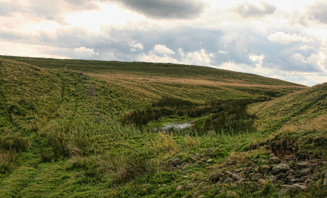
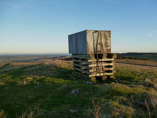
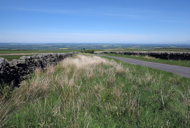
Benzoweine Allotment is a picturesque and serene allotment located in the region of Yorkshire, encompassing both the Downs and Moorland landscapes. Situated amidst the tranquil countryside, it offers a haven for nature enthusiasts and gardening enthusiasts alike.

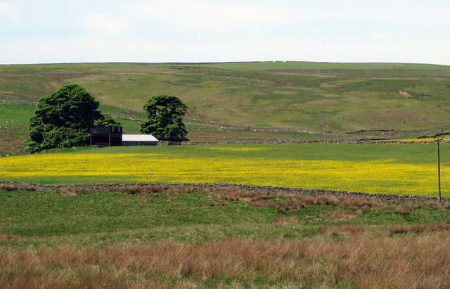
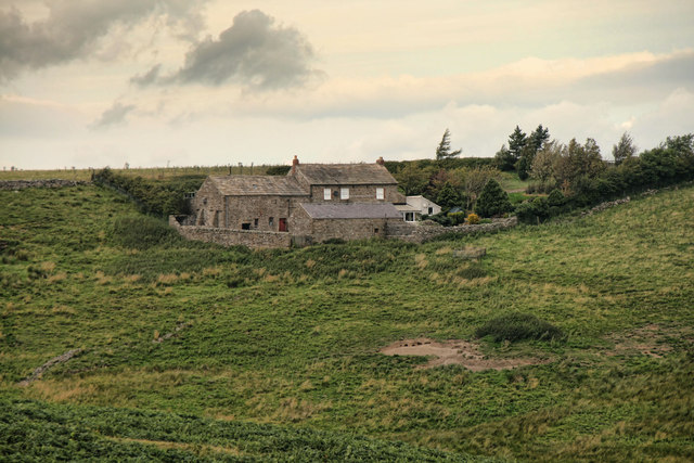
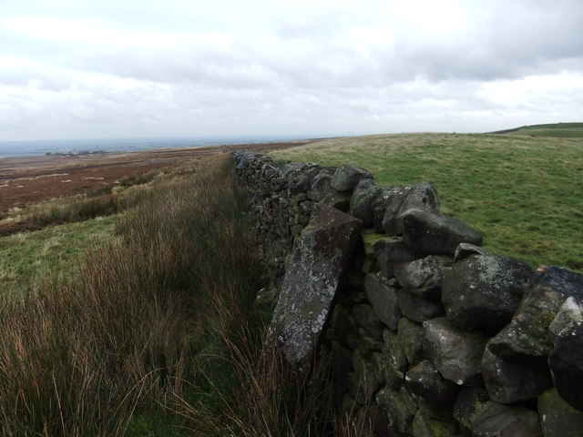
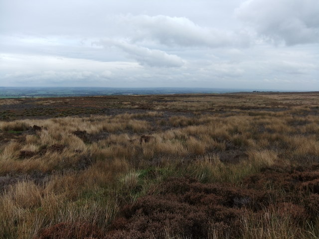
Covering an expansive area, Benzoweine Allotment boasts a diverse range of flora and fauna, making it a hotspot for biodiversity. The allotment is home to a plethora of plants, from vibrant and colorful flowers to various species of trees. The surrounding Yorkshire Downs provide a stunning backdrop of rolling hills and lush greenery, creating a visually pleasing and tranquil atmosphere.

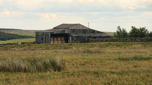
The allotment is meticulously maintained by a dedicated community of gardeners who work tirelessly to ensure its upkeep and beauty. Each plot within the allotment is expertly tended to, showcasing a wide array of vegetables, fruits, and herbs. Visitors to Benzoweine Allotment can witness the skill and dedication of these gardeners, as well as seek advice and inspiration for their own gardening endeavors.

In addition to its natural beauty, the allotment offers a sense of community and camaraderie amongst its members. Regular gatherings and events are organized, fostering a welcoming and inclusive atmosphere. This provides an opportunity for gardeners to exchange knowledge, share experiences, and form lasting connections.

Overall, Benzoweine Allotment in Yorkshire is a haven of natural beauty, biodiversity, and community spirit. Whether one is a gardening enthusiast or simply seeking a peaceful retreat, this allotment offers a serene escape amidst the stunning Yorkshire Downs and Moorland landscapes.

If you have any feedback on the listing, please let us know in the comments section below.

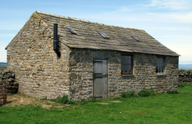
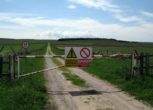
Benzoweine Allotment Images

Images are sourced within 2km of 54.471093/-1.8777309 or Grid Reference NZ0808. Thanks to Geograph Open Source API. All images are credited.

Shooting hut beside Carter House Two buildings stand alongside a farm lane at the edge of Carter Allotment, one is Carter House, this shooting hut lies north of the house.
Shooting hut beside Carter House
Two buildings stand alongside a farm lane at the edge of Carter Allotment, one is Carter House, this shooting hut lies north of the house.
Buildings at Windsor Lodge A flowered hay field stands surrounded by rough pasture and moorland close to the buildings at Windsor Lodge.
Buildings at Windsor Lodge
A flowered hay field stands surrounded by rough pasture and moorland close to the buildings at Windsor Lodge.
Entry to north end of MoD Feldom Range Although the route along the road has public access the notices are unwelcoming and even instruct one to 'Keep Out'!
Entry to north end of MoD Feldom Range
Although the route along the road has public access the notices are unwelcoming and even instruct one to 'Keep Out'!
Footbridge and ford over minor stream near Barningham A very substantial bridge for such a minor crossing! The stream seems to descend a shallow valley known as East Langbrough which is behind the camera position; its water flows onward to enter the River Greta.
Footbridge and ford over minor stream near Barningham
A very substantial bridge for such a minor crossing! The stream seems to descend a shallow valley known as East Langbrough which is behind the camera position; its water flows onward to enter the River Greta.
Byers Hill Byers Hill Farm.
Byers Hill
Byers Hill Farm.
Harker Moss The bridleway crossing Harker Moss.
Harker Moss
The bridleway crossing Harker Moss.
Long Green Farm Barns at Long Green Farm seen from Moor Lane.
Long Green Farm
Barns at Long Green Farm seen from Moor Lane.
Badger Way Stoop
Badger Way Stoop
Barningham Moor
Barningham Moor
Gordale Gill Road crossing Gordale Gill near Crossbeck Bridge.
Gordale Gill
Road crossing Gordale Gill near Crossbeck Bridge.
Bragg House Bragg House on the edge of Barningham  Moor.
Bragg House
Bragg House on the edge of Barningham Moor.
Enclosure east of Cathaw Stoop Cathaw Stoop is a stone - boundary or direction giving - embedded into a wall beside a stile where a public footpath crosses into this enclosure. The path continues beside the wall on the left side of the 'field' which, unaccountably, is not classified as access land.
Enclosure east of Cathaw Stoop
Cathaw Stoop is a stone - boundary or direction giving - embedded into a wall beside a stile where a public footpath crosses into this enclosure. The path continues beside the wall on the left side of the 'field' which, unaccountably, is not classified as access land.
Water tank. Water tank on top of unnamed hill overlooking Dalton near Richmond, North Yorks. For years I've seen this from the A66 thinking it to be a large cairn of some significance, only to find this instead. Still, the views to the North and East are excellent.
Water tank.
Water tank on top of unnamed hill overlooking Dalton near Richmond, North Yorks. For years I've seen this from the A66 thinking it to be a large cairn of some significance, only to find this instead. Still, the views to the North and East are excellent.
Gates at entry to Barningham Park A public footpath enters Barningham Park at its east side through one of the gates here - presumably the less grand one! The monument mounted in the wall commemorates the building of the wall, the creation of the deer park and the planting of trees between 1857 and 1859. Also mentioned is the erection of a model farm in 1863. All of these works were 'Designed and Executed by Augustus Sussex Milbank'... bet he had some help!
Gates at entry to Barningham Park
A public footpath enters Barningham Park at its east side through one of the gates here - presumably the less grand one! The monument mounted in the wall commemorates the building of the wall, the creation of the deer park and the planting of trees between 1857 and 1859. Also mentioned is the erection of a model farm in 1863. All of these works were 'Designed and Executed by Augustus Sussex Milbank'... bet he had some help!
Minor road near Carter House A minor road with wide verges between dry stone walls.
(Carter House is a shooting hut beside a barn in enclosures to the left side of the image and not in view.)
Minor road near Carter House
A minor road with wide verges between dry stone walls. (Carter House is a shooting hut beside a barn in enclosures to the left side of the image and not in view.)
Erect stone with waymark on Barningham Moor Barningham Moor lies to the west of Barningham village. The image was recorded during a walk attempting to follow a public bridleway across the moor; evidence of the route on the ground was scant and the stone seen here was thought to be a sign that we were on the way but a GPS reading showed that we were slightly to the north of it... or the reading was inaccurate. (Note: a similar discrepancy was discovered elsewhere along the route - <a title="https://www.geograph.org.uk/photo/3494497" href="https://www.geograph.org.uk/photo/3494497">Link</a> .) Stang Forest lies in the distance.
Erect stone with waymark on Barningham Moor
Barningham Moor lies to the west of Barningham village. The image was recorded during a walk attempting to follow a public bridleway across the moor; evidence of the route on the ground was scant and the stone seen here was thought to be a sign that we were on the way but a GPS reading showed that we were slightly to the north of it... or the reading was inaccurate. (Note: a similar discrepancy was discovered elsewhere along the route - Link .) Stang Forest lies in the distance.
Stone with waymark on Barningham Moor There are various rights of way on Barningham Moor; the one indicated by the waymark was being followed (more or less) with no actual route on the ground when the stone was come upon. A GPS receiver reading gave the stone location as being quite off the route as mapped - the second such discrepancy on the route - see <a title="https://www.geograph.org.uk/photo/3494279" href="https://www.geograph.org.uk/photo/3494279">Link</a>
The small cairn beside the stone is of a few rocks and a breeze block! The breeze block is used by the estate keeper(s) as a reservoir for 'grouse grit' - a common enough feature on heather moorland.
Stone with waymark on Barningham Moor
There are various rights of way on Barningham Moor; the one indicated by the waymark was being followed (more or less) with no actual route on the ground when the stone was come upon. A GPS receiver reading gave the stone location as being quite off the route as mapped - the second such discrepancy on the route - see Link The small cairn beside the stone is of a few rocks and a breeze block! The breeze block is used by the estate keeper(s) as a reservoir for 'grouse grit' - a common enough feature on heather moorland.
Strange stones on Barningham Moor Barningham Moor is well known for a large number of cup and ring marked stones, all hard to find and difficult to recognise. There are various bronze-age stone structures, too, but this one seems a lot more recent, since closer inspection reveals that it is based on two breeze blocks buried flush with the surface of the moor, and marked with what might once have been a small plywood sign, but which has no discernible writing now. Lettering isn't the only thing which is hardly discernible, since this is also about the point where the bridleway disappeared from under me - aerial photos show lots of tyre tracks randomly crossing the moor but no one obvious track for horses and pedestrians.

It's all to do with grouse management, I believe, but I groused a lot at this point and fortunately, no-one came along trying to manage me !
Strange stones on Barningham Moor
Barningham Moor is well known for a large number of cup and ring marked stones, all hard to find and difficult to recognise. There are various bronze-age stone structures, too, but this one seems a lot more recent, since closer inspection reveals that it is based on two breeze blocks buried flush with the surface of the moor, and marked with what might once have been a small plywood sign, but which has no discernible writing now. Lettering isn't the only thing which is hardly discernible, since this is also about the point where the bridleway disappeared from under me - aerial photos show lots of tyre tracks randomly crossing the moor but no one obvious track for horses and pedestrians. It's all to do with grouse management, I believe, but I groused a lot at this point and fortunately, no-one came along trying to manage me !
Show me another place!

Benzoweine Allotment is located at Grid Ref: NZ0808 (Lat: 54.471093, Lng: -1.8777309)

Division: North Riding

Administrative County: North Yorkshire

District: Richmondshire

Police Authority: North Yorkshire

What 3 Words

///slicer.prune.campsites. Near Barningham, Co. Durham

Related Wikis

Barningham Park

Barningham Park is a Grade II* listed country house and 7,000 acre estate located in the village of Barningham, County Durham (formerly the North Riding...

Milbank Arms, Barningham

The Milbank Arms is a Grade II listed public house at Barningham, County Durham. Built in the early 19th century, it spent a period as a hotel before converting...

Barningham, County Durham

Barningham is a village in County Durham, in the Pennines of England. == History == Barningham is listed in the Domesday Book under the Gilling Wapentake...

Newsham, Richmondshire

Newsham is a village and civil parish in the Richmondshire district of North Yorkshire, England. The village is 8 miles (13 km) north west of Richmond...

Brignall Banks

Brignall Banks is a Site of Special Scientific Interest in the Teesdale district of south-west County Durham, England. It consists of a narrow belt of...

Dalton, west North Yorkshire

Dalton is a village and civil parish in North Yorkshire in England. Dalton is situated about six miles north-west of Richmond and about five miles south...

New Forest, North Yorkshire

New Forest is a civil parish in the Richmondshire district of North Yorkshire, England. It lies 6 miles (10 km) west of Richmond. There is no village...

Scargill, County Durham

Scargill is a hamlet in the Pennines of England, situated close to the River Greta. The population taken at the 2011 Census was less than 100. Details...

Nearby Amenities

Located within 500m of 54.471093,-1.8777309
Cathaw
Place: locality
Lat/Long: 54.473796/-1.8760627
Benzoweine Plantation
Place: locality
Lat/Long: 54.471625/-1.8762122
The data included in this document is from www.openstreetmap.org. The data is made available under ODbL.

Have you been to Benzoweine Allotment?

Leave your review of Benzoweine Allotment below (or comments, questions and feedback).