Hartfordbeach

Settlement in Cheshire

England

Hartfordbeach

Hartford Bridge Over the Weaver navigation just outside Hartford, Cheshire.
Hartford Bridge Credit: Colin Wynne-Parle

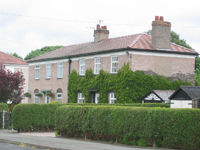
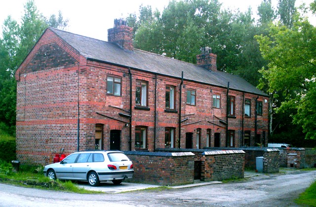
Hartfordbeach is a picturesque village located in the county of Cheshire, England. Situated on the banks of the River Weaver, it offers residents and visitors alike a tranquil and idyllic setting. With a population of around 3,000 people, it maintains a close-knit community atmosphere.

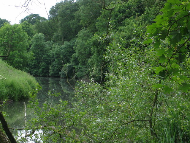
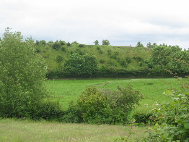
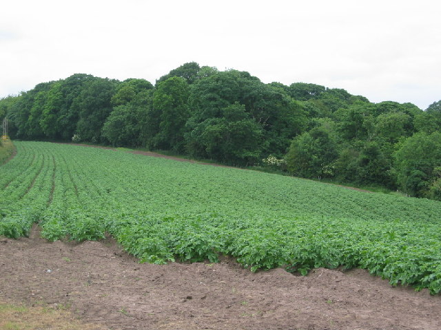
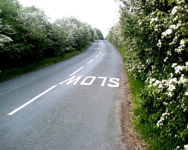
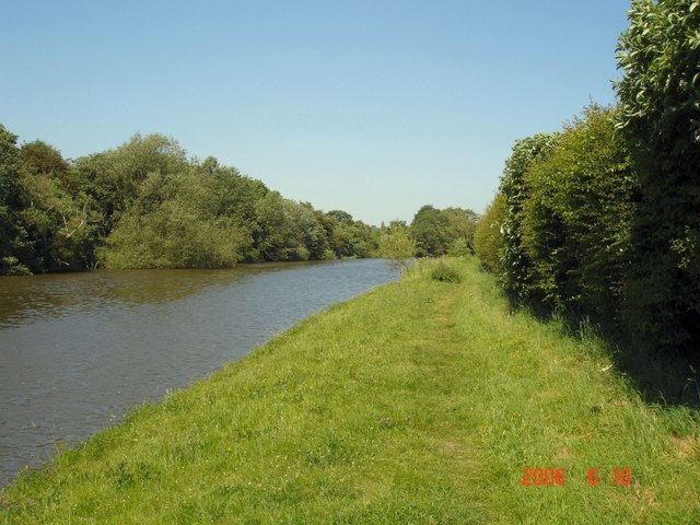
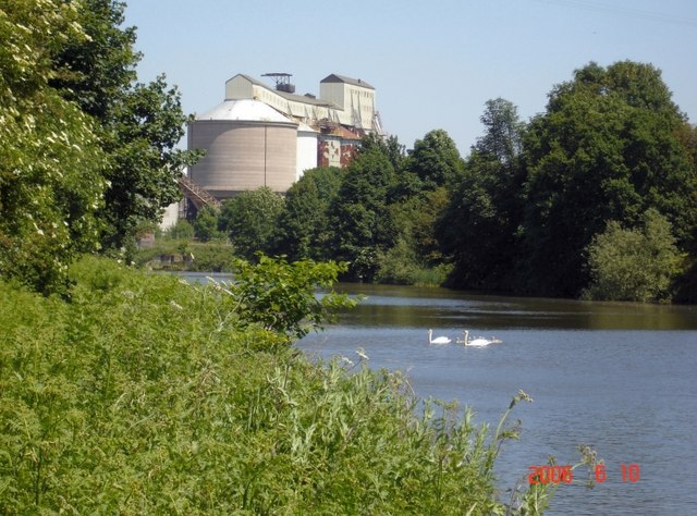
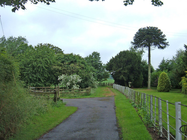
The village is known for its stunning natural surroundings, with beautiful countryside and scenic river views. Hartfordbeach is particularly popular among nature enthusiasts and those seeking outdoor activities. The area is abundant in wildlife, making it a haven for birdwatching and nature walks.

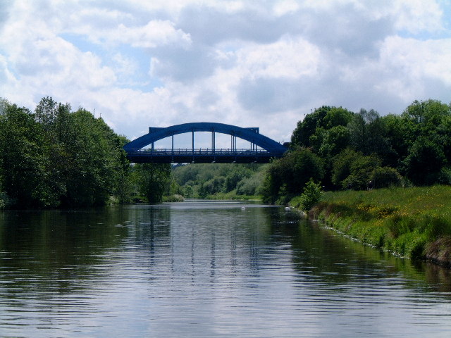
One of the main attractions in Hartfordbeach is its historic bridge, dating back to the 18th century. This iconic landmark not only serves as a crossing point over the River Weaver but also offers breathtaking views of the surrounding countryside. It is a popular spot for photography enthusiasts and tourists.

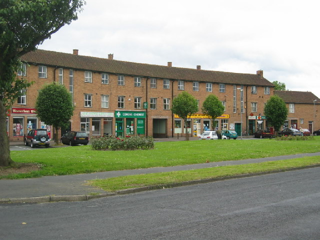
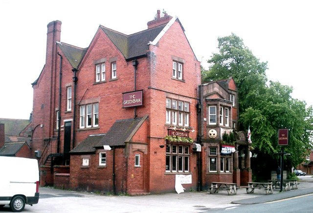
The village is well-served by amenities, including a range of local shops, restaurants, and pubs. The local primary school provides education for the village's younger population, while nearby towns offer secondary education options.

Hartfordbeach benefits from excellent transport links, with regular bus services connecting the village to nearby towns and cities. The nearby Hartford railway station provides direct access to major cities such as Manchester and Liverpool.

Overall, Hartfordbeach offers a charming and peaceful setting, perfect for those looking to escape the hustle and bustle of city life. Its natural beauty, community spirit, and convenient location make it an attractive place to live or visit in Cheshire.

If you have any feedback on the listing, please let us know in the comments section below.

Hartfordbeach Images

Images are sourced within 2km of 53.250933/-2.54927 or Grid Reference SJ6372. Thanks to Geograph Open Source API. All images are credited.

Hartford Bridge Over the Weaver navigation just outside Hartford, Cheshire.
Hartford Bridge
Over the Weaver navigation just outside Hartford, Cheshire.
Lime Avenue shops, Weaverham A neighbourhood group of shops built to serve the estate of council built houses developed in the late 1940's.
Lime Avenue shops, Weaverham
A neighbourhood group of shops built to serve the estate of council built houses developed in the late 1940's.
Owley Wood Owley Wood close to Weaverham a popular recreational area.
Owley Wood
Owley Wood close to Weaverham a popular recreational area.
River Weaver, Cheshire River Weaver as it flows close to Owley Wood
River Weaver, Cheshire
River Weaver as it flows close to Owley Wood
Embankment Embankment close to River Weaver.
Embankment
Embankment close to River Weaver.
Works, close to Moss Farm, Northwich Area of mixed industry this building is at 643737
Works, close to Moss Farm, Northwich
Area of mixed industry this building is at 643737
Works  close to Moss Farm An area of mixed industry.
Works close to Moss Farm
An area of mixed industry.
Potato field close to Owley Wood Cheshire potatoes growing on the edge of the village of Weaverham.
Potato field close to Owley Wood
Cheshire potatoes growing on the edge of the village of Weaverham.
Houses in Owley Wood Houses built and owned by ICI for their workers at the nearby factories at Winnington. Houses now privately owned.
Houses in Owley Wood
Houses built and owned by ICI for their workers at the nearby factories at Winnington. Houses now privately owned.
May Blossom, Hartford May (hawthorn) blossom lining the hedgerows at Hodge Lane, Hartford Junction, between the bridges.
May Blossom, Hartford
May (hawthorn) blossom lining the hedgerows at Hodge Lane, Hartford Junction, between the bridges.
Lych Gate, Hartford Church Lych gate to the churchyard of St. John the Baptist, The Green, Hartford.
For detail see <a href="https://www.geograph.org.uk/photo/175686">SJ6372 : Inscription on Lych Gate, Hartford Church</a>
Lych Gate, Hartford Church
Lych gate to the churchyard of St. John the Baptist, The Green, Hartford. For detail see SJ6372 : Inscription on Lych Gate, Hartford Church
Inscription on Lych Gate, Hartford Church Inscription on <a href="https://www.geograph.org.uk/photo/175663">SJ6372 : Lych Gate, Hartford Church</a>
Inscription on Lych Gate, Hartford Church
Hartford Church St. John the Baptist Church, Chester Road, Hartford.
Hartford Church
St. John the Baptist Church, Chester Road, Hartford.
Greenbank Hotel Greenbank Hotel, Chester Road (A559), Greenbank.
Greenbank Hotel
Greenbank Hotel, Chester Road (A559), Greenbank.
Terraced Cottages, Hartford Junction Former railway workers' cottages
Terraced Cottages, Hartford Junction
Former railway workers' cottages
Barnton Cut Contrast this image with the one taken by another contributor to this square showing the original course of the River Weaver near Owley Wood, Weaverham. The present image taken from the edge of, and looking into, the square shows the canalised Barnton Cut built between 1832 and 1835 to improve navigation. The old river leaves the navigable line upstream at the weir near Wallerscote and rejoins it downstream at Saltersford locks. The photo also shows the riverside footpath that runs from Winnington Bridge to Acton Bridge.
Barnton Cut
Contrast this image with the one taken by another contributor to this square showing the original course of the River Weaver near Owley Wood, Weaverham. The present image taken from the edge of, and looking into, the square shows the canalised Barnton Cut built between 1832 and 1835 to improve navigation. The old river leaves the navigable line upstream at the weir near Wallerscote and rejoins it downstream at Saltersford locks. The photo also shows the riverside footpath that runs from Winnington Bridge to Acton Bridge.
Heaven and Hell? On the Barnton Cut The Barnton Cut is the canalised portion of the River Weaver, built 1832-5 to improve navigation, between Saltersford Locks and Winnington. The photo shows some of the soda ash storage at Wallerscote soda ash works, Winnington - formerly ICI and now owned by Brunner Mond and seemingly partially derelict. This section of the river used to be busy with boats, including quite sizeable sea-going vessels carrying chemicals from the Wallerscote and Winnington works. These days it seems only the occasional maintenance craft or leisure boat would disturb the tranquility of the swan family. Taken from the riverside path.
Heaven and Hell? On the Barnton Cut
The Barnton Cut is the canalised portion of the River Weaver, built 1832-5 to improve navigation, between Saltersford Locks and Winnington. The photo shows some of the soda ash storage at Wallerscote soda ash works, Winnington - formerly ICI and now owned by Brunner Mond and seemingly partially derelict. This section of the river used to be busy with boats, including quite sizeable sea-going vessels carrying chemicals from the Wallerscote and Winnington works. These days it seems only the occasional maintenance craft or leisure boat would disturb the tranquility of the swan family. Taken from the riverside path.
Moss Farm, Sandiway Looking west from where the tarmac ends outside Moss Farm, where there are now several new houses. The path, which is a "road used as a public path" (RUPP), continues across farmland to the village of Sandiway.
Moss Farm, Sandiway
Looking west from where the tarmac ends outside Moss Farm, where there are now several new houses. The path, which is a "road used as a public path" (RUPP), continues across farmland to the village of Sandiway.
Show me another place!

Hartfordbeach is located at Grid Ref: SJ6372 (Lat: 53.250933, Lng: -2.54927)

Unitary Authority: Cheshire West and Chester

Police Authority: Cheshire

What 3 Words

///marmalade.rock.basics. Near Hartford, Cheshire

Related Wikis

Hartford, Cheshire

Hartford is a village and civil parish in the unitary authority of Cheshire West and Chester and the ceremonial county of Cheshire, England. It lies at...

The Grange School, Northwich

The Grange School is an independent day school near Northwich, Cheshire, England, a member of the Headmasters' and Headmistresses' Conference. Founded...

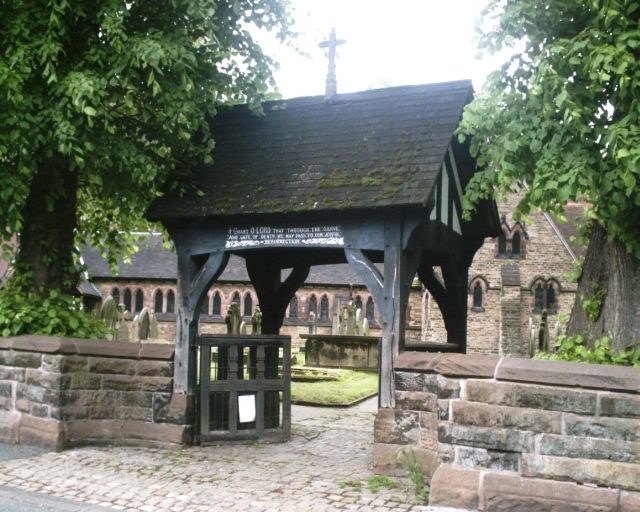
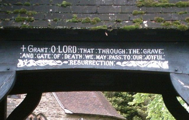
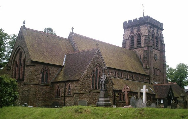
St John's Church, Hartford

St John the Baptist Church, is in the village of Hartford, Cheshire, England. The church is recorded in the National Heritage List for England as a designated...

Mid Cheshire College

Mid Cheshire College was a further education college based in Hartford and Winsford, Cheshire. The college merged with Warrington Collegiate in 2017 to...

Hartford Church of England High School

Hartford Church of England High School is a voluntary aided Church of England secondary school on Neot Road in Hartford, Cheshire, for students between...

Greenbank railway station

Greenbank railway station serves the village of Hartford, Cheshire as well as the Greenbank and Castle areas of Northwich, Cheshire, England. The station...

Hartford railway station

Hartford railway station is in the village of Hartford, in Cheshire, England. It is situated on the A559 road approximately two miles (3.2 km) west of...

Hartford Manor

Hartford Manor is a former country house in the village of Hartford, Cheshire, England. Its age is uncertain; it was said to have been re-fronted in about...

Nearby Amenities

Located within 500m of 53.250933,-2.54927
Crossing
Crossing: traffic_signals
Crossing Island: no
Crossing Ref: puffin
Tactile Paving: yes
Lat/Long: 53.2500504/-2.5468124
Bus Stop
Hartford, Beach Road / Royalty Wood
Bus: yes
Naptan AtcoCode: 0610VR1009
Naptan Bearing: NE
Naptan BusStopType: CUS
Naptan CommonName: Royalty Wood
Naptan Indicator: o/s
Naptan Landmark: Royalty Wood
Naptan LocalityName: Hartford
Naptan NaptanCode: chwgdtp
Naptan ShortCommonName: Royalty Wood
Naptan Street: Beach Road
Naptan Verified: no
Public Transport: platform
Source: naptan_import
Lat/Long: 53.2509752/-2.5423381
Bus Stop
Hartford, Beach Road / Royalty Wood
Bus: yes
Naptan AtcoCode: 0610VR1010
Naptan Bearing: W
Naptan CommonName: Royalty Wood
Naptan Indicator: opp
Naptan Landmark: Royalty Wood
Naptan LocalityName: Hartford
Naptan NaptanCode: chwgdtw
Naptan ShortCommonName: Royalty Wood
Naptan Street: Beach Road
Naptan Verified: no
Public Transport: platform
Source: naptan_import
Lat/Long: 53.2508119/-2.5426658
Bus Stop
Hartford, Beach Road / Methodist Chapel
Bus: yes
Naptan AtcoCode: 0610VR1011
Naptan Bearing: W
Naptan CommonName: Methodist Chapel
Naptan Crossing: Bradburns Lane
Naptan Indicator: opp
Naptan Landmark: Bradburns Lane
Naptan LocalityName: Hartford
Naptan NaptanCode: chwagtj
Naptan ShortCommonName: Methodist Chapel
Naptan Street: Beach Road
Naptan Verified: no
Public Transport: platform
Source: naptan_import
Lat/Long: 53.2499644/-2.5471514
Bus Stop
Hartford, Beach Road / Methodist Chapel
Bus: yes
Naptan AtcoCode: 0610VR1012
Naptan Bearing: E
Naptan CommonName: Methodist Chapel
Naptan Crossing: Bradburns Lane
Naptan Indicator: nr
Naptan Landmark: Park
Naptan LocalityName: Hartford
Naptan NaptanCode: chwagtm
Naptan ShortCommonName: Methodist Chapel
Naptan Street: Beach Road
Naptan Verified: no
Public Transport: platform
Source: naptan_import
Lat/Long: 53.2500068/-2.5477065
Bus Stop
Hartford, Northwich Road / Hodge Lane
Bus: yes
Naptan AtcoCode: 0610VR1013
Naptan Bearing: NW
Naptan CommonName: Hodge Lane
Naptan Crossing: Hodge Lane
Naptan Indicator: nr
Naptan Landmark: Hodge Lane Island
Naptan LocalityName: Hartford
Naptan NaptanCode: chwgdwa
Naptan ShortCommonName: Hodge Lane
Naptan Street: Northwich Road
Naptan Verified: no
Public Transport: platform
Source: naptan_import
Lat/Long: 53.2502448/-2.5526255
Bus Stop
Hartford, Northwich Road / Hodge Lane
Bus: yes
Naptan AtcoCode: 0610VR1014
Naptan Bearing: SE
Naptan CommonName: Hodge Lane
Naptan Crossing: Hodge Lane
Naptan Indicator: opp
Naptan Landmark: Hodge Lane Island
Naptan LocalityName: Hartford
Naptan NaptanCode: chwgdwd
Naptan ShortCommonName: Hodge Lane
Naptan Street: Northwich Road
Naptan Verified: no
Public Transport: platform
Shelter: yes
Source: naptan_import
Lat/Long: 53.250382/-2.5527229
Railway: buffer_stop
Lat/Long: 53.2480728/-2.5523511
Railway: switch
Lat/Long: 53.2477384/-2.5531948
Railway: switch
Lat/Long: 53.2475068/-2.5538846
Railway: switch
Lat/Long: 53.2479348/-2.5525832
Railway: switch
Lat/Long: 53.2481444/-2.5520278
Railway: switch
Lat/Long: 53.2481795/-2.5519347
Railway: switch
Lat/Long: 53.2482514/-2.5515988
Turning Circle
Lat/Long: 53.2473347/-2.547114
Generator Method: photovoltaic
Generator Output Electricity: yes
Generator Source: solar
Generator Type: solar_photovoltaic_panel
Location: roof
Power: generator
Lat/Long: 53.2514836/-2.5508822
Generator Method: photovoltaic
Generator Output Electricity: yes
Generator Source: solar
Generator Type: solar_photovoltaic_panel
Location: roof
Power: generator
Lat/Long: 53.2505881/-2.5458075
Generator Method: photovoltaic
Generator Output Electricity: yes
Generator Source: solar
Generator Type: solar_photovoltaic_panel
Location: roof
Power: generator
Lat/Long: 53.2484071/-2.5480954
Hartfort C.L.C. Junction
Alt Name: Hartford Junction
Railway: junction
Lat/Long: 53.2481326/-2.5520012
Stop
Lat/Long: 53.2508885/-2.5518104
Crossing
Crossing: traffic_signals
Crossing Island: no
Crossing Ref: puffin
Tactile Paving: yes
Lat/Long: 53.2486283/-2.5438735
Cycleway: asl
Direction: backward
Lat/Long: 53.2500525/-2.5461383
Traffic Signals
Traffic Signals: signal
Traffic Signals Direction: backward
Lat/Long: 53.2500344/-2.5460994
Crossing
Crossing: traffic_signals
Crossing Island: no
Crossing Ref: puffin
Tactile Paving: yes
Lat/Long: 53.2501018/-2.5462443
Traffic Signals
Traffic Signals: signal
Traffic Signals Direction: forward
Lat/Long: 53.2500417/-2.5468586
Cycleway: asl
Direction: backward
Lat/Long: 53.2502551/-2.5460392
Traffic Signals
Traffic Signals: signal
Traffic Signals Direction: backward
Lat/Long: 53.2502783/-2.545962
Defibrillator
Access: permissive
Emergency: defibrillator
Indoor: yes
Opening Hours: "Daytime only"
Lat/Long: 53.2487416/-2.5443828
Post Box
Collection Times: Mo-Fr 09:00; Sa 07:00
Ref: CW8 35D
Royal Cypher: EIIR
Lat/Long: 53.249956/-2.5470984
Post Box
Collection Times: Mo-Fr 09:00; Sa 07:00
Ref: CW8 37D
Royal Cypher: EIIR
Lat/Long: 53.2498959/-2.5520047
The data included in this document is from www.openstreetmap.org. The data is made available under ODbL.

Have you been to Hartfordbeach?

Leave your review of Hartfordbeach below (or comments, questions and feedback).