Hartford

Settlement in Huntingdonshire Huntingdonshire

England

Hartford

Huntingdon Hosiery Mill Dates from about 1850, now in residential use <span class="nowrap"><a title="https://historicengland.org.uk/listing/the-list/list-entry/1128656" rel="nofollow ugc noopener" href="https://historicengland.org.uk/listing/the-list/list-entry/1128656">Link</a><img style="margin-left:2px;" alt="External link" title="External link - shift click to open in new window" src="https://s1.geograph.org.uk/img/external.png" width="10" height="10"/></span>
Huntingdon Hosiery Mill Credit: Jonathan Thacker

Hartford is a small village located in the district of Huntingdonshire in Cambridgeshire, England. Situated on the banks of the River Great Ouse, it is approximately 2 miles west of the town of Huntingdon and 17 miles north of Cambridge. With a population of around 2,500 residents, Hartford maintains a close-knit community feel.

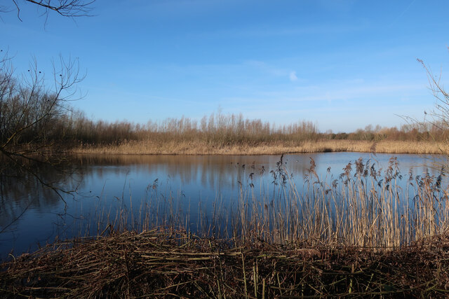
The village is known for its picturesque setting, surrounded by beautiful countryside and greenery. It offers a peaceful and tranquil environment, making it an ideal place for those seeking a quieter lifestyle away from the hustle and bustle of larger towns and cities.

Hartford has a rich history dating back centuries. The village features a number of historic buildings, including the Grade II listed St. John the Baptist Church, which dates back to the 13th century. The church boasts stunning architecture and is a prominent landmark in the area.

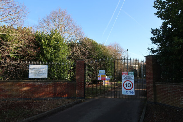
Despite its small size, Hartford has a range of amenities to cater to the needs of its residents. These include a primary school, village hall, local shops, and a pub. The village also benefits from excellent transport links, with easy access to major roads such as the A14 and A1, allowing for convenient travel to nearby towns and cities.

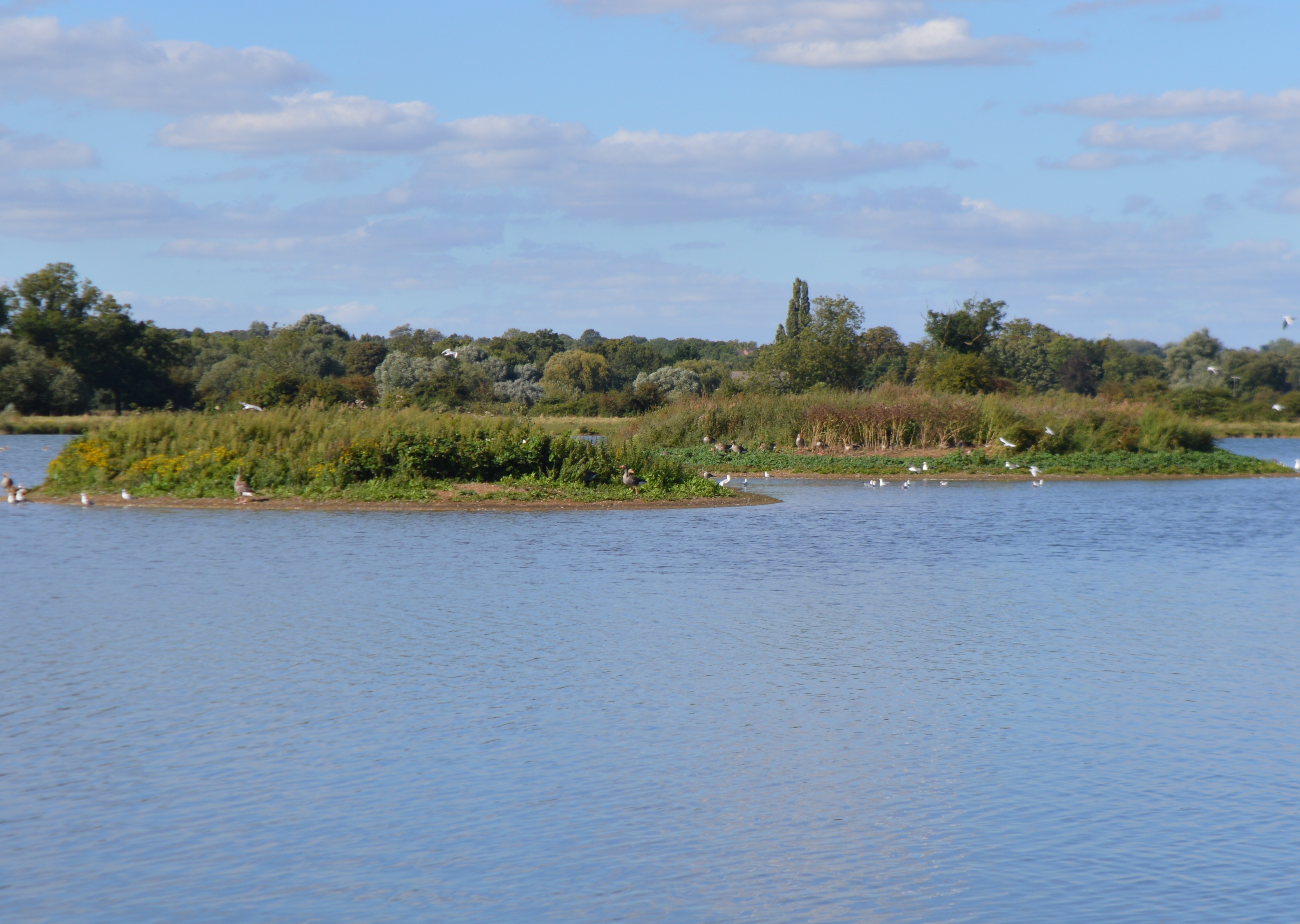
The surrounding area offers a variety of outdoor activities, with opportunities for walking, cycling, and boating along the River Great Ouse. Additionally, nearby attractions such as Hinchingbrooke Country Park and Grafham Water provide further recreational options for residents and visitors alike.

Overall, Hartford is a charming and idyllic village that offers a peaceful lifestyle, rich history, and convenient access to both rural beauty and urban conveniences.

If you have any feedback on the listing, please let us know in the comments section below.

Hartford Images

Images are sourced within 2km of 52.340209/-0.157074 or Grid Reference TL2572. Thanks to Geograph Open Source API. All images are credited.

Huntingdon Hosiery Mill Dates from about 1850, now in residential use <span class="nowrap"><a title="https://historicengland.org.uk/listing/the-list/list-entry/1128656" rel="nofollow ugc noopener" href="https://historicengland.org.uk/listing/the-list/list-entry/1128656">Link</a><img style="margin-left:2px;" alt="External link" title="External link - shift click to open in new window" src="https://s1.geograph.org.uk/img/external.png" width="10" height="10"/></span>
Huntingdon Hosiery Mill
Dates from about 1850, now in residential use LinkExternal link
Terrace on Hartford Road, Huntingdon
Junction on A141
Junction on A141
Island Lake, Godmanchester Nature Reserve One of many sets of gravel pits along the Ouse valley.
Island Lake, Godmanchester Nature Reserve
One of many sets of gravel pits along the Ouse valley.
Island Lake, Godmanchester Nature Reserve Wildlife Trust nature reserve.
Island Lake, Godmanchester Nature Reserve
Wildlife Trust nature reserve.
Cook's Stream, Godmanchester Nature Reserve
Ouse Valley Way
Ouse Valley Way
Roman Lake, Godmanchester Nature Reserve
Wigeon Pond, Godmanchester Nature Reserve
Huntingdon Sewage Treatment Works entrance On Cow Lane.
Huntingdon Sewage Treatment Works entrance
On Cow Lane.
Cow Lane to Godmanchester Nature Reserve
Bridleway to Hemingford Abbots Across Godmanchester Eastside Common.
Bridleway to Hemingford Abbots
Across Godmanchester Eastside Common.
St. Michael the Archangel Parish Church Huntingdon Catholic Church in Huntingdon
St. Michael the Archangel Parish Church Huntingdon
Catholic Church in Huntingdon
Hartford, All Saints
Spittals Way at the junction of Kings Ripton Road, Hartford This is the Huntingdon bypass.
Spittals Way at the junction of Kings Ripton Road, Hartford
This is the Huntingdon bypass.
Layby on the A141, Hartford Here was my previous visit. <a title="https://www.geograph.org.uk/photo/6876875" href="https://www.geograph.org.uk/photo/6876875">Link</a>
Layby on the A141, Hartford
Here was my previous visit. Link
Show me another place!

Hartford is located at Grid Ref: TL2572 (Lat: 52.340209, Lng: -0.157074)

Administrative County: Cambridgeshire

District: Huntingdonshire

Police Authority: Cambridgeshire

What 3 Words

///fats.nerves.outermost. Near Huntingdon, Cambridgeshire

Nearby Locations

Hartford

Related Wikis

Hartford, Cambridgeshire

Hartford is a suburb of Huntingdon and former civil parish, now in the parish of Huntingdon, in Cambridgeshire, England. Historically part of Huntingdonshire...

Huntingdon

Huntingdon is a market town in the Huntingdonshire district of Cambridgeshire, England. The town was given its town charter by King John in 1205. It was...

Godmanchester Nature Reserve

Godmanchester Nature Reserve is a 59-hectare nature reserve in Godmanchester in Cambridgeshire, England. It is managed by the Wildlife Trust for Bedfordshire...

Huntingdonshire Regional College

Huntingdon Campus of Cambridge Regional College, formerly Huntingdonshire Regional College is a further education college located in the Huntingdonshire...

Huntingdon Priory

The Priory of St Mary, Huntingdon was an Augustinian Priory in Huntingdonshire (now Cambridgeshire), England. Its foundation date is unknown. Dugdale suggests...

St Peter's School, Huntingdon

St Peter's School is a co-educational secondary school and sixth form located in Huntingdon in the English county of Cambridgeshire. == History == St Peter...

Godmanchester railway station

Godmanchester railway station was a railway station situated in the town of Godmanchester in Huntingdonshire, England. It was situated on the Huntingdon...

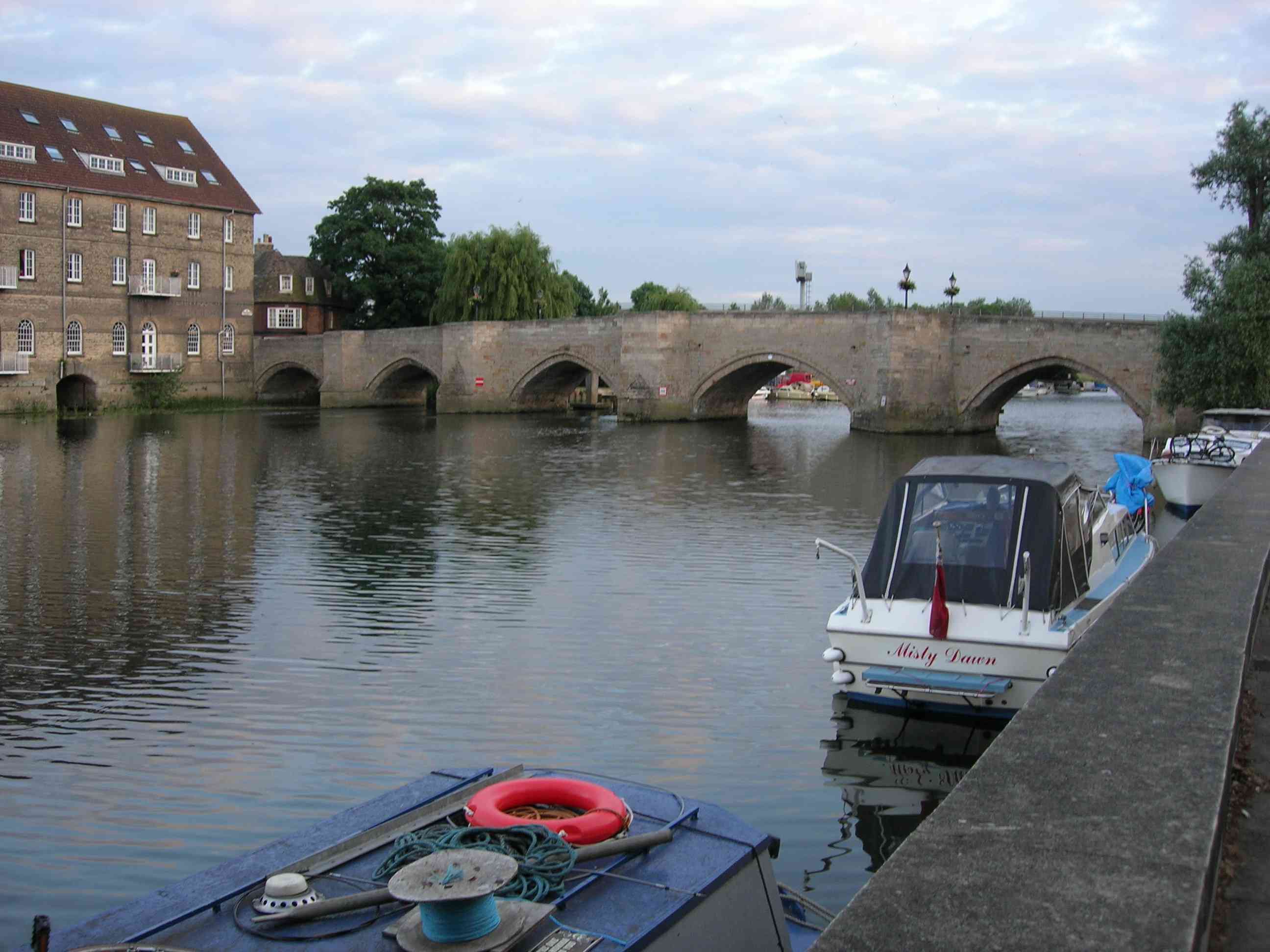
Old Bridge, Huntingdon

The Old Bridge between Huntingdon and Godmanchester (now part of Cambridgeshire, England) is a well-preserved medieval stone bridge over the River Great...

Nearby Amenities

Located within 500m of 52.340209,-0.157074
Turning Circle
Lat/Long: 52.3373534/-0.1588614
Barrier: bollard
Bicycle: yes
Bollard: rising
Bus: permit
Foot: yes
Horse: yes
Motor Vehicle: private
Lat/Long: 52.3379061/-0.152063
Turning Circle
Lat/Long: 52.3380921/-0.1611431
Turning Circle
Lat/Long: 52.341052/-0.156799
Post Box
Lat/Long: 52.3405876/-0.1550961
Hartford Village Stores
Shop: convenience
Lat/Long: 52.3384887/-0.1583953
Pub
Barley Mow
Source Name: dictaphone
Lat/Long: 52.3384705/-0.1574996
The Hurst
Source Name: dictaphone
Tourism: hotel
Lat/Long: 52.3378763/-0.1593337
Pub
King Of The Belgians
Source Name: dictaphone
Wikidata: Q26421500
Lat/Long: 52.3377798/-0.1596963
Turning Circle
Lat/Long: 52.3385227/-0.1607656
Turning Circle
Lat/Long: 52.3420934/-0.1624349
Post Box
Lat/Long: 52.341489/-0.1637976
Bench
Lat/Long: 52.3364693/-0.1581639
Bench
Lat/Long: 52.3364927/-0.1579726
Bus Stop
Old Houghton Road
Bus: yes
Naptan AtcoCode: 0500HHUNT017
Naptan Bearing: SW
Naptan CommonName: Old Houghton Road
Naptan Indicator: near
Naptan Landmark: Old Houghton Road
Naptan NaptanCode: cmbdpgtp
Naptan ShortCommonName: Old Houghton Road
Naptan Street: Main Street
Naptan Verified: no
Public Transport: platform
Shelter: yes
Source: naptan_import
Lat/Long: 52.3394403/-0.153733
Bus Stop
The Spinney
Bus: yes
Naptan AtcoCode: 0500HHUNT041
Naptan Bearing: SW
Naptan CommonName: The Spinney
Naptan Indicator: near
Naptan Landmark: The Spinney
Naptan NaptanCode: cmbdpjgd
Naptan ShortCommonName: The Spinney
Naptan Street: Longstaff Way
Naptan Verified: no
Public Transport: platform
Source: naptan_import
Lat/Long: 52.3375214/-0.1598314
Bus Stop
The Hollow
Bench: no
Bin: no
Bus: yes
Lit: no
Naptan AtcoCode: 0500HHUNT042
Naptan Bearing: SW
Naptan CommonName: The Hollow
Naptan Indicator: near
Naptan Landmark: The Hollow
Naptan NaptanCode: cmbdpjgj
Naptan ShortCommonName: The Hollow
Naptan Street: Main Street
Naptan Verified: no
Public Transport: platform
Shelter: no
Source: naptan_import
Tactile Paving: no
Lat/Long: 52.3381735/-0.1572501
Bus Stop
Eaton Close
Bus: yes
Naptan AtcoCode: 0500HHUNT044
Naptan Bearing: N
Naptan CommonName: Eaton Close
Naptan Indicator: opp
Naptan Landmark: Eaton Close
Naptan NaptanCode: cmbdpjgp
Naptan PlusbusZoneRef: HNTNGDN
Naptan ShortCommonName: Eaton Close
Naptan Street: Desborough Road
Naptan Verified: no
Public Transport: platform
Source: naptan_import
Lat/Long: 52.3407368/-0.1636468
Bus Stop
Eaton Close
Bus: yes
Naptan AtcoCode: 0500HHUNT060
Naptan Bearing: S
Naptan CommonName: Eaton Close
Naptan Indicator: near
Naptan Landmark: Eaton Close
Naptan NaptanCode: cmbdpjpw
Naptan PlusbusZoneRef: HNTNGDN
Naptan ShortCommonName: Eaton Close
Naptan Street: Desborough Road
Naptan Verified: no
Public Transport: platform
Source: naptan_import
Lat/Long: 52.3404995/-0.1634218
Bus Stop
Pennington Road
Bus: yes
Naptan AtcoCode: 0500HHUNT061
Naptan Bearing: NE
Naptan CommonName: Pennington Road
Naptan Indicator: near
Naptan Landmark: Pennington Road
Naptan NaptanCode: cmbdpjta
Naptan PlusbusZoneRef: HNTNGDN
Naptan ShortCommonName: Pennington Road
Naptan Street: Desborough Road
Naptan Verified: no
Public Transport: platform
Source: naptan_import
Lat/Long: 52.3424216/-0.1632834
Bus Stop
Rodney Road
Bus: yes
Naptan AtcoCode: 0500HHUNT076
Naptan Bearing: S
Naptan CommonName: Rodney Road
Naptan Indicator: opp
Naptan Landmark: Rodney Road
Naptan NaptanCode: cmbdpmag
Naptan ShortCommonName: Rodney Road
Naptan Street: Desborough Road
Naptan Verified: no
Public Transport: platform
Source: naptan_import
Lat/Long: 52.3382054/-0.1633407
Bus Stop
Old Houghton Road
Bus: yes
Naptan AtcoCode: 0500HHUNT083
Naptan Bearing: NE
Naptan CommonName: Old Houghton Road
Naptan Indicator: opp
Naptan Landmark: Old Houghton Road
Naptan NaptanCode: cmbdpmdg
Naptan ShortCommonName: Old Houghton Road
Naptan Street: Main Street
Naptan Verified: no
Public Transport: platform
Source: naptan_import
Lat/Long: 52.3396982/-0.1535461
Bus Stop
The Hollow
Bench: no
Bin: no
Bus: yes
Naptan AtcoCode: 0500HHUNT084
Naptan Bearing: NE
Naptan CommonName: The Hollow
Naptan Indicator: opp
Naptan Landmark: The Grove
Naptan NaptanCode: cmbdpmdj
Naptan ShortCommonName: The Hollow
Naptan Street: Main Street
Naptan Verified: no
Public Transport: platform
Shelter: no
Source: naptan_import
Lat/Long: 52.3383744/-0.1568748
Bus Stop
The Spinney
Bus: yes
Naptan AtcoCode: 0500HHUNT085
Naptan Bearing: NE
Naptan CommonName: The Spinney
Naptan Indicator: opp
Naptan Landmark: The Spinney
Naptan NaptanCode: cmbdpmdm
Naptan ShortCommonName: The Spinney
Naptan Street: Longstaff Way
Naptan Verified: no
Public Transport: platform
Source: naptan_import
Lat/Long: 52.337942/-0.1585515
Pennington Road
Bus: yes
Naptan AtcoCode: 0500HHUNT097
Naptan Bearing: SW
Naptan BusStopType: CUS
Naptan CommonName: Pennington Road
Naptan Indicator: opp
Naptan Landmark: Pennington Road
Naptan NaptanCode: cmbdpmgw
Naptan PlusbusZoneRef: HNTNGDN
Naptan ShortCommonName: Pennington Road
Naptan Street: Desborough Road
Naptan Verified: no
Public Transport: platform
Source: naptan_import
Lat/Long: 52.3424103/-0.1631371
Bus Stop
Owl Way
Bus: yes
Naptan AtcoCode: 0500HHUNT109
Naptan Bearing: SE
Naptan BusStopType: CUS
Naptan CommonName: Owl Way
Naptan Indicator: near
Naptan NaptanCode: CMBGMAGJ
Naptan PlusbusZoneRef: HNTNGDN
Naptan Street: Sapley Road
Naptan Verified: no
Public Transport: platform
Lat/Long: 52.3425974/-0.161241
Leisure: picnic_table
Lat/Long: 52.3362132/-0.1598943
Bench
Lat/Long: 52.3363563/-0.1585079
Kayak: put_in
Waterway: access_point
Lat/Long: 52.3366411/-0.1574695
Hartford
Place: village
Wikidata: Q5674391
Lat/Long: 52.3380869/-0.1604126
Power: pole
Lat/Long: 52.3446361/-0.1564906
Power: pole
Lat/Long: 52.3427707/-0.1514671
Power: pole
Lat/Long: 52.3440097/-0.154811
Power: pole
Lat/Long: 52.3435854/-0.1535788
Power: pole
Lat/Long: 52.3368402/-0.1574479
Turning Circle
Lat/Long: 52.3388548/-0.15923
Bus Stop
Owl Way
Bus: yes
Naptan AtcoCode: 0500HHUNT108
Naptan Bearing: NW
Naptan CommonName: Owl Way
Naptan Indicator: opp
Naptan NaptanCode: CMBGMAGD
Naptan PlusbusZoneRef: HNTNGDN
Naptan Street: Sapley Road
Naptan Verified: no
Public Transport: platform
Shelter: no
Lat/Long: 52.3421347/-0.1611149
Turning Circle
Lat/Long: 52.3390397/-0.1574233
Post Box
Lat/Long: 52.3384054/-0.1584676
Turning Circle
Lat/Long: 52.3379277/-0.1622146
Generator Method: photovoltaic
Generator Output Electricity: yes
Generator Source: solar
Generator Type: solar_photovoltaic_panel
Location: roof
Power: generator
Lat/Long: 52.3391355/-0.1518291
Generator Method: photovoltaic
Generator Output Electricity: yes
Generator Source: solar
Generator Type: solar_photovoltaic_panel
Location: roof
Power: generator
Lat/Long: 52.3393051/-0.151455
Generator Method: photovoltaic
Generator Output Electricity: yes
Generator Source: solar
Generator Type: solar_photovoltaic_panel
Location: roof
Power: generator
Lat/Long: 52.3391052/-0.1513812
Generator Method: photovoltaic
Generator Output Electricity: yes
Generator Source: solar
Generator Type: solar_photovoltaic_panel
Location: roof
Power: generator
Lat/Long: 52.3385496/-0.151294
Generator Method: photovoltaic
Generator Output Electricity: yes
Generator Source: solar
Generator Type: solar_photovoltaic_panel
Location: roof
Power: generator
Lat/Long: 52.338584/-0.1513101
Generator Method: photovoltaic
Generator Output Electricity: yes
Generator Source: solar
Generator Type: solar_photovoltaic_panel
Location: roof
Power: generator
Lat/Long: 52.3386103/-0.1513302
Generator Method: photovoltaic
Generator Output Electricity: yes
Generator Source: solar
Generator Type: solar_photovoltaic_panel
Location: roof
Power: generator
Lat/Long: 52.3386455/-0.1513463
Generator Method: photovoltaic
Generator Output Electricity: yes
Generator Source: solar
Generator Type: solar_photovoltaic_panel
Location: roof
Power: generator
Lat/Long: 52.3386897/-0.1513745
Generator Method: photovoltaic
Generator Output Electricity: yes
Generator Source: solar
Generator Type: solar_photovoltaic_panel
Location: roof
Power: generator
Lat/Long: 52.338734/-0.1513986
Generator Method: photovoltaic
Generator Output Electricity: yes
Generator Source: solar
Generator Type: solar_photovoltaic_panel
Location: roof
Power: generator
Lat/Long: 52.338775/-0.1514308
Generator Method: photovoltaic
Generator Output Electricity: yes
Generator Source: solar
Generator Type: solar_photovoltaic_panel
Location: roof
Power: generator
Lat/Long: 52.3388102/-0.1514429
Leisure: picnic_table
Lat/Long: 52.3361709/-0.1600847
Life Ring
Emergency: life_ring
Lat/Long: 52.3361522/-0.1596565
Seamark Buoy Lateral Colour: green
Seamark Buoy Lateral Shape: can
Seamark Type: buoy_lateral
Lat/Long: 52.336564/-0.1574748
Seamark Buoy Lateral Colour: green
Seamark Buoy Lateral Shape: can
Seamark Type: buoy_lateral
Lat/Long: 52.3365379/-0.1575765
Seamark Type: hazard
Lat/Long: 52.3363104/-0.1581298
Seamark Type: rock
Lat/Long: 52.3365774/-0.157585
Traffic Calming: table
Lat/Long: 52.3434286/-0.1618877
Traffic Calming: choker
Lat/Long: 52.3400487/-0.1593513
Bench
Lat/Long: 52.3360914/-0.1599546
Man Made: charge_point
Lat/Long: 52.3417452/-0.1507065
Man Made: charge_point
Lat/Long: 52.3417928/-0.1507051
Man Made: charge_point
Lat/Long: 52.3417786/-0.1507055
Man Made: charge_point
Lat/Long: 52.3417611/-0.150706
The data included in this document is from www.openstreetmap.org. The data is made available under ODbL.

Have you been to Hartford?

Leave your review of Hartford below (or comments, questions and feedback).