Hartford
Settlement in Somerset Somerset West and Taunton
England
Hartford

Hartford is a small village located in the county of Somerset, England. Situated in the South West region of the country, it lies approximately 9 miles north-west of the county town of Taunton. The village is nestled among picturesque rolling hills and is surrounded by lush green countryside, making it an idyllic rural retreat.
Hartford is a close-knit community, with a population of around 500 residents. The village has a rich history, dating back to medieval times, and is known for its charming architecture, with several traditional thatched-roof cottages still standing. The village church, St. Mary's, is a focal point of the community and showcases beautiful stained glass windows and intricate stonework.
Despite its small size, Hartford offers a range of amenities for its residents. These include a village shop, post office, and a local pub, providing essential services and a place for locals to socialize. The village also benefits from its proximity to Taunton, where a wider range of amenities, including supermarkets, schools, and healthcare facilities, can be found.
Hartford is surrounded by breathtaking natural beauty, making it an ideal location for outdoor enthusiasts. The village is close to the Quantock Hills, an Area of Outstanding Natural Beauty, offering opportunities for hiking, cycling, and horse riding. Additionally, the nearby Somerset Levels provide scenic walks and bird-watching opportunities, with various nature reserves dotted around the area.
Overall, Hartford, Somerset, is a picturesque village that offers a peaceful and community-oriented lifestyle, while also providing convenient access to nearby towns and stunning natural landscapes.
If you have any feedback on the listing, please let us know in the comments section below.
Hartford Images
Images are sourced within 2km of 51.055092/-3.4864188 or Grid Reference SS9529. Thanks to Geograph Open Source API. All images are credited.


Hartford is located at Grid Ref: SS9529 (Lat: 51.055092, Lng: -3.4864188)
Administrative County: Somerset
District: Somerset West and Taunton
Police Authority: Avon and Somerset
What 3 Words
///case.restores.broth. Near Dulverton, Somerset
Nearby Locations
Related Wikis

Haddon Hill
Haddon Hill is a prominent east–west aligned ridge in west Somerset, England, close to Hartford within the civil parish of Brompton Regis. It lies on the...
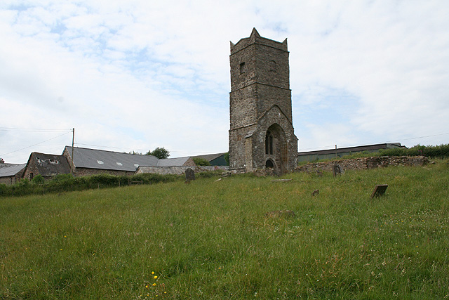
Old Church of St James, Upton
The Old St James's Church is a former church in the village of Upton, Somerset, England, of which only the tower remains, overlooking Wimbleball Lake....
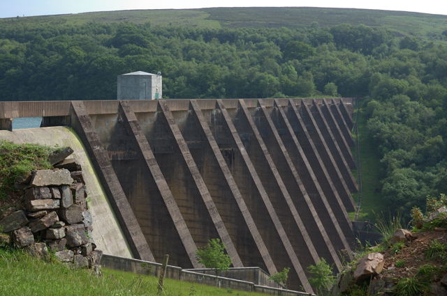
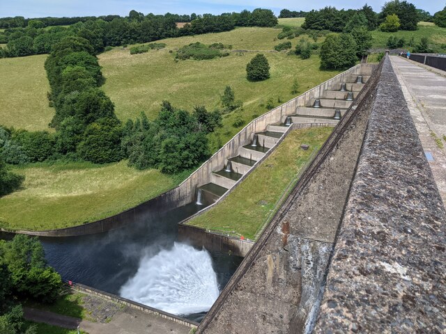
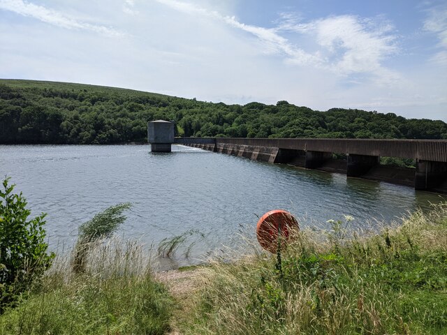
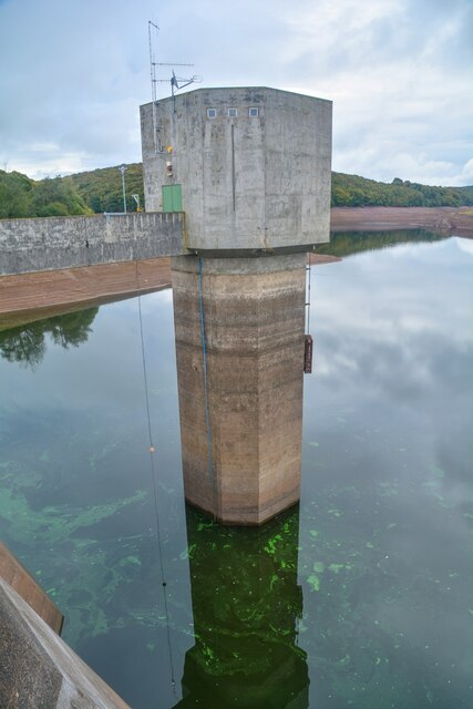
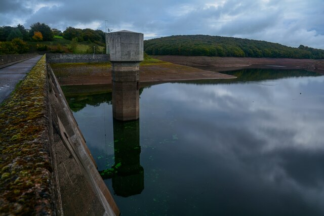
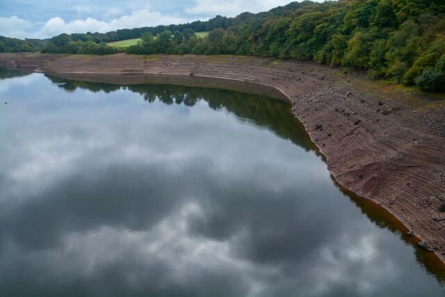
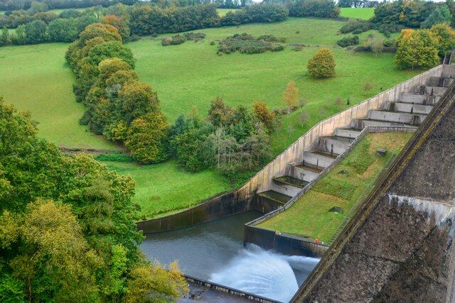
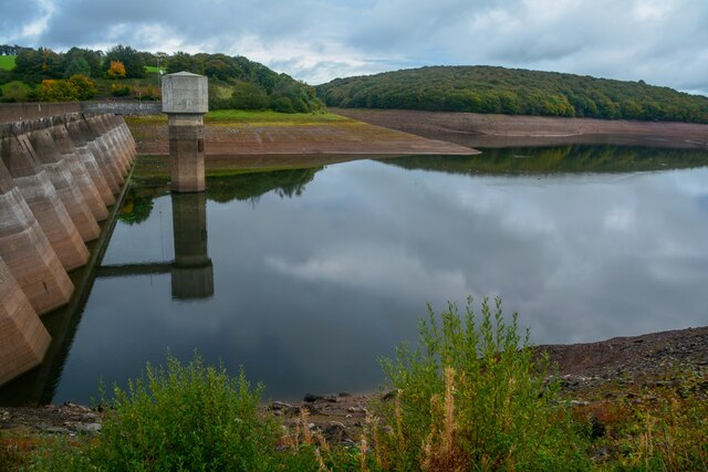
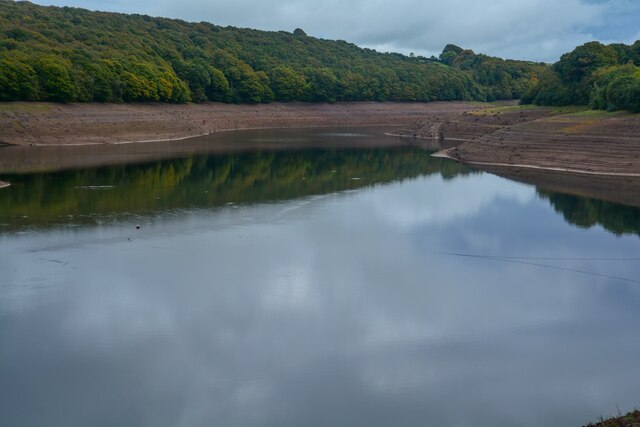
Wimbleball Lake
Wimbleball Lake on Exmoor in Somerset, England, is a water supply reservoir constructed in the 1970s and completed in 1979. The 161 feet (49 m) high dam...

Brompton Regis
Brompton Regis (formerly known as Kingsbrompton) is a village and civil parish in the Somerset West and Taunton district of Somerset, England about 5 miles...

Church of St Mary, Brompton Regis
The Anglican Church of St Mary in Brompton Regis, Somerset, England was built in the 13th century. It is a Grade II* listed building. == History == The...

Bury Bridge
Bury Bridge at Bury in the parish of Brompton Regis within the English county of Somerset is a medieval packhorse bridge. It has been scheduled as an ancient...

Skilgate
Skilgate is a village and civil parish 5 miles (8 km) east of Dulverton and 8 miles (13 km) west of Wiveliscombe in the Somerset West and Taunton district...

Bury Castle, Brompton Regis
Bury Castle near Brompton Regis in the English county of Somerset was an Iron Age univallate hillfort which was reused with the creation of a motte after...
Nearby Amenities
Located within 500m of 51.055092,-3.4864188Have you been to Hartford?
Leave your review of Hartford below (or comments, questions and feedback).