Carlton Flats

Downs, Moorland in Yorkshire Richmondshire

England

Carlton Flats

East Scrafton Moor The moors on the south side of Coverdale seen from Town Head Cottage above Melmerby
East Scrafton Moor Credit: Nick Wright

Carlton Flats is a picturesque region situated in Yorkshire, England. Nestled amidst the stunning landscape of the Yorkshire Downs and Moorland, the area offers a captivating blend of natural beauty and rural charm.

The region is renowned for its rolling hills and vast open spaces, making it a haven for outdoor enthusiasts and nature lovers. With its idyllic countryside, Carlton Flats attracts hikers, cyclists, and walkers who are drawn to its extensive network of trails and paths that wind through the countryside. The stunning vistas and panoramic views from the hilltops are a sight to behold.

In addition to its natural beauty, Carlton Flats boasts a rich history and cultural heritage. The area is dotted with historic villages and quaint cottages, showcasing the traditional architectural style of the region. Visitors can explore ancient churches, historic landmarks, and even remnants of ancient settlements, providing a glimpse into the area's past.

The local community in Carlton Flats is warm and welcoming, with traditional pubs and tea rooms offering a taste of the region's hospitality. The area also hosts regular fairs, festivals, and agricultural shows, providing visitors with a chance to experience the local culture and traditions firsthand.

Whether it's exploring the rugged moorland, enjoying a leisurely walk through the countryside, or immersing oneself in the rich history and culture of the region, Carlton Flats offers a truly immersive experience in the heart of Yorkshire's natural beauty.

If you have any feedback on the listing, please let us know in the comments section below.

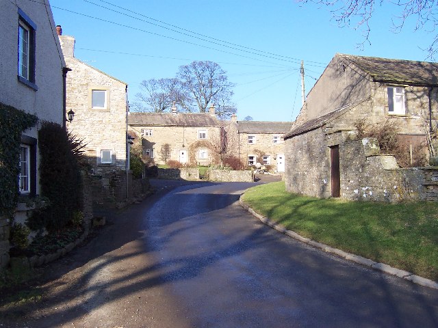
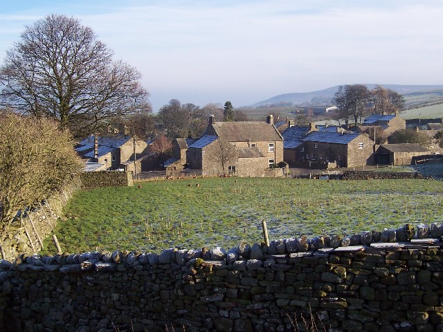
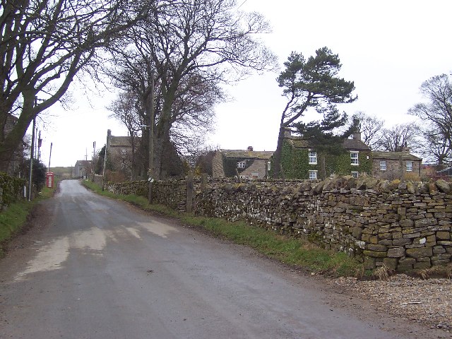
Carlton Flats Images

Images are sourced within 2km of 54.254343/-1.8980795 or Grid Reference SE0684. Thanks to Geograph Open Source API. All images are credited.

East Scrafton Moor The moors on the south side of Coverdale seen from Town Head Cottage above Melmerby
East Scrafton Moor
The moors on the south side of Coverdale seen from Town Head Cottage above Melmerby
Cottages at West Scrafton A view across the head of Caygill to cottages on the far side.
Cottages at West Scrafton
A view across the head of Caygill to cottages on the far side.
Telephone kiosk and green at West Scrafton A very small Coverdale village with a suitably small green, at one side of which is the telephone kiosk.
Telephone kiosk and green at West Scrafton
A very small Coverdale village with a suitably small green, at one side of which is the telephone kiosk.
The post box in West Scrafton A 'VR' postbox set into the wall of a barn in West Scrafton.
The post box in West Scrafton
A 'VR' postbox set into the wall of a barn in West Scrafton.
Methodist chapel, West Scrafton Stone built chapel dated 1866 in West Scrafton.
Methodist chapel, West Scrafton
Stone built chapel dated 1866 in West Scrafton.
West Scrafton The view over the village from the moor track. Penhill dominates the distant skyline.
West Scrafton
The view over the village from the moor track. Penhill dominates the distant skyline.
Trees in Great Gill The moor above West Scrafton is largely treeless, but they are found along the minor valley of Great Gill.
Trees in Great Gill
The moor above West Scrafton is largely treeless, but they are found along the minor valley of Great Gill.
Great Gill A sizeable beck flows down the gill, passes through West Scrafton in a gorge and empties into the River Cover.
Great Gill
A sizeable beck flows down the gill, passes through West Scrafton in a gorge and empties into the River Cover.
A strange place for park benches Two rather dilapidated benches on the moor above West Scrafton. The fence encloses a water reservoir. In the distance can be seen the long whaleback which is Little Whernside, with a ridge of Great Whernside beyond.
A strange place for park benches
Two rather dilapidated benches on the moor above West Scrafton. The fence encloses a water reservoir. In the distance can be seen the long whaleback which is Little Whernside, with a ridge of Great Whernside beyond.
Bridleway to West Scrafton Walking uphill from the village, this bridleway makes a promising start, being well defined and relatively well drained, but once on the moor top and at the parish boundary the route disappears into heather and bog.
Bridleway to West Scrafton
Walking uphill from the village, this bridleway makes a promising start, being well defined and relatively well drained, but once on the moor top and at the parish boundary the route disappears into heather and bog.
West Scrafton Looking across Coverdale, with the village of Carlton beyond on the far side of the dale.
West Scrafton
Looking across Coverdale, with the village of Carlton beyond on the far side of the dale.
West Scrafton and Coverdale Looking west from the track heading south from the bridge.
West Scrafton and Coverdale
Looking west from the track heading south from the bridge.
Looking up to Great Roova Crags Through pasture to the south of West Scrafton, in Coverdale.
Looking up to Great Roova Crags
Through pasture to the south of West Scrafton, in Coverdale.
Great Roova Crags From just south of West Scrafton, in Coverdale.
Great Roova Crags
From just south of West Scrafton, in Coverdale.
Heading for Great Roova Crags On a superb Saturday afternoon in October, walkers follow the path south from West Scrafton.
Heading for Great Roova Crags
On a superb Saturday afternoon in October, walkers follow the path south from West Scrafton.
Carlton Moor Taken from just south of West Scrafton, in Coverdale.
Carlton Moor
Taken from just south of West Scrafton, in Coverdale.
Bridge Cottage, West Scrafton In the gloaming at the end of a stunning (and unexpectedly) beautiful October day.
Bridge Cottage, West Scrafton
In the gloaming at the end of a stunning (and unexpectedly) beautiful October day.
Tatty barn at West Scrafton It appears that the Pennine weather has been at work on this barn close to West Scrafton village.
Tatty barn at West Scrafton
It appears that the Pennine weather has been at work on this barn close to West Scrafton village.
Show me another place!

Carlton Flats is located at Grid Ref: SE0684 (Lat: 54.254343, Lng: -1.8980795)

Division: North Riding

Administrative County: North Yorkshire

District: Richmondshire

Police Authority: North Yorkshire

What 3 Words

///ramps.doses.marginal. Near Leyburn, North Yorkshire

Related Wikis

Carlton, Richmondshire

Carlton is a village in the civil parish of Carlton Town in the Richmondshire district of North Yorkshire, England. According to the 2011 Census it had...

Coverdale, North Yorkshire

Coverdale is a dale in the far east of the Yorkshire Dales, North Yorkshire, England. It takes its name from the River Cover, a tributary of the River...

West Scrafton

West Scrafton is a village and civil parish in Coverdale in the Yorkshire Dales, England. It is located 4 miles (6.4 km) south west of Leyburn. It falls...

Melmerby in Coverdale

Melmerby is a village and civil parish in North Yorkshire, England. It lies in Coverdale in the Yorkshire Dales about 3 miles (4.8 km) south-west of Leyburn...

Nearby Amenities

Located within 500m of 54.254343,-1.8980795
Barrier: stile
Lat/Long: 54.257268/-1.9013445
Castle Motte
Historic: castle
Lat/Long: 54.2574545/-1.8975227
Post Box
Post Box Type: lamp
Lat/Long: 54.2575832/-1.8999622
Telephone
Booth: K6
Covered: booth
Lat/Long: 54.2577367/-1.9022421
Barrier: stile
Lat/Long: 54.2552069/-1.9032716
Power: pole
Lat/Long: 54.2585117/-1.9000849
Power: pole
Lat/Long: 54.2583206/-1.9012876
Power: pole
Lat/Long: 54.2522517/-1.8999072
Power: pole
Lat/Long: 54.2516493/-1.9009999
Power: pole
Lat/Long: 54.2511362/-1.901958
Power: pole
Lat/Long: 54.2546385/-1.905722
Power: pole
Lat/Long: 54.2537909/-1.9043305
Power: pole
Lat/Long: 54.2532605/-1.9028089
Power: pole
Lat/Long: 54.2527741/-1.9014106
Power: pole
Lat/Long: 54.2517652/-1.8985248
Power: pole
Lat/Long: 54.2511748/-1.8968162
Power: pole
Lat/Long: 54.250671/-1.8955912
The data included in this document is from www.openstreetmap.org. The data is made available under ODbL.

Have you been to Carlton Flats?

Leave your review of Carlton Flats below (or comments, questions and feedback).