East Down

Downs, Moorland in Wiltshire

England

East Down

Candown Copse, Wiltshire Looking south over Westdown Artillery Range from the vicinity of Candown Copse.
Candown Copse, Wiltshire Credit: Rebecca A Wills

East Down is located in the county of Wiltshire, England, and is a region characterized by its breathtaking natural beauty and diverse landscape. It encompasses the areas of Downs and Moorland, which offer a unique blend of rolling hills, vast open spaces, and lush vegetation.

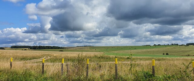
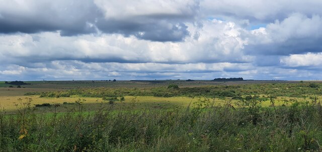
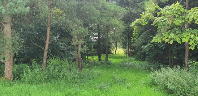
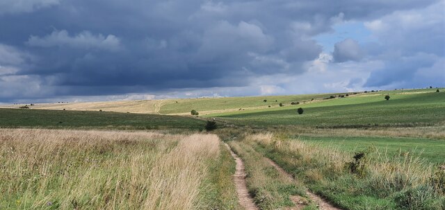
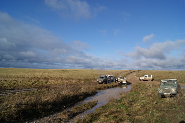
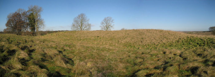
The Downs in East Down are renowned for their panoramic views, with undulating hills stretching as far as the eye can see. This picturesque landscape is dotted with charming villages, ancient woodlands, and meandering rivers, providing a haven for both wildlife and outdoor enthusiasts. The area is a haven for hikers and cyclists, with an extensive network of trails and paths that allow visitors to explore the natural wonders at their own pace.

The Moorland in East Down is a stark contrast to the Downs, with its rugged and wild terrain. This vast expanse of heather-covered moors is home to an array of unique flora and fauna, including rare species such as the Dartford warbler and the marsh gentian. The Moorland is also a popular destination for birdwatching, as it attracts a variety of birds throughout the year.

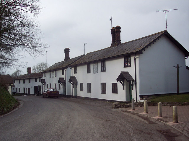
East Down is not only a paradise for nature lovers but also has a rich cultural heritage. The area is dotted with ancient archaeological sites, including barrows and hill forts, which provide insight into the region's ancient history. The local communities are proud of their heritage and often organize events and festivals to celebrate the traditions and customs of the area.

In conclusion, East Down in Wiltshire offers a harmonious blend of natural beauty, outdoor activities, and cultural heritage. Its Downs and Moorland provide an idyllic setting for exploration and relaxation, making it a must-visit destination for those seeking a true escape from the hustle and bustle of modern life.

If you have any feedback on the listing, please let us know in the comments section below.

East Down Images

Images are sourced within 2km of 51.241406/-1.9135404 or Grid Reference SU0649. Thanks to Geograph Open Source API. All images are credited.

Candown Copse, Wiltshire Looking south over Westdown Artillery Range from the vicinity of Candown Copse.
Candown Copse, Wiltshire
Looking south over Westdown Artillery Range from the vicinity of Candown Copse.
West Down, Wiltshire Tank markers on the side of a bridleway on West Down. This area is within the Westdown Artillery Range danger area, but is open to walkers on the bridleways when no red flags are displayed.
West Down, Wiltshire
Tank markers on the side of a bridleway on West Down. This area is within the Westdown Artillery Range danger area, but is open to walkers on the bridleways when no red flags are displayed.
West Down Plantation, Wiltshire Looking north west from over the Westdown Artillery Range from West Down Plantation. This area is within the Westdown Artillery Range danger area, but is open to walkers on the bridleways when no red flags are displayed.
West Down Plantation, Wiltshire
Looking north west from over the Westdown Artillery Range from West Down Plantation. This area is within the Westdown Artillery Range danger area, but is open to walkers on the bridleways when no red flags are displayed.
East Down, Wiltshire Looking northeast along a bridleway on East Down. This area is within the Westdown Artillery Range danger area, but is open to walkers on the bridleways when no red flags are displayed.
East Down, Wiltshire
Looking northeast along a bridleway on East Down. This area is within the Westdown Artillery Range danger area, but is open to walkers on the bridleways when no red flags are displayed.
Rushall Down, Wiltshire A helpful sign post on Westdown Artillery Range, nestled between Rushall Down and East Down. This area is within the Westdown Artillery Range danger area, but is open to walkers on the bridleways when no red flags are displayed.
Rushall Down, Wiltshire
A helpful sign post on Westdown Artillery Range, nestled between Rushall Down and East Down. This area is within the Westdown Artillery Range danger area, but is open to walkers on the bridleways when no red flags are displayed.
Rushall Down, Wiltshire Overlooking an observation post and tank hulks on Rushall Down. This area is within the Westdown Artillery Range danger area, but is open to walkers on the bridleways when no red flags are displayed.
Rushall Down, Wiltshire
Overlooking an observation post and tank hulks on Rushall Down. This area is within the Westdown Artillery Range danger area, but is open to walkers on the bridleways when no red flags are displayed.
Orcheston Down, Wiltshire A view through a little un-named copse located between Prospect Clump and Honeydown Copse on Orcheston Down. This area is within the Westdown Artillery Range danger area, but is open to walkers on the bridleways when no red flags are displayed.
Orcheston Down, Wiltshire
A view through a little un-named copse located between Prospect Clump and Honeydown Copse on Orcheston Down. This area is within the Westdown Artillery Range danger area, but is open to walkers on the bridleways when no red flags are displayed.
East Down, Wiltshire Looking over East Down from the vicinity of Prospect Clump. This area is within the Westdown Artillery Range danger area, but is open to walkers on the bridleways when no red flags are displayed.
East Down, Wiltshire
Looking over East Down from the vicinity of Prospect Clump. This area is within the Westdown Artillery Range danger area, but is open to walkers on the bridleways when no red flags are displayed.
East Down, Wiltshire Looking south over East Down from the vicinity of Prospect Clump. This area is within the Westdown Artillery Range danger area, but is open to walkers on the bridleways when no red flags are displayed.
East Down, Wiltshire
Looking south over East Down from the vicinity of Prospect Clump. This area is within the Westdown Artillery Range danger area, but is open to walkers on the bridleways when no red flags are displayed.
East Down, Wiltshire Looking south over grassland on East Down. This area is within the Westdown Artillery Range danger area, but is open to walkers on the bridleways when no red flags are displayed.
East Down, Wiltshire
Looking south over grassland on East Down. This area is within the Westdown Artillery Range danger area, but is open to walkers on the bridleways when no red flags are displayed.
West Down, Wiltshire Looking east along a bridleway running over West Down. This area is within the Westdown Artillery Range danger area, but is open to walkers on the bridleways when no red flags are displayed.
West Down, Wiltshire
Looking east along a bridleway running over West Down. This area is within the Westdown Artillery Range danger area, but is open to walkers on the bridleways when no red flags are displayed.
Prospect Clump, Wiltshire A Timaracha beetle (Bloody-nosed beetle) enjoying some early blackberries.
Prospect Clump, Wiltshire
A Timaracha beetle (Bloody-nosed beetle) enjoying some early blackberries.
Westdown Camp - 4x4s Playing In The Mud A group of 4x4 vehicles playing in the mud.
Westdown Camp - 4x4s Playing In The Mud
A group of 4x4 vehicles playing in the mud.
Westdown Camp - Clearing The Undergrowth Hawthorn being cleared and burnt.
Westdown Camp - Clearing The Undergrowth
Hawthorn being cleared and burnt.
Westdown Camp - Observation Post This observation post is used to observe accuracy of artillery fire on tank targets.
Westdown Camp - Observation Post
This observation post is used to observe accuracy of artillery fire on tank targets.
Westdown Camp - Target Tanks Tanks used for artillery practice.
Westdown Camp - Target Tanks
Tanks used for artillery practice.
Westdown Camp - Tank Turrets The remains of tanks that have been used for target practice.
Westdown Camp - Tank Turrets
The remains of tanks that have been used for target practice.
Show me another place!

East Down is located at Grid Ref: SU0649 (Lat: 51.241406, Lng: -1.9135404)

Unitary Authority: Wiltshire

Police Authority: Wiltshire

What 3 Words

///circulate.apple.clockwork. Near Shrewton, Wiltshire

Nearby Locations

East Down

Related Wikis

Tilshead

Tilshead () is a village and civil parish in the county of Wiltshire in Southern England, about 9 miles (14 km) northwest of the town of Amesbury. It...

RAF Shrewton

Royal Air Force Shrewton or more simply RAF Shrewton is a former Royal Air Force satellite airfield located in Wiltshire, England. The following units...

White Barrow

White Barrow is a large Neolithic long barrow just below the crest of Copehill Down on Salisbury Plain, just south of the village of Tilshead in Wiltshire...

Orcheston

Orcheston (OR-Chest-ton) is a civil parish and village in Wiltshire, England, lying on Salisbury Plain less than a mile north-west of neighbouring Shrewton...

A360 road

The A360 is an A road in Wiltshire, England, running from Devizes to Salisbury, through the villages of Potterne, West Lavington, Tilshead, and Shrewton...

Tilshead Lodge

Tilshead Lodge (now demolished) was a large 18th-century country house, southwest of Tilshead in Wiltshire, England, and about 13 miles (21 km) northwest...

River Till SSSI, Wiltshire

The River Till SSSI (grid reference SU051452) is a 32.07 hectares (79.2 acres) biological Site of Special Scientific Interest in Wiltshire, England, notified...

RAF Tilshead

Royal Air Force Tilshead or more simply RAF Tilshead is a former Royal Air Force station west of Tilshead, Wiltshire, England and 9 miles (14 km) east...

Nearby Amenities

Located within 500m of 51.241406,-1.9135404
Archaeological Site: megalith
Historic: archaeological_site
Megalith Type: long_barrow
Lat/Long: 51.2441504/-1.9159998
The data included in this document is from www.openstreetmap.org. The data is made available under ODbL.

Have you been to East Down?

Leave your review of East Down below (or comments, questions and feedback).