Adam Pasture

Downs, Moorland in Yorkshire

England

Adam Pasture

Butterley Reservoir
Butterley Reservoir Credit: Dave Pickersgill

Adam Pasture is a picturesque area located in the county of Yorkshire, England. Nestled in the heart of the region's stunning countryside, the Pasture encompasses a variety of landscapes, including downs and moorland.

The downs of Adam Pasture are characterized by gently rolling hills covered in lush green grasses. These open spaces provide ample opportunities for outdoor activities such as picnicking, hiking, and horseback riding. The downs also offer breathtaking panoramic views of the surrounding countryside, making it a popular destination for nature lovers and photographers alike.

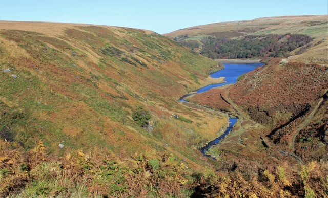
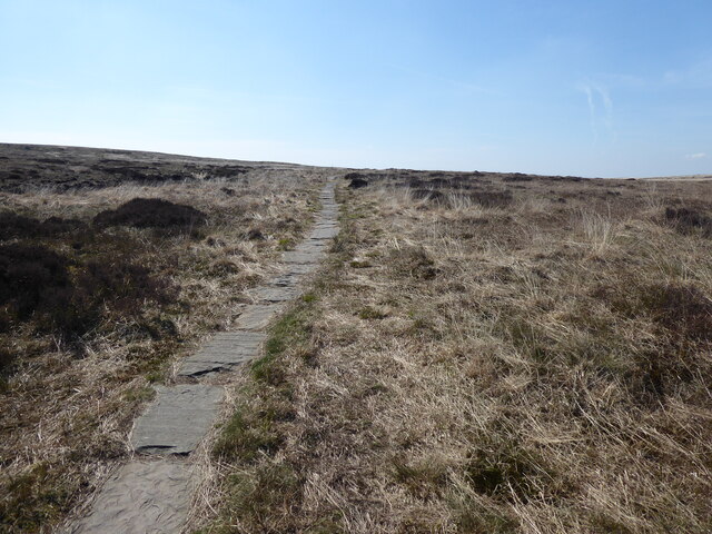
In contrast, the moorland in Adam Pasture is a more rugged and wild terrain. Here, visitors can explore vast expanses of heather-covered hills and deep valleys. The moorland is home to a variety of wildlife, including birds of prey, grouse, and deer. It is an ideal setting for those seeking solitude and tranquility, as well as for outdoor enthusiasts looking to engage in activities such as birdwatching, mountain biking, and hiking.

Adam Pasture is also rich in history and cultural heritage. The area is dotted with ancient archaeological sites, including burial mounds and stone circles, which offer a glimpse into its past. Additionally, the Pasture is home to several charming villages and market towns, where visitors can experience the region's traditional architecture, local cuisine, and warm hospitality.

Overall, Adam Pasture in Yorkshire is a diverse and captivating destination that offers a perfect blend of natural beauty, outdoor adventures, and cultural experiences. Whether one seeks relaxation or exploration, this area has something to offer for everyone.

If you have any feedback on the listing, please let us know in the comments section below.

Adam Pasture Images

Images are sourced within 2km of 53.579213/-1.9170146 or Grid Reference SE0509. Thanks to Geograph Open Source API. All images are credited.

Butterley Reservoir
Butterley Reservoir
Blakeley Reservoir
Blakeley Reservoir
Track, Bridleway and Footpath at Wessenden Lodge Looking south-westward.
Track, Bridleway and Footpath at Wessenden Lodge
Looking south-westward.
Track and footpath signage in the Wassenden Valley Looking northward. The Kirklees Way continues ahead towards Marsden whilst the Pennine Way turns westward towards Black Moss
Track and footpath signage in the Wassenden Valley
Looking northward. The Kirklees Way continues ahead towards Marsden whilst the Pennine Way turns westward towards Black Moss
The Pennine Way near Leyzing Clough
The Pennine Way near Great Hey Cote Hill
The Pennine Way near Wessenden Reservoir
The Pennine Way near Hey Green
The Pennine Way above Wessenden Reservoir
The Pennine Way near Blakely Clough
The Pennine Way near Swellands reservoir
Waterfall at Wessenden
Wessenden Brook
Wessenden Brook
Blakeley Reservoir View from the path along Deer Hill Reservoir conduit
Blakeley Reservoir
View from the path along Deer Hill Reservoir conduit
Waterfall from Wessenden Reservoir overflow The spillway on the reservoir ends abruptly in this waterfall down to Wessenden Brook
Waterfall from Wessenden Reservoir overflow
The spillway on the reservoir ends abruptly in this waterfall down to Wessenden Brook
Waterfalls in Great Hey Sike Clough View from a contour path following a water pipe line that feeds Deer Hill Reservoir conduit
Waterfalls in Great Hey Sike Clough
View from a contour path following a water pipe line that feeds Deer Hill Reservoir conduit
Show me another place!

Adam Pasture is located at Grid Ref: SE0509 (Lat: 53.579213, Lng: -1.9170146)

Division: West Riding

Unitary Authority: Kirklees

Police Authority: West Yorkshire

What 3 Words

///jotting.crisp.lingering. Near Marsden, West Yorkshire

Related Wikis

Wessenden Valley

The Wessenden Valley is a moorland valley in the Dark Peak, immediately south of Marsden in West Yorkshire, England. The name Wessenden derives from Old...

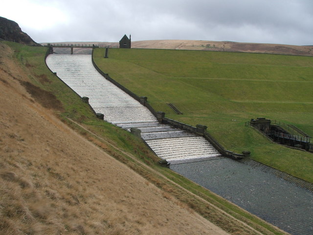
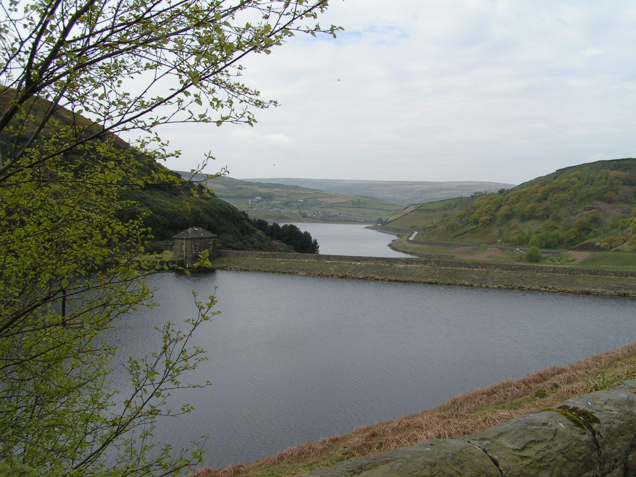
Butterley Reservoir, West Yorkshire

Butterley Reservoir is a reservoir located near Marsden, West Yorkshire, near the Peak District National Park boundary. It was completed in 1906. The reservoir...
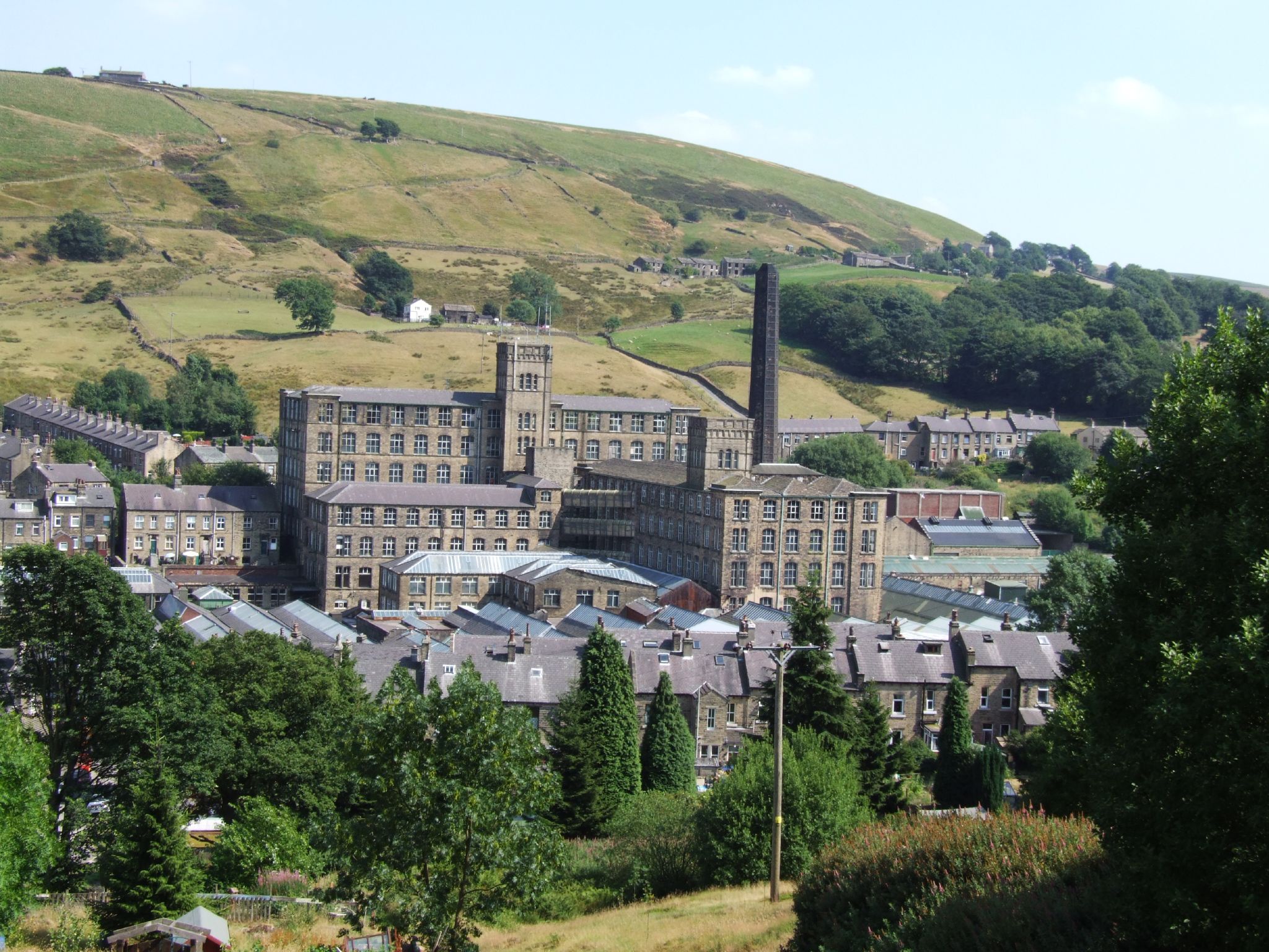
Bank Bottom Mill

Bank Bottom Mill, later known as Marsden Mill, was from 1824 an important centre for the production of woollen cloth in Marsden, West Yorkshire, England...

Marsden, West Yorkshire

Marsden is a large village in the Colne Valley, in the metropolitan borough of Kirklees, West Yorkshire, England. It is in the South Pennines close to...

Marsden railway station

Marsden railway station serves the village of Marsden near Huddersfield in West Yorkshire, England. The station is on the Huddersfield Line, operated by...

Standedge Tunnels

The Standedge Tunnels () are four parallel tunnels through the Pennine hills at the Standedge crossing between Marsden in Kirklees, West Yorkshire and...

Standedge

Standedge () is a moorland escarpment in the Pennine Hills of northern England between Marsden, West Yorkshire and Diggle, Greater Manchester. Standedge...

Marsden Moor Estate

The Marsden Moor Estate is a large expanse of moorland in the South Pennines, between the conurbations of West Yorkshire and Greater Manchester in the...

Nearby Amenities

Located within 500m of 53.579213,-1.9170146
Barrier: stile
Material: wood
Stile: stepover
Lat/Long: 53.5825741/-1.9155175
Barrier: kissing_gate
Lat/Long: 53.578997/-1.9136019
Barrier: stile
Material: wood
Stile: stepover
Lat/Long: 53.5772688/-1.9168273
Barrier: stile
Lat/Long: 53.5809239/-1.9160611
Wessenden
Place: locality
Source: Local knowledge
Lat/Long: 53.5767466/-1.914488
Barrier: entrance
Width: 0.8
Lat/Long: 53.5829584/-1.9182851
Barrier: cattle_grid
Lat/Long: 53.5835957/-1.9183239
Bench
Material: wood
Lat/Long: 53.5800417/-1.9194971
Bench
Material: wood
Note: concrete supports
Lat/Long: 53.5803501/-1.9191957
Marker: post
Note: With yellow footpath disc
Lat/Long: 53.5762068/-1.915175
Ford: yes
Lat/Long: 53.5782703/-1.9161581
Fixme: Where does this lead? I didn't follow this branch
Lat/Long: 53.5782775/-1.9159904
Height: 1.1
Information: route_marker
Marker: post
Note: With yellow footpath disc
Lat/Long: 53.5776397/-1.9160947
Barrier: stile
Material: wood
Note: With yellow footpath disc
Lat/Long: 53.5783635/-1.9163458
Marker: post
Lat/Long: 53.5797394/-1.9187169
Information: route_marker
Marker: post
Note: With yellow footpath disc. Path itself is barely visible
Lat/Long: 53.5788874/-1.9183508
Barrier: stile
Material: wood
Lat/Long: 53.5783209/-1.9181096
Note: Path petered out here
Lat/Long: 53.5785633/-1.9176587
Barrier: stile
Material: wood
Note: With yellow footpath disc
Lat/Long: 53.5804639/-1.918991
Information: guidepost
Tourism: information
Lat/Long: 53.5757167/-1.9141967
Barrier: stile
Material: wood
Stile: stepover
Lat/Long: 53.5830512/-1.9140914
Ford: yes
Lat/Long: 53.5789699/-1.916683
Barrier: stile
Material: wood
Note: New in 2021
Stile: stepover
Lat/Long: 53.5830786/-1.9149967
Height: 1.1
Information: route_marker
Marker: post
Material: wood
Note: With yellow footpath disc
Lat/Long: 53.5827239/-1.9155049
Height: 1.1
Information: route_marker
Marker: post
Material: wood
Note: With yellow footpath disc
Lat/Long: 53.5818274/-1.9157577
Ford: yes
Lat/Long: 53.5809415/-1.916054
The data included in this document is from www.openstreetmap.org. The data is made available under ODbL.

Have you been to Adam Pasture?

Leave your review of Adam Pasture below (or comments, questions and feedback).