Blake Moor
Downs, Moorland in Derbyshire High Peak
England
Blake Moor

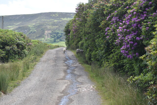
Blake Moor is a picturesque area located in Derbyshire, England, known for its stunning downs and moorland landscapes. Spanning approximately 500 acres, this area is situated in the heart of the Peak District National Park, offering visitors a truly breathtaking experience.
The moorland of Blake Moor is characterized by its vast expanses of open grassland, heather, and bracken. Visitors can enjoy leisurely walks and hikes through the moors, taking in the panoramic views of rolling hills and distant valleys. The diverse flora and fauna found here make it a haven for nature enthusiasts, with sightings of rare bird species, including the iconic red grouse, being a common occurrence.
The downs of Blake Moor are equally captivating, offering a more undulating landscape. The gentle slopes are covered in a patchwork of grasses and wildflowers, creating a vibrant and ever-changing scenery. The downs are home to a variety of wildlife, such as rabbits, hares, and various species of butterflies that flutter around the colorful blooms.
For those seeking outdoor activities, Blake Moor provides excellent opportunities for horse riding, mountain biking, and even paragliding. The vast expanse of open space and the challenging terrain make it an ideal location for these adventurous pursuits.
In addition to its natural beauty, Blake Moor is also steeped in history. The area is dotted with ancient archaeological sites, including burial mounds and stone circles, revealing its rich past and the lives of those who once inhabited the land.
All in all, Blake Moor is a truly stunning destination that offers visitors a chance to immerse themselves in the beauty of nature and experience the rich history of Derbyshire's downs and moorland.
If you have any feedback on the listing, please let us know in the comments section below.
Blake Moor Images
Images are sourced within 2km of 53.46269/-1.9196663 or Grid Reference SK0596. Thanks to Geograph Open Source API. All images are credited.


Blake Moor is located at Grid Ref: SK0596 (Lat: 53.46269, Lng: -1.9196663)
Administrative County: Derbyshire
District: High Peak
Police Authority: Derbyshire
What 3 Words
///sifts.pictures.mirroring. Near Glossop, Derbyshire
Nearby Locations
Related Wikis
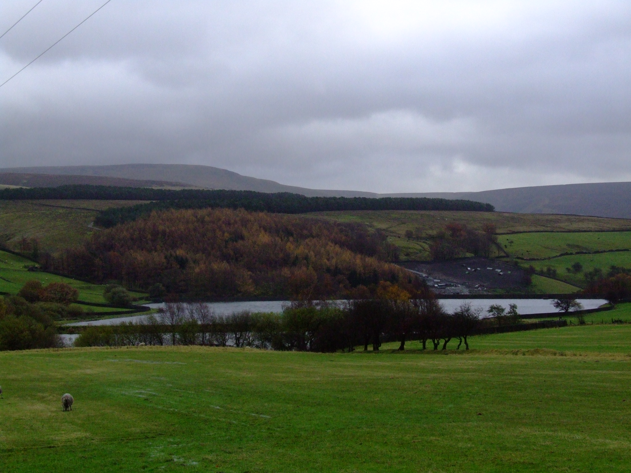
Swineshaw Reservoir (Derbyshire)
For the reservoirs near Stalybridge, in Tameside, Greater Manchester, see Higher Swineshaw Reservoir and Lower Swineshaw Reservoir Swineshaw Reservoir...

Shire Hill Hospital
Shire Hill Hospital was a healthcare facility in Bute Street, Glossop, Derbyshire, England. It was managed by Tameside and Glossop Integrated Care NHS...

Mossy Lea Reservoir
Mossy Lea Reservoir is a disused reservoir near Glossop, north Derbyshire. In 1837, 50 local millowners and gentlemen, known as the "Glossop Commissioners...

Longdendale Trail
The Longdendale Trail is an English long-distance rail trail following the former Woodhead railway line, which ran between Manchester and Sheffield and...
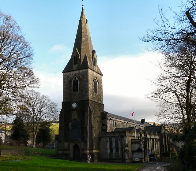
All Saints' Church, Glossop
All Saints’ Church, Glossop, is a Grade II listed parish church in the Church of England: 218 in Glossop, Derbyshire, England. == History == The first...
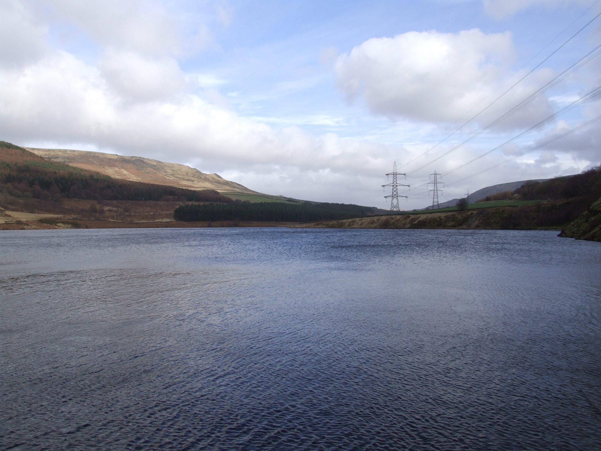
Rhodeswood Reservoir
Rhodeswood Reservoir is a man-made lake in Longdendale in north Derbyshire, England. It was constructed by John Frederick Bateman between 1849 and June...

Manor Park, Glossop
Manor Park is a city park in Glossop, Derbyshire, England. == History == The park was originally part of the now demolished Glossop Hall, formerly called...
Glossop Hall
Glossop Hall was the last residential building on the site of Royle Hall in Glossop, Derbyshire. It was located south of Old Glossop at the heart of Glossop...
Nearby Amenities
Located within 500m of 53.46269,-1.9196663Have you been to Blake Moor?
Leave your review of Blake Moor below (or comments, questions and feedback).