Stoney Allotment

Downs, Moorland in Durham

England

Stoney Allotment

Tunstall Reservoir
Tunstall Reservoir Credit: Clive Nicholson

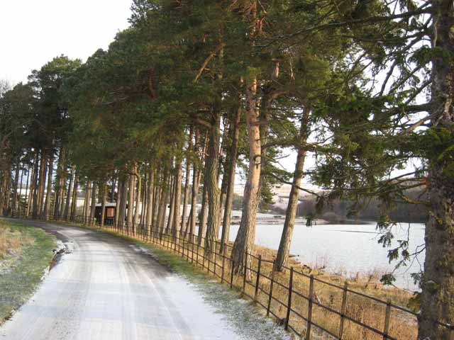
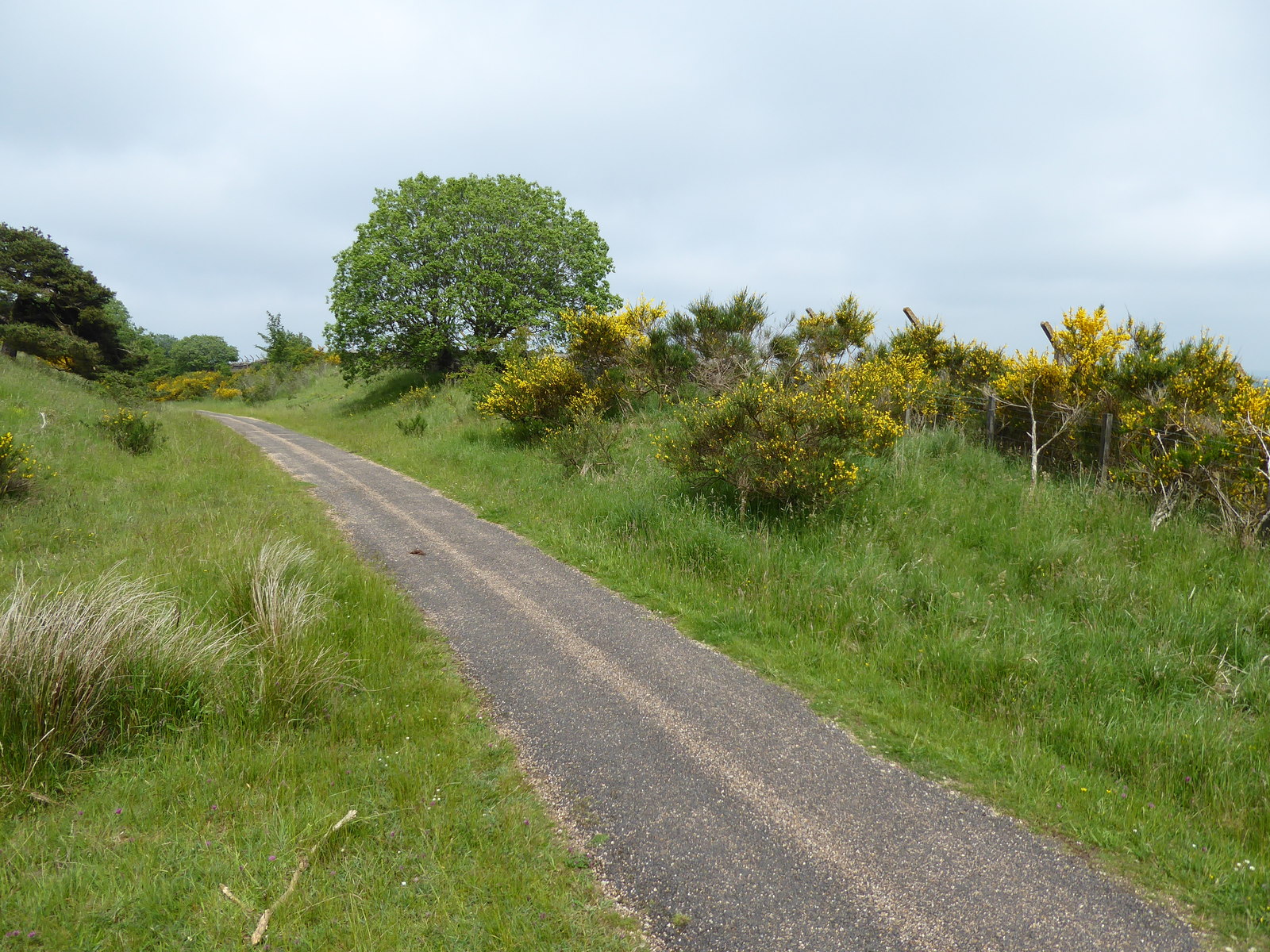
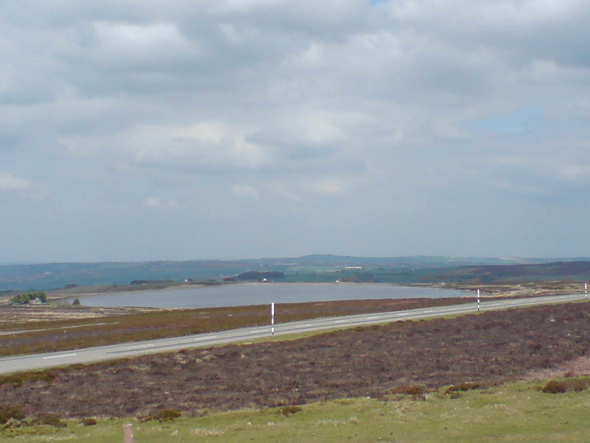
Stoney Allotment is a picturesque piece of land located in Durham, England. Situated in the heart of the county, this allotment is known for its unique blend of downs and moorland landscapes. Covering an area of approximately 10 acres, Stoney Allotment offers a tranquil retreat for nature enthusiasts and those seeking a peaceful escape from the bustling city life.

The allotment boasts a diverse range of flora and fauna, making it a haven for wildlife. The downs section of the allotment is characterized by rolling hills and open grasslands, providing ample space for recreational activities such as picnics and leisurely walks. The moorland area, on the other hand, is adorned with heather and gorse, creating a vibrant and colorful landscape. This section also features a small pond, attracting various bird species and amphibians.

Visitors to Stoney Allotment can enjoy breathtaking views of the surrounding countryside, with its undulating hills and valleys. The allotment is also home to a variety of indigenous plant species, including wildflowers and native grasses. These flora attract an array of butterflies and other insects, adding to the ecological richness of the area.

Stoney Allotment is open to the public all year round and is a popular destination for nature walks, birdwatching, and photography. The site is well-maintained by the local council, with clearly marked paths and seating areas for visitors to relax and take in the beauty of the surroundings. Whether it's a leisurely stroll or an opportunity to connect with nature, Stoney Allotment offers an idyllic setting for individuals of all ages to enjoy the outdoors.

If you have any feedback on the listing, please let us know in the comments section below.

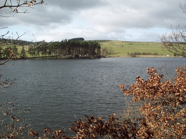
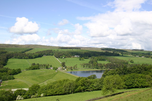
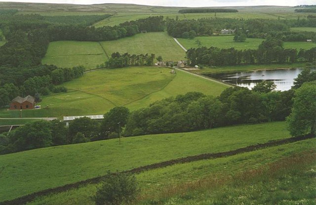
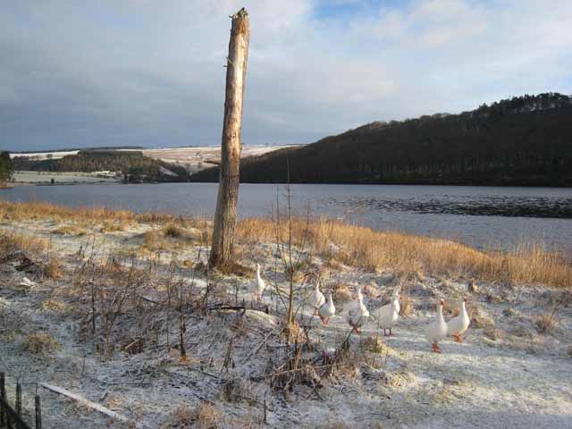
Stoney Allotment Images

Images are sourced within 2km of 54.77026/-1.919484 or Grid Reference NZ0541. Thanks to Geograph Open Source API. All images are credited.

Tunstall Reservoir
Tunstall Reservoir
Tunstall Reservoir, - the Dam Seen from the Wolsingham to Tunstall footpath that runs up the East side of the Waskerley Beck.
Tunstall Reservoir, - the Dam
Seen from the Wolsingham to Tunstall footpath that runs up the East side of the Waskerley Beck.
Tunstall Reservoir
Tunstall Reservoir
Winter sunshine on Wolsingham Park Moor
Sheepfold on Wolsingham Park Moor Non-traditional - the fold is enclosed by fences, not stone walls.
Sheepfold on Wolsingham Park Moor
Non-traditional - the fold is enclosed by fences, not stone walls.
Track on Wolsingham Park Moor
Moorland near Catchwater Plantation Looking towards the valley of the Tunstall Burn. The valley containing the Tunstall Reservoir lies in the distance.
Moorland near Catchwater Plantation
Looking towards the valley of the Tunstall Burn. The valley containing the Tunstall Reservoir lies in the distance.
Moorland burn near the Catchwater Plantation Looking towards the valley of the Tunstall Burn.
Moorland burn near the Catchwater Plantation
Looking towards the valley of the Tunstall Burn.
Leat feeding the Waskerley Reservoir This leat runs for over 2 km from the Tunstall Burn, capturing the water from that and several other burns which would otherwise drain into the Waskerley Beck below the dam of the Reservoir.
Leat feeding the Waskerley Reservoir
This leat runs for over 2 km from the Tunstall Burn, capturing the water from that and several other burns which would otherwise drain into the Waskerley Beck below the dam of the Reservoir.
Boundary wall and fence, Wolsingham Park Moor This stout fence, which proved to be particularly difficult to cross, reinforces the wall and is presumably the boundary of the Wolsingham Park Moor, one of the grouse moors above Weardale.
Boundary wall and fence, Wolsingham Park Moor
This stout fence, which proved to be particularly difficult to cross, reinforces the wall and is presumably the boundary of the Wolsingham Park Moor, one of the grouse moors above Weardale.
Catchwater Plantation, Wolsingham Park Moor Presumably so-called because it is near the leat which captures the Tunstall Beck and other streams and diverts them into the Tunstall Reservoir.
Catchwater Plantation, Wolsingham Park Moor
Presumably so-called because it is near the leat which captures the Tunstall Beck and other streams and diverts them into the Tunstall Reservoir.
Moorland track, north of Slateyford Plantation Looking eastwards across the valley of the Waskerley Burn. Saltersgate Plantation <a href="https://www.geograph.org.uk/gridref/NZ0743">NZ0743</a> stands on the skyline.
Moorland track, north of Slateyford Plantation
Looking eastwards across the valley of the Waskerley Burn. Saltersgate Plantation NZ0743 stands on the skyline.
Cat Beck Cat Beck lies across the valley of the Waskerley Beck. On the skyline is Parkhead Plantation, once much more extensive than it is now, according to the 1940s map.
Cat Beck
Cat Beck lies across the valley of the Waskerley Beck. On the skyline is Parkhead Plantation, once much more extensive than it is now, according to the 1940s map.
Edge of Wolsingham Park Moor Looking down Weardale in the distance. The Tunstall valley is coming in from the left.
Edge of Wolsingham Park Moor
Looking down Weardale in the distance. The Tunstall valley is coming in from the left.
Wolsingham Park Moor Running across the photo in middle distance is the Park Wall, part of the impressive perimeter wall, 15 Km long (now partly replaced by a fence) which encircles Wolsingham Park Moor. The Moor (beyond the wall in this photo) was for many centuries an extra-parochial territory which formed part of the hunting grounds of the Prince-Bishops of Durham.
Wolsingham Park Moor
Running across the photo in middle distance is the Park Wall, part of the impressive perimeter wall, 15 Km long (now partly replaced by a fence) which encircles Wolsingham Park Moor. The Moor (beyond the wall in this photo) was for many centuries an extra-parochial territory which formed part of the hunting grounds of the Prince-Bishops of Durham.
High Jofless Farm
High Jofless Farm
Geese by Tunstall Reservoir
Tunstall Reservoir Just south of the car park and picnic site.
Tunstall Reservoir
Just south of the car park and picnic site.
Show me another place!

Stoney Allotment is located at Grid Ref: NZ0541 (Lat: 54.77026, Lng: -1.919484)

Unitary Authority: County Durham

Police Authority: Durham

What 3 Words

///outlawing.cloth.pegs. Near Wolsingham, Co. Durham

Related Wikis

Backstone Bank and Baal Hill Woods

Backstone Bank and Baal Hill Woods is a Site of Special Scientific Interest in the County Durham district of Durham, England. It occupies the steep eastern...

Burnhill railway station

Burnhill railway station served the village of Waskerley, County Durham, England, from 1859 to 1939 on the Stanhope and Tyne Railway. == History == The...

Waskerley

Waskerley is a village in County Durham, England. It is situated six miles to the southwest of Consett and three miles southwest of Castleside and the...

Waskerley railway station

Waskerley railway station, also known as Waskerley Park, served the village of Waskerley, County Durham, England from 1845 to 1859 on the Stanhope and...

River Browney

The River Browney is a river in County Durham, England, and the largest tributary of the River Wear. The River Browney rises from a spring in Head Plantation...
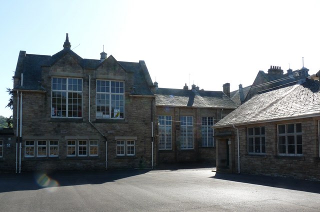
Wolsingham School

Wolsingham School is a coeducational secondary school located in Wolsingham, County Durham, England.The school is situated just off the A689, and near...

Wolsingham

Wolsingham is a market town in Weardale, County Durham, England. It is situated by the River Wear, between Crook and Stanhope. == History == Wolsingham...

Blanchland railway station

Blanchland railway station served the village of Blanchland, Northumberland, England, from 1845 to 1965 on the Stanhope and Tyne Railway. == History... ==

Have you been to Stoney Allotment?

Leave your review of Stoney Allotment below (or comments, questions and feedback).