Alton Common

Downs, Moorland in Staffordshire Staffordshire Moorlands

England

Alton Common

Old Milestone, Threapwood Head Cast iron post by the B5032, in parish of ALTON (STAFFORDSHIRE MOORLANDS District), by hedge, on North side of road. Cochrane iron casting, erected by the County Council in the 20th century.

Inscription reads:-
: ALTON 2½ / DENSTONE 4½ / ELLASTONE 6¼ / ASHBOURNE 11 : : ALTON / PARISH : : CHEADLE 2 :
Maker:- Cochrane & Co, Dudley. :

Milestone Society National ID: ST_ABCD11
Old Milestone, Threapwood Head Credit: Ivan Clare

Alton Common is a picturesque region located in Staffordshire, England. Situated amidst the enchanting countryside, it is renowned for its stunning downs and sprawling moorland. With an area of approximately 10 square miles, Alton Common offers a diverse landscape that is a treat for nature lovers and outdoor enthusiasts.

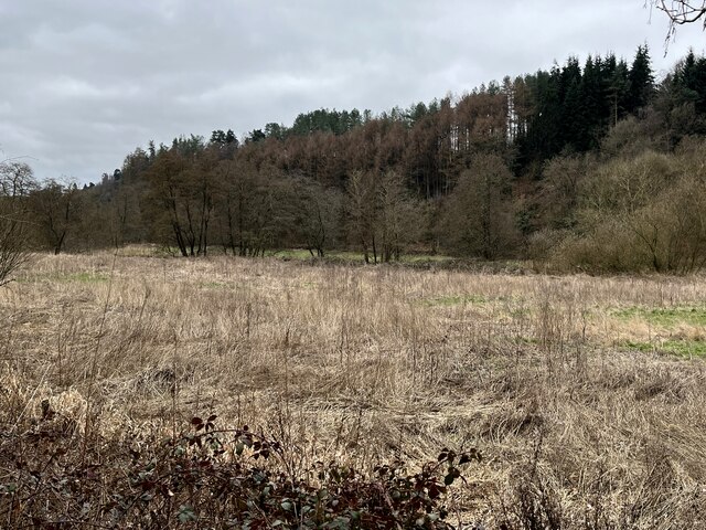
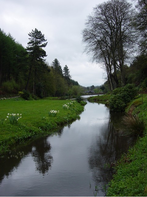
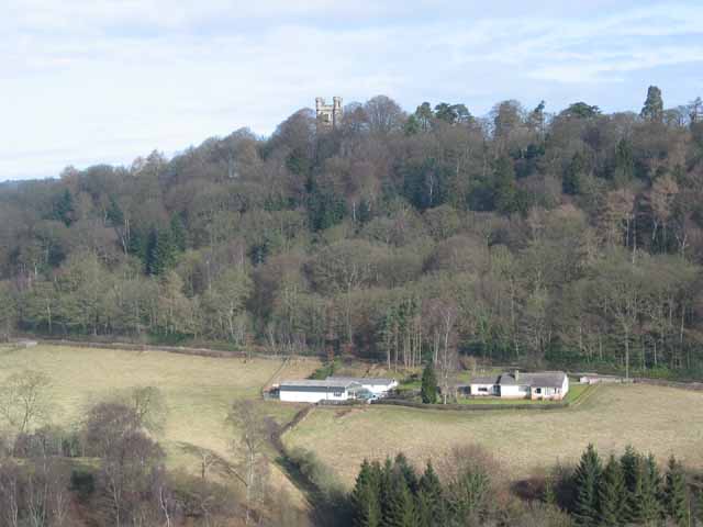
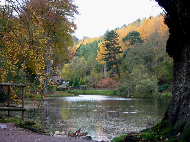
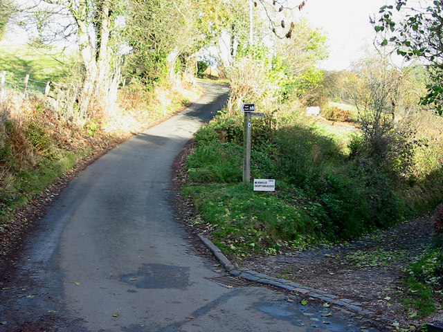
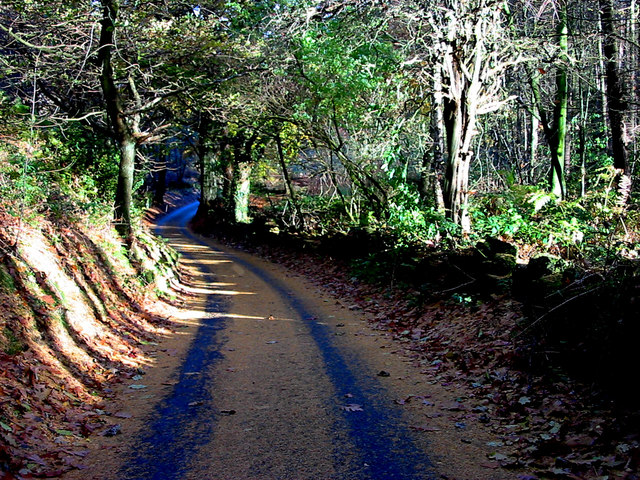
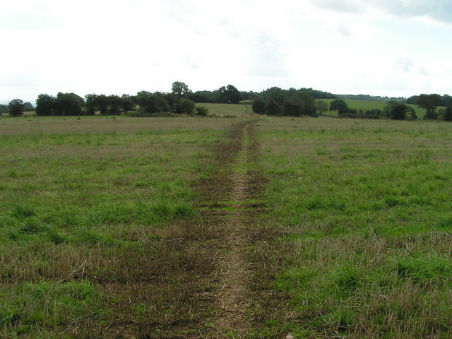
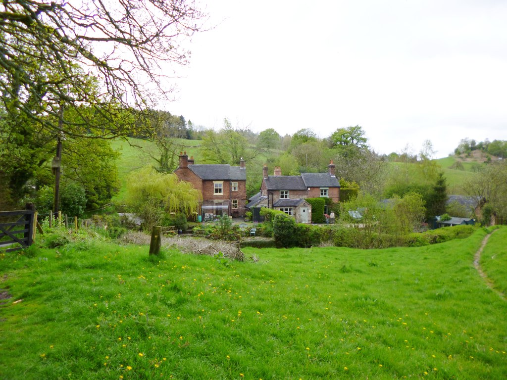
The downs of Alton Common are characterized by their gently rolling hills, covered in lush green grasslands. These open spaces provide a perfect setting for leisurely walks, picnics, and recreational activities. Visitors can take in the panoramic views of the surrounding countryside, with its patchwork of fields and meadows, dotted with charming cottages and farmhouses.

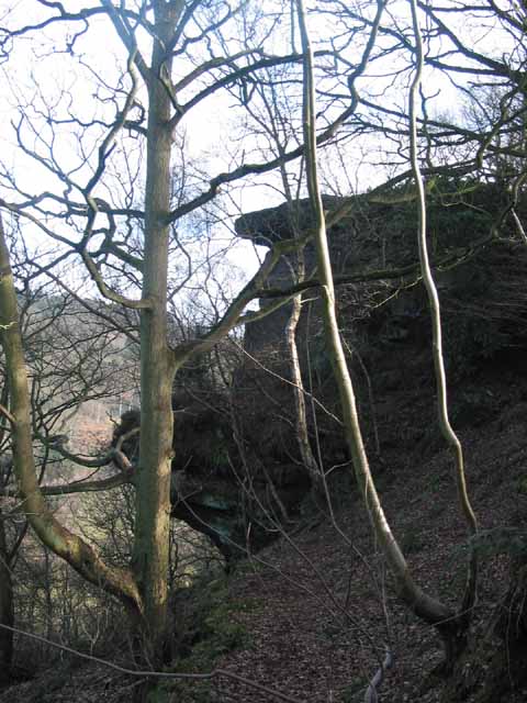
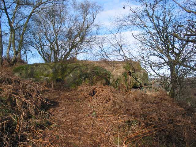
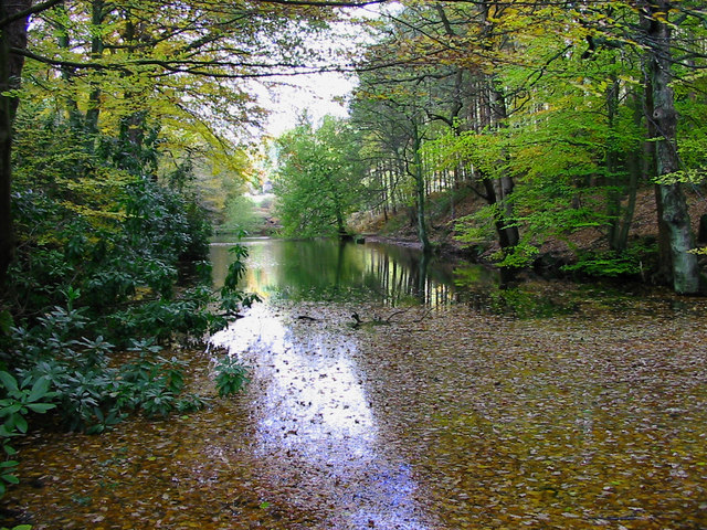
The moorland in Alton Common adds another layer of beauty and ruggedness to the landscape. Here, visitors can immerse themselves in the untouched wilderness and explore the rich biodiversity that thrives in this unique habitat. The moors are home to an array of flora and fauna, including heather, bilberry, and a variety of bird species.

Alongside its natural beauty, Alton Common also offers historical and cultural attractions. The area is steeped in history, with ancient settlements and archaeological sites scattered throughout. Additionally, there are several quaint villages nearby, where visitors can discover traditional English charm and experience local hospitality.

Overall, Alton Common is a hidden gem in Staffordshire, offering a blend of natural splendor, history, and cultural richness. It is a destination that appeals to both adventure seekers and those seeking tranquility in the midst of nature's beauty.

If you have any feedback on the listing, please let us know in the comments section below.
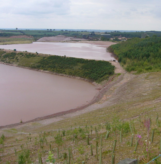
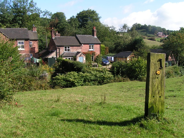
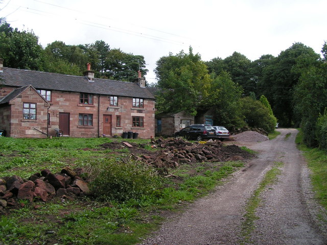
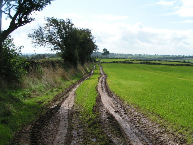
Alton Common Images

Images are sourced within 2km of 52.978474/-1.9259853 or Grid Reference SK0542. Thanks to Geograph Open Source API. All images are credited.

Old Milestone, Threapwood Head Cast iron post by the B5032, in parish of ALTON (STAFFORDSHIRE MOORLANDS District), by hedge, on North side of road. Cochrane iron casting, erected by the County Council in the 20th century.

Inscription reads:-
: ALTON 2½ / DENSTONE 4½ / ELLASTONE 6¼ / ASHBOURNE 11 : : ALTON / PARISH : : CHEADLE 2 :
Maker:- Cochrane & Co, Dudley. :

Milestone Society National ID: ST_ABCD11
Old Milestone, Threapwood Head
Cast iron post by the B5032, in parish of ALTON (STAFFORDSHIRE MOORLANDS District), by hedge, on North side of road. Cochrane iron casting, erected by the County Council in the 20th century. Inscription reads:- : ALTON 2½ / DENSTONE 4½ / ELLASTONE 6¼ / ASHBOURNE 11 : : ALTON / PARISH : : CHEADLE 2 : Maker:- Cochrane & Co, Dudley. : Milestone Society National ID: ST_ABCD11
Churnet Valley flood plain
The Ramblers' Retreat A deservedly popular cafe and tea room in Dimmingsdale.
The Ramblers' Retreat
A deservedly popular cafe and tea room in Dimmingsdale.
Deep in the Churnet Valley Narcissi on the bank of the Churnet near the head of Dimmingsdale
Deep in the Churnet Valley
Narcissi on the bank of the Churnet near the head of Dimmingsdale
Toothill Rock A popular viewpoint above the River Churnet near Alton
Toothill Rock
A popular viewpoint above the River Churnet near Alton
Toothill Rock Toothill Rock - a popular viewpoint above the River Churnet, Alton
Toothill Rock
Toothill Rock - a popular viewpoint above the River Churnet, Alton
View from Toothill Rock View across the Churnet Valley from Toothill Rock towards the Flag Tower (just inside <a href="https://www.geograph.org.uk/gridref/SK0643">SK0643</a>) part of the Alton Towers Leisure Park complex.
View from Toothill Rock
View across the Churnet Valley from Toothill Rock towards the Flag Tower (just inside SK0643) part of the Alton Towers Leisure Park complex.
View up the Churnet Valley from Toothill Rock View north west up the Churnet Valley from Toothill Rock.
View up the Churnet Valley from Toothill Rock
View north west up the Churnet Valley from Toothill Rock.
Ramblers' Retreat Dimmings Dale The Ramblers' Retreat, now a popular restaurant and tea room deep in the Churnet Valley, was once a lodge for the 16th Earl of Shrewsbury's Alton Towers estate.
Ramblers' Retreat Dimmings Dale
The Ramblers' Retreat, now a popular restaurant and tea room deep in the Churnet Valley, was once a lodge for the 16th Earl of Shrewsbury's Alton Towers estate.
Dimmingsdale Dimmingsdale in all its autumnal glory showing one of the holding ponds built to hold water used in the adjacent smelting mill, now a private residence.
Dimmingsdale
Dimmingsdale in all its autumnal glory showing one of the holding ponds built to hold water used in the adjacent smelting mill, now a private residence.
Dimmingsdale in Autumn Autumnal leaves cover one of several ponds in Dimmingsdale in the Staffordshire Moorlands.
Dimmingsdale in Autumn
Autumnal leaves cover one of several ponds in Dimmingsdale in the Staffordshire Moorlands.
Country Lane The Threapwood to Oakamoor road showing the western entrance to Dimmingsdale
Country Lane
The Threapwood to Oakamoor road showing the western entrance to Dimmingsdale
Autumn Lane A country lane near Oakamoor in the Staffordshire Moorlands covered in pine needles.
Autumn Lane
A country lane near Oakamoor in the Staffordshire Moorlands covered in pine needles.
Croxden Quarry in Freehay. From the same viewpoint as <a href="https://www.geograph.org.uk/photo/223705">SK0241 : Croxden Quarry</a>. The sand and gravel processing plants can be seen in the distance. In the foreground the quarry operators, Tarmac have already started tree planting for the eventual restoration of the site.
Croxden Quarry
in Freehay. From the same viewpoint as SK0241 : Croxden Quarry. The sand and gravel processing plants can be seen in the distance. In the foreground the quarry operators, Tarmac have already started tree planting for the eventual restoration of the site.
Oldfurnace Cottages at Oldfurnace from the footpath to Newton.
Oldfurnace
Cottages at Oldfurnace from the footpath to Newton.
Newton Newly renovated cottages in the local pink stone. Newton is a cluster of cottages set back from the road down a gravelled track.
Newton
Newly renovated cottages in the local pink stone. Newton is a cluster of cottages set back from the road down a gravelled track.
Ridge above Bradley Elms A footpath follows the crest of this broad ridge from Newton to Great Gate, with views to the quarries to the west and Alton Towers to the northeast.
Ridge above Bradley Elms
A footpath follows the crest of this broad ridge from Newton to Great Gate, with views to the quarries to the west and Alton Towers to the northeast.
Footpath west of Bradley in the Moors A footpath follows the crest of the broad ridge between Newton and Great Gate. The clumps of trees to the right of the path indicate the position of ponds; the field boundaries marked on the map to their right have gone.
Footpath west of Bradley in the Moors
A footpath follows the crest of the broad ridge between Newton and Great Gate. The clumps of trees to the right of the path indicate the position of ponds; the field boundaries marked on the map to their right have gone.
Show me another place!

Alton Common is located at Grid Ref: SK0542 (Lat: 52.978474, Lng: -1.9259853)

Administrative County: Staffordshire

District: Staffordshire Moorlands

Police Authority: Staffordshire

What 3 Words

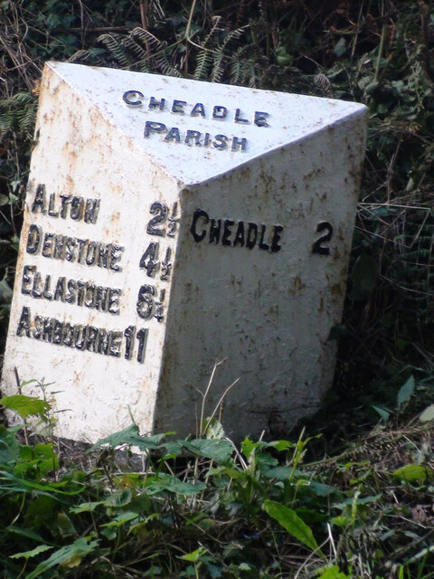
///beauty.earlobes.myths. Near Cheadle, Staffordshire

Nearby Locations

Alton Alton Common

Related Wikis

Bradley in the Moors

Bradley in the Moors is a village and former civil parish, now in the parish of Alton, in the Staffordshire Moorlands district, in the county of Staffordshire...

The Old Furnace

The Old Furnace is a colloquial name given to an historic site in Oakamoor, Staffordshire, England, that supported the development of medieval and post...

Farley, Staffordshire

Farley is a hamlet and civil parish in the Staffordshire Moorlands district, in the English county of Staffordshire. It is near to the villages of Alton...

Chained Oak

The Chained Oak is an oak tree, tied in chains, near to the village of Alton, Staffordshire, England. The tree, referred to as "The Old Oak", is the subject...

Alton Towers railway station

Alton railway station is a former railway station in Staffordshire. Opened in 1849 by the North Staffordshire Railway and called Alton, the station was...

Oakamoor railway station

Oakamoor railway station is a closed railway station in the Churnet Valley, Staffordshire. The station was opened in 1849 as part of the Churnet Valley...

Oakamoor Tunnel

Oakamoor Tunnel is a disused 497-yard (454 m) long tunnel located north of Oakamoor railway station on the former Uttoxeter to North Rode section of the...

Submission (Alton Towers)

Submission was a theme park ride at Alton Towers in Staffordshire, England from 2001 until 2013. It was a Chance Rides double swinging inverter. ��2...

Nearby Amenities

Located within 500m of 52.978474,-1.9259853
Cuckoo Well Lodges
Tourism: Holiday Lodges
Lat/Long: 52.975181/-1.924427
Barrier: stile
Material: wood
Source: survey;gps
Stile: stepover
Lat/Long: 52.979696/-1.9248848
Barrier: stile
Material: stone
Source: survey;gps
Stile: squeezer
Lat/Long: 52.9821818/-1.9255738
Barrier: stile
Material: wood
Source: survey;gps
Stile: stepover
Lat/Long: 52.9787375/-1.9202042
The data included in this document is from www.openstreetmap.org. The data is made available under ODbL.

Have you been to Alton Common?

Leave your review of Alton Common below (or comments, questions and feedback).